- Joined
- Jun 25, 2012
- Messages
- 4,429
Leidy Peak Circumnavigation and Ascent 7/1 - Far Eastern High Uintas
My family, Beck and Luna, and friend Don drove out to the far eastern Uintas and backpacked a circumnavigation of Leidy Peak this weekend and the next day I climbed the peak. We walked from the same high trailhead on the eastern flanks of Leidy that I had used to start my full crossing of the High Uintas on the Highline Trail several years back in August 2011. This was a return to a spot that surprised me then and pleased me now. My favorite ecosystem or biozone is the alpine tundra and this hike has plenty of that. The eastern Uintas are a delight and seriously under-appreciated.
We were curious about the state of the snow in the very high country as many of you here are too. In short, snow is not an issue all the way to the tops of the peaks and will only be an impediment on steep, mostly north-facing passes. The snow has melted off enough too that the high runoff in the streams and rivers will be quickly reducing now too. So, even though this was an extraordinary high snowpack year in the high country the Uintas are open for business!
The mosquitoes varied from moderate to quite heavy and I believe there was a major hatch in this area in the last weeks. Black flies were also omni-present too but were of the non-biting flavor.
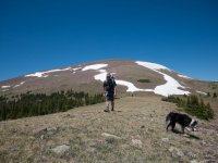
Don and Luna traversing a ridge on the way from the trailhead to Lakeshore. Leidy in the background at just over 12k'.
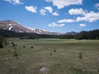
The Lakeshore basin that we were camping in the first night on the south side of the peak. Great wetlands - the second highest lake is a great camping destination.
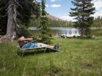
Enjoying the view near camp from the cot-trash left by some human.
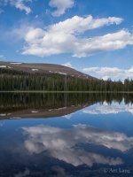
Leidy Peak Reflection
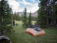
Our camp between the third and fourth highest lakes in Lakeshore Basin. (Should have held out for the second which was only 1/8 of a mile further along).
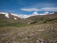
Climbing out of Lakeshore Basin to head around the west and north sides of Leidy on a bench at over 11K'. Route finding was easy even though the trail is mostly non-existent. There are some huge cairns left behind to guide your way. Gabbro pass is the low point and the first pass on the Highline crossing. This is the view of the southeast side of the pass. When we crossed in 2011 there was less snow and we beat the snow on the left on loose rock. Looks like that is possible now as well.
Climbing out of the basin to complete our circumnavigation and walking onto tundra. Yea!
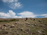
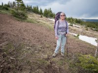
Family portrait with Gabbro pass in the background. As soon as we climbed out onto this bench we could see weather heading in from the north. So we accelerated.
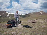
Walking is pretty easy most of the time on tundra. Marsh Peak in the background.
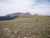
Easy walking until you get to this and then you slow right down. The entire tundra meadow here, and all the way to the top of Leidy the next day was covered in flowers. Yea!
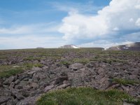
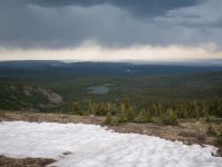
The cause of our previously-mentioned acceleration of pace. We scooted right down to down to where the trees are taller than we are: tree line in the mid-left in the view as mother nature rumbled in the distance. Lightning was striking the Flaming Gorge area you can see in the background.
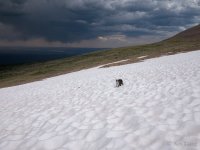
Continuing our traverse of the north side of Leidy, now down closer to treeline and the krummholz trees that inhabit that zone.
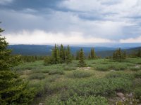
Red lake and our view to the north.
The largest ungulate bed and scrape I have ever seen. Probably elk. We saw copious evidence of these big critters. There is a large population of mountain goats on Leidy as well.
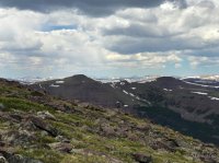
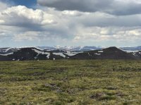
We scooted to the car in impending rain and set up a car camp near the trailhead. The next day the weather was slightly better so I headed up Leidy Peak. Halfway to the top, the view looking west down the spine of the High Uintas.
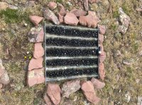
On the summit of Leidy Peak I found this gadget. The small black container on the right was a temperature recorder. My working hypothesis is these black pellets were set to absorb chemicals in the rain and snowfall in order to capture and analyze the degree of acid rain on the peak. Anyone else know different?
The summit of Leidy at 12,028. Alpine tundra and wildflower topped. Yea! The view is down the Uintas divide to the west. Gabbro at about 11,850 is low center again but now viewed from above.
The End.. of a great adventure. This gives details on current conditions for all of you Jonesing to get high in the Uintas soon. Go!
My family, Beck and Luna, and friend Don drove out to the far eastern Uintas and backpacked a circumnavigation of Leidy Peak this weekend and the next day I climbed the peak. We walked from the same high trailhead on the eastern flanks of Leidy that I had used to start my full crossing of the High Uintas on the Highline Trail several years back in August 2011. This was a return to a spot that surprised me then and pleased me now. My favorite ecosystem or biozone is the alpine tundra and this hike has plenty of that. The eastern Uintas are a delight and seriously under-appreciated.
We were curious about the state of the snow in the very high country as many of you here are too. In short, snow is not an issue all the way to the tops of the peaks and will only be an impediment on steep, mostly north-facing passes. The snow has melted off enough too that the high runoff in the streams and rivers will be quickly reducing now too. So, even though this was an extraordinary high snowpack year in the high country the Uintas are open for business!
The mosquitoes varied from moderate to quite heavy and I believe there was a major hatch in this area in the last weeks. Black flies were also omni-present too but were of the non-biting flavor.
Don and Luna traversing a ridge on the way from the trailhead to Lakeshore. Leidy in the background at just over 12k'.

The Lakeshore basin that we were camping in the first night on the south side of the peak. Great wetlands - the second highest lake is a great camping destination.

Enjoying the view near camp from the cot-trash left by some human.

Leidy Peak Reflection

Our camp between the third and fourth highest lakes in Lakeshore Basin. (Should have held out for the second which was only 1/8 of a mile further along).

Climbing out of Lakeshore Basin to head around the west and north sides of Leidy on a bench at over 11K'. Route finding was easy even though the trail is mostly non-existent. There are some huge cairns left behind to guide your way. Gabbro pass is the low point and the first pass on the Highline crossing. This is the view of the southeast side of the pass. When we crossed in 2011 there was less snow and we beat the snow on the left on loose rock. Looks like that is possible now as well.

Climbing out of the basin to complete our circumnavigation and walking onto tundra. Yea!

Family portrait with Gabbro pass in the background. As soon as we climbed out onto this bench we could see weather heading in from the north. So we accelerated.

Walking is pretty easy most of the time on tundra. Marsh Peak in the background.

Easy walking until you get to this and then you slow right down. The entire tundra meadow here, and all the way to the top of Leidy the next day was covered in flowers. Yea!

The cause of our previously-mentioned acceleration of pace. We scooted right down to down to where the trees are taller than we are: tree line in the mid-left in the view as mother nature rumbled in the distance. Lightning was striking the Flaming Gorge area you can see in the background.

Continuing our traverse of the north side of Leidy, now down closer to treeline and the krummholz trees that inhabit that zone.

Red lake and our view to the north.

The largest ungulate bed and scrape I have ever seen. Probably elk. We saw copious evidence of these big critters. There is a large population of mountain goats on Leidy as well.

We scooted to the car in impending rain and set up a car camp near the trailhead. The next day the weather was slightly better so I headed up Leidy Peak. Halfway to the top, the view looking west down the spine of the High Uintas.

On the summit of Leidy Peak I found this gadget. The small black container on the right was a temperature recorder. My working hypothesis is these black pellets were set to absorb chemicals in the rain and snowfall in order to capture and analyze the degree of acid rain on the peak. Anyone else know different?

The summit of Leidy at 12,028. Alpine tundra and wildflower topped. Yea! The view is down the Uintas divide to the west. Gabbro at about 11,850 is low center again but now viewed from above.

The End.. of a great adventure. This gives details on current conditions for all of you Jonesing to get high in the Uintas soon. Go!
Last edited:
