- Joined
- Jul 23, 2013
- Messages
- 1,655
Day six of our spring break trip featured an early morning hike up the Spencer Trail at Lee's Ferry for myself, followed by a visit to some of the historic Lee's ferry cabins, Navajo Bridge, and nearby Horseshoe Bend with the family.
Friday - April 7, 2017
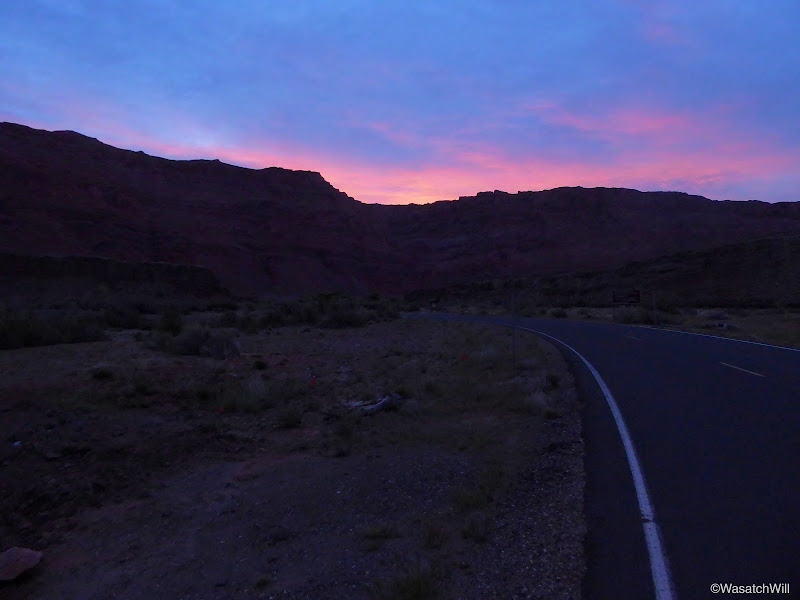
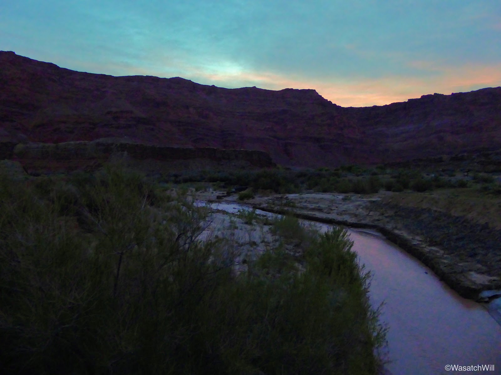
Eager to try out the nearby two-mile Spencer Trail that switchbacks and climbs up the Vermillion Cliffs from the banks of the Colorado River at the site of Lee's Ferry and on up to a high plateau above, I awoke at 5 am and started hiking down the road for the trailhead. Along the way, the road crossed over the Paria River. It was pretty cool to think about what was upstream from there. More on that later, though.

Crossing over the Paria River

The Paria River, looking upstream
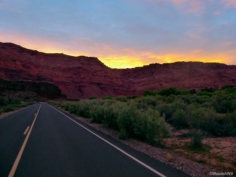
I had hoped to make it all the way up the Spencer Trail before sunrise, but that hope was vain. I did not account for the fact that due to Arizona time being an hour behind what Utah time was, the sun was to rise an hour sooner than what I expecting. I also did not account for the one and a half mile length of road between the campground and the trail itself. I had actually planned to just drive it, but in the interest of not wanting to wake up our youngest or anyone else still sleeping at our camp, I opted to use my feet to travel the road instead. Despite all that, I was still privileged to witness another beautiful sunrise.
Sunrise
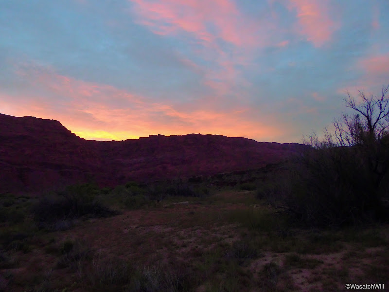
Sunrise
Sunrise

Looking back west down the road
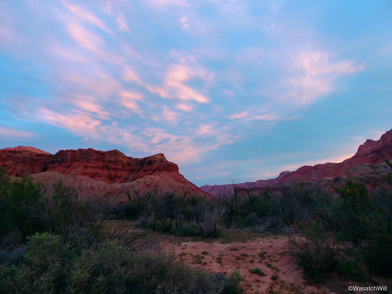
Looking northward from along the road
Just prior to the trailhead, I veered off down to the boat launch for a few moments to stand at the banks of the Colorado River.
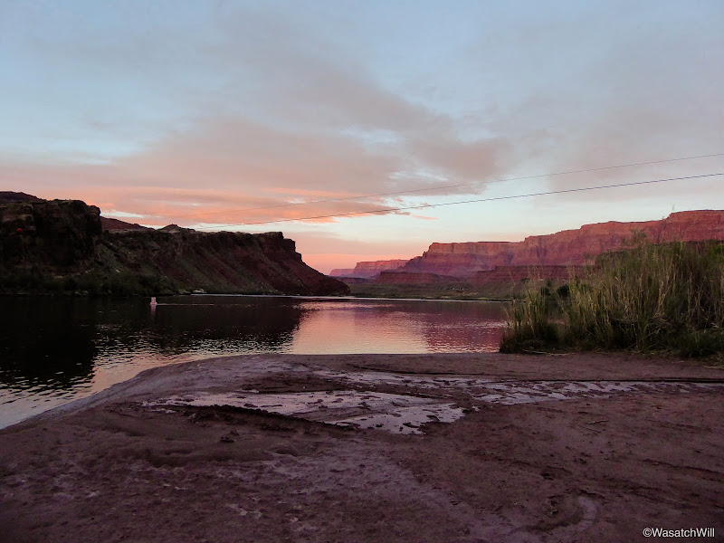
On the banks of the Colorado River
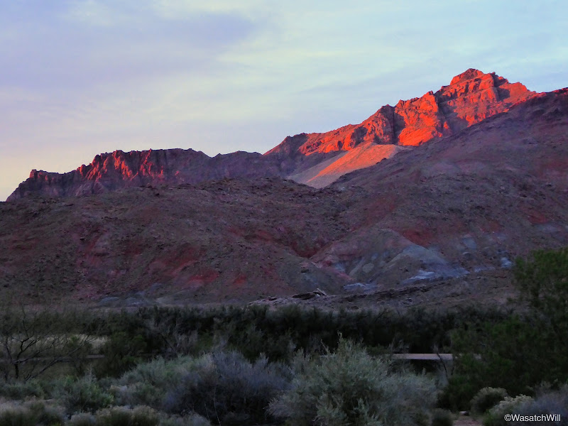
Morning alpenglow
At the start of the trail, I spent a few more minutes looking over the historic pioneer structures and ruins that remained from when Lee's Ferry had operated from the late 1800's through the early 1900's.

Historic marker
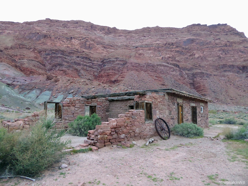
Lee's Ferry Ruins

Lee's Ferry Ruins
Lee's Ferry Ruins
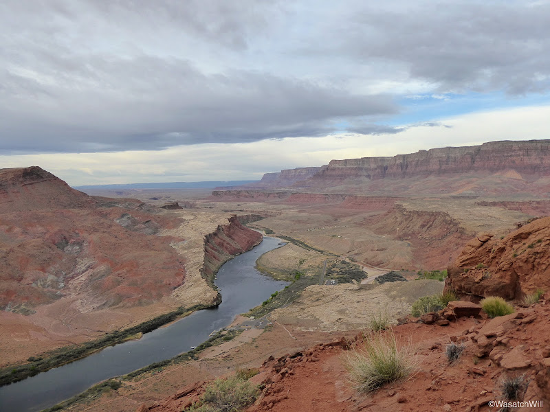
After passing through the ruins, I continued on up the trail and soon started rising high above the Colorado.
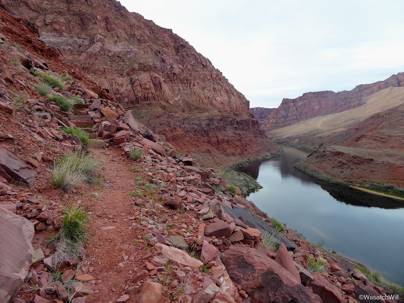
On the Spencer Trail looking up the Colorado River
Climbing high up the cliffs

Spencer Trail
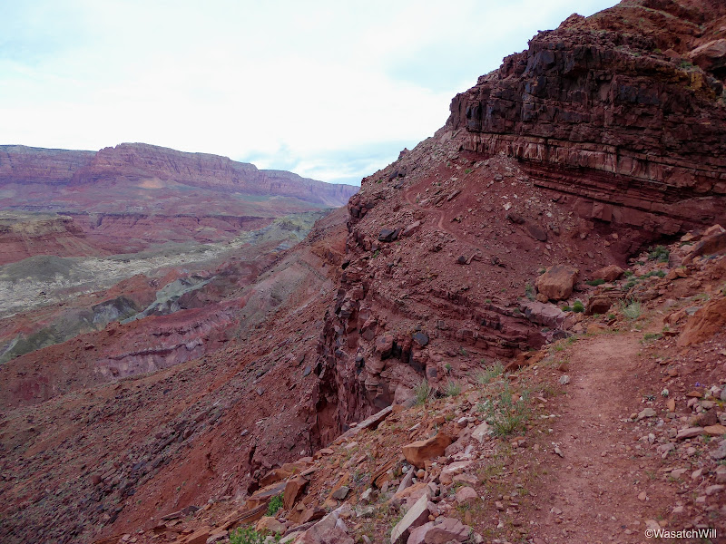
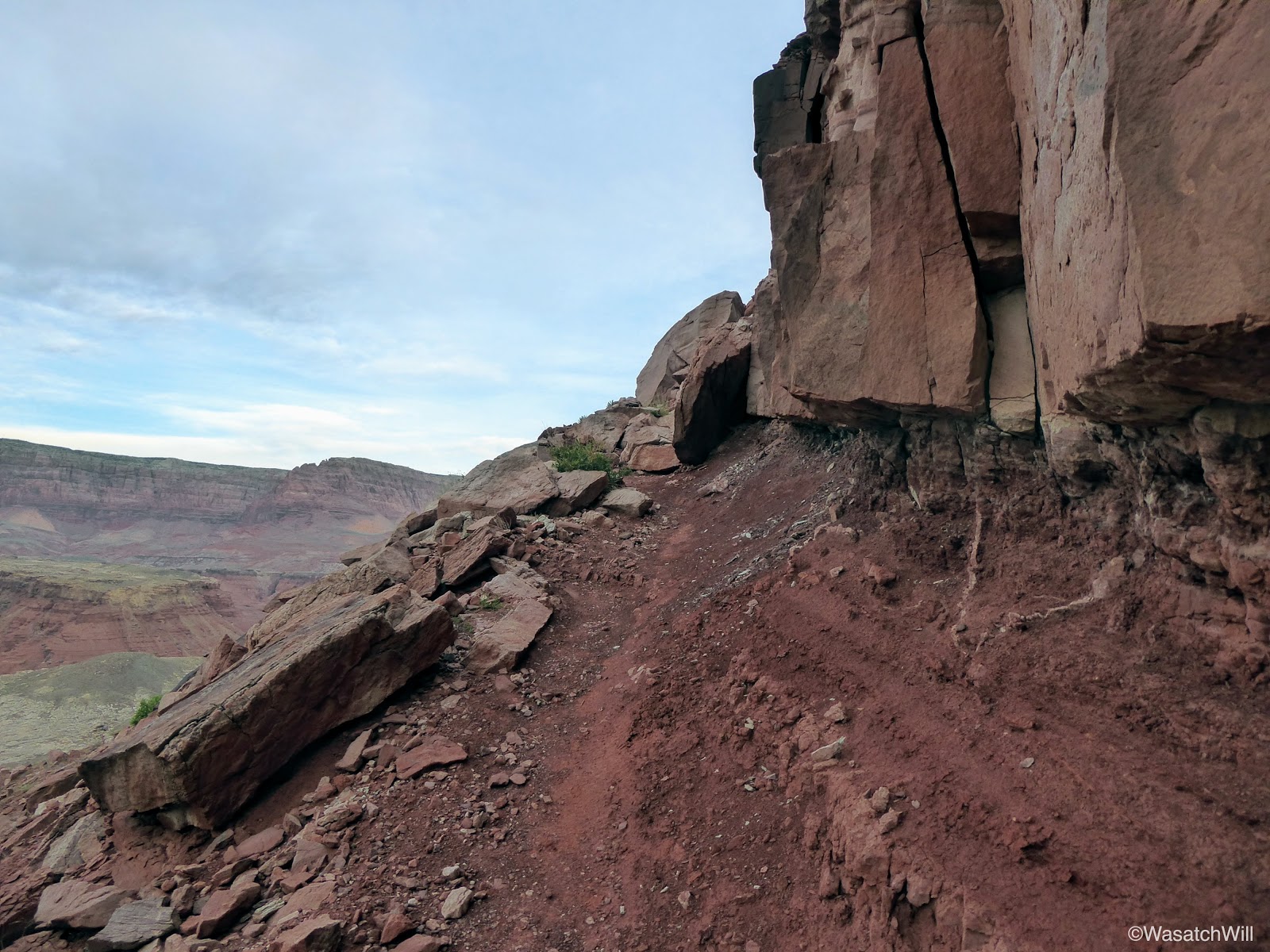
About 3/4 of a mile up, the trail became quite exposed. On the left was a short and very steep slide down to a cliff band resulting in a vertical drop of at least 75 feet and on the right was a wall of sandstone clumps and clay. The trail itself was just shy of being a foot wide, or so it seemed. A slip, bump, trip, or tumble at this point, could have easily been fatal, sending myself down the slope and off the cliff.
Narrow and exposed
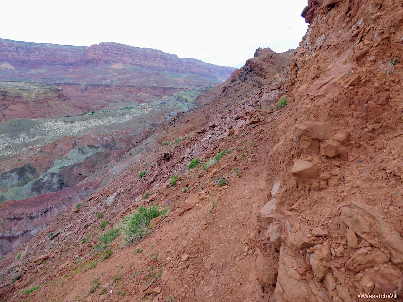
As one who can have a real fear of heights at times, it was a little nerve-wracking, but I pressed on, slow and steady, as I side stepped it up around the next corner. Given the conditions on either side of the trail, I felt claustrophobic the whole way through this section. Fortunately, it was a very short little stretch and the trail soon led me back to where I had much more 'breathing room'.
Once around what had become the crux for me, I pressed on for another half mile or so before stopping for a good rest and to take in some great views overlooking the Colorado River, Lee's Ferry, and out to the campground and the Navajo Bridge at Marble Canyon.
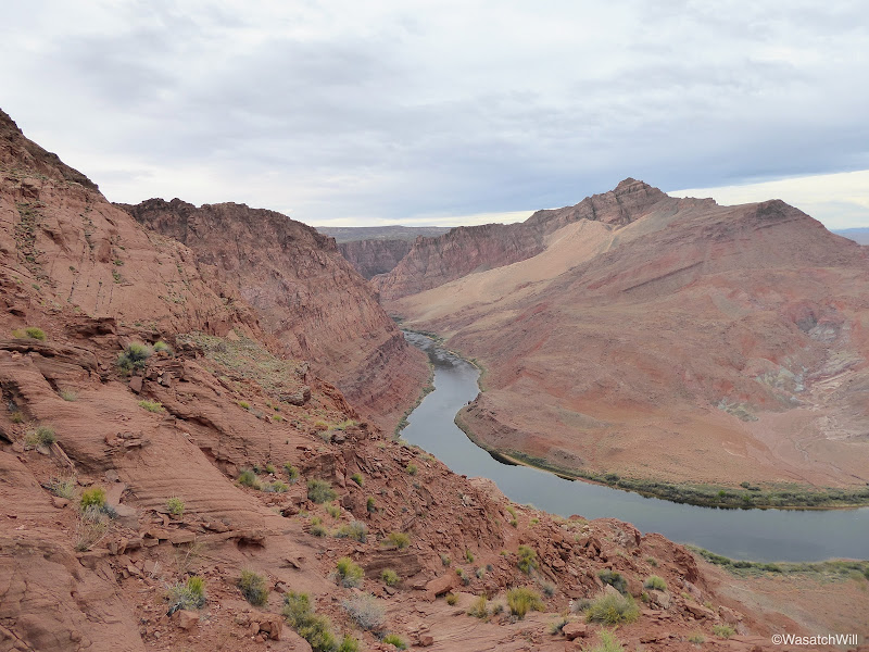
Looking up the Colorado River
Looking down the Colorado River

Navajo Bridge and Marble Canyon

Campground
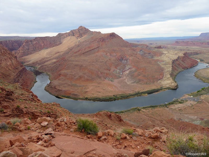
Lee's Ferry

Desert Primrose
It was here that I made the decision to call it good and turn back. It was well past sunrise, my lungs were burning a bit, and my heart rate had been racing. I still had to hike back up the road to get back to camp too. I could not get a cell signal as I thought I might by being within sight of the small community at Marble Canyon. Had I been able to do that, I probably would have kept going all the way up to the top and then made contact with Jessica to have her bring the car with the kids to pick me up at the trailhead and let them checkout the old settlement as well. In hindsight, I probably could have gotten a cell signal at the top as I would have been in sight with the town of Page. Oh well.
I was not looking forward to having to negotiate the exposed spot again, but it came and passed without any incident. On my way down, some boaters could be seen launching off down at the river, no doubt heading upstream to do some fishing.
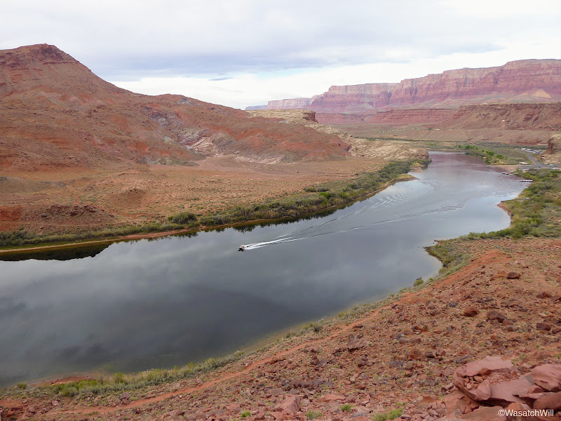
Boat on Colorado River
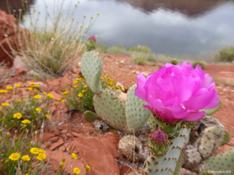
Prickly Pear near Colorado River

Prickly Pear
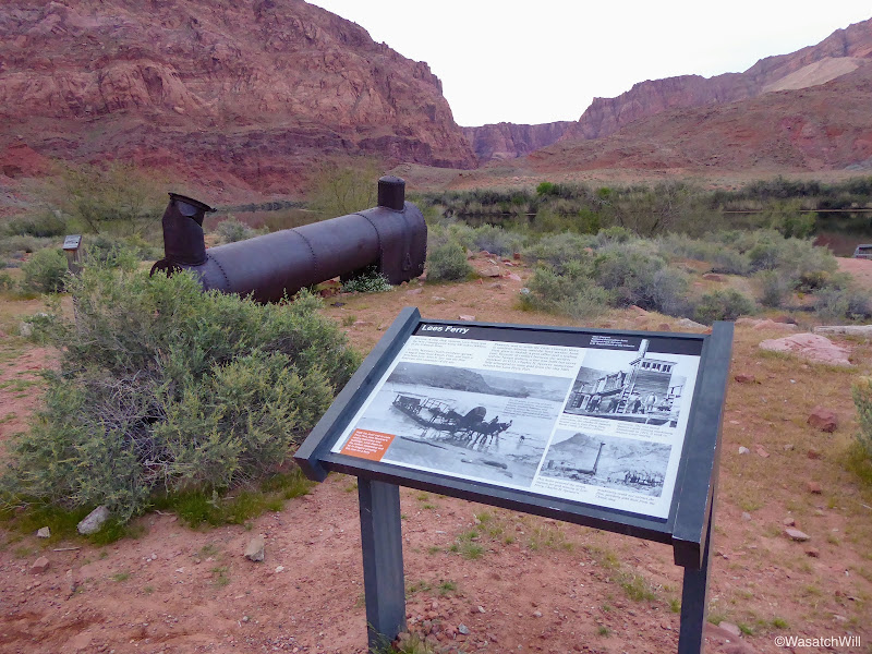
The Spencer Trail is an old mule path named after Charles H Spencer who briefly ran a gold mining operation at Lee's Ferry in the early 1900's along the banks of the river. Part of that operation relied on a steamboat to haul coal up and down the river. All that remains of the steamboat now is the boiler that sits just below the trail at the edge of the river where a flood in 1921 had sunk the boat.
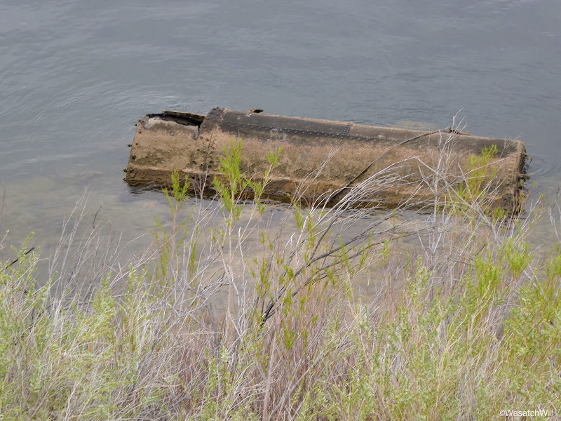
Spencer Steamboat ruin
On my way back up the road, I stopped at the Paria River and went upstream a bit to Lonely Dell Ranch, which was also set up by John D. Lee and served as a homestead for his family.
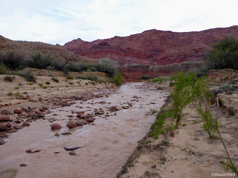
Paria River
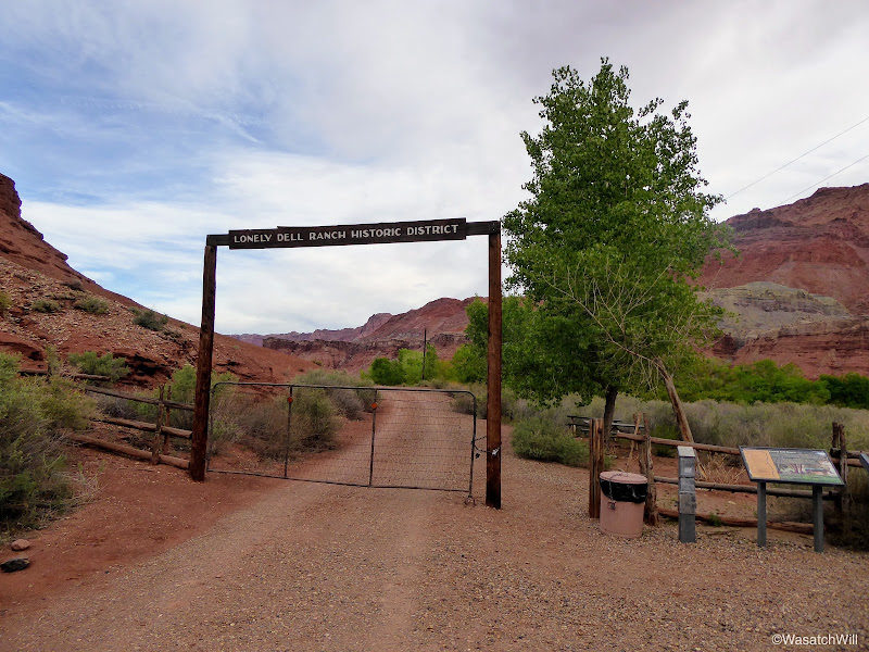
Lonely Dell Ranch
Of the many hikes that are on my bucket list, one is to hike through a slot called Wire Pass and into Buckskin Gulch which then leads to the Paria River and on down to where I was now standing. So here I was standing at the tail end of that route. Had I more time, I would have gone on up into the orchards and explored the old ranch and cemetery further up from the gate, but alas, I needed to get back to camp as I was sure my family was all up by now and I didn't want to leave them waiting on me much longer.
Soon, I was back camp where we packed up and got going again.
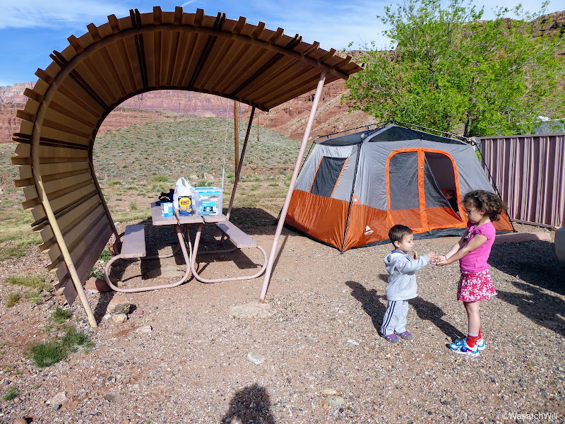
Our Camp
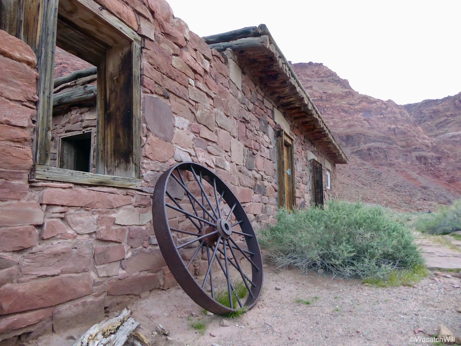
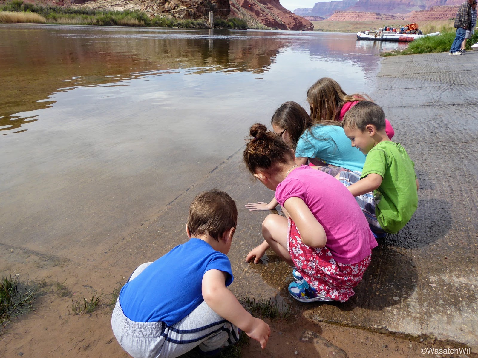
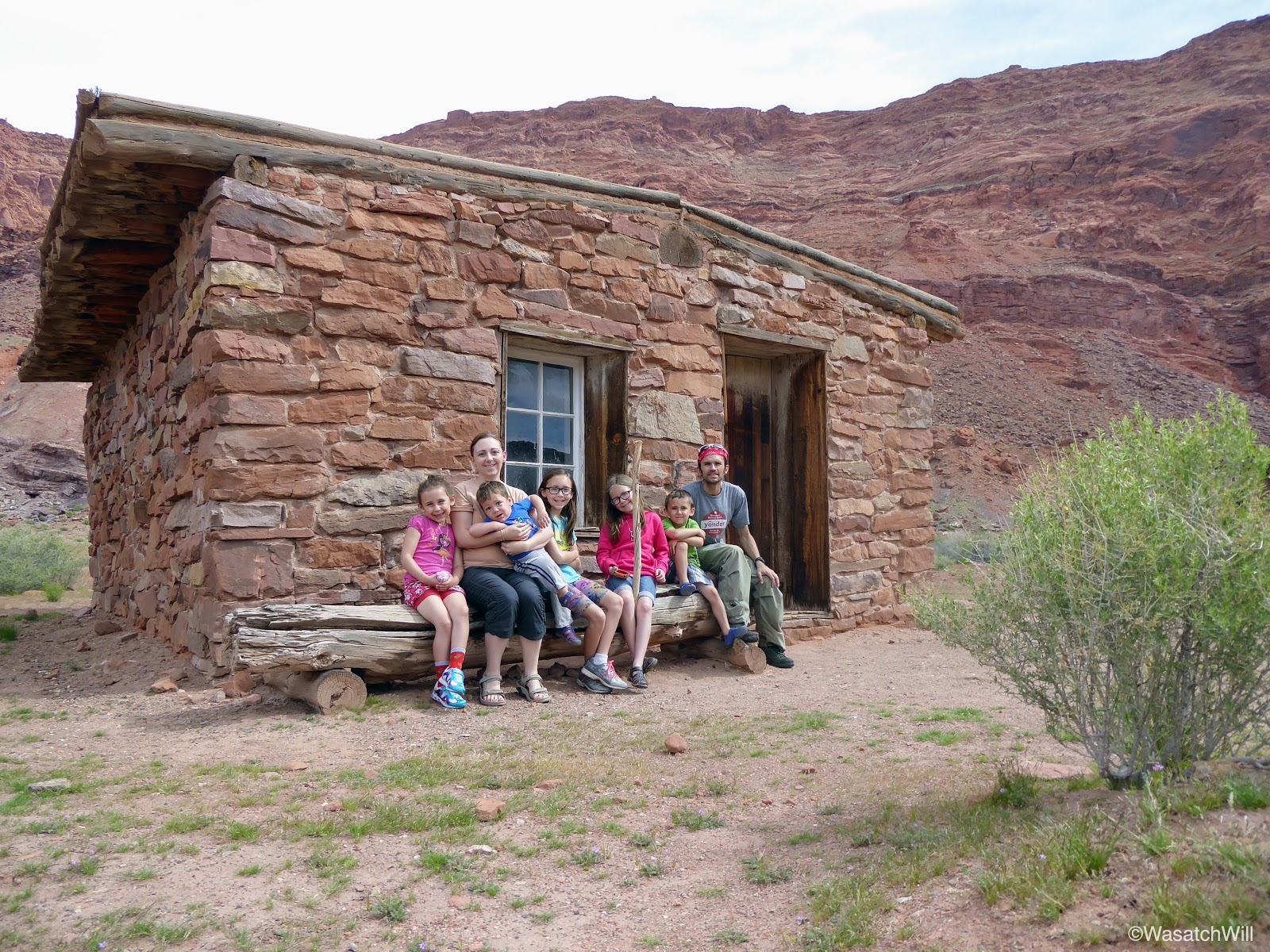
Before heading out from Lee's Ferry, I drove the family back up to the trailhead so they could stand at the edge of the Colorado River and see all the old structures nearby.

Touching the Colorado River

Family photo at Lee's Ferry ruins
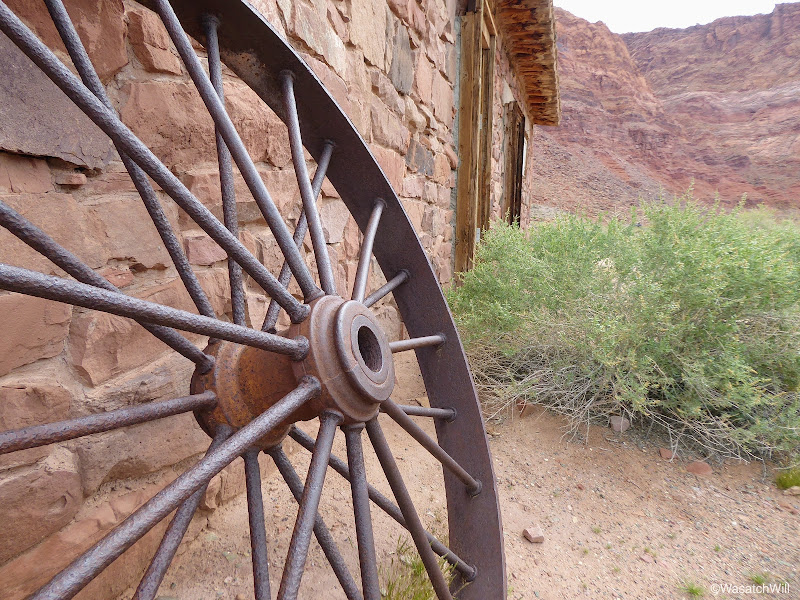
Old wheel at Lee's Ferry ruins
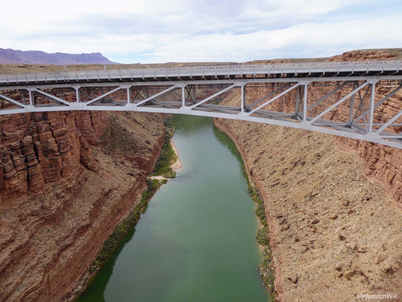
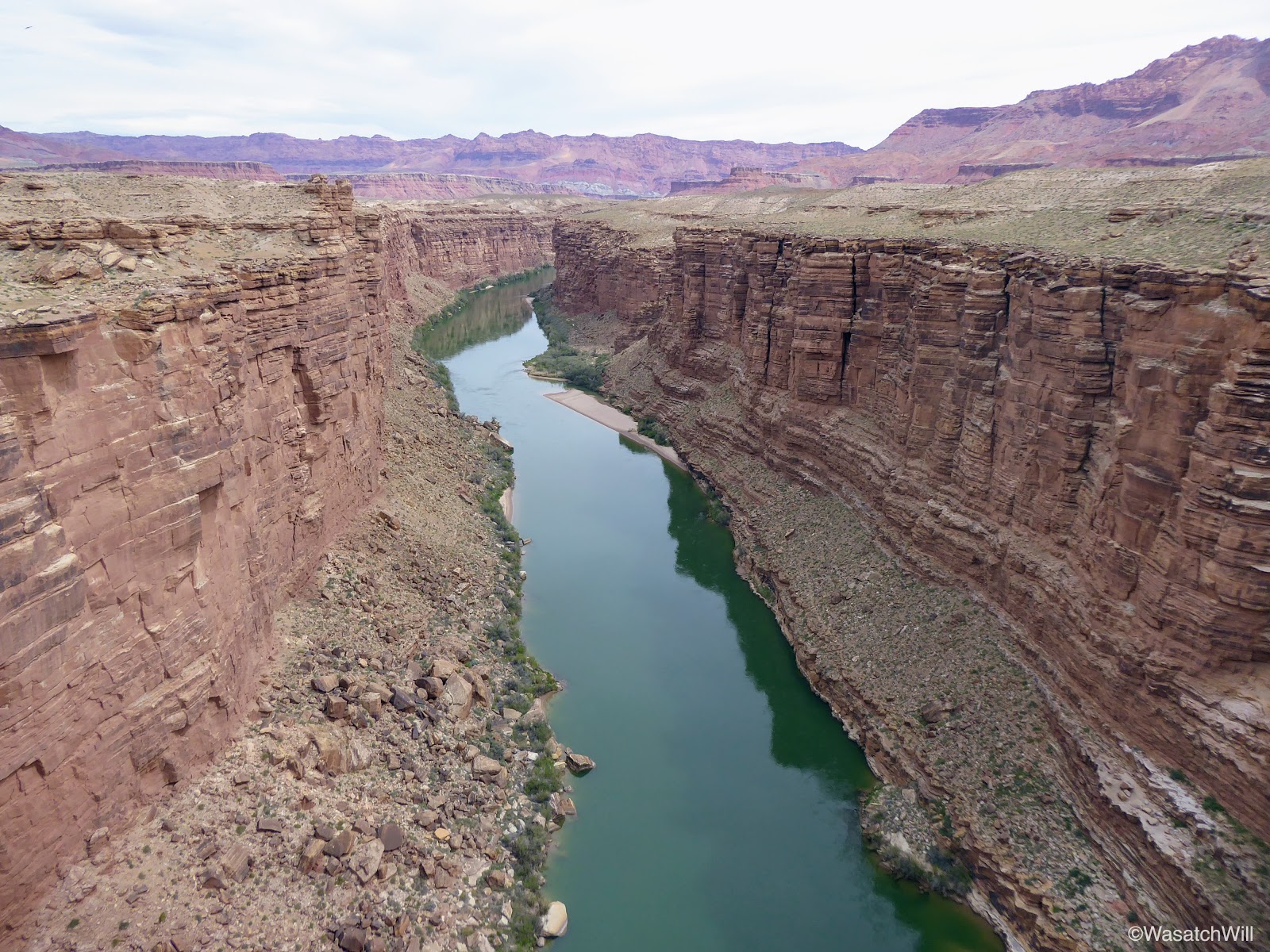
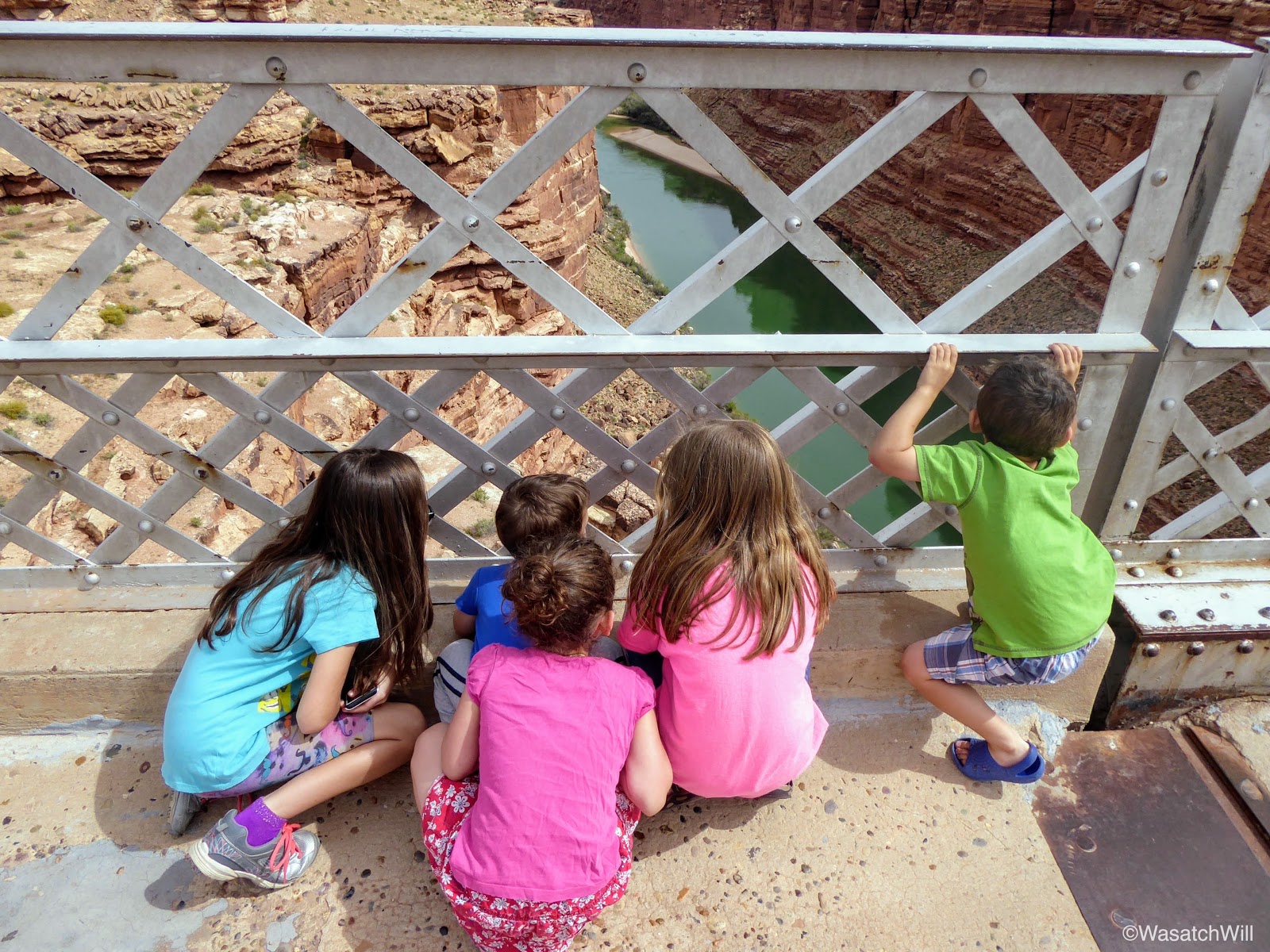
On the way out from Lee's Ferry, we made another quick stop at the Navajo Bridge.

New Navajo Bridge

Marble Canyon

Checking out Marble Canyon from old Navajo Bridge
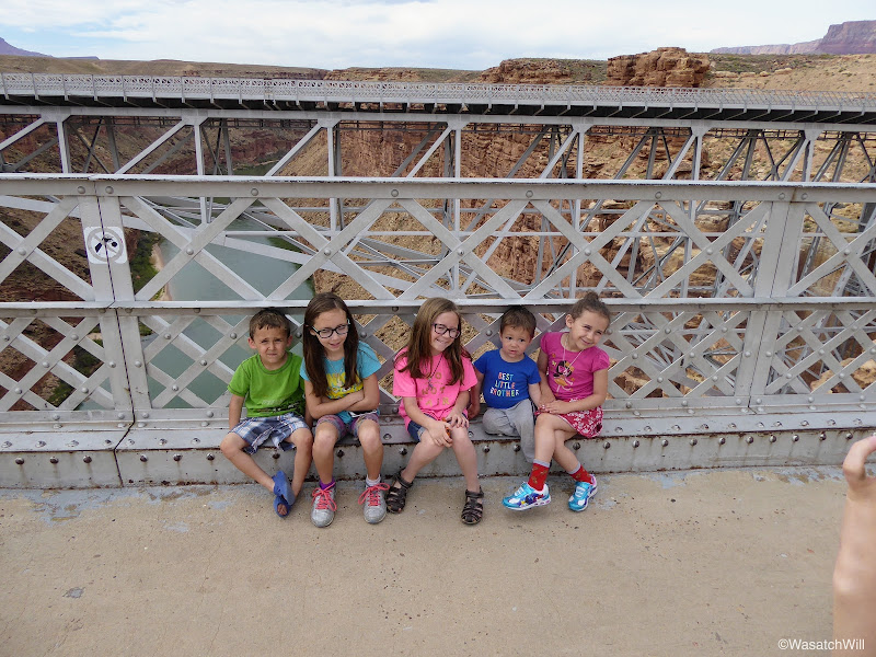
The kids on the old Navajo Bridge
From Navajo Bridge and Marble Canyon, the faster route back into Utah and up to Torrey for the night would have been to head west toward Jacobs Lake and then northward up through Kanab from there. But since we were so close to Horseshoe Bend, a scenic point where the Colorado River makes a sharp bend, we opted to go to other way to check that out.
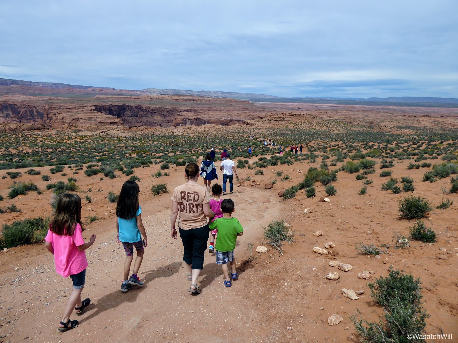
I knew Horseshoe Bend was popular among photographers, especially around sunrise and sunset, but I did not anticipate much more than a dozen other vehicles being at the trailhead since it was closer to the middle of the day. I was wrong. I did not know just how big the trailhead parking lot really was and when we arrived, it felt like we were back at the zoo. There was literally close to a couple hundred cars and it showed on the trails with hundreds of people parading up and down the short trail and flocked all around the viewpoint. Still, we found ourselves a parking spot and joined the throngs of others on the trail.
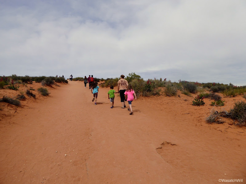
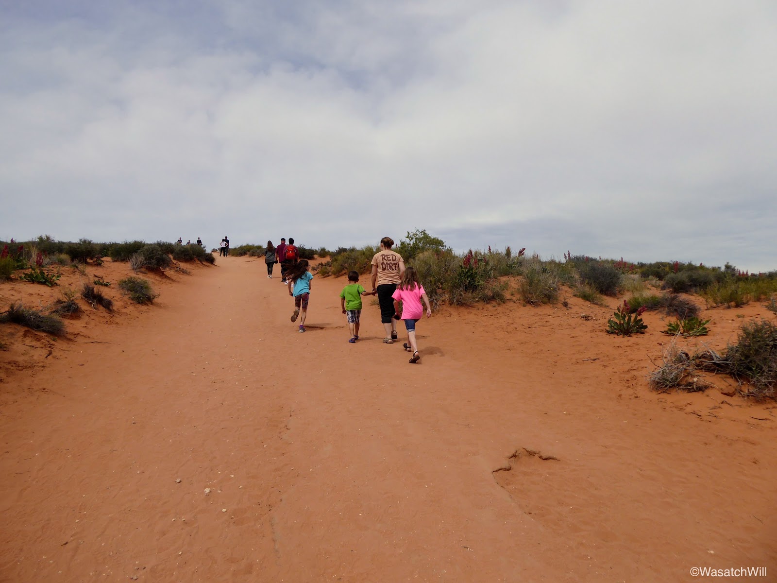
Starting up the trail to Horseshoe Bend
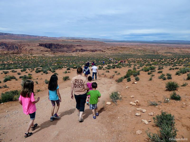
On the trail to Horseshoe Bend

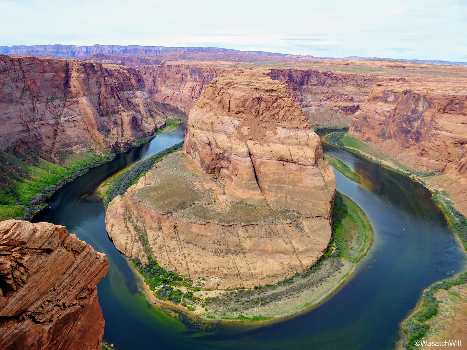
Horseshoe Bend
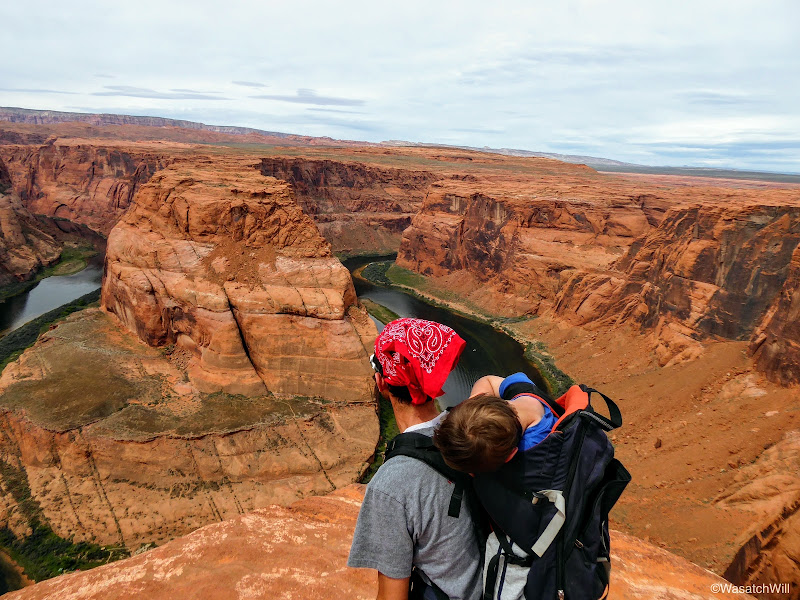
Will overlooking Horseshoe Bend
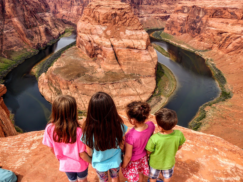
The kids looking out at Horseshoe Bend
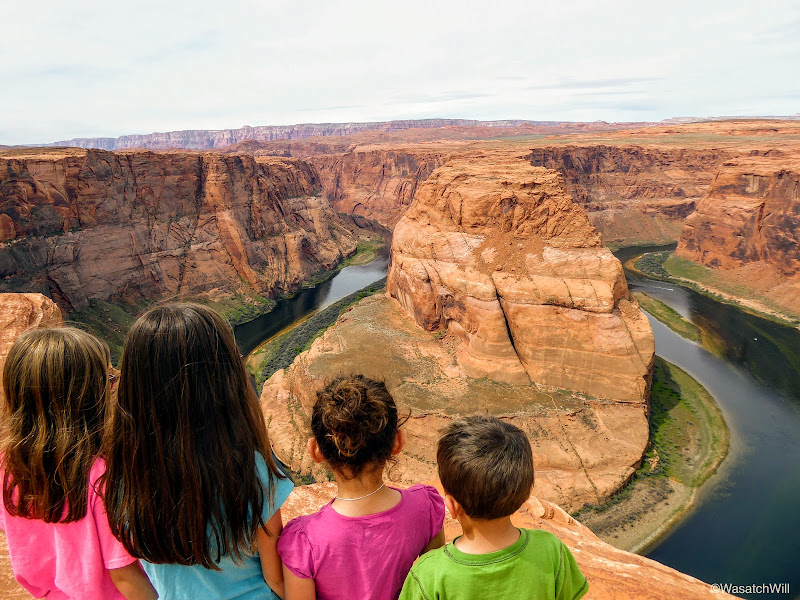
The kids looking out at Horseshoe Bend
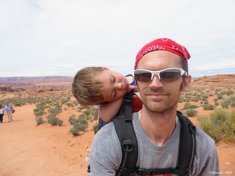
Everett opted for a nap the whole time
After Horseshoe Bend, we were all very hungry and drove another 5 minutes down into Page for some lunch. From Page we drove on over Glen Canyon, pulling over to have a quick look at the dam before moving on to Kanab.
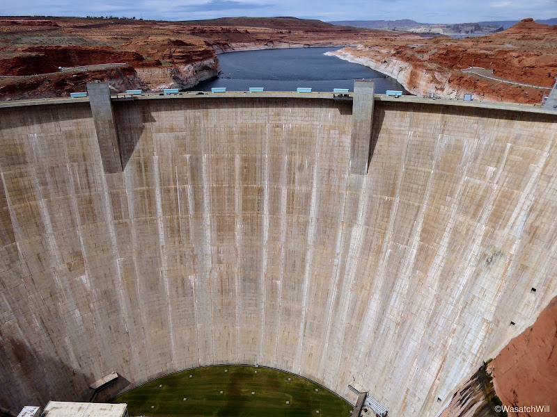
Glen Canyon Dam
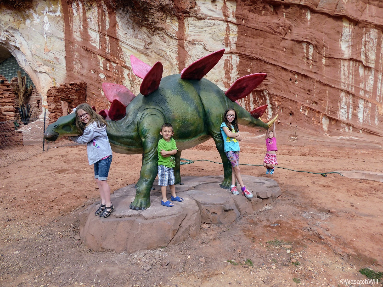
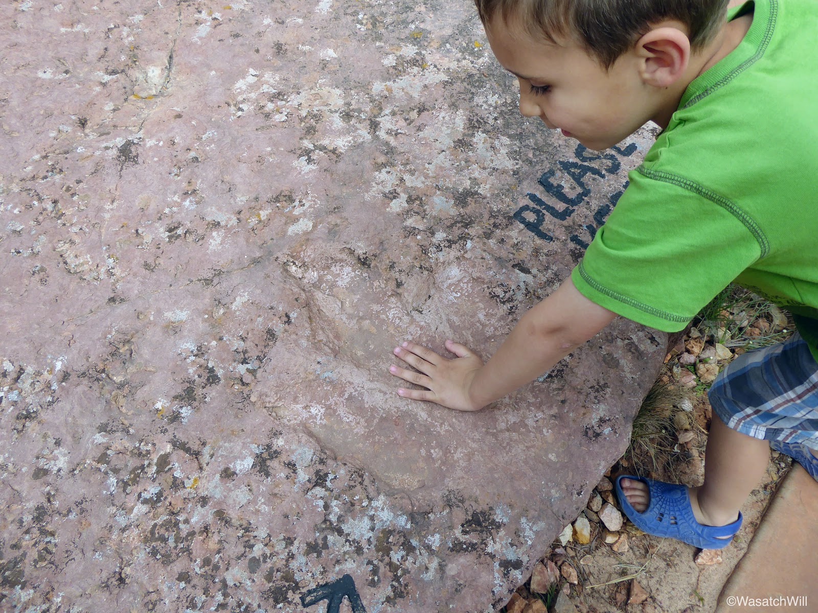
Had we more time and energy, we would have pulled over for another hike up to a little area called the Toadstools before reaching Kanab. Instead, we all agreed to keep on going and save the Toadstools for another day. Just outside of Kanab, we did pull over at a place called Moqui Cave.
Again, had we more time, we may have paid the admission to tour the little museum that it has, but instead, just kept to the outside for a few minutes to stretch and loosen our legs a bit. The kids were particularly fond of the dinosaur statue and some dinosaur footprints fossilized into a boulder out on display.

Dinosaur at Moqui Cave

Lennox sizing up a dinosaur track
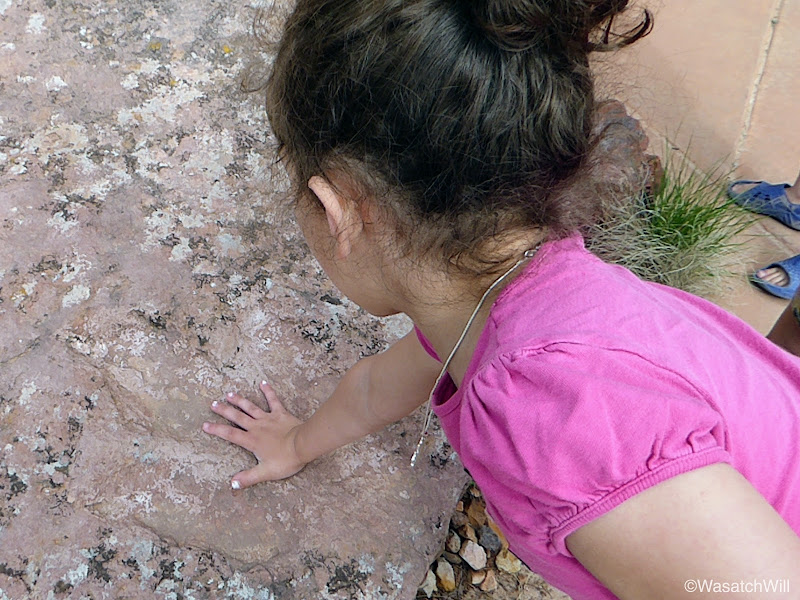
Raylee sizing up a dinosaur track
From Moqui Cave we headed straight up for Torrey where we reunited with our dog, Sophie, and spent our final night of the trip at the home of Jessica's parents.
Video:
Friday - April 7, 2017
Eager to try out the nearby two-mile Spencer Trail that switchbacks and climbs up the Vermillion Cliffs from the banks of the Colorado River at the site of Lee's Ferry and on up to a high plateau above, I awoke at 5 am and started hiking down the road for the trailhead. Along the way, the road crossed over the Paria River. It was pretty cool to think about what was upstream from there. More on that later, though.
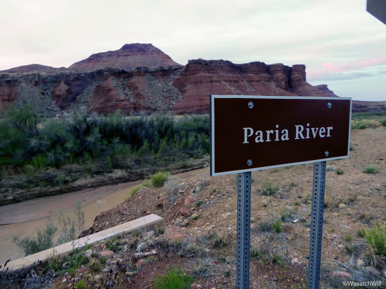
Crossing over the Paria River
The Paria River, looking upstream
I had hoped to make it all the way up the Spencer Trail before sunrise, but that hope was vain. I did not account for the fact that due to Arizona time being an hour behind what Utah time was, the sun was to rise an hour sooner than what I expecting. I also did not account for the one and a half mile length of road between the campground and the trail itself. I had actually planned to just drive it, but in the interest of not wanting to wake up our youngest or anyone else still sleeping at our camp, I opted to use my feet to travel the road instead. Despite all that, I was still privileged to witness another beautiful sunrise.

Sunrise

Sunrise

Sunrise

Looking back west down the road

Looking northward from along the road
Just prior to the trailhead, I veered off down to the boat launch for a few moments to stand at the banks of the Colorado River.

On the banks of the Colorado River

Morning alpenglow
At the start of the trail, I spent a few more minutes looking over the historic pioneer structures and ruins that remained from when Lee's Ferry had operated from the late 1800's through the early 1900's.
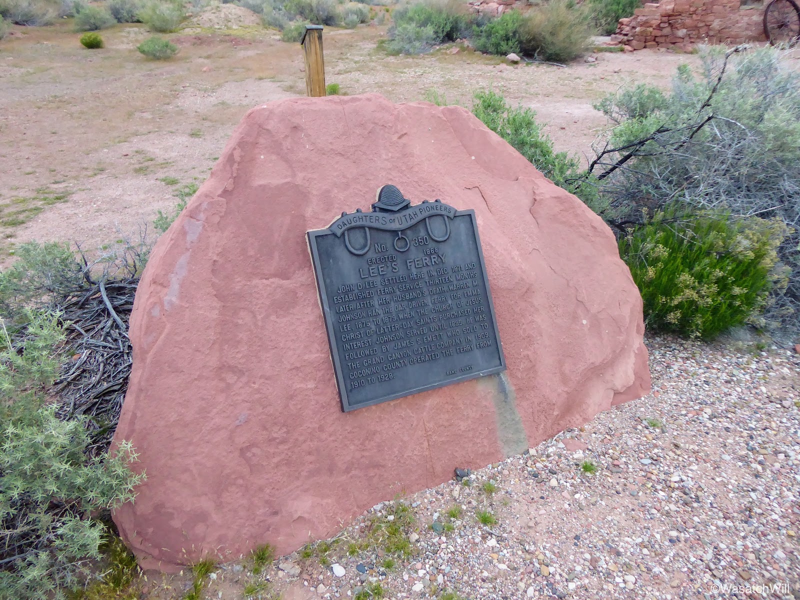
Historic marker

Lee's Ferry Ruins
Lee's Ferry Ruins

Lee's Ferry Ruins
After passing through the ruins, I continued on up the trail and soon started rising high above the Colorado.

On the Spencer Trail looking up the Colorado River
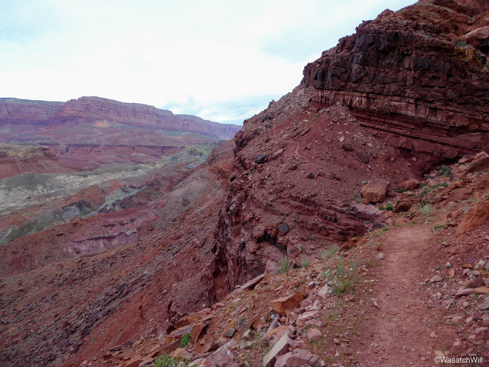
Climbing high up the cliffs
Spencer Trail
About 3/4 of a mile up, the trail became quite exposed. On the left was a short and very steep slide down to a cliff band resulting in a vertical drop of at least 75 feet and on the right was a wall of sandstone clumps and clay. The trail itself was just shy of being a foot wide, or so it seemed. A slip, bump, trip, or tumble at this point, could have easily been fatal, sending myself down the slope and off the cliff.

Narrow and exposed
As one who can have a real fear of heights at times, it was a little nerve-wracking, but I pressed on, slow and steady, as I side stepped it up around the next corner. Given the conditions on either side of the trail, I felt claustrophobic the whole way through this section. Fortunately, it was a very short little stretch and the trail soon led me back to where I had much more 'breathing room'.
Once around what had become the crux for me, I pressed on for another half mile or so before stopping for a good rest and to take in some great views overlooking the Colorado River, Lee's Ferry, and out to the campground and the Navajo Bridge at Marble Canyon.

Looking up the Colorado River

Looking down the Colorado River
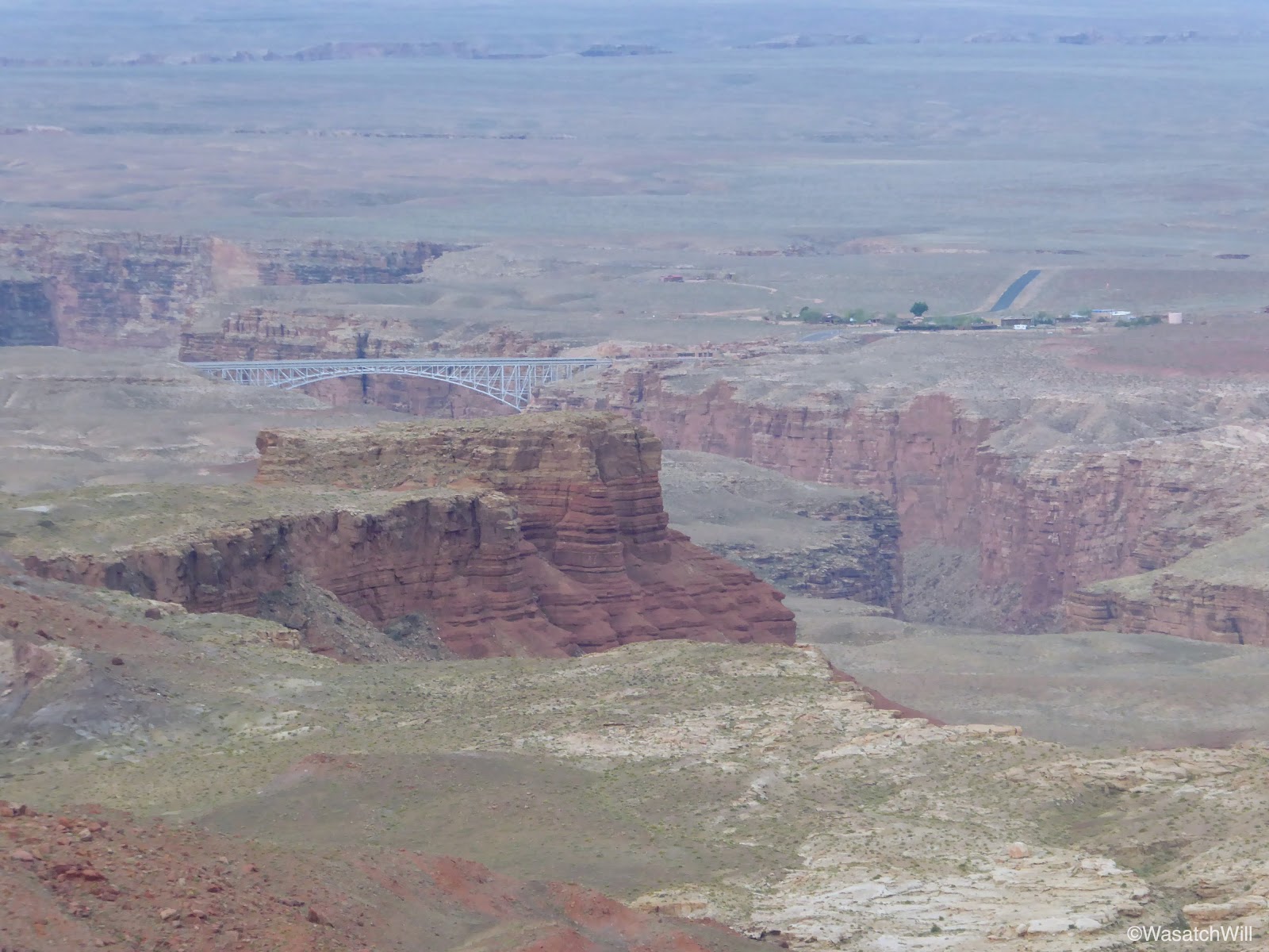
Navajo Bridge and Marble Canyon
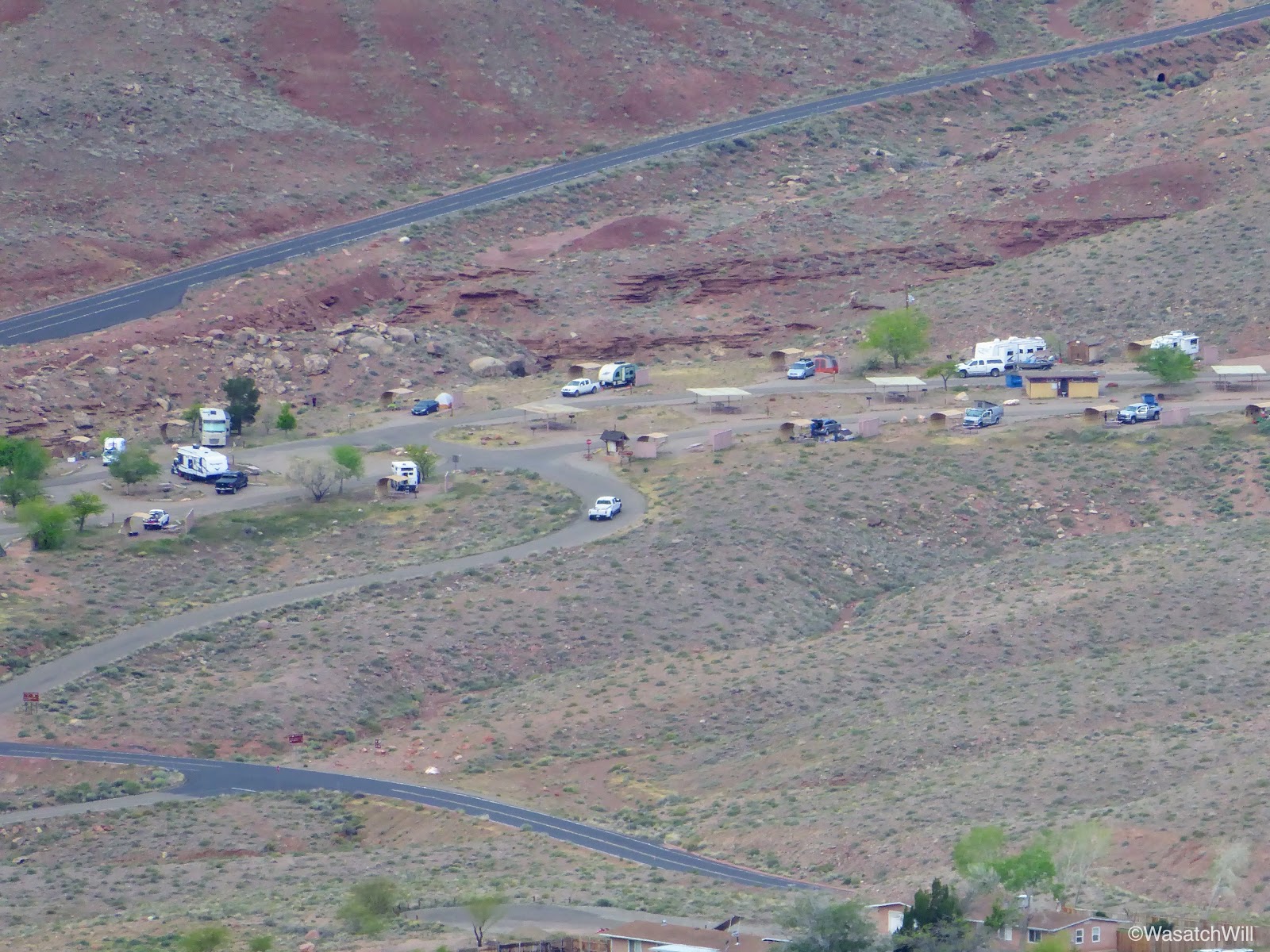
Campground

Lee's Ferry
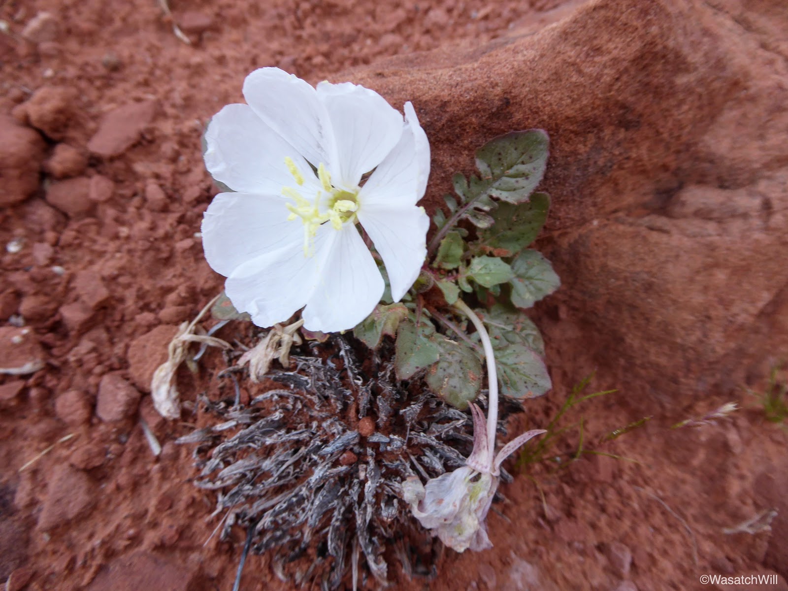
Desert Primrose
It was here that I made the decision to call it good and turn back. It was well past sunrise, my lungs were burning a bit, and my heart rate had been racing. I still had to hike back up the road to get back to camp too. I could not get a cell signal as I thought I might by being within sight of the small community at Marble Canyon. Had I been able to do that, I probably would have kept going all the way up to the top and then made contact with Jessica to have her bring the car with the kids to pick me up at the trailhead and let them checkout the old settlement as well. In hindsight, I probably could have gotten a cell signal at the top as I would have been in sight with the town of Page. Oh well.
I was not looking forward to having to negotiate the exposed spot again, but it came and passed without any incident. On my way down, some boaters could be seen launching off down at the river, no doubt heading upstream to do some fishing.

Boat on Colorado River

Prickly Pear near Colorado River
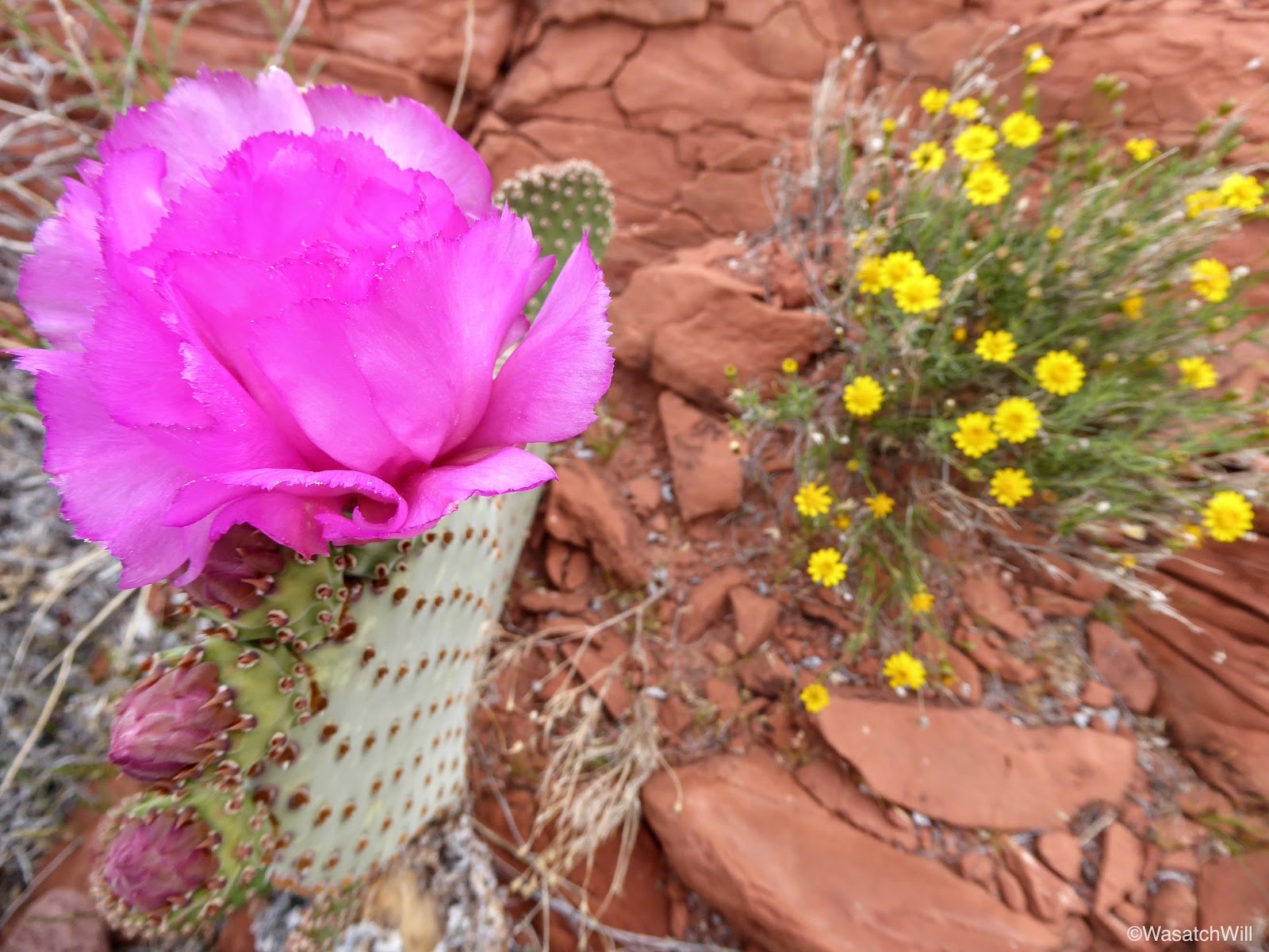
Prickly Pear
The Spencer Trail is an old mule path named after Charles H Spencer who briefly ran a gold mining operation at Lee's Ferry in the early 1900's along the banks of the river. Part of that operation relied on a steamboat to haul coal up and down the river. All that remains of the steamboat now is the boiler that sits just below the trail at the edge of the river where a flood in 1921 had sunk the boat.
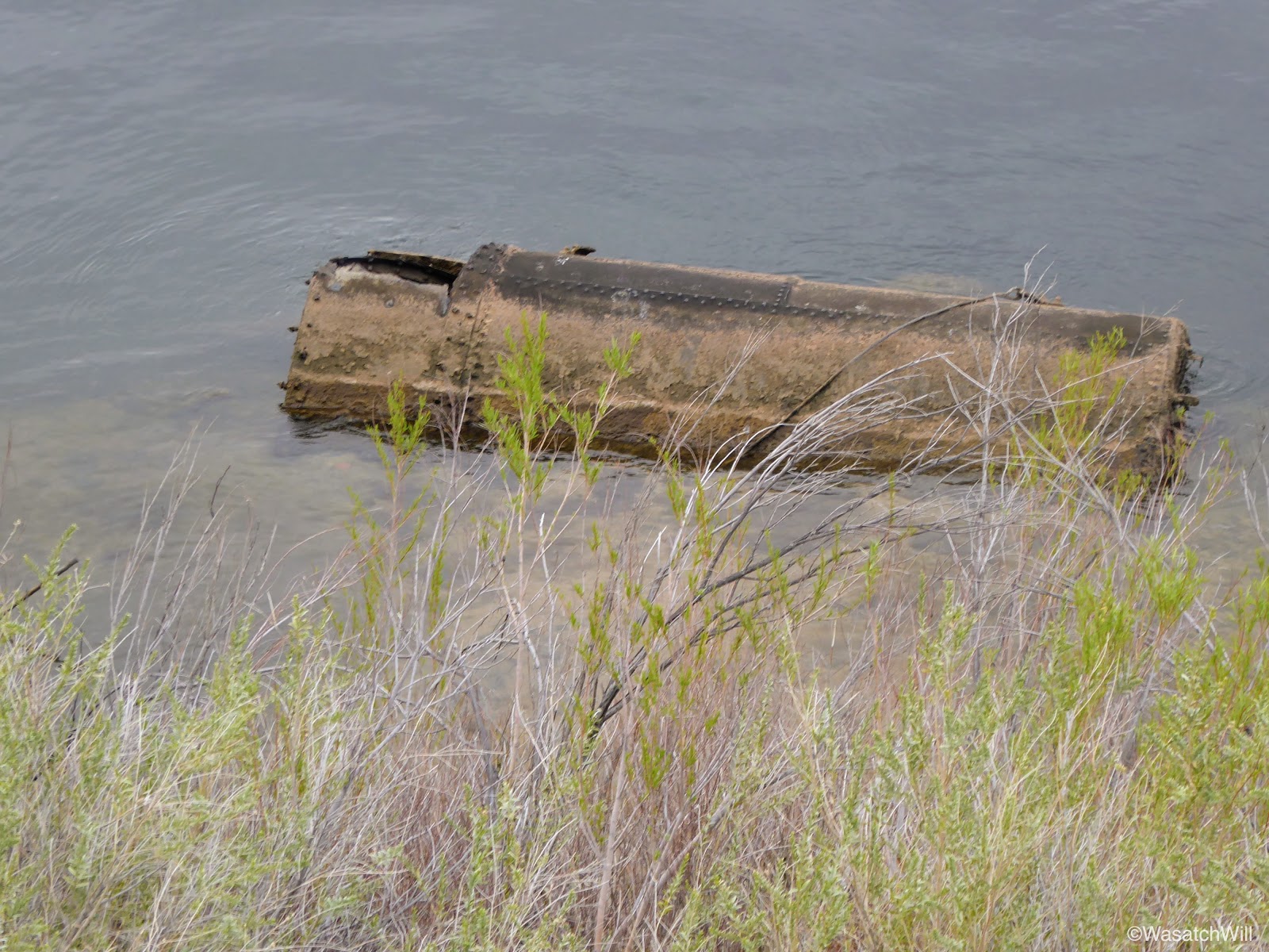
Spencer Steamboat ruin
On my way back up the road, I stopped at the Paria River and went upstream a bit to Lonely Dell Ranch, which was also set up by John D. Lee and served as a homestead for his family.
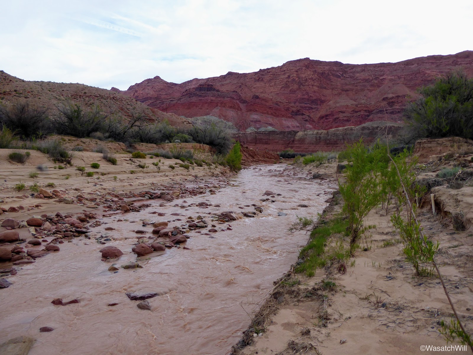
Paria River
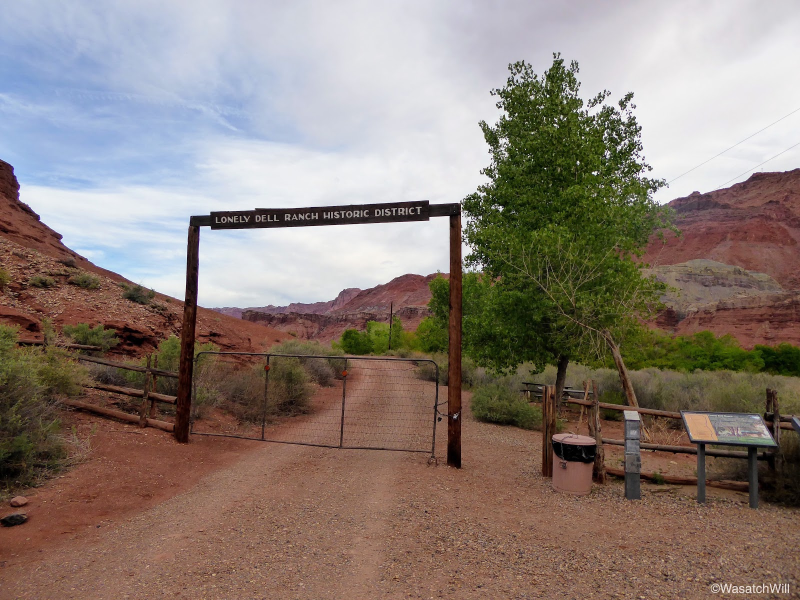
Lonely Dell Ranch
Of the many hikes that are on my bucket list, one is to hike through a slot called Wire Pass and into Buckskin Gulch which then leads to the Paria River and on down to where I was now standing. So here I was standing at the tail end of that route. Had I more time, I would have gone on up into the orchards and explored the old ranch and cemetery further up from the gate, but alas, I needed to get back to camp as I was sure my family was all up by now and I didn't want to leave them waiting on me much longer.
Soon, I was back camp where we packed up and got going again.
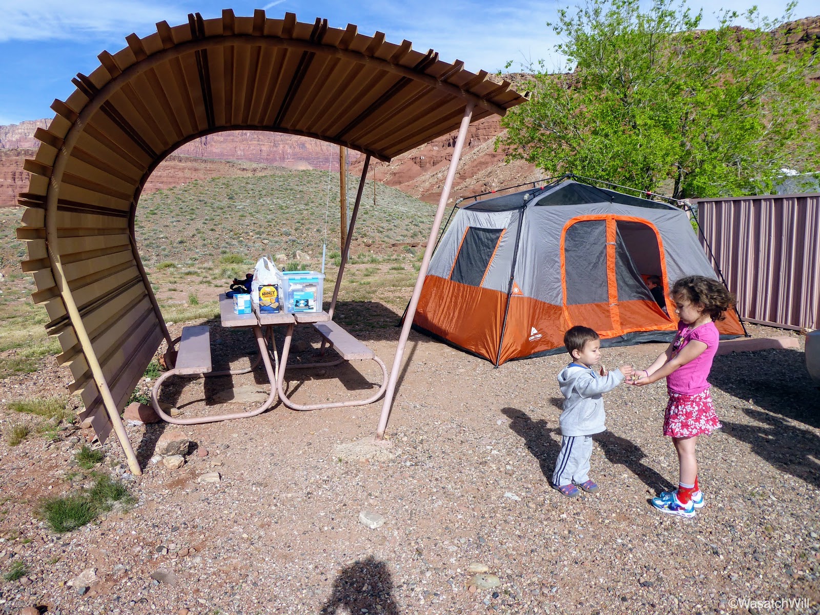
Our Camp
Before heading out from Lee's Ferry, I drove the family back up to the trailhead so they could stand at the edge of the Colorado River and see all the old structures nearby.
Touching the Colorado River
Family photo at Lee's Ferry ruins

Old wheel at Lee's Ferry ruins
On the way out from Lee's Ferry, we made another quick stop at the Navajo Bridge.
New Navajo Bridge
Marble Canyon
Checking out Marble Canyon from old Navajo Bridge

The kids on the old Navajo Bridge
From Navajo Bridge and Marble Canyon, the faster route back into Utah and up to Torrey for the night would have been to head west toward Jacobs Lake and then northward up through Kanab from there. But since we were so close to Horseshoe Bend, a scenic point where the Colorado River makes a sharp bend, we opted to go to other way to check that out.
I knew Horseshoe Bend was popular among photographers, especially around sunrise and sunset, but I did not anticipate much more than a dozen other vehicles being at the trailhead since it was closer to the middle of the day. I was wrong. I did not know just how big the trailhead parking lot really was and when we arrived, it felt like we were back at the zoo. There was literally close to a couple hundred cars and it showed on the trails with hundreds of people parading up and down the short trail and flocked all around the viewpoint. Still, we found ourselves a parking spot and joined the throngs of others on the trail.
Starting up the trail to Horseshoe Bend
On the trail to Horseshoe Bend
Horseshoe Bend

Will overlooking Horseshoe Bend

The kids looking out at Horseshoe Bend

The kids looking out at Horseshoe Bend

Everett opted for a nap the whole time
After Horseshoe Bend, we were all very hungry and drove another 5 minutes down into Page for some lunch. From Page we drove on over Glen Canyon, pulling over to have a quick look at the dam before moving on to Kanab.

Glen Canyon Dam
Had we more time and energy, we would have pulled over for another hike up to a little area called the Toadstools before reaching Kanab. Instead, we all agreed to keep on going and save the Toadstools for another day. Just outside of Kanab, we did pull over at a place called Moqui Cave.
Again, had we more time, we may have paid the admission to tour the little museum that it has, but instead, just kept to the outside for a few minutes to stretch and loosen our legs a bit. The kids were particularly fond of the dinosaur statue and some dinosaur footprints fossilized into a boulder out on display.
Dinosaur at Moqui Cave
Lennox sizing up a dinosaur track

Raylee sizing up a dinosaur track
From Moqui Cave we headed straight up for Torrey where we reunited with our dog, Sophie, and spent our final night of the trip at the home of Jessica's parents.
Video: