- Joined
- May 5, 2012
- Messages
- 1,727
A few years back my brother and I set out on a late-season backpacking hike with the intention of overnighting at Ibantik Lake. The plan was to do an out-and-back by way of the Crystal Lake trailhead. But cold, rainy weather turned us back at the notch.
We've intended to make good on the aborted effort ever since.
With clear weather forecast for September 14th and each of us having the day off work, we set out to do just that. However this time we opted for the point-to-point route starting from the Bald Mountain trailhead.
It was a gorgeous, cloudless day cruising up the Mirror Lake Highway. Fall colors down low around Samak were just starting to pop. Kids were back in school and the road wasn't too crowded for the start of a fall weekend. We made a couple quick stops before starting on trail so my brother could fly his RC planes.
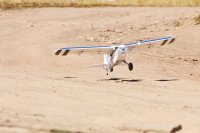
This included taking his pontoon plane to Mirror Lake.
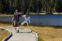
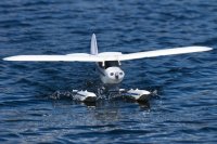
Winds were a little squirrelly but he managed to keep the little plane under control as a small crowd of fishermen and picnickers spectated.
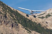
The delay meant we didn't start on trail until about 3 p.m. We made quick time down to Clegg Lake, then continued on to Notch Lake.
The drought has taken a real toll on Notch. The water level is down 10-12 feet from full pool. This has left wide stretches of barren shoreline. The "lake" that's left is quite shallow.
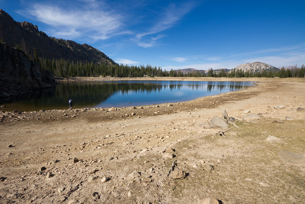
Drought by ashergrey, on Flickr
Moving on, we continued down the trail as it drops toward the Main Fork of the Weber River. Views were grand, with a few isolated stands of deciduous trees turning colors on the far side of the gorge. Then, turning south we worked our way back up to Ibantik Lake, listening to a chorus of Clarks Woodpeckers along the way.
Two other groups were in the vicinity, with one group camped on the south-eastern shore and another fishing on the south-western side. We snagged a campsite on the north-western side, up on the rocks above the lake. I set up to shoot a time-lapse of the waning afternoon light but failed to switch from raw to jpg. That meant I had to cut the sequence short to avoid burning a full 32 gig card.
Now, thanks to the lateness of the season the fire ban in the national forest had been lifted. While gathering firewood, I spotted some amazing alpenglow on the slopes across the gorge. But by the time I made it back to camp and swapped lenses, it was all but gone.
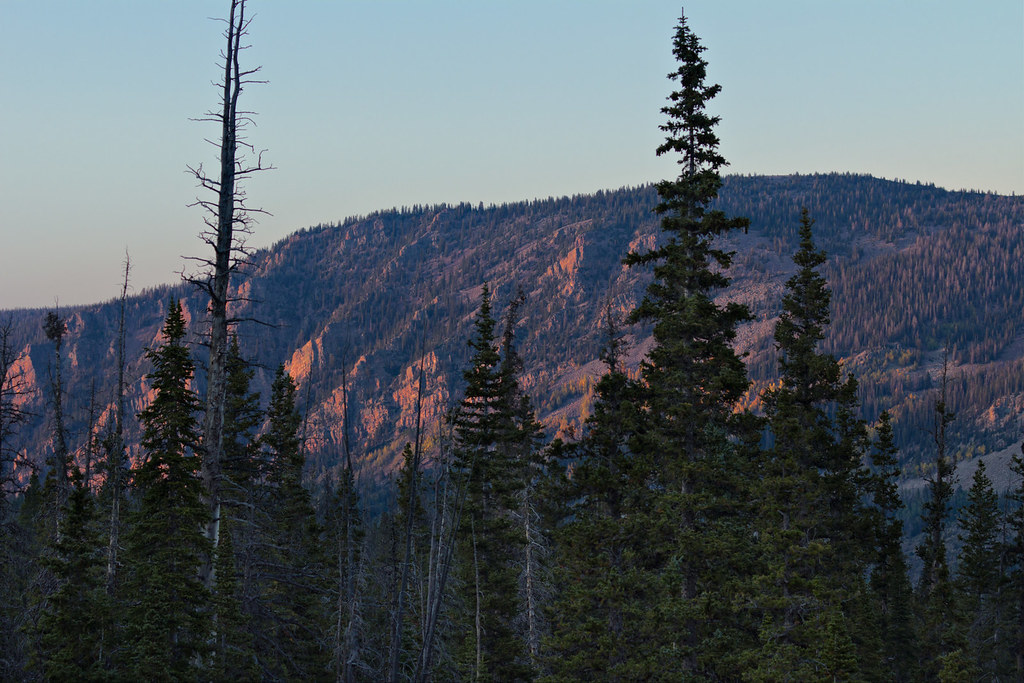
Last Light by ashergrey, on Flickr
As the sun dropped below Notch Mountain on the west, we lit up the fire and enjoyed the familiar smoky scent of dried pine burning. I played around with some campfire light photographs while waiting for the stars to appear.
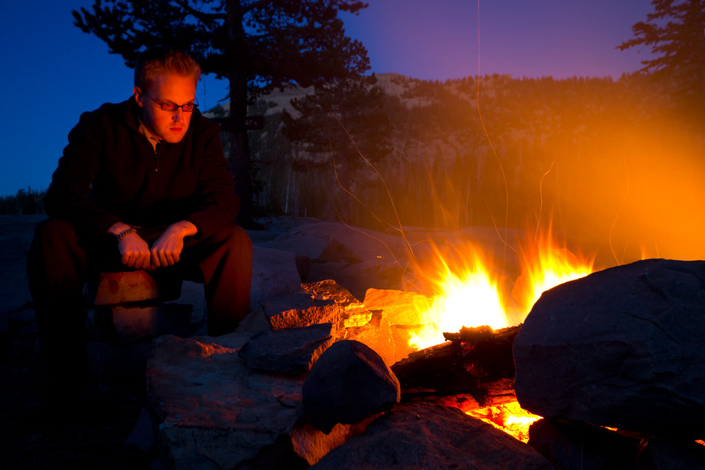
Self-portrait by campfire by ashergrey, on Flickr
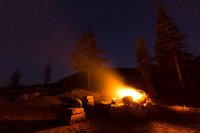
This trip co-incided with the new moon so as soon as the sky darkened, the stars popped.
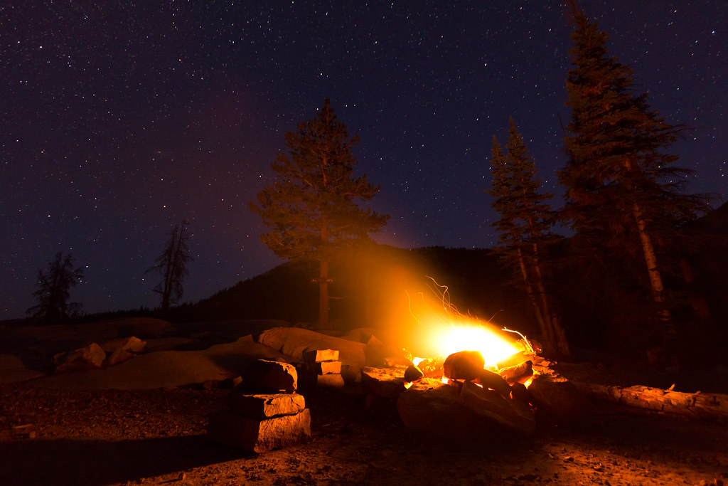
The Campfire by ashergrey, on Flickr
After dinner, I headed down to the water line to shoot some night sky shots. I should have scouted before nightfall because I had a difficult time finding a foreground anchor. Most of the shots came out pretty flat. This is looking south. It's amazing that you can still get so much Salt Lake light pollution bouncing off the low clouds.
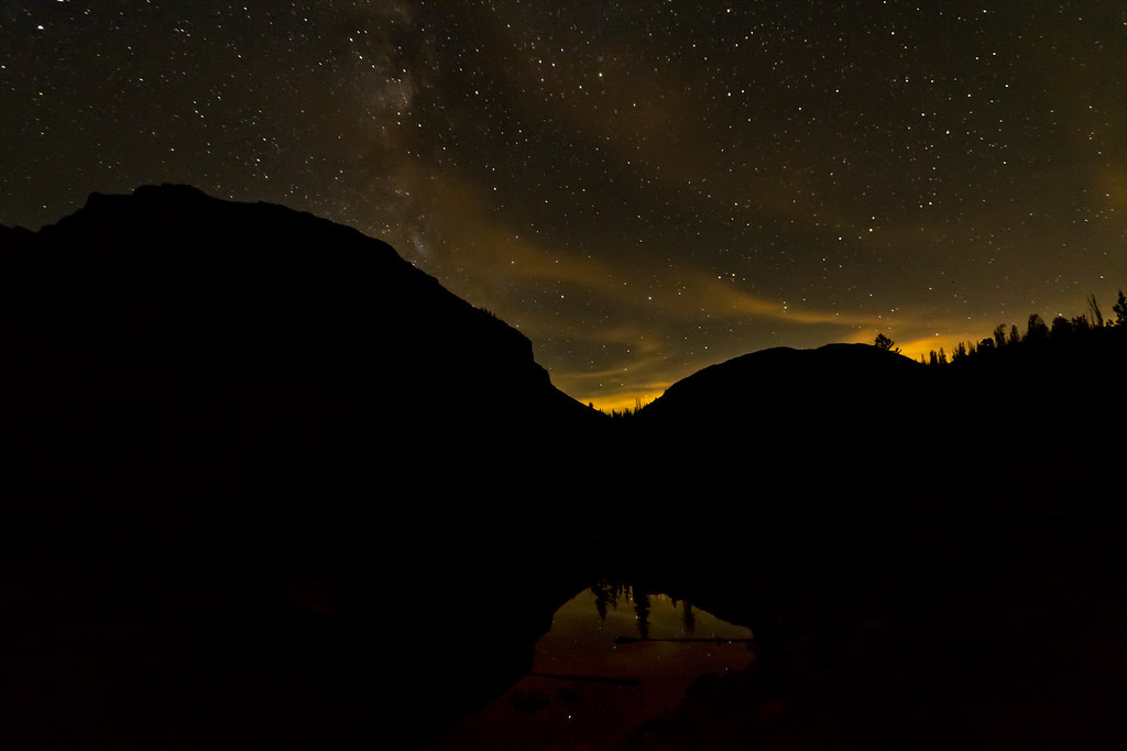
The Notch at Night by ashergrey, on Flickr
I was tempted to walk my flash around to the far side of the lake and see if I could light up the cliff face using the radio trigger but decided it would probably piss off the other campers. Instead I set up for this north-facing star trail shot and headed off to bed.
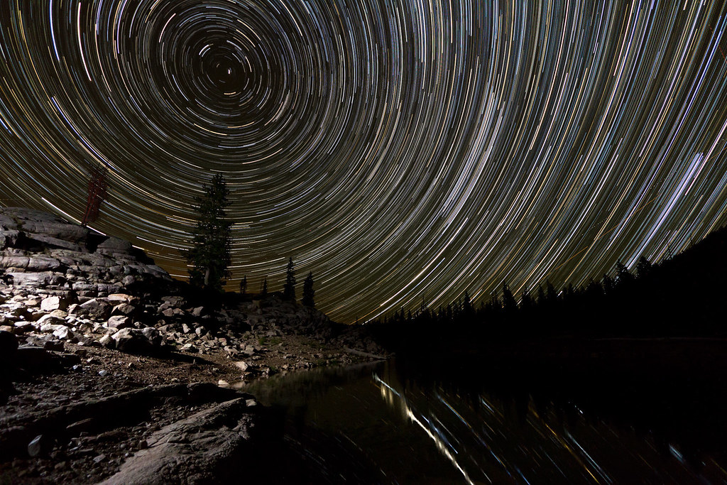
Moonless Night at Ibantik by ashergrey, on Flickr
A light breeze smeared up the reflections on the water. I consider that something of a failed attempt.
At some point during the night, the sky clouded over. It remained dry and chilly though, and I slept comfortably in my 15-degree bag. My brother only has a summer bag and had to carry an extra blanket on this trip to stay warm. Being a cold sleeper, I've not regretted the extra weight of my heavier bag so far. When I awoke at about 6:45 a.m., the predawn sun was lighting up the clouds, turning them pink and orange. But by the time I was dressed and out of bed the colors were gone and I was left with this cool blue hue.
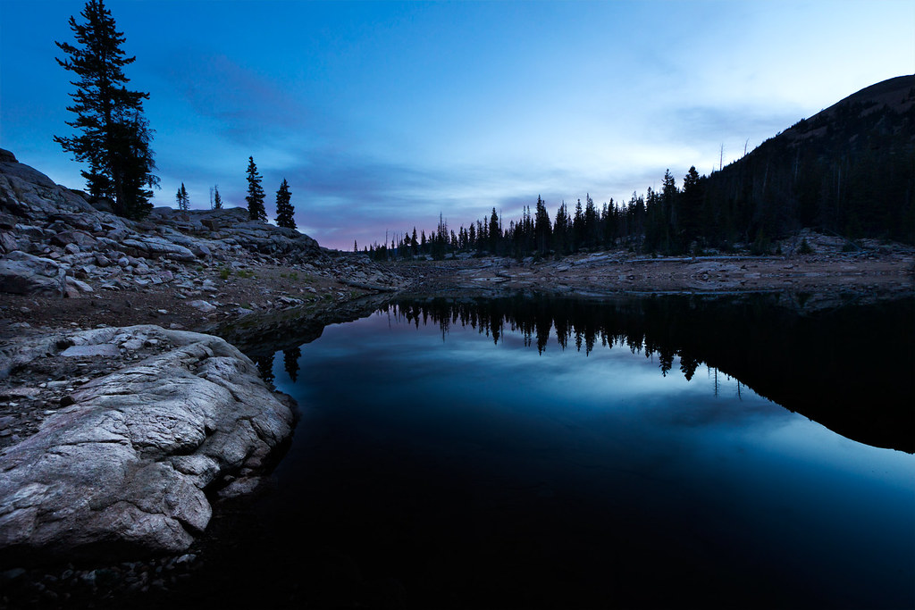
Predawn by ashergrey, on Flickr
I worked my way around the north shore of the lake, shooting as the rising sun moved across the face of Notch Mountain.
As you can see, Ibantik is also very low. This next shot is from the top of the Ibantik dam. I didn't get any good pictures, but there are barren trees around the typical water line that now show bathtub ring five or six feet up the trunks.
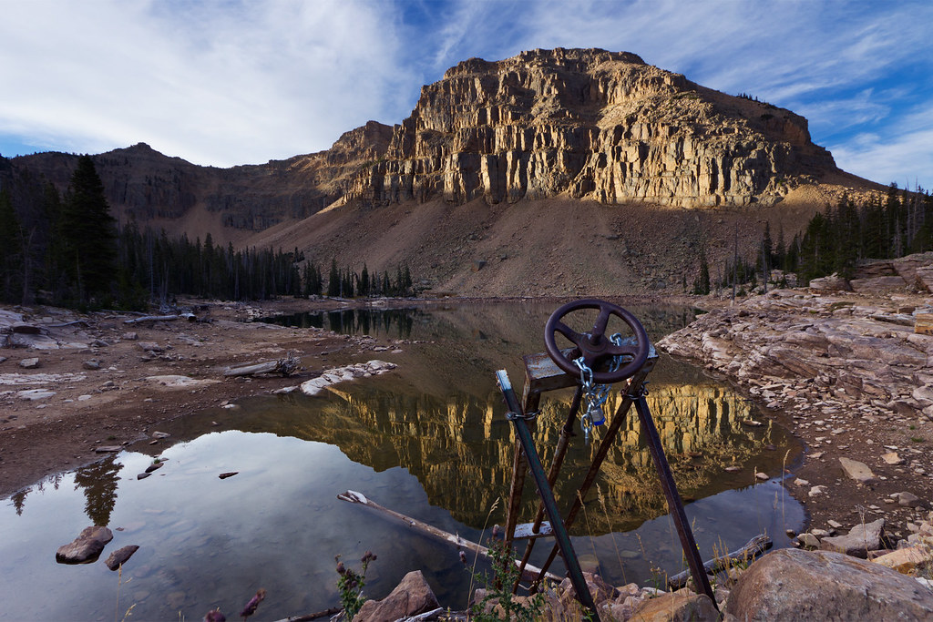
First Light on Notch Mountain by ashergrey, on Flickr
An upshot to the lower water and late-season warmth is that bugs were a complete non-factor. I can't remember the last time I came back from the Uintas without a single mosquito welt.
My brother needed to be back to Salt Lake for work by about noon, so we made quick work of breaking camp and getting back on trail.
By about 9 a.m. we had crested the pass. This is looking down on Lovenia Lake from the Notch.
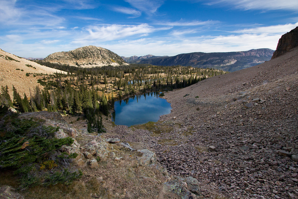
Lake Lovenia by ashergrey, on Flickr
Round about this point we spotted a pair of the reliable mountain goats that inhabit this area, but they were too far away to get a decent picture even with a long telephoto lens. Short on time, I snapped a couple quick shots on the move then put the camera away for the duration.
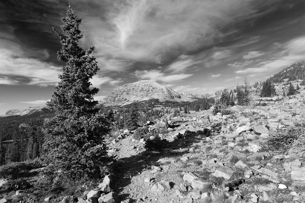
Mt. Watson from the Notch by ashergrey, on Flickr
We pushed on southward, running into many more people as we dropped down toward Wall Lake. The largest was a Boy Scout group probably totaling 25 or so people. I grumbled my gratitude that we were leaving as they were arriving in the area. While this area isn't designated wilderness and thus not subject to the same group size limitations, I really dislike the impact that these sorts of troops create.
The Crystal Lake parking lot was, expectedly, packed when we arrived. It felt good to be leaving the area while most of the Saturday crowd was just setting out. This is a Uintas classic and I'm glad to finally have it off my list. I could see real value into creating a variation where you turn west on the south side of the notch and cross over the divide to Hidden Lake. Spending a second night there and then returning on the far side of the Clyde Lake loop would be fun.
[PARSEHTML]<iframe src="http://www.mappingsupport.com/p/gmap4.php?q=http://dl.dropbox.com/u/3847512/GPS/Notch.kml&t=t4" frameborder="0" marginheight="0" scrolling="no" width="800" height="800"></iframe><br><br>[/PARSEHTML]
Featured image for home page:
We've intended to make good on the aborted effort ever since.
With clear weather forecast for September 14th and each of us having the day off work, we set out to do just that. However this time we opted for the point-to-point route starting from the Bald Mountain trailhead.
It was a gorgeous, cloudless day cruising up the Mirror Lake Highway. Fall colors down low around Samak were just starting to pop. Kids were back in school and the road wasn't too crowded for the start of a fall weekend. We made a couple quick stops before starting on trail so my brother could fly his RC planes.

This included taking his pontoon plane to Mirror Lake.


Winds were a little squirrelly but he managed to keep the little plane under control as a small crowd of fishermen and picnickers spectated.

The delay meant we didn't start on trail until about 3 p.m. We made quick time down to Clegg Lake, then continued on to Notch Lake.
The drought has taken a real toll on Notch. The water level is down 10-12 feet from full pool. This has left wide stretches of barren shoreline. The "lake" that's left is quite shallow.


Drought by ashergrey, on Flickr

Moving on, we continued down the trail as it drops toward the Main Fork of the Weber River. Views were grand, with a few isolated stands of deciduous trees turning colors on the far side of the gorge. Then, turning south we worked our way back up to Ibantik Lake, listening to a chorus of Clarks Woodpeckers along the way.
Two other groups were in the vicinity, with one group camped on the south-eastern shore and another fishing on the south-western side. We snagged a campsite on the north-western side, up on the rocks above the lake. I set up to shoot a time-lapse of the waning afternoon light but failed to switch from raw to jpg. That meant I had to cut the sequence short to avoid burning a full 32 gig card.
Now, thanks to the lateness of the season the fire ban in the national forest had been lifted. While gathering firewood, I spotted some amazing alpenglow on the slopes across the gorge. But by the time I made it back to camp and swapped lenses, it was all but gone.

Last Light by ashergrey, on Flickr
As the sun dropped below Notch Mountain on the west, we lit up the fire and enjoyed the familiar smoky scent of dried pine burning. I played around with some campfire light photographs while waiting for the stars to appear.

Self-portrait by campfire by ashergrey, on Flickr
This trip co-incided with the new moon so as soon as the sky darkened, the stars popped.

The Campfire by ashergrey, on Flickr
After dinner, I headed down to the water line to shoot some night sky shots. I should have scouted before nightfall because I had a difficult time finding a foreground anchor. Most of the shots came out pretty flat. This is looking south. It's amazing that you can still get so much Salt Lake light pollution bouncing off the low clouds.

The Notch at Night by ashergrey, on Flickr
I was tempted to walk my flash around to the far side of the lake and see if I could light up the cliff face using the radio trigger but decided it would probably piss off the other campers. Instead I set up for this north-facing star trail shot and headed off to bed.

Moonless Night at Ibantik by ashergrey, on Flickr
A light breeze smeared up the reflections on the water. I consider that something of a failed attempt.
At some point during the night, the sky clouded over. It remained dry and chilly though, and I slept comfortably in my 15-degree bag. My brother only has a summer bag and had to carry an extra blanket on this trip to stay warm. Being a cold sleeper, I've not regretted the extra weight of my heavier bag so far. When I awoke at about 6:45 a.m., the predawn sun was lighting up the clouds, turning them pink and orange. But by the time I was dressed and out of bed the colors were gone and I was left with this cool blue hue.

Predawn by ashergrey, on Flickr
I worked my way around the north shore of the lake, shooting as the rising sun moved across the face of Notch Mountain.

As you can see, Ibantik is also very low. This next shot is from the top of the Ibantik dam. I didn't get any good pictures, but there are barren trees around the typical water line that now show bathtub ring five or six feet up the trunks.

First Light on Notch Mountain by ashergrey, on Flickr
An upshot to the lower water and late-season warmth is that bugs were a complete non-factor. I can't remember the last time I came back from the Uintas without a single mosquito welt.
My brother needed to be back to Salt Lake for work by about noon, so we made quick work of breaking camp and getting back on trail.

By about 9 a.m. we had crested the pass. This is looking down on Lovenia Lake from the Notch.

Lake Lovenia by ashergrey, on Flickr
Round about this point we spotted a pair of the reliable mountain goats that inhabit this area, but they were too far away to get a decent picture even with a long telephoto lens. Short on time, I snapped a couple quick shots on the move then put the camera away for the duration.

Mt. Watson from the Notch by ashergrey, on Flickr
We pushed on southward, running into many more people as we dropped down toward Wall Lake. The largest was a Boy Scout group probably totaling 25 or so people. I grumbled my gratitude that we were leaving as they were arriving in the area. While this area isn't designated wilderness and thus not subject to the same group size limitations, I really dislike the impact that these sorts of troops create.
The Crystal Lake parking lot was, expectedly, packed when we arrived. It felt good to be leaving the area while most of the Saturday crowd was just setting out. This is a Uintas classic and I'm glad to finally have it off my list. I could see real value into creating a variation where you turn west on the south side of the notch and cross over the divide to Hidden Lake. Spending a second night there and then returning on the far side of the Clyde Lake loop would be fun.
[PARSEHTML]<iframe src="http://www.mappingsupport.com/p/gmap4.php?q=http://dl.dropbox.com/u/3847512/GPS/Notch.kml&t=t4" frameborder="0" marginheight="0" scrolling="no" width="800" height="800"></iframe><br><br>[/PARSEHTML]
Featured image for home page:


