Hurricane Canal and Rim Loop

Joined
Jan 19, 2012
Messages
739
IMG_0575.jpg
Boy its already getting too hot to do my local trails!

The first week of May my younger brothers and myself decided to hike the Hurricane Canal Trail. There are several ways to access the Hurricane Canal. The easiest is just off of SR9 in Hurricane but because of private land issues only about 1 1/2 miles of the trail is accessible (this may be changing I just heard that the owner of Pah Tempe lost his appeal and at one time I heard rumor that Washington County Water Conservancy District (WCWCD) was taking the land this could be good because access will be granted but also bad because I also heard it isnt a fan of the natural springs polluting the river and want to eliminate them but that is all local rumor I believe)

The trailhead we used was the Virgin Dam trailhead. Information about the Canal Trail from this trailhead is lacking so I wasnt sure what to expect. I did underestimate our mileage by about half (I assumed it would be 3-4 and it was 7+)

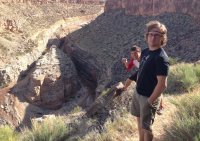
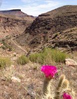
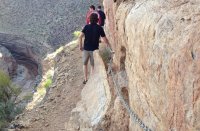
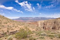
The trail very quickly drops from the rim to the valley
IMG_0531.jpg

IMG_0532.jpg

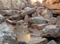
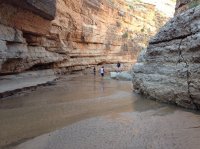
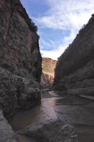
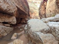
and from above we spotted a surprise the canyon slots up just off the trail. Besides the Narrows I dont know if the walls of the Virgin River Canyon are closer in any other spot.
IMG_0540.jpg

IMG_0544.jpg

IMG_0546.jpg

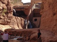
While this section of the canyon was short it was pretty awesome. After about 1/3 a mile we were forced to turn around by the Virgin River Diversion Dam.
IMG_0555.jpg

IMG_0572.jpg

IMG_0561.jpg

IMG_0563.jpg

After exploring the Diversion Dam slot, we started the actual trail.

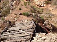
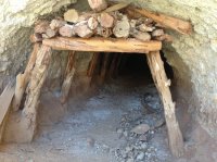
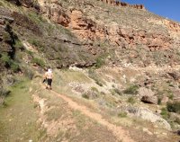
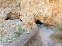
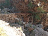
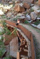
The canal trail mostly is a single track trail along the historic canal. There are a few parts where the trail forces you to walk in the canal and because of some land slides a few parts were you have to scramble above or below the canal. Also along the canal trail there are historic CCC relics, an old flume, and even several tunnels that require a flashlight.
IMG_0569.jpg

IMG_0582.jpg

IMG_0583.jpg

IMG_0586.jpg
The Historic China Town Flume

IMG_0589.jpg

IMG_0590.jpg


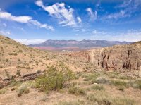
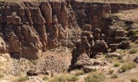
Eventually my brothers realized that I underestimate pretty much every trail I hike and were getting a bit crabby because they knew we had 3+ miles to get back to our car and it was getting hot. I ran ahead and realized we were freaking close to Pah Tempe and the bridge between Hurricane and LaVerkin. I had two of my brothers cross the river and walk along the WCWCD pipeline (they have a right of way and as long as you stay near the pipeline legally you can walk through the private property) My other brother and climbed out of the canyon using the connector trail to the Hurricane Rim Trail and ran back to the car 3 miles away.
IMG_0591.jpg

IMG_0592.jpg
(you can see the canal entering a tunnel)

Featured image for home page:
slide.jpg
 
Awesome TR. Where exactly is this trail? Any chance you could post a map? I love old relics along the trail.
 
Tyler, this trail is just above Hurricane Utah. We parked here N 37° 11.782 W 113° 14.107 and here N 37 11.006 W 113 16.705 and made it a one way hike.
 
http://www.blm.gov/pgdata/etc/media...s.Par.57503.File.dat/Hurricane_trails_map.pdf

Sorry cant figure how to upload the actually pdf?

I started at the virgin dam trailhead, dropped down to the canal trail, followed the canal trail +-3 miles, then climbed back to the rim and followed the rim trail back to the virgin dam trailhead. You could probably shave a couple miles off by taking the Rim trail to the hurricane hill trailhead, or instead just keep going down the Virgin River toward Pah Tempe and follow the pipeline to avoid private property issues. The Chinatown Flume is the pink line on the map and I thought was a highlight of the trail. According to the map you drop off the canal trail and then take a spur trail to the bottom of the flume. We actually stayed in the Canal, went around two trail closed ahead fences and climbed through a sketchy tunnel to cross the flume but....
 
That's cool!
I love your local hikes reports and pictures, Seldom Seen.
Virgin River has a nice scenery.
 
Similar threads
Thread starter Title Forum Replies Date
Yvonne Hiking the Hurricane Canal and Hurricane Rim Loop, February 15 Hiking & Camping 4
Martyn Hi from Hurricane Utah! Noobs: Introduce yourself! 1
fossana AZ Strip bike exploration (Sunshine Trail/Hurricane Wash Loop) Everything Else 3
NorthwestWanderer Backpacking Grand Teton National Park : Fossil Pass,Fox Creek Pass,Indian Lake,Alaska Basin,Hurricane Pass,Ice Floe Lake,& Snowdrift Lake Backpacking 19
kwc Hurricane Mtn hike in the Adirondacks Hiking & Camping 2
woodmaker_58 Table Mt to Hurricane Pass/ Teton Crest Trail Trip Planning 5
natylka Backpacking: Hurricane Wash into Coyote Gulch of 26 miles back in May Backpacking 3
Seldom Seen Anderson Hurricane Rim Trail Hiking & Camping 13
DrNed Murdock Canal Trail Hiking & Camping 0
BeardoMcGrath Fiftymile Mountain rim and ruins tour: 13 May 2023 Hiking & Camping 12
TrailScot Dayhiking the Under-the-Rim Trail - Bryce Canyon NP - October 2023 Hiking & Camping 4
Ugly Thanksgiving Rim Walkin 2022 Backpacking 8
Ellen Zion West Rim Trail, December 2022 Trip Planning 3
chandlerwest Bryce Canyon - Under The Rim Trail Hiking & Camping 0
Yvonne Sky Rim Trail, Yellowstone, August 6, 2020 Hiking & Camping 15
D White Rim Road Off Road 2
Parma White Rim Road FKT General Discussion 4
IntrepidXJ Diane’s Birthday Ride on the White Rim Trail Everything Else 3
Bob Grand Canyon North Rim wildfire Trip Planning 4
priz1234 Virgin River Rim Trail 6/6-6/7 Backpacking 4
Kullaberg63 Pack Creek to Castle Valley - below the rim. Backpacking 0
Yvonne Snow Hike up the West Rim, December 15, 2019 Hiking & Camping 7
fossana 24 Aug rockfall and E Rim trail closure in Zion (again) General Discussion 3
chandlerwest Zion - West Rim Loop...........in July???? Hiking & Camping 7
fossana Snow Canyon rim loop Hiking & Camping 1
M Zion West Rim Trail, Early April 2019 Trip Planning 40
fossana solo white rim day trip on the dual sport Off Road 11
MVS White Rim Side Roads Trip Planning 4
RyanP White Rim Road vehicle/difficulty questions Trip Planning 8
J Dayhikes GSENM, Cap Reef, Behind the Rocks: Deer Cr, Tanks, Sheets Gulch, Moab Rim Apr. 4 to 8, 2018 Hiking & Camping 0
SKLund Anyone Done Under the Rim? Trip Planning 12
MVS White Rim General Discussion 10
Nanda White rim in March Trip Planning 3
Outdoors24 Zion West Rim Trail in winter Trip Planning 6
chandlerwest Zion Nat'l Park - Rim of the East Canyons Hiking & Camping 5
scatman Red Butte Canyon Rim-Walk - May 20, 2017 Hiking & Camping 10
K TR: Under the Rim First segment - Bryce Canyon Backpacking 3
DrNed White Rim On A White Bike Everything Else 9
dug White Rim Trail - self supported. April 2016 Everything Else 1
DrNed White Rim Trail - Fort Ruin Question Trip Planning 4
steve Biking the White Rim Trail Everything Else 7
powderglut Rainbow Rim Trail, Kaibab NF? Trip Planning 2
Ross Canaan Mountain & Little Colorado rim exploration Backpacking 16
DrNed Help With Water On White Rim Trip Planning 11
DrNed White Rim Road Questions Trip Planning 14
Scott Chandler White Rim Road Opinions Trip Planning 18
Ben West Coast Trail, Pacific Rim NP, Vancouver Island Backpacking 20
Vegan.Hiker Access to North Rim during off-season Trip Planning 3
IntrepidXJ Day-Use Permits Now Required for Elephant Hill and White Rim Roads General Discussion 9
Ross Invite: Exploring Little Colorado's north rim + Colorado East Rim viewpts Trip Planning 3

Similar threads

Back
Top