Udink
Still right here.
- Joined
- Jan 17, 2012
- Messages
- 1,691
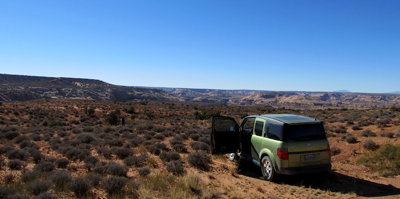
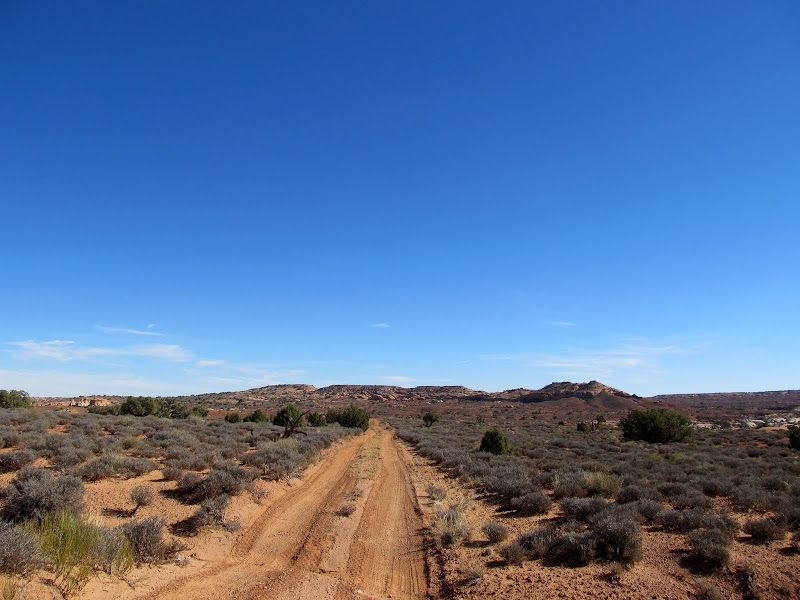
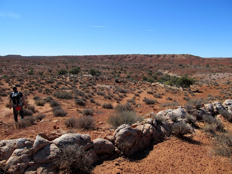
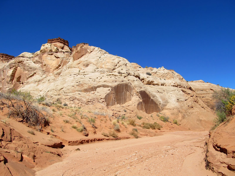
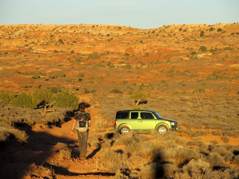
In a departure from my usual fare, my friend Chris and I descended High Spur, a technical canyoneering route in the Robber's Roost area. We woke up early on the morning of Friday, October 19, and started putting our gear together. We could have driven both our vehicles and saved ourselves from a 2.6-mile road walk, but I couldn't justify driving my Jeep over 120 miles of dirt roads for that, and Chris was willing to just take his Honda Element (which performed admirably on the rough parts of the road). Despite rising early we didn't reach the trailhead until around 11:00AM. We hid our packs under a juniper tree near the trailhead then drove toward the canyon's exit and left the vehicle there. It took less than an hour to walk the 2.6 miles back to the trailhead where we shouldered our packs and started off toward High Spur.
We parked the Element here near the end of the canyoneering route, then walked 2.6 miles down the road to retrieve our packs and get started
Road-walking to the start of the canyon
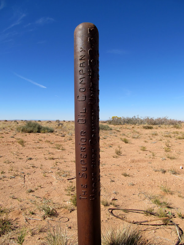
Drill hole along the road
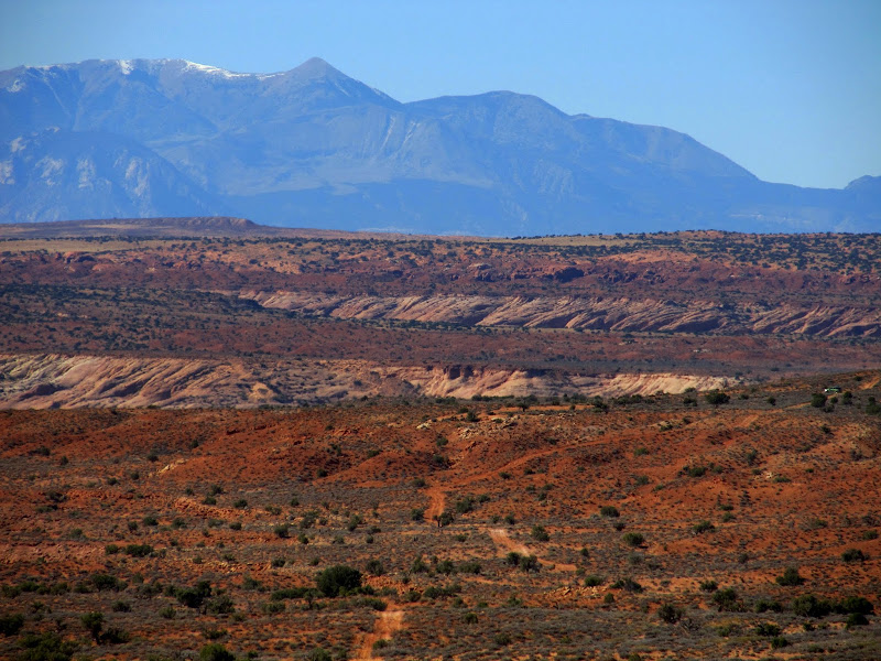
Looking back down the road (the Element is on the far right)
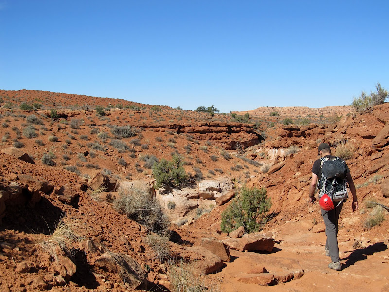
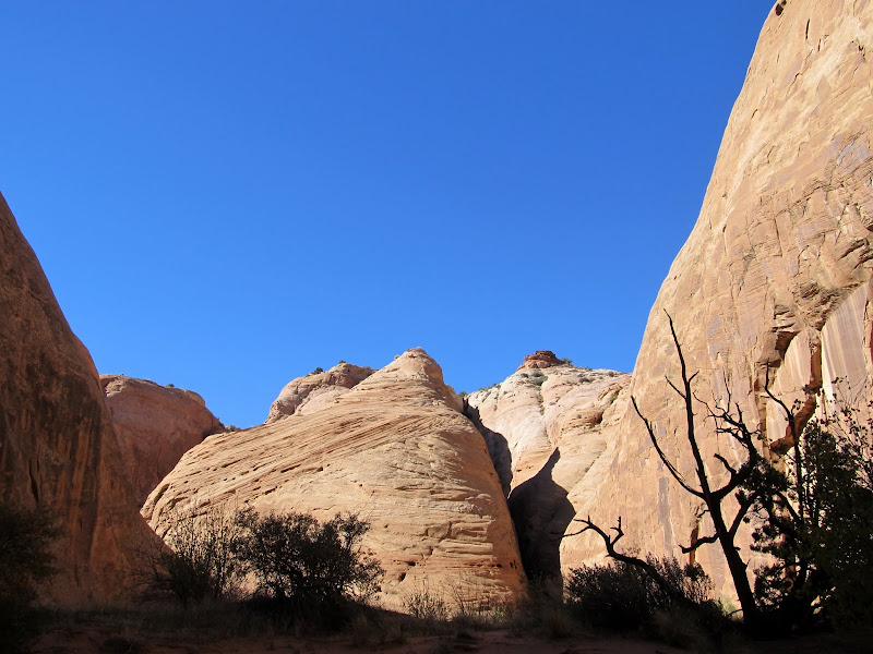
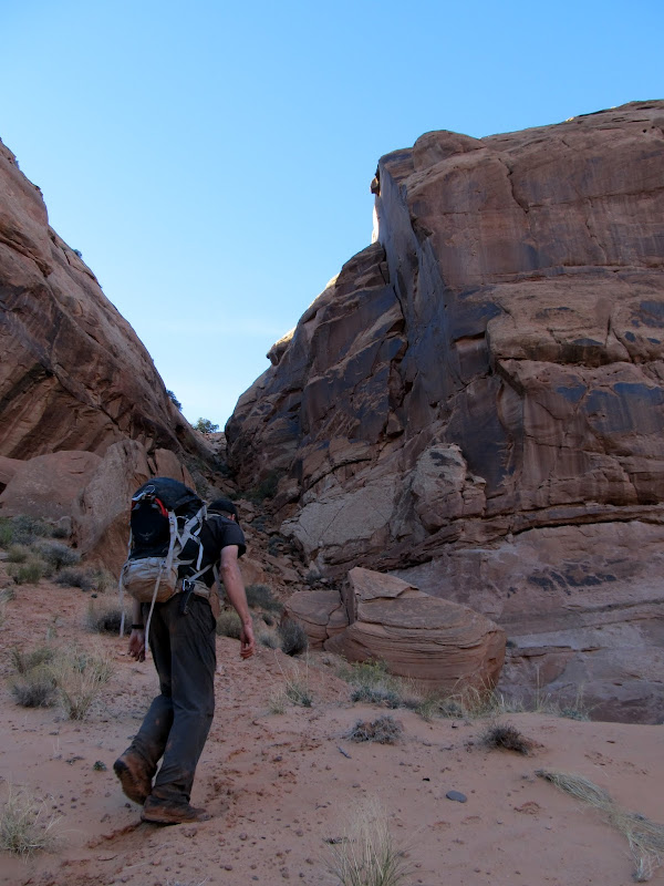
Approaching High Spur
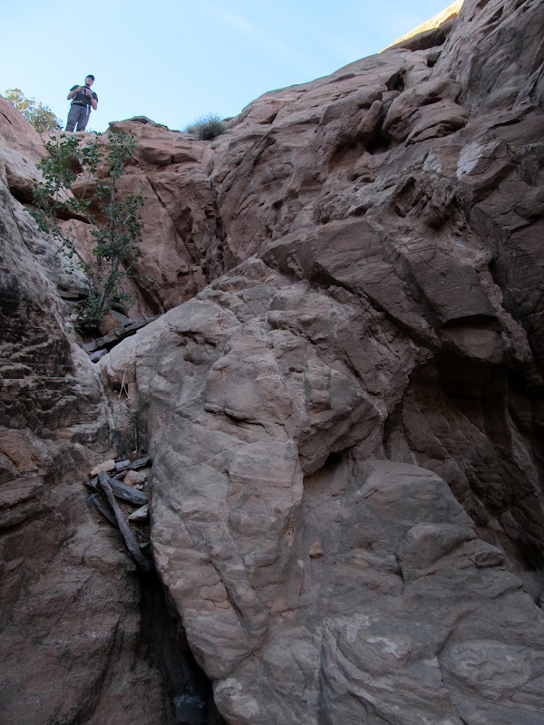
The drop into the canyon
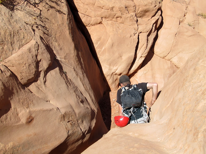
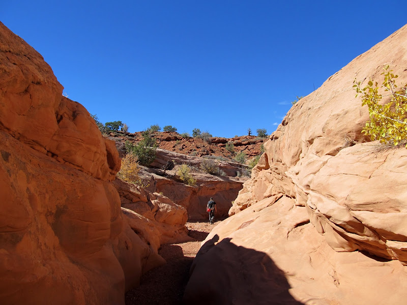
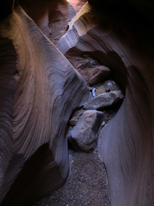
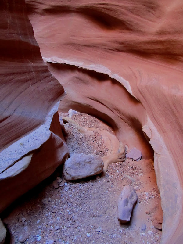
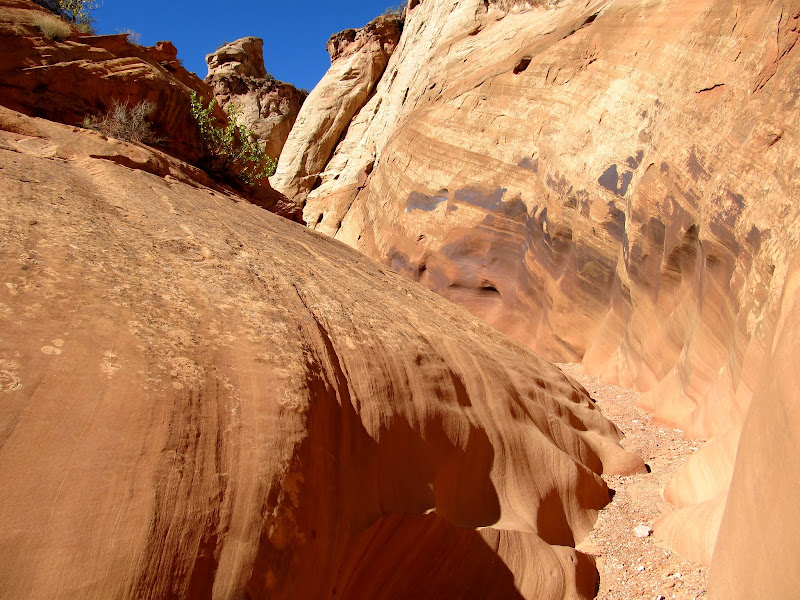
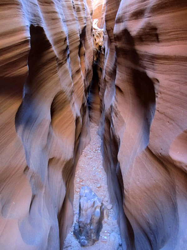
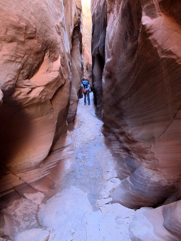
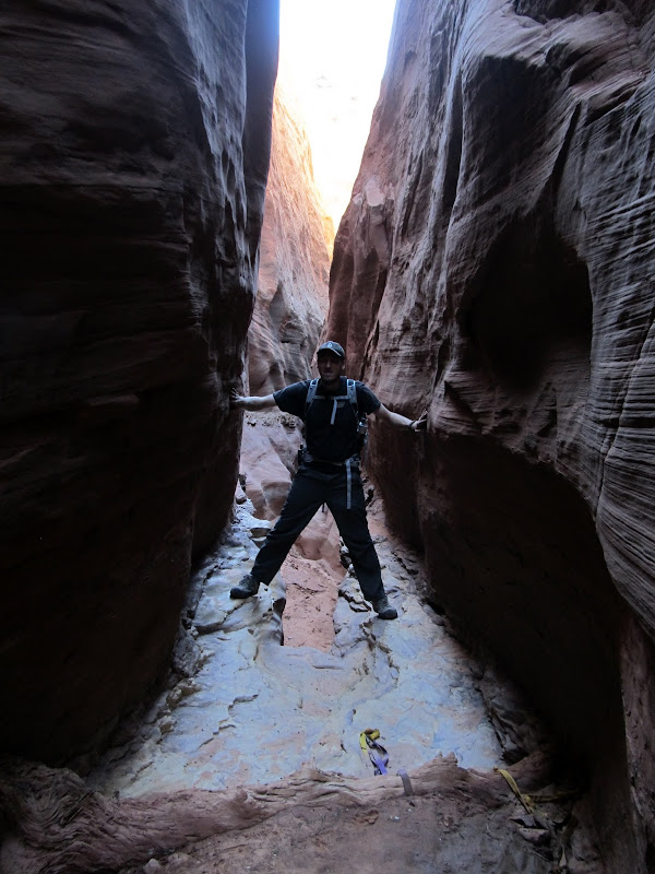
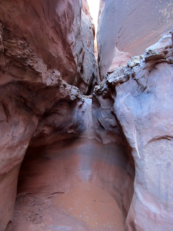
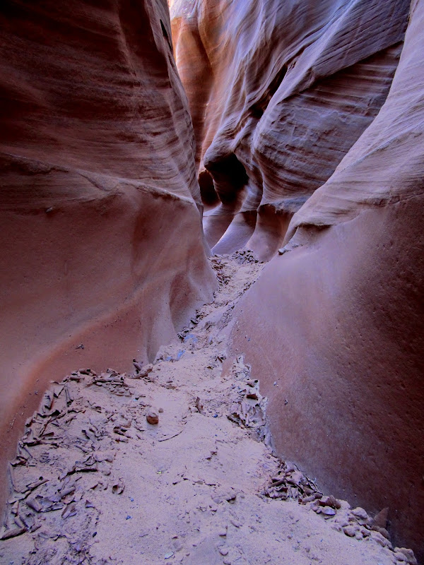
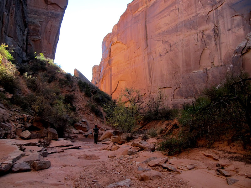
After a brief 2/3-mile overland hike we reached the canyon and dropped in. It started off shallow and narrow but soon grew deeper and darker while remaining skinny. We encountered a few obstacles: sketchy downclimbs where we had to remove our packs and lower them to each other, and boulders and trees wedged in the canyon that required climbing over and/or under. The canyon would occasionally widen and give respite from the dark confines of the narrows, but we never really stopped to rest. It was challenging and interesting enough to keep our pace slow, but easy enough that fatigue didn't present a problem.
Chris doing the butt-slide into the canyon
High Spur
It didn't take long for the canyon to get deep and dark
Climbing over a boulder
First big downclimb
High Spur
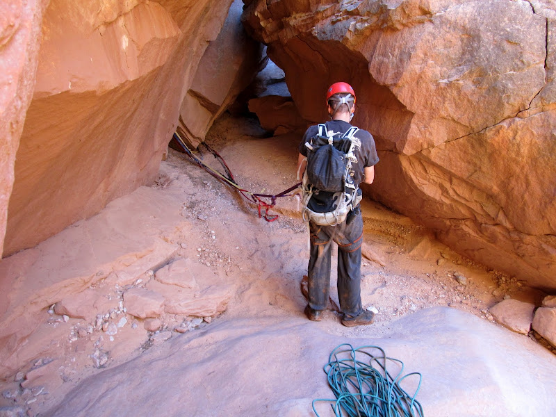
Things went on like that for one and a quarter hours before we reached the first rappel. Out came the helmets, harnesses, carabiners, and rappel devices. The drop was only about 15' so we used Chris' short rope. Some people downclimb this drop, but there was a pool at the bottom and I was certain that if I attempted it I'd end up face-first in the water. Chris rappelled first and tried avoiding the water at the bottom of the drop. The mud on the sandstone above the pool was too slick, though, so into the ankle-deep water he went. I rapped next and just walked backward into the water--if Chris couldn't avoid it, there was no point in me trying. To save time packing and unpacking gear, we left our harnesses and helmets on from that point until after the final rappel. After the first rappel was a stretch of water that was avoidable by clinging to the canyon wall and walking across some slippery mud.
Chris getting on-rope
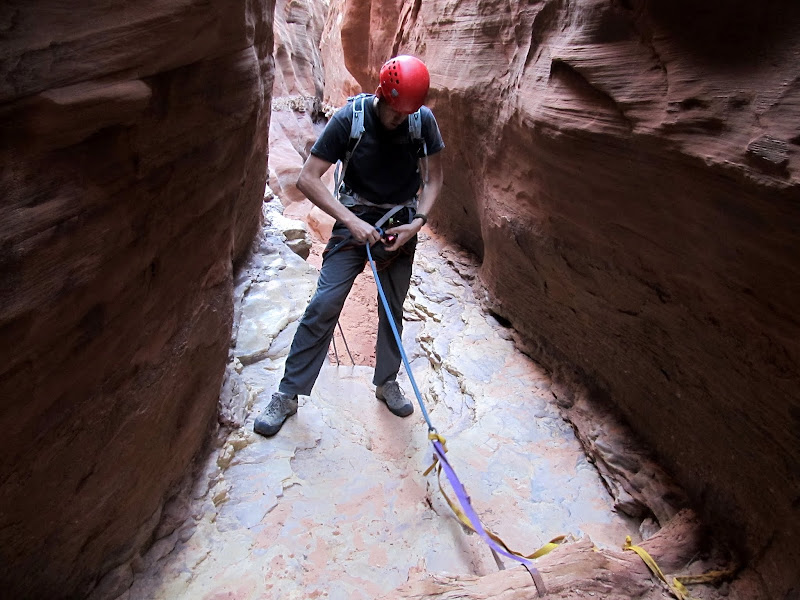
First rappel
Looking back at our first rappel
It was tricky avoiding a slip-and-fall into the water
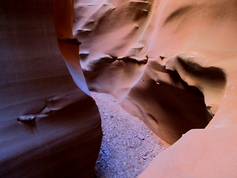
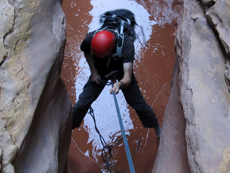
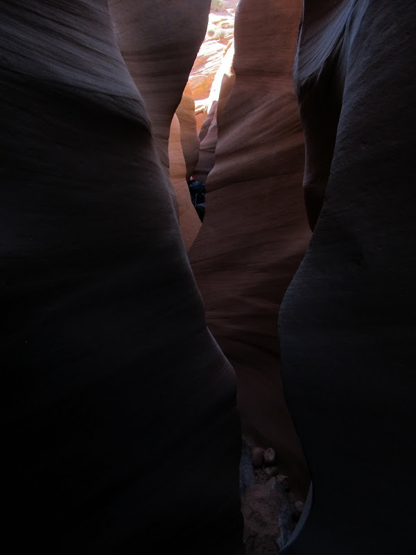
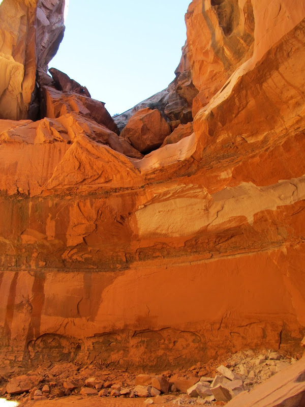
The canyon continued as it had before, with alternating lengths of narrow and wide sections. In the narrows there was little direct sunlight, but the reflected light made for some gorgeous scenes. 45 minutes after completing the first rappel we reached a pothole where the canyon began to really get spicy. The drop into the pothole was about 15' and the exit perhaps 6'. Chris did a butt-slide into the pothole unassisted, then I followed while he slowed my descent by grabbing my feet and lowering me. He stood on my bent knee to exit the pothole and I managed to climb out unassisted.
High Spur
Sliding into the pothole
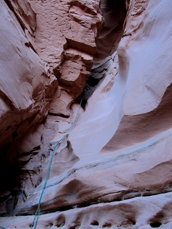
After the pothole, High Spur grew very dark. There were beautiful reds, oranges, and purples formed by the reflected light, and I was disappointed that I couldn't capture that well with my camera. It was so dark in places that I had to remove my prescription sunglasses a few times to see where I was placing my feet. We encountered wall-to-wall water that disappeared around the corner ahead of us and we couldn't see the end of it. I knew from seeing @ststephen's photos from a week earlier that we'd likely have to wade through some water, but up until that point I'd been hoping that the water was gone. Turning back would have been extremely difficult because of the pothole, though above the pothole there were many possible exits from the canyon--not that we seriously considered backtracking. Chris led the way into the abyss. The water was very cold, and as we stirred it up an odor that I can only describe as "sewery" entered our nostrils. I kept my camera out for this first length of water, which only just reached our crotches. Very shortly after the first pool was another that also disappeared around the bend, and this time I dry-bagged my camera. The second stretch was chest-deep, and just as cold and smelly. It was slightly horrifying, yet exhilarating and energizing at the same time.
High Spur
Our first real encounter with water. It was cold and stinky and crotch-deep in this first section.

Entering another stretch of water, this one chest-deep
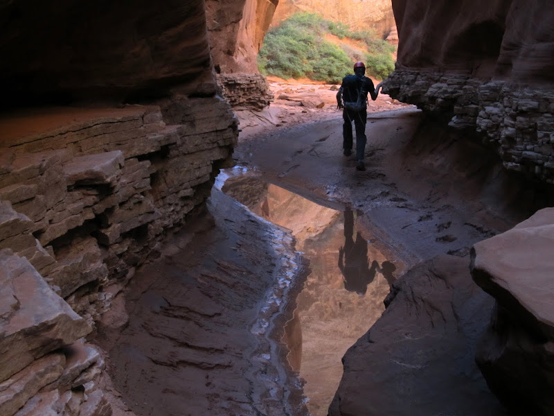
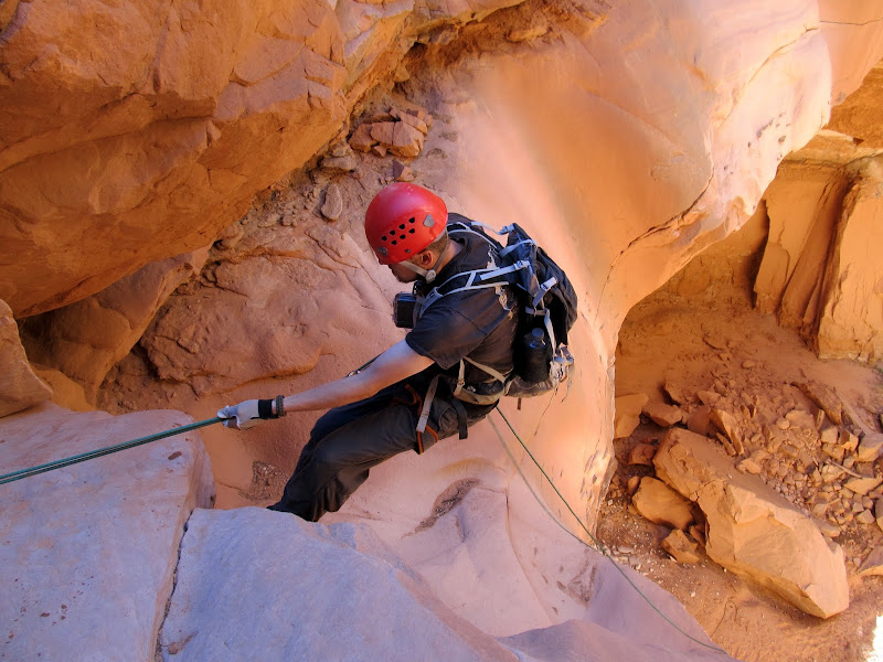
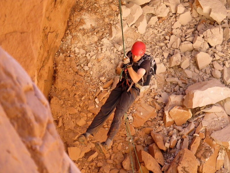
After a couple hundred feet of wading through water we came to what we hoped was the end of the sewer. There was a cavern-like section where one canyon wall had collapsed and was leaning on the other. We climbed over some boulders from the rockfall, scooted through another short narrow section, then came to another downclimb. It seemed that we were done wading through water. Chris and I both attempted to downclimb the short drop but with our muddy shoes neither of us felt comfortable with it. We used the short rope again and rappelled the drop, though the rappel felt as awkward as our attempted downclimb. My GPS indicated that we were very close to the final rappel--surprisingly I had good signal through most of the canyon. We downclimbed through an awkward section where the walls were very narrow but angled to one side, followed by another rappel. We couldn't see the bottom of this rappel because the canyon curved around a corner during the descent, so Chris deployed his 200' Canyonero rope. He reached the bottom of the rap and realized we could have used the short rope, but the final rappel was coming up so the long rope didn't even go back in his pack.
In the rockfall section after the water
We turned this downclimb into a rappel
Chris coming down the awkward downclimb
Setting up one short rappel before the final rappel
Second-to-last rappel
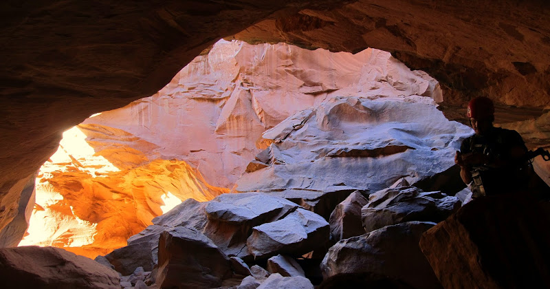
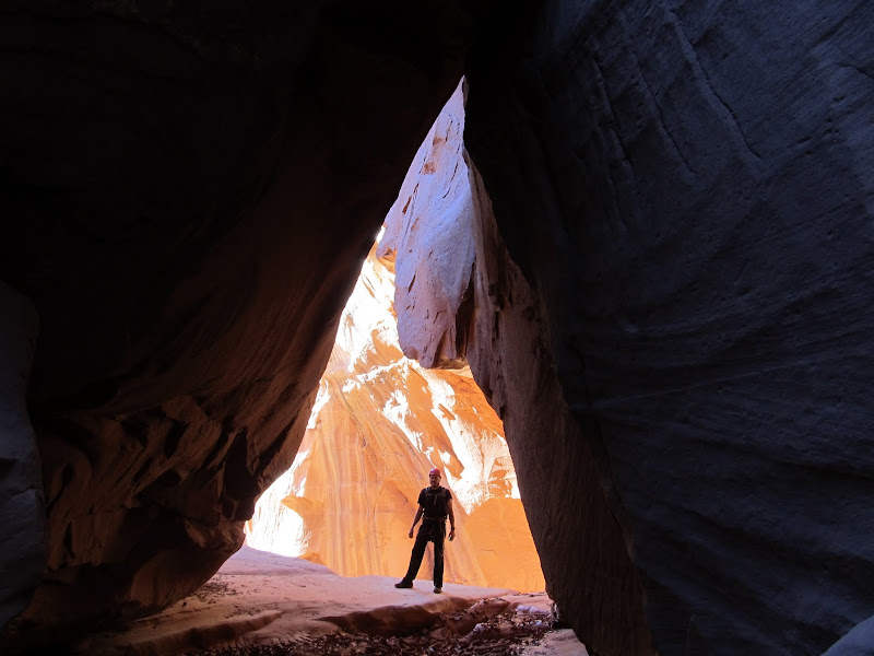
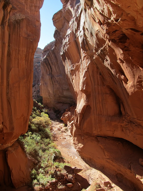
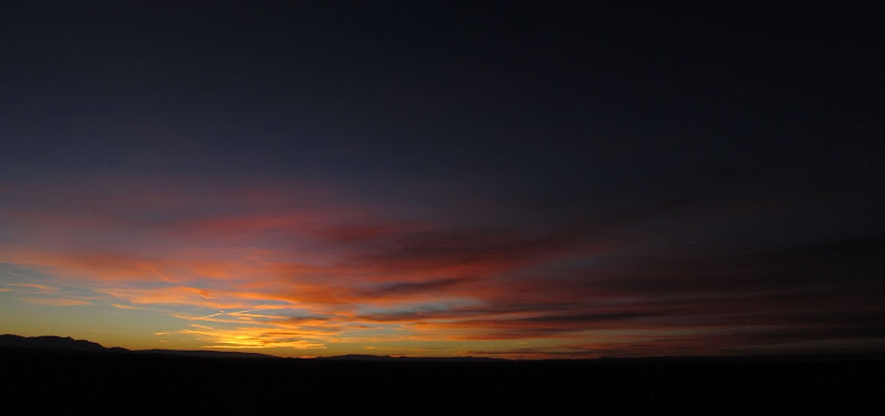
There was another cavern-like section at the top of the final rappel, and there lay a geocache. We signed the log and then inspected the rappel anchor. The anchor was crazy, consisting of four long lengths of webbing tied around a boulder, then three more lengths of webbing extending off those four using various knots and quicklinks. It was overkill, but neither of us felt compelled (or even qualified) to fix it. It was dark at the top of the rappel but the canyon below was bathed in direct sunlight, leaving a nice orange glow on the cliffs in between. Chris did the 80' rappel first and I followed in short order. It was my longest rappel to date, but it paled in comparison to what I'd already experienced in the canyon. While Chris pulled the rope, I changed out of my wet pants into some dry shorts. We continued down the canyon and had no difficulty finding the exit crack which follows a fault in the cliff. It was a short, steep, and bouldery scramble with a little climbing near the top, but it was no more difficult than descending the canyon. We topped out on a flat bench but we still had a couple more short climbs over the next mile before reaching the car. It was a relief to see Chris' Element waiting for us as the sun touched the horizon. It had taken almost seven hours to complete the route, including the road-walk and a lot of photo-taking. We enjoyed a colorful sunset on the drive back to camp that seemed to last for an unusually long time before fading away to darkness.
Signing the log in the geocache above the final rappel
Before the final rap
High Spur below the final rap
Checking out the webbing on the anchor
Final rappel
Looking up the final rap from the bottom
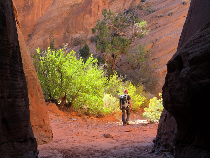
Hiking down the canyon after the final rap
Heading up the exit route
Some climbing was involved at this point in the exit route
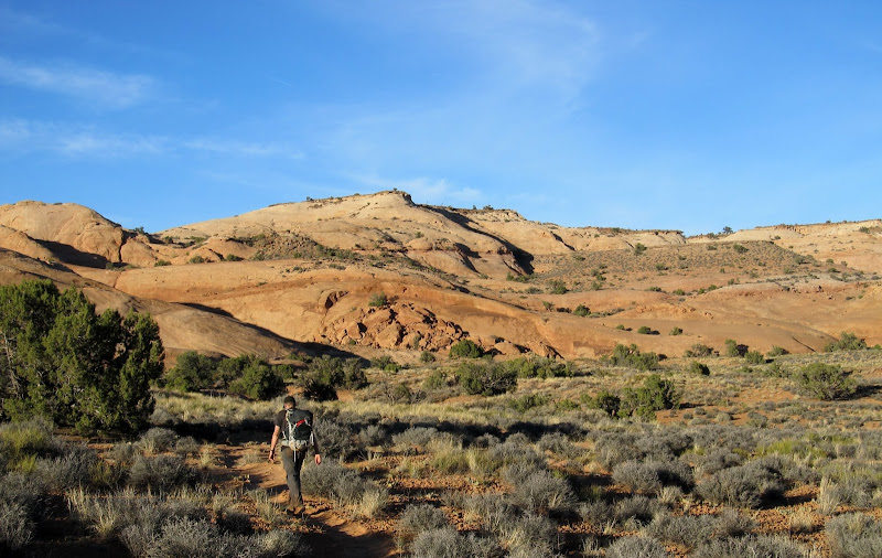
Hiking to the top of the mesa to the waiting car
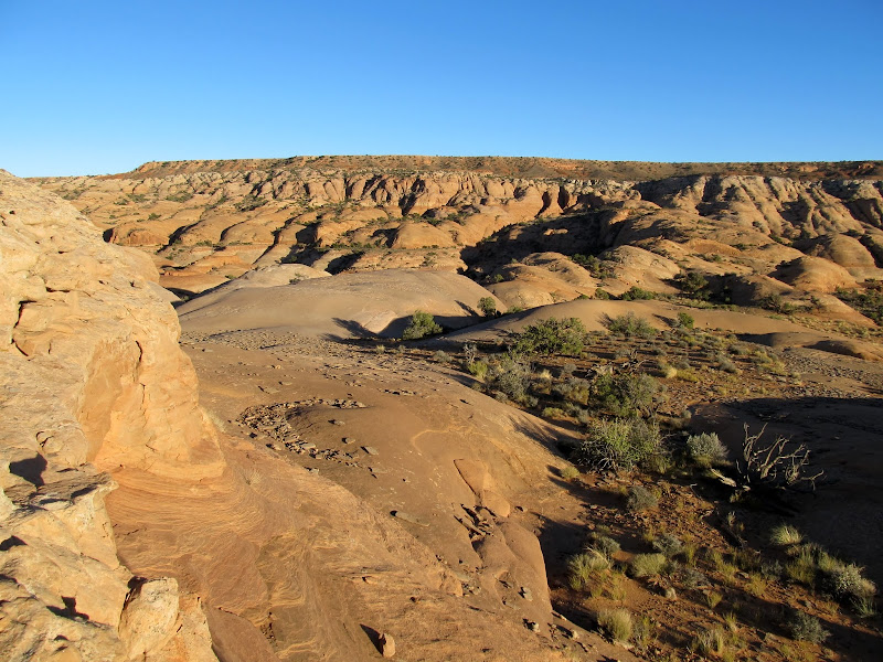
Somewhere in there is High Spur
What a relief to be back at the car!
Sunset during the drive out
Full photo gallery:
https://picasaweb.google.com/Dennis.Udink/HighSpur
GPS tracklog and photo waypoints:
[parsehtml]<iframe width="640" height="480" frameborder="0" scrolling="no" marginheight="0" marginwidth="0" src="https://maps.google.com/maps?q=http:%2F%2Fudink.org%2Fgeo%2FHighSpur.kmz&hl=en&sll=38.414661,-110.169182&sspn=0.038938,0.084543&t=h&ie=UTF8&ll=38.414055,-110.171671&spn=0.032281,0.054932&z=14&output=embed"></iframe><br /><small><a href="https://maps.google.com/maps?q=http:%2F%2Fudink.org%2Fgeo%2FHighSpur.kmz&hl=en&sll=38.414661,-110.169182&sspn=0.038938,0.084543&t=h&ie=UTF8&ll=38.414055,-110.171671&spn=0.032281,0.054932&z=14&source=embed" style="text-align:left">View Larger Map</a></small>[/parsehtml]http://udink.org/geo/HighSpur.kmz
Featured image for home page:

We parked the Element here near the end of the canyoneering route, then walked 2.6 miles down the road to retrieve our packs and get started
Road-walking to the start of the canyon
Drill hole along the road
Looking back down the road (the Element is on the far right)
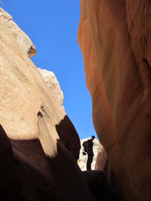
Approaching High Spur
The drop into the canyon
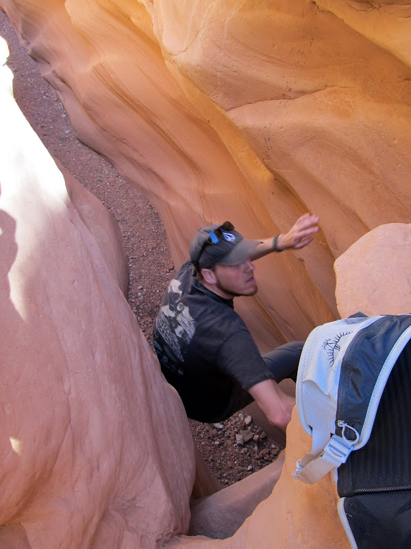
After a brief 2/3-mile overland hike we reached the canyon and dropped in. It started off shallow and narrow but soon grew deeper and darker while remaining skinny. We encountered a few obstacles: sketchy downclimbs where we had to remove our packs and lower them to each other, and boulders and trees wedged in the canyon that required climbing over and/or under. The canyon would occasionally widen and give respite from the dark confines of the narrows, but we never really stopped to rest. It was challenging and interesting enough to keep our pace slow, but easy enough that fatigue didn't present a problem.
Chris doing the butt-slide into the canyon
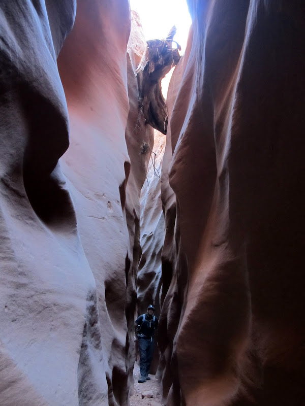
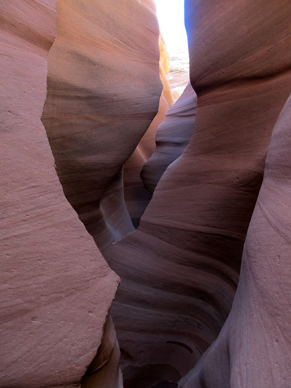
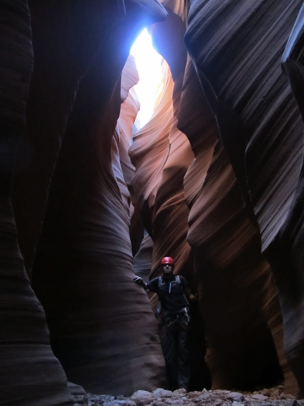
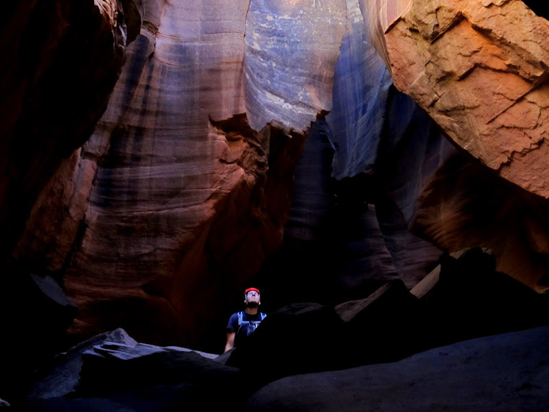
High Spur
It didn't take long for the canyon to get deep and dark
Climbing over a boulder
First big downclimb
High Spur
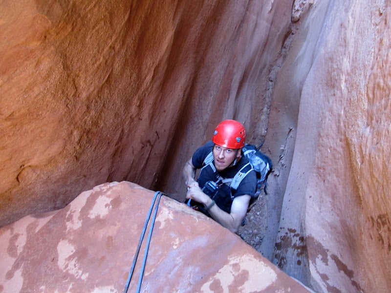
Things went on like that for one and a quarter hours before we reached the first rappel. Out came the helmets, harnesses, carabiners, and rappel devices. The drop was only about 15' so we used Chris' short rope. Some people downclimb this drop, but there was a pool at the bottom and I was certain that if I attempted it I'd end up face-first in the water. Chris rappelled first and tried avoiding the water at the bottom of the drop. The mud on the sandstone above the pool was too slick, though, so into the ankle-deep water he went. I rapped next and just walked backward into the water--if Chris couldn't avoid it, there was no point in me trying. To save time packing and unpacking gear, we left our harnesses and helmets on from that point until after the final rappel. After the first rappel was a stretch of water that was avoidable by clinging to the canyon wall and walking across some slippery mud.
Chris getting on-rope
First rappel
Looking back at our first rappel
It was tricky avoiding a slip-and-fall into the water
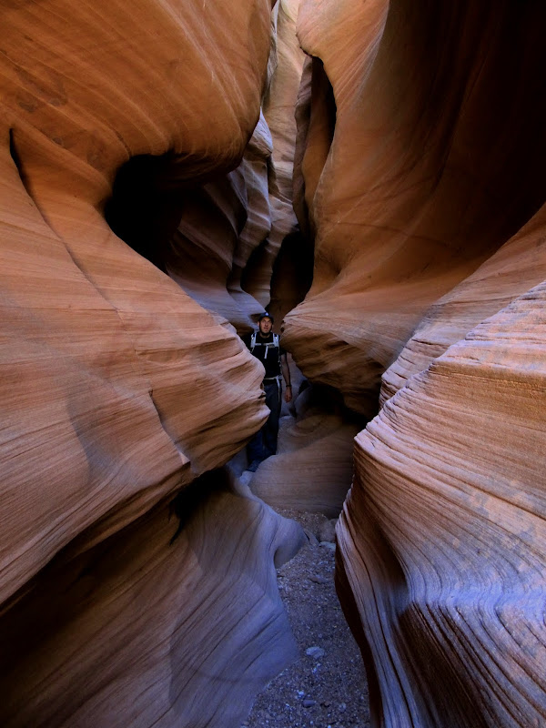
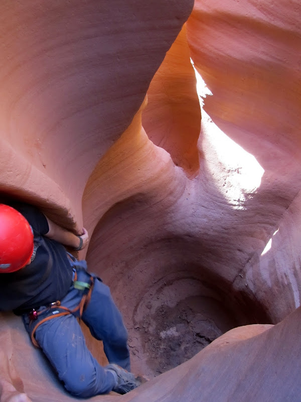
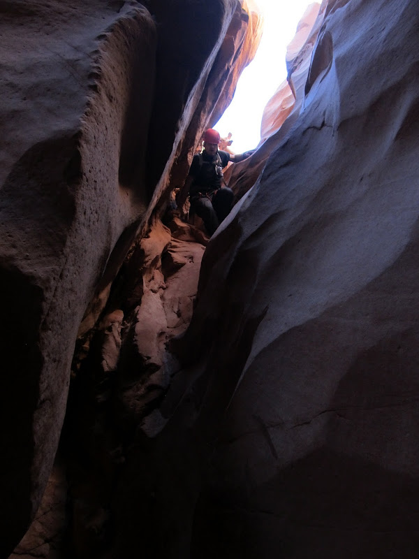
The canyon continued as it had before, with alternating lengths of narrow and wide sections. In the narrows there was little direct sunlight, but the reflected light made for some gorgeous scenes. 45 minutes after completing the first rappel we reached a pothole where the canyon began to really get spicy. The drop into the pothole was about 15' and the exit perhaps 6'. Chris did a butt-slide into the pothole unassisted, then I followed while he slowed my descent by grabbing my feet and lowering me. He stood on my bent knee to exit the pothole and I managed to climb out unassisted.
High Spur
Sliding into the pothole
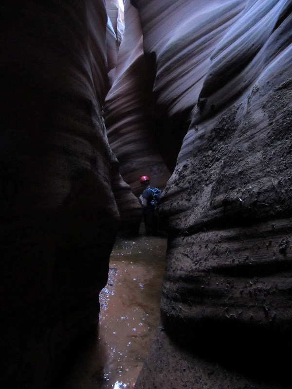
After the pothole, High Spur grew very dark. There were beautiful reds, oranges, and purples formed by the reflected light, and I was disappointed that I couldn't capture that well with my camera. It was so dark in places that I had to remove my prescription sunglasses a few times to see where I was placing my feet. We encountered wall-to-wall water that disappeared around the corner ahead of us and we couldn't see the end of it. I knew from seeing @ststephen's photos from a week earlier that we'd likely have to wade through some water, but up until that point I'd been hoping that the water was gone. Turning back would have been extremely difficult because of the pothole, though above the pothole there were many possible exits from the canyon--not that we seriously considered backtracking. Chris led the way into the abyss. The water was very cold, and as we stirred it up an odor that I can only describe as "sewery" entered our nostrils. I kept my camera out for this first length of water, which only just reached our crotches. Very shortly after the first pool was another that also disappeared around the bend, and this time I dry-bagged my camera. The second stretch was chest-deep, and just as cold and smelly. It was slightly horrifying, yet exhilarating and energizing at the same time.
High Spur
Our first real encounter with water. It was cold and stinky and crotch-deep in this first section.
Entering another stretch of water, this one chest-deep
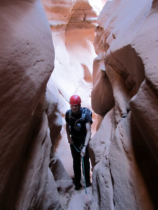
After a couple hundred feet of wading through water we came to what we hoped was the end of the sewer. There was a cavern-like section where one canyon wall had collapsed and was leaning on the other. We climbed over some boulders from the rockfall, scooted through another short narrow section, then came to another downclimb. It seemed that we were done wading through water. Chris and I both attempted to downclimb the short drop but with our muddy shoes neither of us felt comfortable with it. We used the short rope again and rappelled the drop, though the rappel felt as awkward as our attempted downclimb. My GPS indicated that we were very close to the final rappel--surprisingly I had good signal through most of the canyon. We downclimbed through an awkward section where the walls were very narrow but angled to one side, followed by another rappel. We couldn't see the bottom of this rappel because the canyon curved around a corner during the descent, so Chris deployed his 200' Canyonero rope. He reached the bottom of the rap and realized we could have used the short rope, but the final rappel was coming up so the long rope didn't even go back in his pack.
In the rockfall section after the water
We turned this downclimb into a rappel
Chris coming down the awkward downclimb
Setting up one short rappel before the final rappel
Second-to-last rappel
There was another cavern-like section at the top of the final rappel, and there lay a geocache. We signed the log and then inspected the rappel anchor. The anchor was crazy, consisting of four long lengths of webbing tied around a boulder, then three more lengths of webbing extending off those four using various knots and quicklinks. It was overkill, but neither of us felt compelled (or even qualified) to fix it. It was dark at the top of the rappel but the canyon below was bathed in direct sunlight, leaving a nice orange glow on the cliffs in between. Chris did the 80' rappel first and I followed in short order. It was my longest rappel to date, but it paled in comparison to what I'd already experienced in the canyon. While Chris pulled the rope, I changed out of my wet pants into some dry shorts. We continued down the canyon and had no difficulty finding the exit crack which follows a fault in the cliff. It was a short, steep, and bouldery scramble with a little climbing near the top, but it was no more difficult than descending the canyon. We topped out on a flat bench but we still had a couple more short climbs over the next mile before reaching the car. It was a relief to see Chris' Element waiting for us as the sun touched the horizon. It had taken almost seven hours to complete the route, including the road-walk and a lot of photo-taking. We enjoyed a colorful sunset on the drive back to camp that seemed to last for an unusually long time before fading away to darkness.
Signing the log in the geocache above the final rappel
Before the final rap
High Spur below the final rap
Checking out the webbing on the anchor
Final rappel
Looking up the final rap from the bottom
Hiking down the canyon after the final rap
Heading up the exit route
Some climbing was involved at this point in the exit route
Hiking to the top of the mesa to the waiting car
Somewhere in there is High Spur
What a relief to be back at the car!
Sunset during the drive out
Full photo gallery:
https://picasaweb.google.com/Dennis.Udink/HighSpur
GPS tracklog and photo waypoints:
[parsehtml]<iframe width="640" height="480" frameborder="0" scrolling="no" marginheight="0" marginwidth="0" src="https://maps.google.com/maps?q=http:%2F%2Fudink.org%2Fgeo%2FHighSpur.kmz&hl=en&sll=38.414661,-110.169182&sspn=0.038938,0.084543&t=h&ie=UTF8&ll=38.414055,-110.171671&spn=0.032281,0.054932&z=14&output=embed"></iframe><br /><small><a href="https://maps.google.com/maps?q=http:%2F%2Fudink.org%2Fgeo%2FHighSpur.kmz&hl=en&sll=38.414661,-110.169182&sspn=0.038938,0.084543&t=h&ie=UTF8&ll=38.414055,-110.171671&spn=0.032281,0.054932&z=14&source=embed" style="text-align:left">View Larger Map</a></small>[/parsehtml]http://udink.org/geo/HighSpur.kmz
Featured image for home page:

")