- Joined
- Dec 23, 2013
- Messages
- 4,301
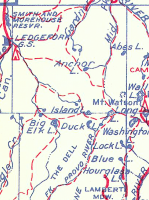
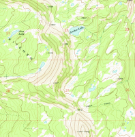
I spent a couple of days camping at the Ledgefork campground near Smith and Morehouse Reservoir over the weekend with my family. On Saturday, I did a day hike up a side drainage of Smith and Morehouse Creek to a basin named Hell's Kitchen that contains a small lake called Jean Lake.
I had originally looked at a 100K topo map of the area and I noticed that there was a trail from the Smith Morehouse trail up the drainage, past Jean Lake then on up to the saddle that overlooks Anchor Lake.
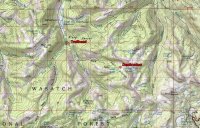
100K map of the area
When I pulled out the 7.5' map of the same area, I was surprised to see that there was no longer a trail to Hell's Kitchen. This intrigued me, so I thought I would try to find the old trail and hike up to Jean Lake. I first drew a line that approximated the trail from the 100K map to the 7.5' map.
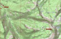
7.5 minute map with no trail to Hell's Kitchen
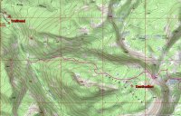
7.5' map with an approximate location of trail from 100K map
I set off about 9:00 am to see if I could find the old trail. I had marked on my GPS unit where I thought the old trail intersected with the Smith Morehouse Trail and it is located about one mile up from the trailhead. I reached this location and did not see anything that was definitive so I began bushwhacking down the slope to Smith Morehouse Creek. I then crossed the creek and began looking for the old trail.
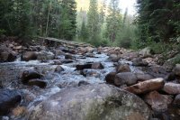
crossing Smith and Morehouse Creek
I soon found a game trail (or perhaps the real trail) that seemed to be heading in the general direction that I wanted to go so I hiked up the south slope of the drainage for a good distance on it.
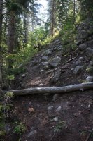
game trail that I followed for awhile
Eventually, I had a clear enough view down the slope towards the stream, and below me there seemed to be a more established trail which I began working my way down to. Once I made it down the slope, I could tell that this was the old trail.
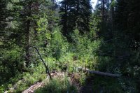
on the no longer maintained trail
I made my way up the draw on the old trail where it crossed the stream a couple of times. The going was rather slow due to quite a bit of downfall that I had to negotiate plus I would lose the trail every now and then and have to search to pick it up again. Along this stretch there were some very large rocks that had been rolled over and each one had old ant colonies exposed. I suspected that a black bear had been busy rolling them to get to the ants. I passed six such large rocks as I continued up the trail.

stream crossing - the trail is hard to see but it is there
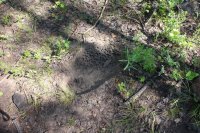 remnants of old ant colony underneath an overturned rock
Once the the terrain started to level out just a bit, there were some cairns and blazes to help guide me on towards the lake though I still had to do some searching occasionally. I eventually made to a small meadow that gave me a little bit of a perspective of where I was in the basin.
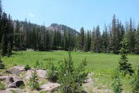
my first view with a perspective
The trail led me to another meadow and beyond this meadow I could not pick up the trail again so I just headed cross country to a pond located just northwest of Jean Lake.
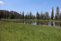
pond located just northwest of Jean Lake
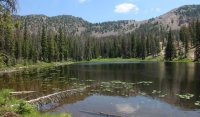
From the pond , it did not take long to arrive at Jean Lake. Once at the Lake, I hike around it to the north side where I stopped and ate lunch. After lunch I took a few pictures of wildflowers growing near the lake.
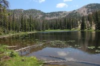
Jean Lake - viewed from the southwest side of the lake
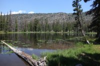
Jean Lake - east side perspective
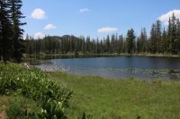
Jean Lake - viewed from the north side of the lake
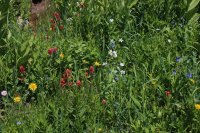
wildflowers along the lake
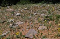
wildflowers along the lake
If I had had enough time I would have liked to continue on to the pass but I felt I needed to start heading back to camp. I did briefly look for the trail north of the lake but I could not pick it up though I am sure it is there. I just need to do a more thorough search.
On the way down I took GPS waypoints every so often including where this trail intersects with the Smith Morehouse Trail. Also on the way down I ran into a family of grouse (scared the hell out of me!).
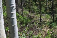
a grouse
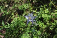
Columbine - seen on the way down
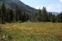
trail skirts the southern edge of this meadow before crossing Smith Morehouse Creek
After I made it back to the main trail, I piled a few rocks to mark the location of the junction of the old trail.
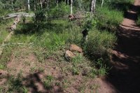
the beginning of the no longer maintained trail to Hell's Kitchen and Jean Lake
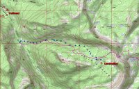
Blue dots are GPS points I recorded on the way down. You can see how far off the trail from the 100K map actually is.
I then returned to the trailhead and back to camp for dinner.
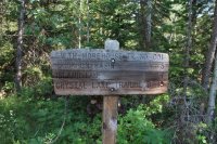
mileage marker at the trailhead
If you are looking for solitude then this is a great little hike. I didn't see another person all day. It doesn't look like anyone has used this trail in quite some time other than wildlife. It took me just over 7.5 hours (including lunch) to complete the just over eight mile round trip route.
Featured image for home page:
I had originally looked at a 100K topo map of the area and I noticed that there was a trail from the Smith Morehouse trail up the drainage, past Jean Lake then on up to the saddle that overlooks Anchor Lake.

100K map of the area
When I pulled out the 7.5' map of the same area, I was surprised to see that there was no longer a trail to Hell's Kitchen. This intrigued me, so I thought I would try to find the old trail and hike up to Jean Lake. I first drew a line that approximated the trail from the 100K map to the 7.5' map.

7.5 minute map with no trail to Hell's Kitchen

7.5' map with an approximate location of trail from 100K map
I set off about 9:00 am to see if I could find the old trail. I had marked on my GPS unit where I thought the old trail intersected with the Smith Morehouse Trail and it is located about one mile up from the trailhead. I reached this location and did not see anything that was definitive so I began bushwhacking down the slope to Smith Morehouse Creek. I then crossed the creek and began looking for the old trail.

crossing Smith and Morehouse Creek
I soon found a game trail (or perhaps the real trail) that seemed to be heading in the general direction that I wanted to go so I hiked up the south slope of the drainage for a good distance on it.

game trail that I followed for awhile
Eventually, I had a clear enough view down the slope towards the stream, and below me there seemed to be a more established trail which I began working my way down to. Once I made it down the slope, I could tell that this was the old trail.

on the no longer maintained trail
I made my way up the draw on the old trail where it crossed the stream a couple of times. The going was rather slow due to quite a bit of downfall that I had to negotiate plus I would lose the trail every now and then and have to search to pick it up again. Along this stretch there were some very large rocks that had been rolled over and each one had old ant colonies exposed. I suspected that a black bear had been busy rolling them to get to the ants. I passed six such large rocks as I continued up the trail.

stream crossing - the trail is hard to see but it is there
 remnants of old ant colony underneath an overturned rock
Once the the terrain started to level out just a bit, there were some cairns and blazes to help guide me on towards the lake though I still had to do some searching occasionally. I eventually made to a small meadow that gave me a little bit of a perspective of where I was in the basin.

my first view with a perspective
The trail led me to another meadow and beyond this meadow I could not pick up the trail again so I just headed cross country to a pond located just northwest of Jean Lake.

pond located just northwest of Jean Lake
From the pond , it did not take long to arrive at Jean Lake. Once at the Lake, I hike around it to the north side where I stopped and ate lunch. After lunch I took a few pictures of wildflowers growing near the lake.

Jean Lake - viewed from the southwest side of the lake

Jean Lake - east side perspective

Jean Lake - viewed from the north side of the lake

wildflowers along the lake

wildflowers along the lake
If I had had enough time I would have liked to continue on to the pass but I felt I needed to start heading back to camp. I did briefly look for the trail north of the lake but I could not pick it up though I am sure it is there. I just need to do a more thorough search.
On the way down I took GPS waypoints every so often including where this trail intersects with the Smith Morehouse Trail. Also on the way down I ran into a family of grouse (scared the hell out of me!).

a grouse

Columbine - seen on the way down

trail skirts the southern edge of this meadow before crossing Smith Morehouse Creek
After I made it back to the main trail, I piled a few rocks to mark the location of the junction of the old trail.

the beginning of the no longer maintained trail to Hell's Kitchen and Jean Lake

Blue dots are GPS points I recorded on the way down. You can see how far off the trail from the 100K map actually is.
I then returned to the trailhead and back to camp for dinner.

mileage marker at the trailhead
If you are looking for solitude then this is a great little hike. I didn't see another person all day. It doesn't look like anyone has used this trail in quite some time other than wildlife. It took me just over 7.5 hours (including lunch) to complete the just over eight mile round trip route.
Featured image for home page:

Last edited by a moderator:

