Udink
Still right here.
- Joined
- Jan 17, 2012
- Messages
- 1,692
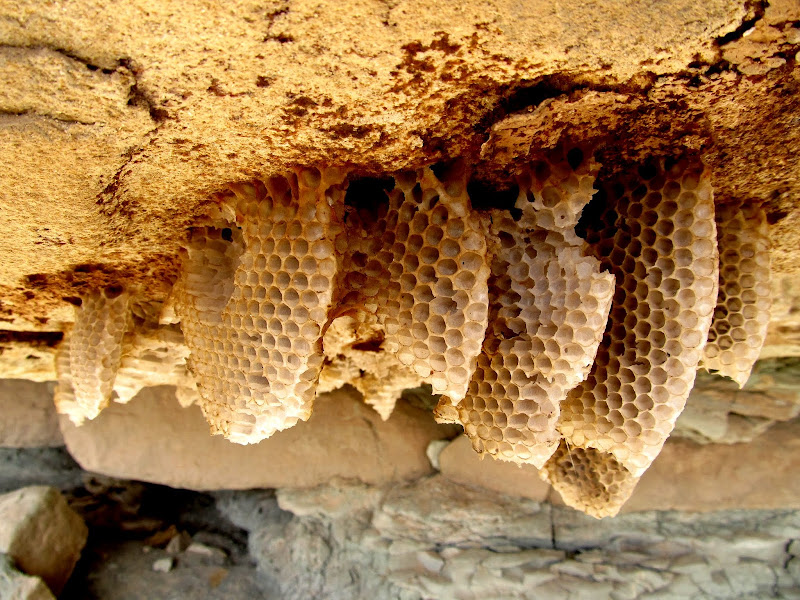
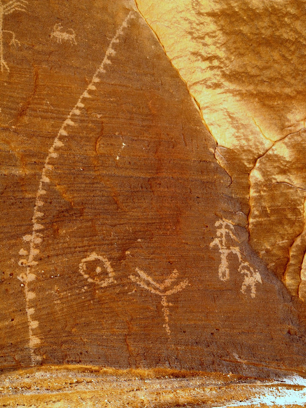
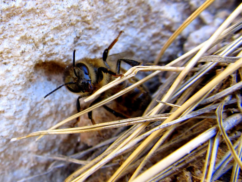
I had a somewhat lackluster camping trip last weekend. My son's birthday party was on Saturday and we took him out to dinner that evening, and because of those plans I'd been thinking I wouldn't be able to do an overnighter during the weekend. That changed mid-week when I got an e-mail from payroll at work telling me to have my timesheet submitted early on Friday because Monday was a company holiday--I didn't even realize I had President's Day off! Despite knowing I had a three-day weekend, I didn't begin to plan a trip until Sunday morning. I woke up, threw my gear into the Jeep, uploaded a few waypoints to my GPS, then hit the road. I drove toward the Head of Sinbad area with the intention of repeating parts of a trip that Chris and I did two years ago. On the way there I stopped to find some petroglyphs that a friend had told me about. I knew roughly where to find them and it only took me a couple of minutes to find the rock art (along with some bees!).
Honeycomb under a boulder near some rock art
Tree of Life petroglyphs
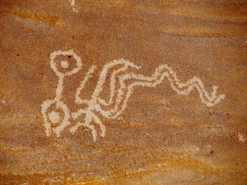
Tree of Life petroglyphs
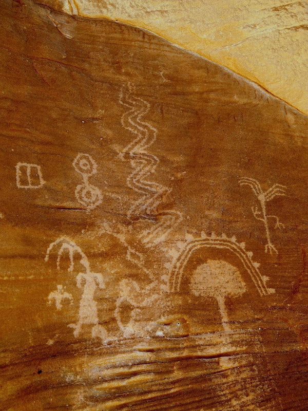
Tree of Life petroglyphs
A bee near the rock art
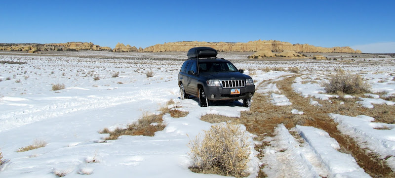
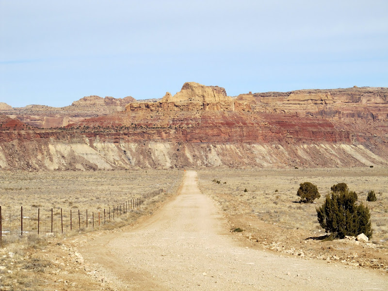
I continued toward my destination, exiting I-70 at exit 131 and driving toward Swasey's Cabin. After leaving the main graded road I found increasing amounts of snow on the road. In one place the road is cupped down below the surface of the ground and a lot of snow had drifted up there. It appeared that an ATV had managed to drive over the snow, but from the mess in a couple of spots I could tell that some full-sized vehicles had become stuck at one point. I tried plowing through the snow but lost forward momentum a couple of times, then I did like most everyone else and left the roadway, driving parallel 20 feet or so to the side. I made it to Swasey's Cabin and tried finding the "Ice Cave Double Bridges" seen in Google Earth. There was more snow than I was expecting there and I simply didn't feel like exploring while hiking through it, so I only got as far as the Ice Box before turning around. Strike one.
Trying to avoid getting stuck
Swasey's Cabin
Ice Box Trail
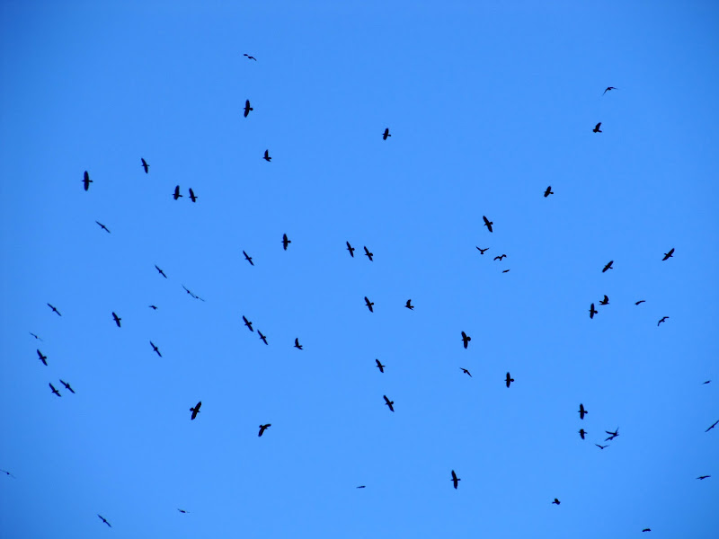
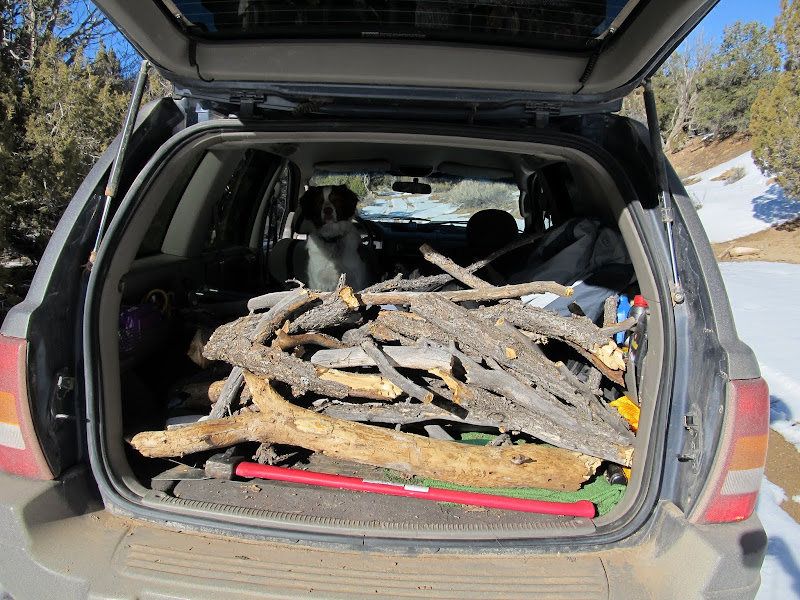
My next plan took me south into Rod's Valley to try finding the Family Spurs geocache. It's a multi-stage geocache where the first location has information that leads one to the final. I found the information welded onto a drill hole cap, crunched some very simple numbers, and found that the final was too far for me to drive to and still make it to my planned camp spot before dark. Strike two. The short excursion to the drill hole wasn't a complete bust, though. I saw what must have been hundreds of ravens in flight over the pinyon/juniper forest at the north end of Rod's Valley. Never had I seen that many in one place. I also found a downed pinyon pine near the road, which I bludgeoned with the blunt end of a log splitter to get enough wood for a nice campfire.
Ravens in the air over Head of Sinbad
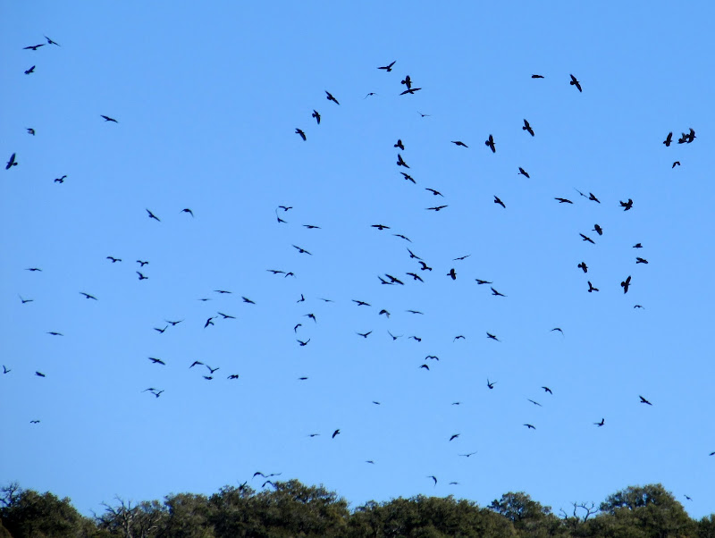
Ravens in the air over Head of Sinbad
Drill hole in Rod's Valley
Parked at a drill hole in Rod's Valley
Jeep full of pinyon to burn in the campfire
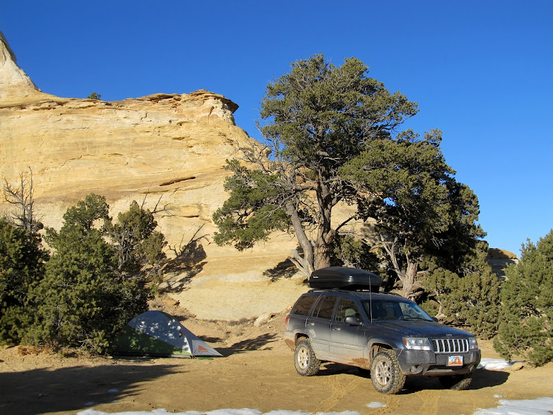
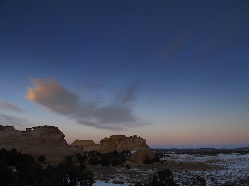
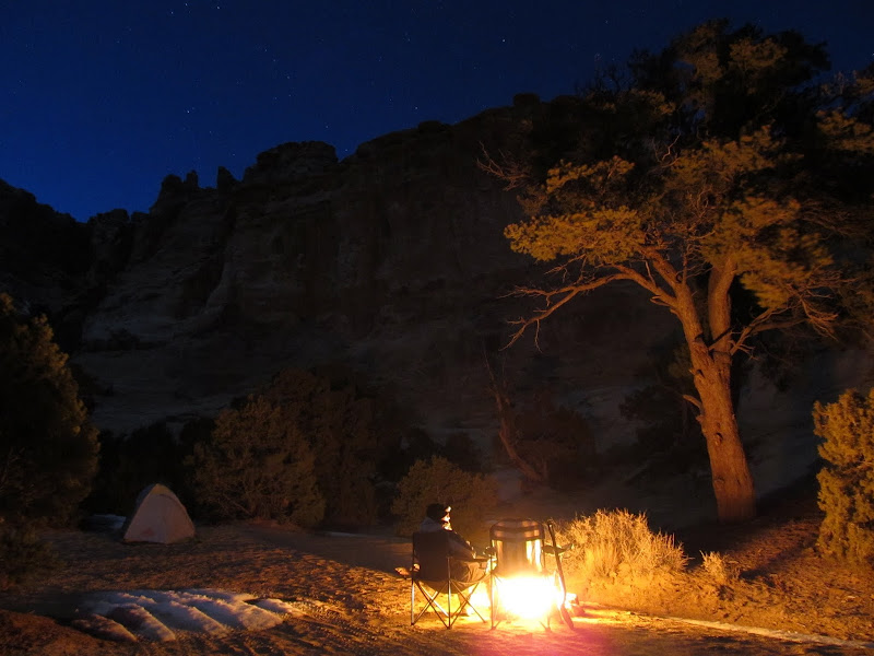
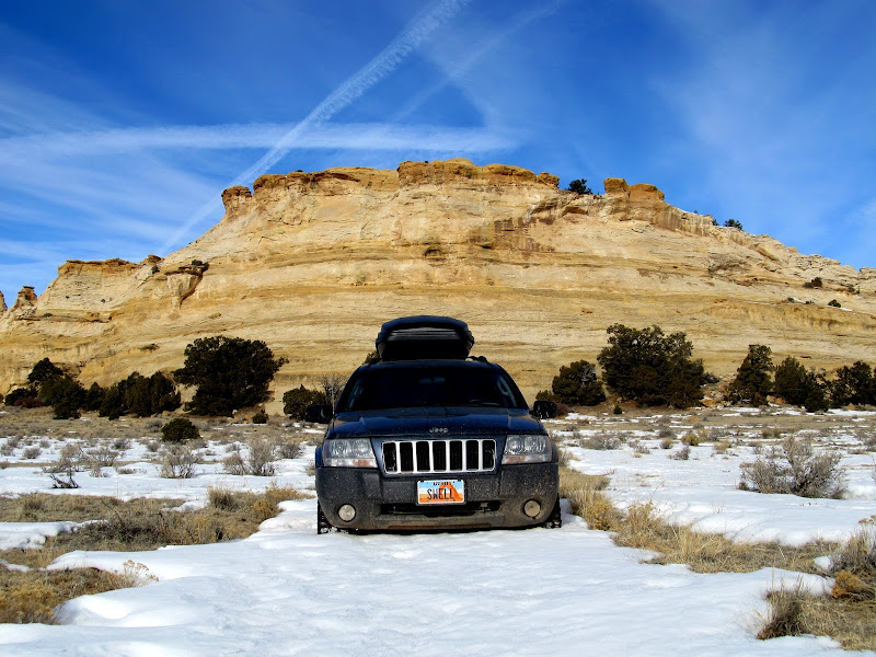
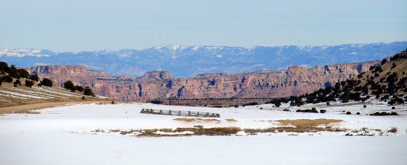
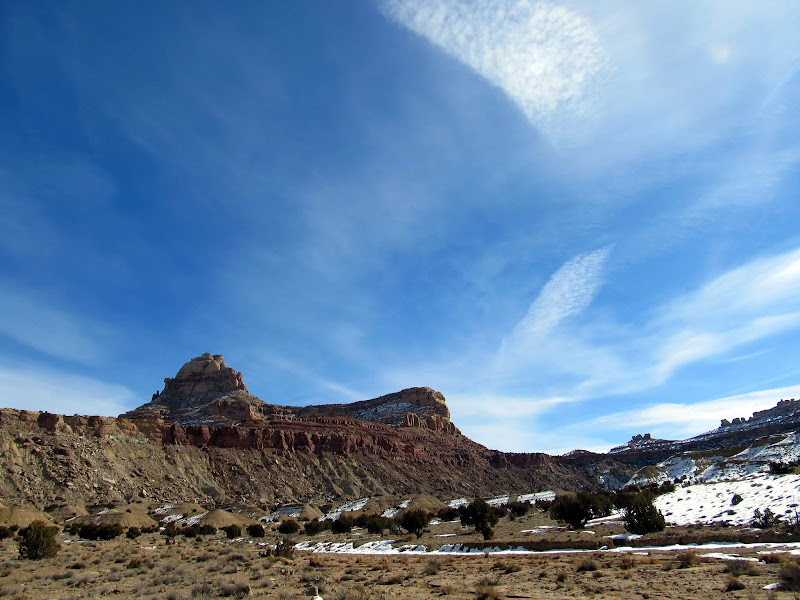
I searched around the Head of Sinbad for a place to camp. The first place I had in mind turned out to be breezier than I would have liked, and I ended up at the same spot where Chris and I camped a couple of years ago. I set up the tent, built a fire ring, then hiked around the ledges and cliffs above camp briefly before the sun went down. I heated some canned dinner over the fire, then read a magazine until I got chilly enough to hit the sack. That sack, by the way, was a new Marmot 0° down sleeping bag that I bought for backpacking, and this was my first time sleeping in it. The temperature got into the mid-teens and the bag kept me plenty warm. I pulled the drawstring tight so that there was a hole only about four inches in diameter above my head. A thick layer of frost formed around the hole during the night, so that when I crawled out to piss at 5AM my sleeves and beanie cap ended up slightly damp (from the frost, not the piss).
Heading back north to Head of Sinbad to find a spot to camp
Camp spot near Lone Warrior
Camp spot near Lone Warrior
After sunset
Sitting at the fire trying to keep warm with a cold wind at my back
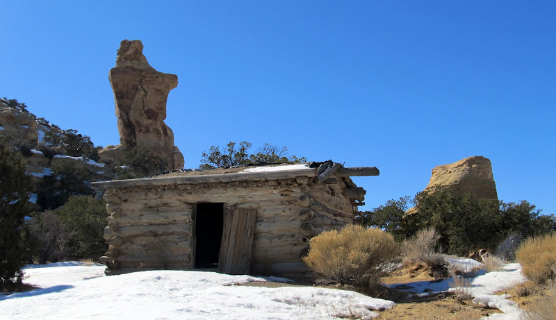
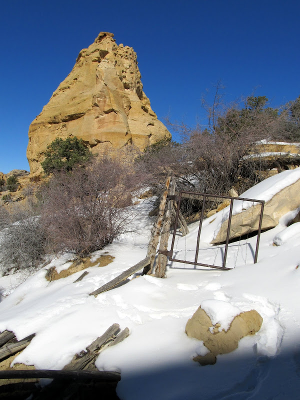
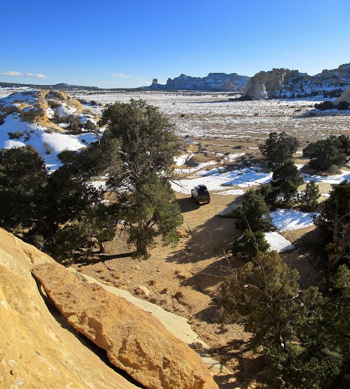
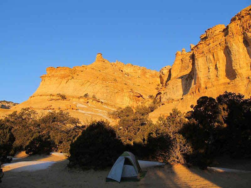
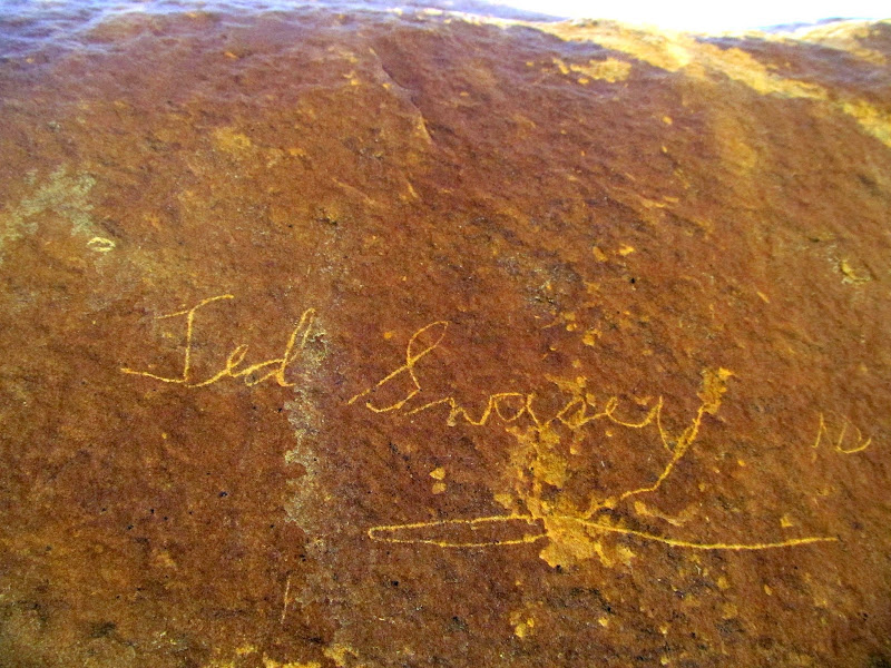
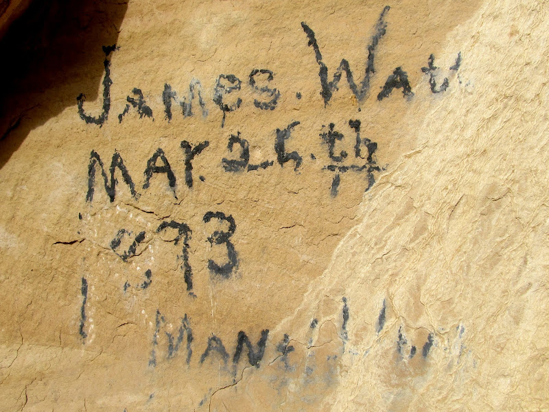
I roused slightly after 7AM and fixed some coffee, which I sipped while sitting in the sunshine on a ledge above my camp. Despite the cold air temperature, the sun felt quite warm and I thoroughly enjoyed that moment more than any other on the trip. I quickly packed my gear up. Since almost everything was covered in frost I didn't bother packing it up properly. I wadded the tent, air pad, etc., up and stuffed it inside the Jeep, which made for a quick departure from camp. I explored a couple of the roads in the area and found the remains of a collapsed cabin. It was presumably a cow camp, as nearby there's a cove surrounded by steep sandstone on three sides and a fence on the final side where I'm sure cattle were corralled. I also found some old cowboy names inscribed on the rocks, the oldest of which was from 1893.
After sunrise
Ted Swasey signature
James Watt signature from 1893
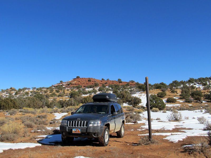
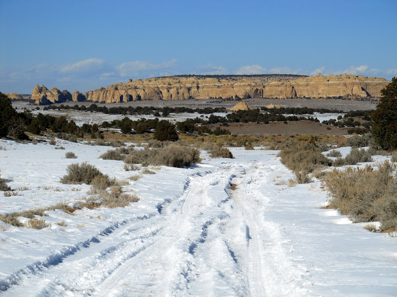
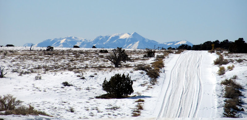
After finding the cowboy names I started driving out to the main road following a different route than I'd taken in. The snow on the road hadn't been traveled at all, and as I tried powering through it the Jeep bogged down until all the tires were spinning and the axles and body were sitting on the snow. I had to dig for a couple of minutes with a shovel to free myself, then I drove a short distance cross-country to reach the main road. Twin Knolls was my next destination. Chris placed a geocache there which nobody has found in the two years since. Since I didn't make the climb up either of the Twin Knolls on that trip, I really wanted to do it this time. I hoped for less snow there than I'd seen around Head of Sinbad. I drove as far as I could on the 4x4 route before the trail turned into a motorcycle-only designation, but I was disappointed by how much snow was there. I wasn't willing to hike the four miles round-trip to get to the geocache. Strike three. I drove home on the freshly graded dirt and gravel road to Buckhorn Wash and realized how desensitized I'd become to that view. One of my first trips through the Swell was along that road. I've been through there many times since, but on my way home this time I had a little more appreciation for it.
Buried to the axles in snow
A semi passes near Dutchman Arch on I-70
The Henrys to the south
Sinkhole Flat
Limestone Bench and Calf Mesa
Window Blind Peak
Full photo gallery:
[picasa]https://picasaweb.google.com/Dennis.Udink/HeadOfSinbad[/picasa]
[parsehtml]<iframe width="640" height="480" frameborder="0" scrolling="no" marginheight="0" marginwidth="0" src="https://maps.google.com/maps?q=http:%2F%2Fudink.org%2Fgeo%2FHeadOfSinbad.kmz&hl=en&sll=39.499761,-111.547028&sspn=4.907901,10.821533&t=h&ie=UTF8&ll=38.88355,-110.708542&spn=0.25656,0.439453&z=11&output=embed"></iframe><br /><small><a href="https://maps.google.com/maps?q=http:%2F%2Fudink.org%2Fgeo%2FHeadOfSinbad.kmz&hl=en&sll=39.499761,-111.547028&sspn=4.907901,10.821533&t=h&ie=UTF8&ll=38.88355,-110.708542&spn=0.25656,0.439453&z=11&source=embed" style="color:#0000FF;text-align:left">View Larger Map</a></small>[/parsehtml]http://udink.org/geo/HeadOfSinbad.kmz
Featured image for home page:

Honeycomb under a boulder near some rock art
Tree of Life petroglyphs
Tree of Life petroglyphs
Tree of Life petroglyphs
A bee near the rock art
I continued toward my destination, exiting I-70 at exit 131 and driving toward Swasey's Cabin. After leaving the main graded road I found increasing amounts of snow on the road. In one place the road is cupped down below the surface of the ground and a lot of snow had drifted up there. It appeared that an ATV had managed to drive over the snow, but from the mess in a couple of spots I could tell that some full-sized vehicles had become stuck at one point. I tried plowing through the snow but lost forward momentum a couple of times, then I did like most everyone else and left the roadway, driving parallel 20 feet or so to the side. I made it to Swasey's Cabin and tried finding the "Ice Cave Double Bridges" seen in Google Earth. There was more snow than I was expecting there and I simply didn't feel like exploring while hiking through it, so I only got as far as the Ice Box before turning around. Strike one.
Trying to avoid getting stuck
Swasey's Cabin
Ice Box Trail
My next plan took me south into Rod's Valley to try finding the Family Spurs geocache. It's a multi-stage geocache where the first location has information that leads one to the final. I found the information welded onto a drill hole cap, crunched some very simple numbers, and found that the final was too far for me to drive to and still make it to my planned camp spot before dark. Strike two. The short excursion to the drill hole wasn't a complete bust, though. I saw what must have been hundreds of ravens in flight over the pinyon/juniper forest at the north end of Rod's Valley. Never had I seen that many in one place. I also found a downed pinyon pine near the road, which I bludgeoned with the blunt end of a log splitter to get enough wood for a nice campfire.
Ravens in the air over Head of Sinbad
Ravens in the air over Head of Sinbad
Drill hole in Rod's Valley
Parked at a drill hole in Rod's Valley
Jeep full of pinyon to burn in the campfire
I searched around the Head of Sinbad for a place to camp. The first place I had in mind turned out to be breezier than I would have liked, and I ended up at the same spot where Chris and I camped a couple of years ago. I set up the tent, built a fire ring, then hiked around the ledges and cliffs above camp briefly before the sun went down. I heated some canned dinner over the fire, then read a magazine until I got chilly enough to hit the sack. That sack, by the way, was a new Marmot 0° down sleeping bag that I bought for backpacking, and this was my first time sleeping in it. The temperature got into the mid-teens and the bag kept me plenty warm. I pulled the drawstring tight so that there was a hole only about four inches in diameter above my head. A thick layer of frost formed around the hole during the night, so that when I crawled out to piss at 5AM my sleeves and beanie cap ended up slightly damp (from the frost, not the piss).
Heading back north to Head of Sinbad to find a spot to camp
Camp spot near Lone Warrior
Camp spot near Lone Warrior
After sunset
Sitting at the fire trying to keep warm with a cold wind at my back
I roused slightly after 7AM and fixed some coffee, which I sipped while sitting in the sunshine on a ledge above my camp. Despite the cold air temperature, the sun felt quite warm and I thoroughly enjoyed that moment more than any other on the trip. I quickly packed my gear up. Since almost everything was covered in frost I didn't bother packing it up properly. I wadded the tent, air pad, etc., up and stuffed it inside the Jeep, which made for a quick departure from camp. I explored a couple of the roads in the area and found the remains of a collapsed cabin. It was presumably a cow camp, as nearby there's a cove surrounded by steep sandstone on three sides and a fence on the final side where I'm sure cattle were corralled. I also found some old cowboy names inscribed on the rocks, the oldest of which was from 1893.
After sunrise
Ted Swasey signature
James Watt signature from 1893
After finding the cowboy names I started driving out to the main road following a different route than I'd taken in. The snow on the road hadn't been traveled at all, and as I tried powering through it the Jeep bogged down until all the tires were spinning and the axles and body were sitting on the snow. I had to dig for a couple of minutes with a shovel to free myself, then I drove a short distance cross-country to reach the main road. Twin Knolls was my next destination. Chris placed a geocache there which nobody has found in the two years since. Since I didn't make the climb up either of the Twin Knolls on that trip, I really wanted to do it this time. I hoped for less snow there than I'd seen around Head of Sinbad. I drove as far as I could on the 4x4 route before the trail turned into a motorcycle-only designation, but I was disappointed by how much snow was there. I wasn't willing to hike the four miles round-trip to get to the geocache. Strike three. I drove home on the freshly graded dirt and gravel road to Buckhorn Wash and realized how desensitized I'd become to that view. One of my first trips through the Swell was along that road. I've been through there many times since, but on my way home this time I had a little more appreciation for it.
Buried to the axles in snow
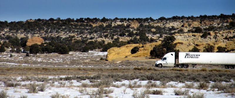
A semi passes near Dutchman Arch on I-70
The Henrys to the south
Sinkhole Flat
Limestone Bench and Calf Mesa
Window Blind Peak
Full photo gallery:
[picasa]https://picasaweb.google.com/Dennis.Udink/HeadOfSinbad[/picasa]
[parsehtml]<iframe width="640" height="480" frameborder="0" scrolling="no" marginheight="0" marginwidth="0" src="https://maps.google.com/maps?q=http:%2F%2Fudink.org%2Fgeo%2FHeadOfSinbad.kmz&hl=en&sll=39.499761,-111.547028&sspn=4.907901,10.821533&t=h&ie=UTF8&ll=38.88355,-110.708542&spn=0.25656,0.439453&z=11&output=embed"></iframe><br /><small><a href="https://maps.google.com/maps?q=http:%2F%2Fudink.org%2Fgeo%2FHeadOfSinbad.kmz&hl=en&sll=39.499761,-111.547028&sspn=4.907901,10.821533&t=h&ie=UTF8&ll=38.88355,-110.708542&spn=0.25656,0.439453&z=11&source=embed" style="color:#0000FF;text-align:left">View Larger Map</a></small>[/parsehtml]http://udink.org/geo/HeadOfSinbad.kmz
Featured image for home page: