Udink
Still right here.
- Joined
- Jan 17, 2012
- Messages
- 1,692
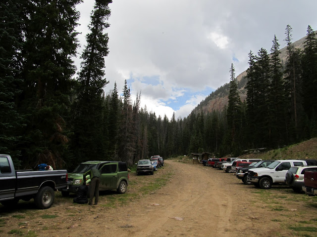
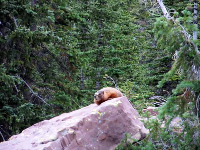
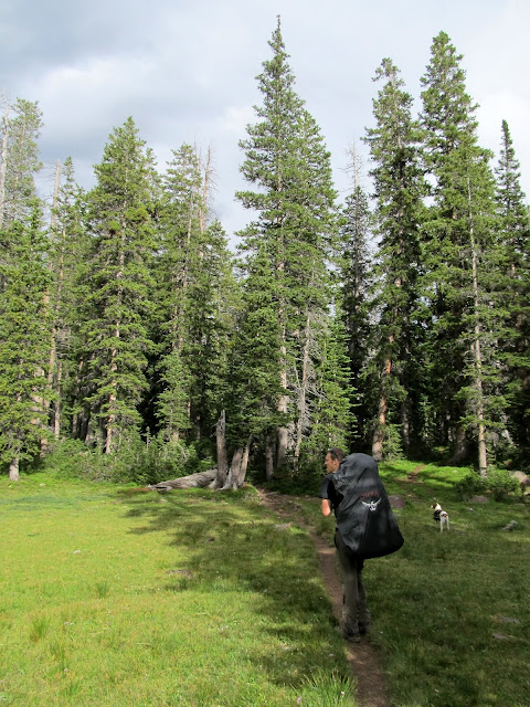
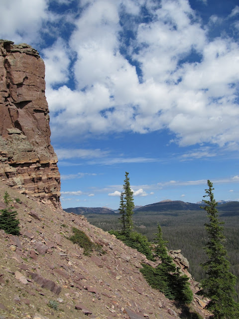
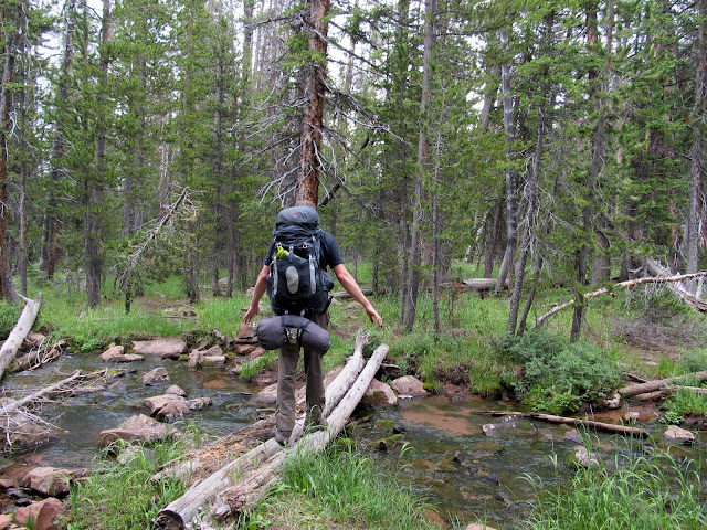
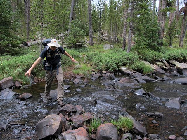
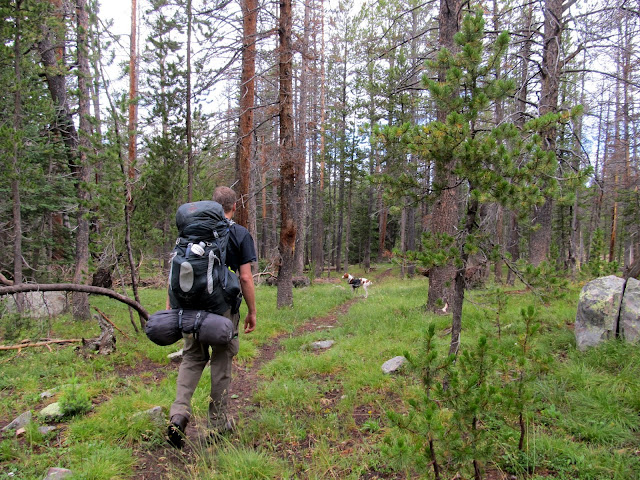
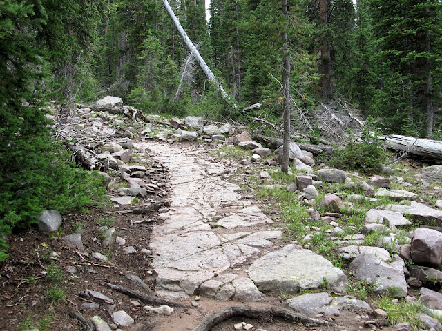
On the weekend of July 20-22 I went on my second backpacking trip of the year, this time to Grandaddy Basin. I chose that area because it's one of the closest places to get into the High Uintas from Price, and it has a lot of trail and lake options. I invited Chris, and he told me about an old geocache that he found nine years ago that was now archived. We decided to try finding it to see if the Forest Service really had removed the container. I took half a day off work Friday and we hit the road that afternoon, arriving at the nearly-full Grandview Trailhead after 3:00PM and starting up the trail by 3:30. It had started sprinkling just as we got to the trailhead but it never got bad enough for me to dig the rain poncho out of my backpack (yes, after my last trip I bought a poncho online and it arrived in the mail about an hour before this trip! ") ). It was a four-mile hike to Grandaddy Lake from the trailhead, and we gained 1,000' in elevation hiking up to Hades Pass before descending to the lake. I saw my first marmot during the hike up into the basin.
). It was a four-mile hike to Grandaddy Lake from the trailhead, and we gained 1,000' in elevation hiking up to Hades Pass before descending to the lake. I saw my first marmot during the hike up into the basin.
At the nearly-packed Grandview Trailhead on Friday afternoon
Grandview Trailhead
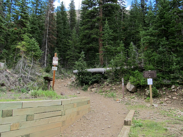
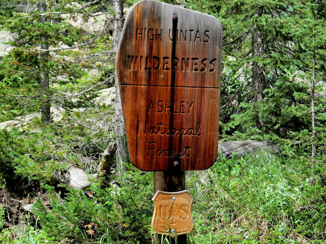
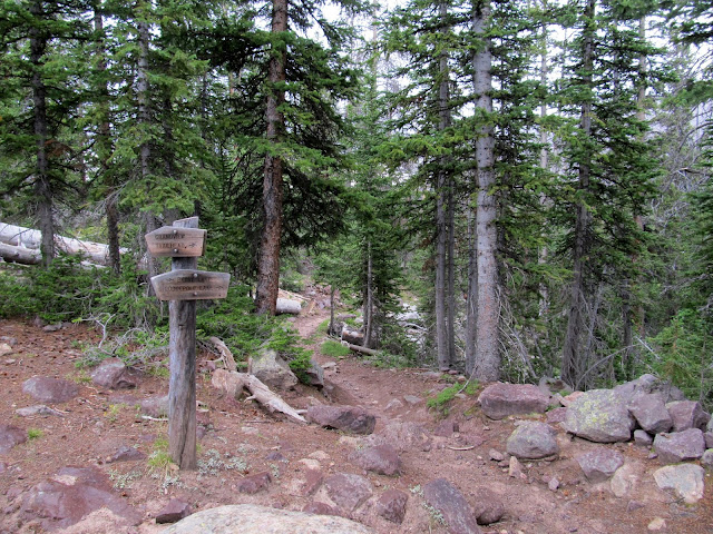
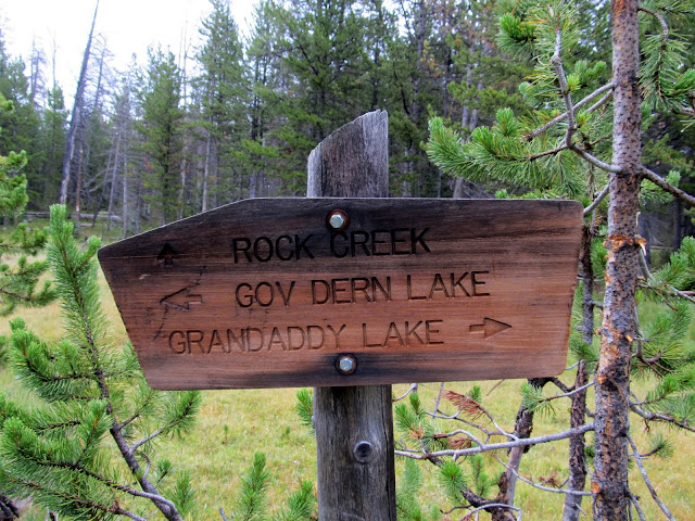
Sign at the trailhead
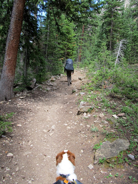
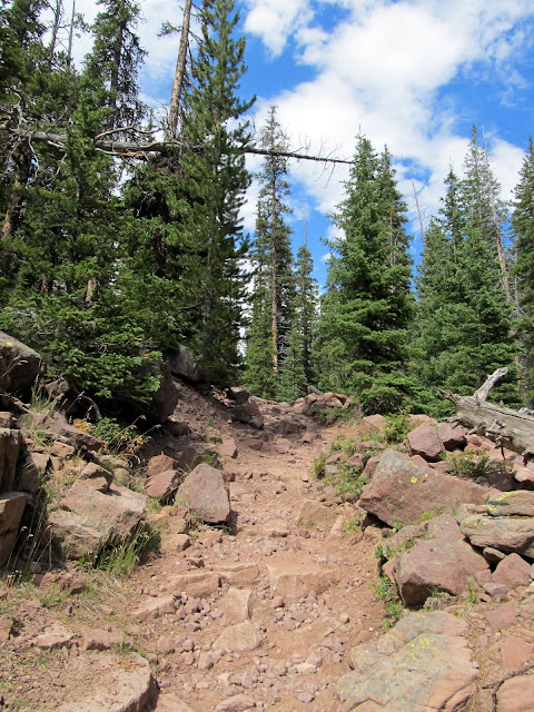
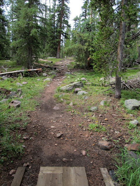
Starting up the trail
Entering the High Uintas Wilderness
Climbing up toward Grandaddy Lake
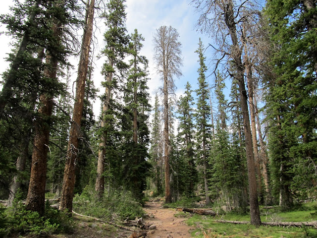
The trail
The first marmot I'd ever seen
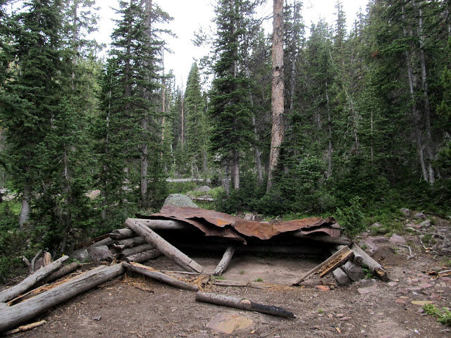
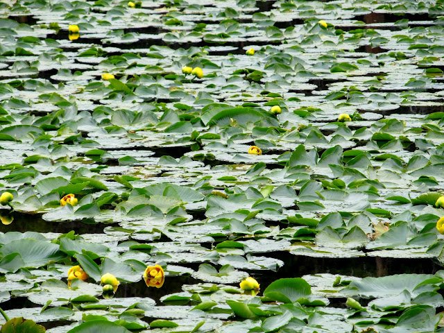
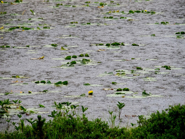
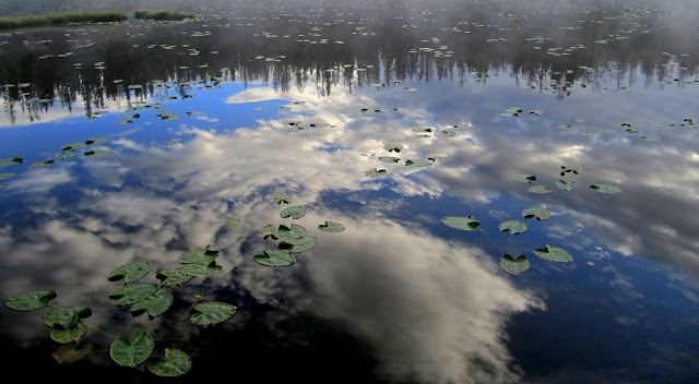
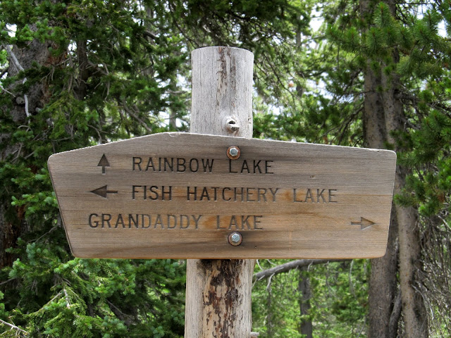
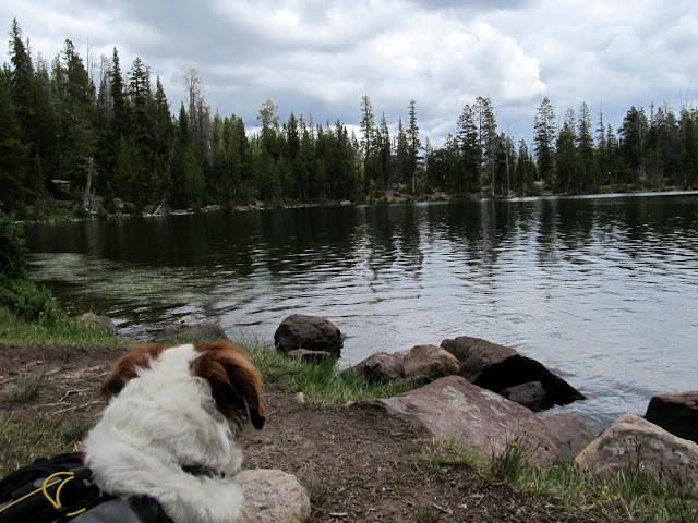
There were several groups of people around Grandaddy Lake, including a few who had camp fires burning. There were fire restrictions in place so I was surprised to see people flaunting their fires just off the trail in a very popular area. At the trail junction near Grandaddy Lake, we turned right (east) and hiked toward Lodgepole Lake. Chris and I had made no specific plans on where to hike or camp, which was a huge departure from how I normally do things. I usually plan my route and camp sites meticulously, but it was nice not having an itinerary this time. We saw a lot of people as we passed the north side of Grandaddy Lake, but after we left the lake shore near the outlet and descended the relatively steep trail toward Lodgepole, we didn't see another person for almost the next two days. There was an old cabin near Lodgepole Lake where we stopped to rest, and in the nearby pond I saw lily pads for the first time ever.
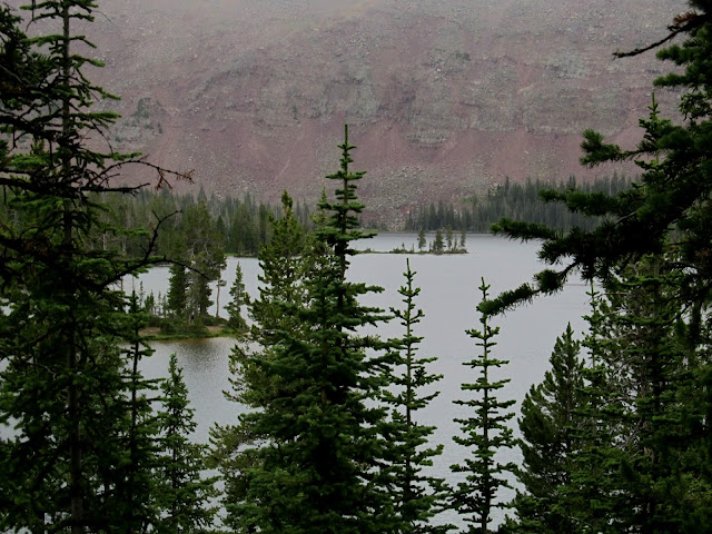
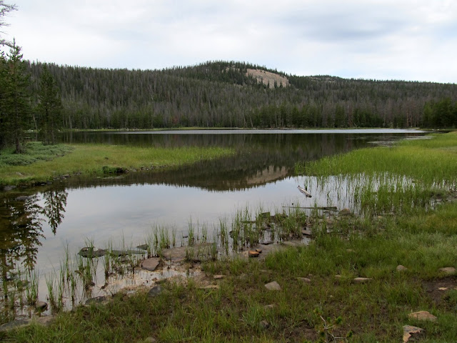
Heart Lake and a small pond above it

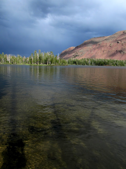
First view of Grandaddy Lake
Trail junction near Grandaddy Lake
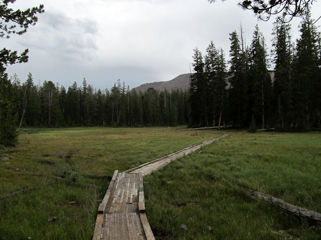
Boardwalk through a meadow in the 'wilderness'
The sun made a brief appearance
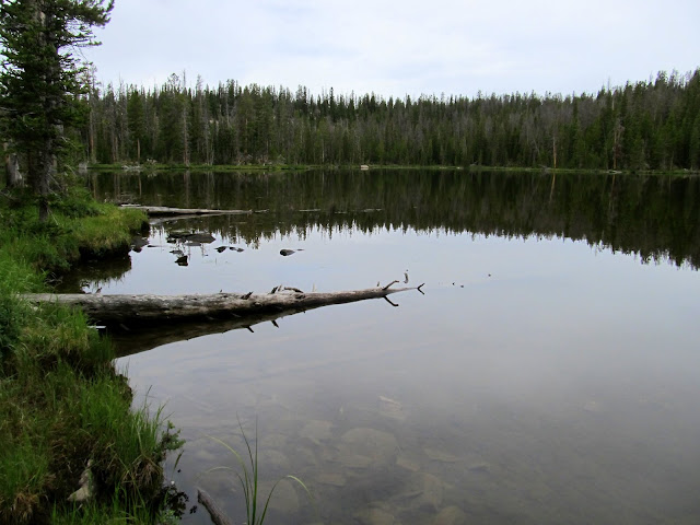
Grandaddy Lake
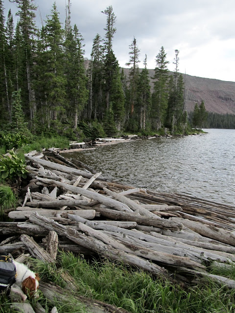
Log jam at the Grandaddy outlet
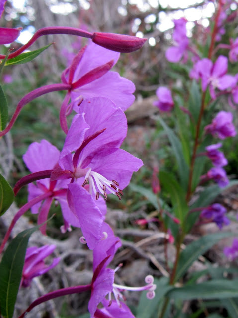
Alpine Fireweed
Lodgepole Lake with Mt. Agassiz in the distance
Cabin at Lodgepole Lake
Torrey begging Chris for some jerky
Lily pads
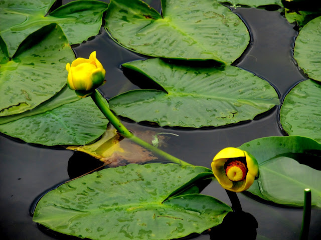
Lily pads
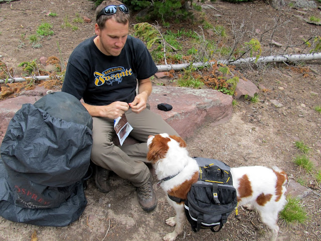
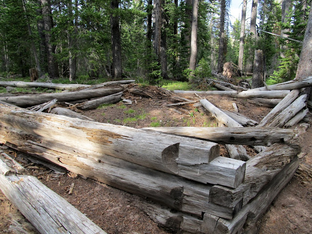
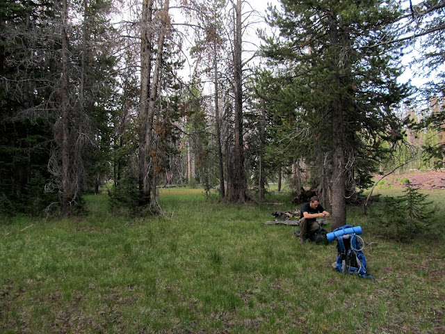
We found another old cabin southeast of Lodgepole, and at that point we decided to leave the trail and get closer to the geocache that we were hoping to find. It took some bushwhacking through some ugly terrain before we found a perfect place to camp. We set up our tents on a flat, dry, grassy spot just inside the trees at the edge of a small boulder field. There were some nice boulders to sit on at the edge of the boulder field where we spent a couple of hours just hanging out, fixing meals, and talking about the next day's activities. I awoke to light rain a couple of times during the night. I brought an inflatable pillow on this trip and it made a huge difference--I slept much more comfortably and woke up feeling pretty good the next morning.
Another cabin southeast of Lodgepole Lake
Setting up camp
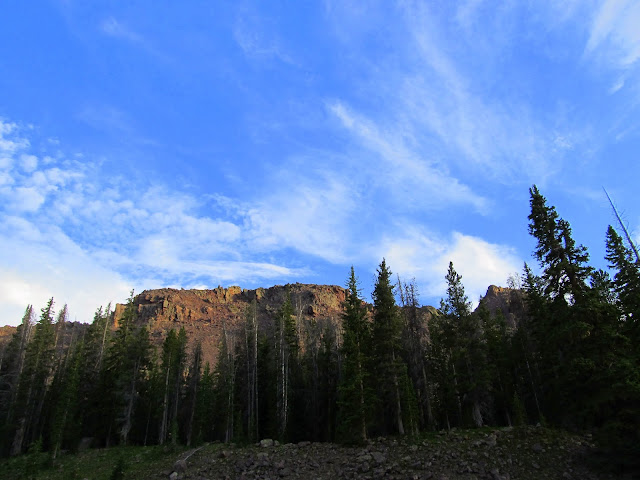
Tents set up at the base of East Grandaddy Mountain
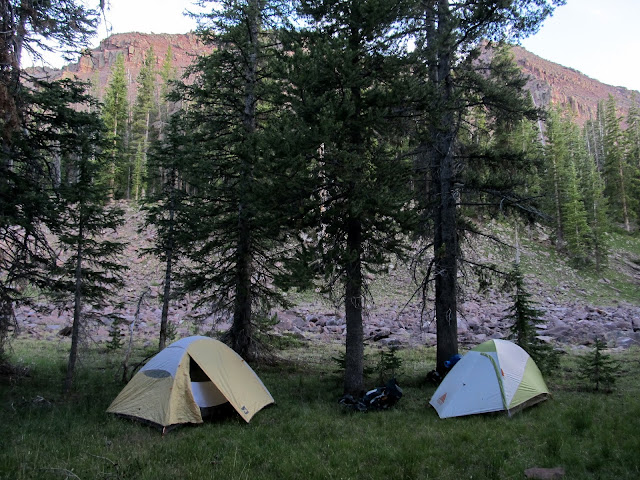
East Grandaddy Mountain
Beggar at dinner time
Tents at night
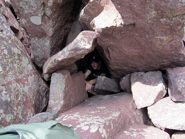
I was surprised to find things pretty dry the next morning. I expected the grass to be pretty wet, but apparently the light rain during the night was even lighter than I thought. Chris and I ate breakfast, re-packed our backpacks, and filtered some water out of a small stream before setting out sans packs up the steep mountain to look for the geocache. We crossed a couple of boulder fields and scrambled up some steep talus. Well, Chris, being in much better shape, left me in his dust, so Torrey and I climbed up together while Chris went ahead. I reached top of the ridge where I expected it to get easier, but it was just as difficult following the top of the ridge. I got to within a couple hundred feet of where my GPS said the cache should be and whistled to get Chris' attention. I heard him holler back but couldn't make out the words. He sounded excited, so I assumed that meant he'd found the geocache. I got closer and closer but still couldn't see him. I called out again and heard his reply come from very close by, but somewhat echo-y and muffled. I scrambled over some boulders to find Chris down in a deep hole where his GPS had fallen and he'd gone in to retrieve it. While climbing into the hole a large rock had fallen and pinned his arm (i.e., he got "Ralstoned"), but he was able to lift it off with his free arm. After that, he'd decided to sit tight and wait for me just in case the hole caved in without anybody knowing where he was. Once I arrived he dove into the hole a little deeper and just barely reached his GPS, then climbed out without issue.
Hiking up East Grandaddy Mountain on Saturday morning
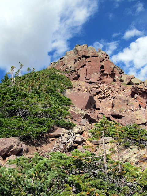
East Grandaddy Mountain--it's pretty imposing from the bottom!
View as I hiked up the slope
Finally at the ridgeline
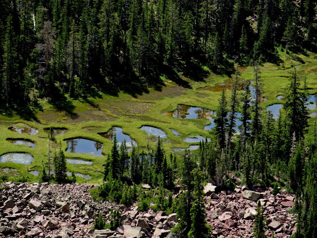
Marsh below the ridge
Chris deep in a hole where his GPS fell from about 40 feet above
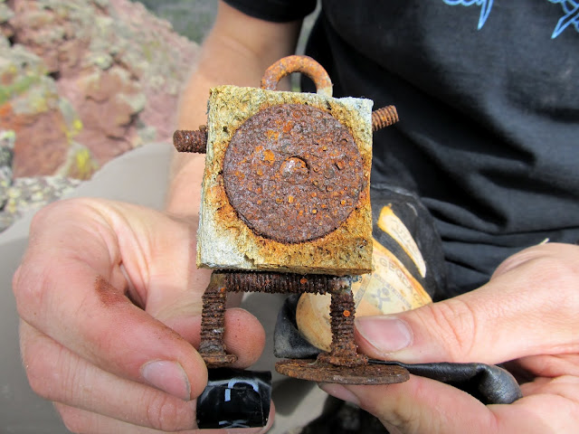
We both looked for the geocache for quite some time. He couldn't remember specifically where it was from his find nearly a decade ago. We began to wonder if the Forest Service really did retrieve it due to being in a wilderness area. Finally, Chris found the spot where the geocache had been. We were both surprised to find that they actually did remove the container, but apparently didn't notice the small black leather sack hidden just beneath it. Chris had left the sack there when he originally found the cache because it wouldn't fit inside the container, and it contained a Cach-U-Nut, part of a now-defunct game similar to Geocaching.com's travel bugs. Finding that alone made the scramble up the mountain worthwhile.
Our goal for climbing up East Grandaddy--the '39 Geezer Square Sponge, Cachunut #196.
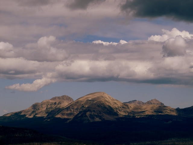
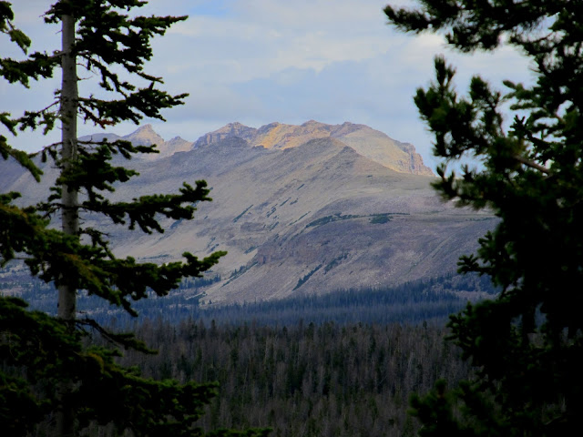
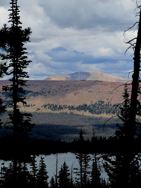
Hayden Peak (left), Mt. Agassiz (center) and East Hayden Peak (right)
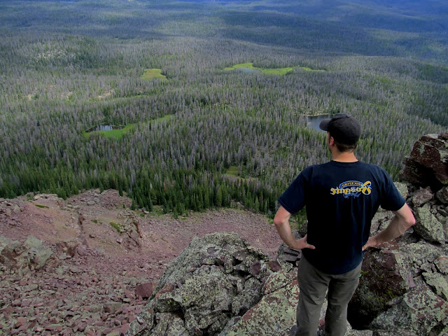
Chris surveying the view
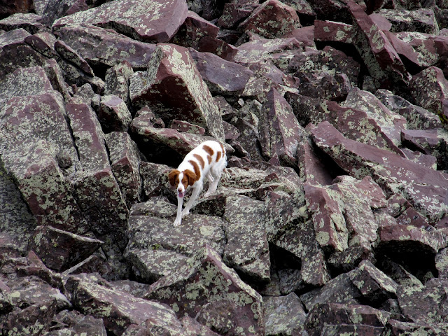
Torrey waited below--she wouldn't go past this point for some reason
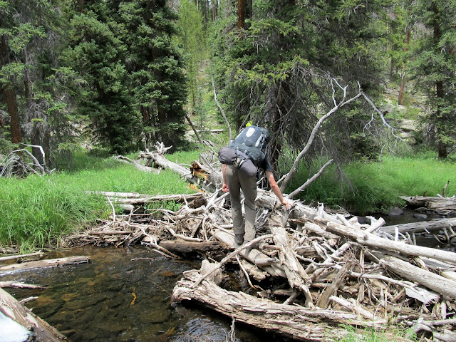
After descending to our camp, Chris and I picked up our backpacks and tried finding an easier route back to the trail than we'd taken in the previous evening. We made it back to the trail easily, then had a decision to make. I'd already made up my mind, and voice my decision to Chris, that I didn't want to venture deeper into Grandaddy Basin. We'd already hiked six miles to our previous night's camp and did another mile of very steep scrambling, and I didn't think I could take another eight or so miles of backpacking for the day. However, at the very moment we reached the trail, I had a change of heart. We hit the trail and turned right rather than left, and headed northeast over new ground instead of backtracking to Grandaddy Lake. My reason for changing my mind was that my muscles and joints may temporarily regret the much longer trek, but my mind will always look back fondly on it. And, after all, it turned out not to be so bad. We followed the trail past LaMarla Lake, then down the West Fork of Rock Creek. We crossed a few creeks on rickety bridges, and the "bridge" over Rock Creek was particularly bad--it was merely a jumble of fallen trees that I expected to fall off of, but made it over safely. At the next trail junction, and after losing 1,100' of elevation, we filtered some water out of Rock Creek and began the climb up the Fish Creek drainage toward Rainbow Lake. Rainbow Lake seemed like a good destination for our next camp, which we figured would leave us with about eight miles of backpacking to get back to the trailhead on Sunday.
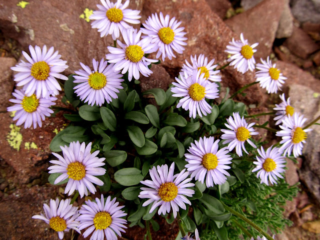
Daisies
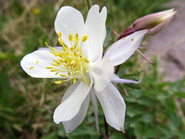
The only Columbine flower that I saw in Grandaddy Basin
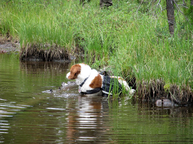
Torrey taking a dip in a pond
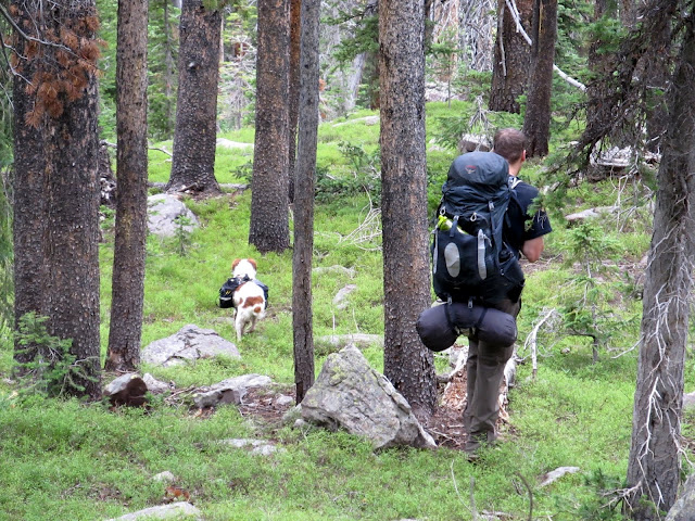
Heading back for the trail
Bridge over a creek
'Bridge' over the West Fork of Rock Creek
Trail junction at Rock Creek
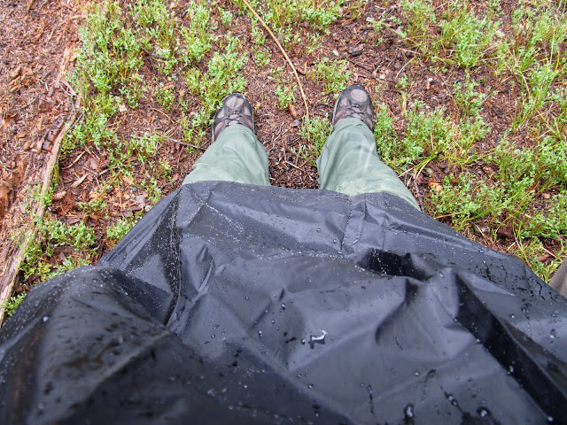
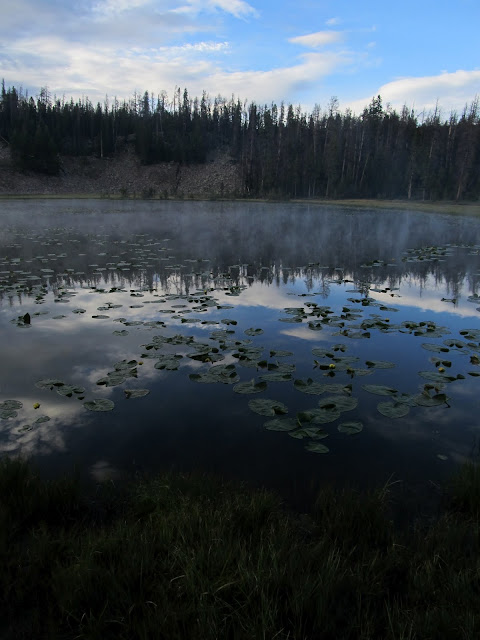
The trail along Fish Creek ascended steeply at first, then leveled off and gradually climbed the rest of the way toward Rainbow Lake. The trail along Rock Creek was completely unmaintained, with dozens of fallen trees along the way, and we found the trail along Fish Creek to be no different. This made things only a little more difficult for us, carrying more than 40 pounds on our backs, but it also contributed to the solitude that we enjoyed being off the main routes of Grandaddy Basin. Around 4:30 that afternoon the rain came, and it was much heavier than we experienced the previous day. I donned my rain poncho and Chris his rain jacket and pack cover, then we trudged farther up the trail. Poor Torrey--she doesn't seem to mind the rain, but I keep thinking she should have a rain poncho too. We got close to Rainbow Lake and left the trail in search of a place to camp. We found a flat spot in the trees near Range Lake where we set up our tents then started a camp fire. Yep, I thought we were breaking the law, but after returning home I learned that the Forest Service had lifted the fire restrictions in the High Uintas effective that same day at midnight. Restrictions or no, there was no way that soggy forest was going to catch fire.
The trails along Rock Creek and Fish Creek were completely unmaintained. We must have had to climb over more than 50 trees like this.
Fish Creek crossing
Heavy rain on a small pond
I donned my poncho during Saturday evening's heavy downpour
Range Lake near our second night's camp
Saturday night's camp

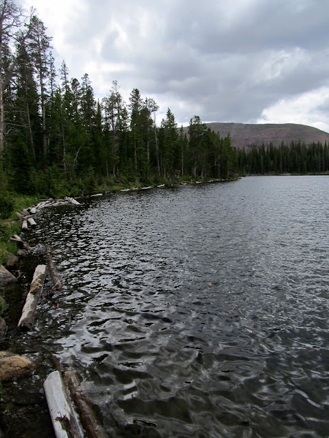
I was able to dry my shoes out that evening, and Torrey dried out pretty well as she lay next to the fire. Things were still soaking wet on Sunday morning. I filtered some water out of Range Lake--my first time pumping water from a still body--and it tasted like frog ass...it makes my reconsider my choice of water filter. We rolled up our wet gear and loaded our packs after a quick breakfast. We hit the trail around 9:00AM and stopped by Rainbow Lake for a quick look-see, then went south at the trail junction that would lead us back to Grandaddy Lake. We found the trail much better maintained between Rainbow and Grandaddy--there were precisely zero fallen trees to step over or around. We passed Lost Lake and Brinton Meadow, and at the next trail junction we decided to look for the Brinton Meadow Guard Station that was listed on both mine and Chris' GPS maps. We found a clearing where the guard station may have been, but found no signs of a building having been there. We continued south and slowly gained elevation as we neared Betsy Lake, where we saw the first people since leaving Grandaddy Lake on Friday evening.
Range Lake reflection
On the trail Sunday morning
Trail junction near Rainbow Lake
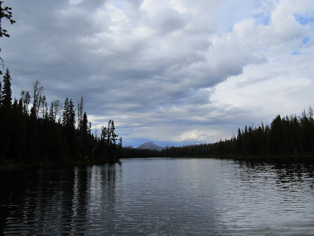
Rainbow Lake
Lost Lake
After the crappy trails on Saturday, I enjoyed the well-maintained trails south of Rainbow Lake
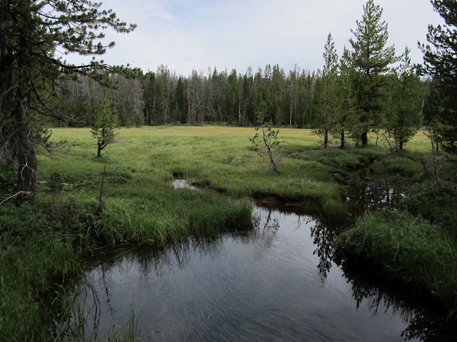
Brinton Meadow
Near the Brinton Meadow Guard Station, which we couldn't locate
Nice sidewalk on the trail
Distant view toward Spread-Eagle Peak
A short while south of Betsy Lake we reached the trail junction on the north side of Grandaddy Lake and stopped on the shore to eat a quick lunch and rest for a while. We then steeled ourselves for some more climbing to Hades Pass. After the pass it was all downhill to the trailhead, and we made excellent time. I didn't think I could move so quickly with so much weight in my pack. A quarter-mile down from the pass it started raining heavily and we put on our rain gear, then continued at a hurried pace down the trail. The rain let up as we reached our vehicles, and Chris and I enjoyed some Powerade that I'd left in the truck. After being there for a while, I noticed a note left inside a plastic bag stuffed behind one of my windshield wipers. It was from one of Traci's friends, and their family had spent the night at Grandaddy Lake on Friday and returned Saturday. I also met another dog named Torrey at the trailhead. Two Labradoodles came over to visit us while we were lounging around and relaxing near the vehicles after the hike, and I heard their owner call out to them, "Torrey, Boulder, come here!" I now regret not going over and introducing myself. We covered about 23 miles on our trip: 6 miles on the first day, 8.5 on the second, and another 8.5 on the final day. It was wonderful getting off the well-traveled routes and seeing more of Grandaddy Basin than do apparently most people who go there.
Trail junction at Betsy Lake
Betsy Lake
Lunch break at Grandaddy Lake
View over Grandaddy Lake from Hades Pass
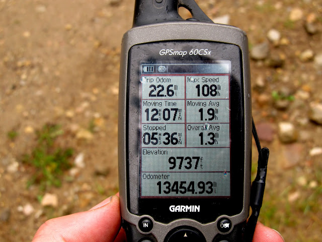
Shot of the GPS back at the trailhead
Full Photo Gallery:
https://picasaweb.google.com/Dennis.Udink/GrandaddyBasin
GPS Tracklog and Photo Waypoints (Google Earth .KMZ File)
http://udink.org/geo/GrandaddyBasin.kmz
GPS Tracklog and Photo Waypoints (Google Maps)
[parsehtml]<iframe width="640" height="480" frameborder="0" scrolling="no" marginheight="0" marginwidth="0" src="https://maps.google.com/maps?q=http:%2F%2Fudink.org%2Fgeo%2FGrandaddyBasin.kmz&hl=en&sll=39.499761,-111.547028&sspn=4.950576,10.821533&t=h&ie=UTF8&ll=40.606915,-110.789223&spn=0.125111,0.219727&z=12&output=embed"></iframe><br /><small><a href="https://maps.google.com/maps?q=http:%2F%2Fudink.org%2Fgeo%2FGrandaddyBasin.kmz&hl=en&sll=39.499761,-111.547028&sspn=4.950576,10.821533&t=h&ie=UTF8&ll=40.606915,-110.789223&spn=0.125111,0.219727&z=12&source=embed" style="color:#0000FF;text-align:left">View Larger Map</a></small>[/parsehtml]https://maps.google.com/maps?q=http://udink.org/geo/GrandaddyBasin.kmz&hl=en&ll=40.606915,-110.789394&spn=0.076109,0.169086&sll=39.499761,-111.547028&sspn=4.950576,10.821533&t=h&z=13
Featured image for slideshow:

). It was a four-mile hike to Grandaddy Lake from the trailhead, and we gained 1,000' in elevation hiking up to Hades Pass before descending to the lake. I saw my first marmot during the hike up into the basin.At the nearly-packed Grandview Trailhead on Friday afternoon
Grandview Trailhead
Sign at the trailhead
Starting up the trail
Entering the High Uintas Wilderness
Climbing up toward Grandaddy Lake
The trail
The first marmot I'd ever seen
There were several groups of people around Grandaddy Lake, including a few who had camp fires burning. There were fire restrictions in place so I was surprised to see people flaunting their fires just off the trail in a very popular area. At the trail junction near Grandaddy Lake, we turned right (east) and hiked toward Lodgepole Lake. Chris and I had made no specific plans on where to hike or camp, which was a huge departure from how I normally do things. I usually plan my route and camp sites meticulously, but it was nice not having an itinerary this time. We saw a lot of people as we passed the north side of Grandaddy Lake, but after we left the lake shore near the outlet and descended the relatively steep trail toward Lodgepole, we didn't see another person for almost the next two days. There was an old cabin near Lodgepole Lake where we stopped to rest, and in the nearby pond I saw lily pads for the first time ever.
Heart Lake and a small pond above it
First view of Grandaddy Lake
Trail junction near Grandaddy Lake
Boardwalk through a meadow in the 'wilderness'
The sun made a brief appearance
Grandaddy Lake
Log jam at the Grandaddy outlet
Alpine Fireweed
Lodgepole Lake with Mt. Agassiz in the distance
Cabin at Lodgepole Lake
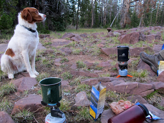
Torrey begging Chris for some jerky
Lily pads
Lily pads
We found another old cabin southeast of Lodgepole, and at that point we decided to leave the trail and get closer to the geocache that we were hoping to find. It took some bushwhacking through some ugly terrain before we found a perfect place to camp. We set up our tents on a flat, dry, grassy spot just inside the trees at the edge of a small boulder field. There were some nice boulders to sit on at the edge of the boulder field where we spent a couple of hours just hanging out, fixing meals, and talking about the next day's activities. I awoke to light rain a couple of times during the night. I brought an inflatable pillow on this trip and it made a huge difference--I slept much more comfortably and woke up feeling pretty good the next morning.
Another cabin southeast of Lodgepole Lake
Setting up camp
Tents set up at the base of East Grandaddy Mountain
East Grandaddy Mountain
Beggar at dinner time
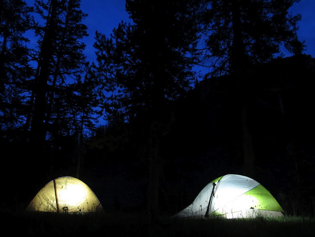
Tents at night
I was surprised to find things pretty dry the next morning. I expected the grass to be pretty wet, but apparently the light rain during the night was even lighter than I thought. Chris and I ate breakfast, re-packed our backpacks, and filtered some water out of a small stream before setting out sans packs up the steep mountain to look for the geocache. We crossed a couple of boulder fields and scrambled up some steep talus. Well, Chris, being in much better shape, left me in his dust, so Torrey and I climbed up together while Chris went ahead. I reached top of the ridge where I expected it to get easier, but it was just as difficult following the top of the ridge. I got to within a couple hundred feet of where my GPS said the cache should be and whistled to get Chris' attention. I heard him holler back but couldn't make out the words. He sounded excited, so I assumed that meant he'd found the geocache. I got closer and closer but still couldn't see him. I called out again and heard his reply come from very close by, but somewhat echo-y and muffled. I scrambled over some boulders to find Chris down in a deep hole where his GPS had fallen and he'd gone in to retrieve it. While climbing into the hole a large rock had fallen and pinned his arm (i.e., he got "Ralstoned"), but he was able to lift it off with his free arm. After that, he'd decided to sit tight and wait for me just in case the hole caved in without anybody knowing where he was. Once I arrived he dove into the hole a little deeper and just barely reached his GPS, then climbed out without issue.
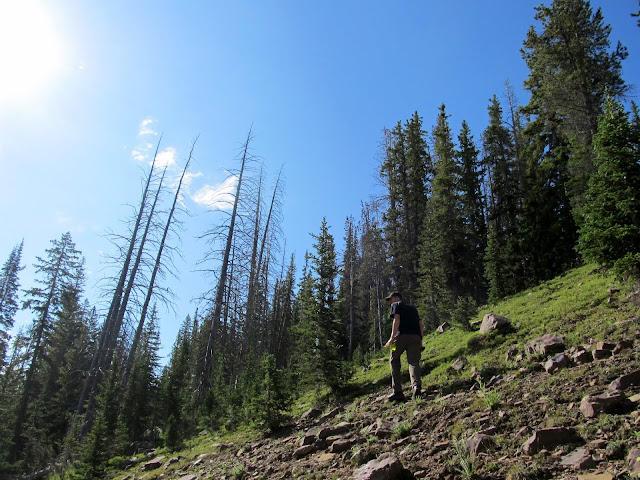
Hiking up East Grandaddy Mountain on Saturday morning
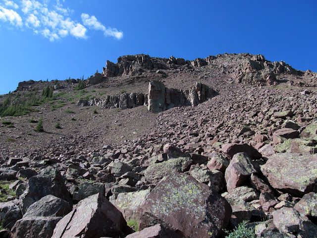
East Grandaddy Mountain--it's pretty imposing from the bottom!
View as I hiked up the slope
Finally at the ridgeline
Marsh below the ridge
Chris deep in a hole where his GPS fell from about 40 feet above
We both looked for the geocache for quite some time. He couldn't remember specifically where it was from his find nearly a decade ago. We began to wonder if the Forest Service really did retrieve it due to being in a wilderness area. Finally, Chris found the spot where the geocache had been. We were both surprised to find that they actually did remove the container, but apparently didn't notice the small black leather sack hidden just beneath it. Chris had left the sack there when he originally found the cache because it wouldn't fit inside the container, and it contained a Cach-U-Nut, part of a now-defunct game similar to Geocaching.com's travel bugs. Finding that alone made the scramble up the mountain worthwhile.
Our goal for climbing up East Grandaddy--the '39 Geezer Square Sponge, Cachunut #196.
Hayden Peak (left), Mt. Agassiz (center) and East Hayden Peak (right)
Chris surveying the view
Torrey waited below--she wouldn't go past this point for some reason
After descending to our camp, Chris and I picked up our backpacks and tried finding an easier route back to the trail than we'd taken in the previous evening. We made it back to the trail easily, then had a decision to make. I'd already made up my mind, and voice my decision to Chris, that I didn't want to venture deeper into Grandaddy Basin. We'd already hiked six miles to our previous night's camp and did another mile of very steep scrambling, and I didn't think I could take another eight or so miles of backpacking for the day. However, at the very moment we reached the trail, I had a change of heart. We hit the trail and turned right rather than left, and headed northeast over new ground instead of backtracking to Grandaddy Lake. My reason for changing my mind was that my muscles and joints may temporarily regret the much longer trek, but my mind will always look back fondly on it. And, after all, it turned out not to be so bad. We followed the trail past LaMarla Lake, then down the West Fork of Rock Creek. We crossed a few creeks on rickety bridges, and the "bridge" over Rock Creek was particularly bad--it was merely a jumble of fallen trees that I expected to fall off of, but made it over safely. At the next trail junction, and after losing 1,100' of elevation, we filtered some water out of Rock Creek and began the climb up the Fish Creek drainage toward Rainbow Lake. Rainbow Lake seemed like a good destination for our next camp, which we figured would leave us with about eight miles of backpacking to get back to the trailhead on Sunday.
Daisies
The only Columbine flower that I saw in Grandaddy Basin
Torrey taking a dip in a pond
Heading back for the trail
Bridge over a creek
'Bridge' over the West Fork of Rock Creek
Trail junction at Rock Creek
The trail along Fish Creek ascended steeply at first, then leveled off and gradually climbed the rest of the way toward Rainbow Lake. The trail along Rock Creek was completely unmaintained, with dozens of fallen trees along the way, and we found the trail along Fish Creek to be no different. This made things only a little more difficult for us, carrying more than 40 pounds on our backs, but it also contributed to the solitude that we enjoyed being off the main routes of Grandaddy Basin. Around 4:30 that afternoon the rain came, and it was much heavier than we experienced the previous day. I donned my rain poncho and Chris his rain jacket and pack cover, then we trudged farther up the trail. Poor Torrey--she doesn't seem to mind the rain, but I keep thinking she should have a rain poncho too. We got close to Rainbow Lake and left the trail in search of a place to camp. We found a flat spot in the trees near Range Lake where we set up our tents then started a camp fire. Yep, I thought we were breaking the law, but after returning home I learned that the Forest Service had lifted the fire restrictions in the High Uintas effective that same day at midnight. Restrictions or no, there was no way that soggy forest was going to catch fire.
The trails along Rock Creek and Fish Creek were completely unmaintained. We must have had to climb over more than 50 trees like this.
Fish Creek crossing
Heavy rain on a small pond
I donned my poncho during Saturday evening's heavy downpour
Range Lake near our second night's camp
Saturday night's camp
I was able to dry my shoes out that evening, and Torrey dried out pretty well as she lay next to the fire. Things were still soaking wet on Sunday morning. I filtered some water out of Range Lake--my first time pumping water from a still body--and it tasted like frog ass...it makes my reconsider my choice of water filter. We rolled up our wet gear and loaded our packs after a quick breakfast. We hit the trail around 9:00AM and stopped by Rainbow Lake for a quick look-see, then went south at the trail junction that would lead us back to Grandaddy Lake. We found the trail much better maintained between Rainbow and Grandaddy--there were precisely zero fallen trees to step over or around. We passed Lost Lake and Brinton Meadow, and at the next trail junction we decided to look for the Brinton Meadow Guard Station that was listed on both mine and Chris' GPS maps. We found a clearing where the guard station may have been, but found no signs of a building having been there. We continued south and slowly gained elevation as we neared Betsy Lake, where we saw the first people since leaving Grandaddy Lake on Friday evening.
Range Lake reflection
On the trail Sunday morning
Trail junction near Rainbow Lake
Rainbow Lake
Lost Lake
After the crappy trails on Saturday, I enjoyed the well-maintained trails south of Rainbow Lake
Brinton Meadow
Near the Brinton Meadow Guard Station, which we couldn't locate
Nice sidewalk on the trail
Distant view toward Spread-Eagle Peak
A short while south of Betsy Lake we reached the trail junction on the north side of Grandaddy Lake and stopped on the shore to eat a quick lunch and rest for a while. We then steeled ourselves for some more climbing to Hades Pass. After the pass it was all downhill to the trailhead, and we made excellent time. I didn't think I could move so quickly with so much weight in my pack. A quarter-mile down from the pass it started raining heavily and we put on our rain gear, then continued at a hurried pace down the trail. The rain let up as we reached our vehicles, and Chris and I enjoyed some Powerade that I'd left in the truck. After being there for a while, I noticed a note left inside a plastic bag stuffed behind one of my windshield wipers. It was from one of Traci's friends, and their family had spent the night at Grandaddy Lake on Friday and returned Saturday. I also met another dog named Torrey at the trailhead. Two Labradoodles came over to visit us while we were lounging around and relaxing near the vehicles after the hike, and I heard their owner call out to them, "Torrey, Boulder, come here!" I now regret not going over and introducing myself. We covered about 23 miles on our trip: 6 miles on the first day, 8.5 on the second, and another 8.5 on the final day. It was wonderful getting off the well-traveled routes and seeing more of Grandaddy Basin than do apparently most people who go there.
Trail junction at Betsy Lake
Betsy Lake
Lunch break at Grandaddy Lake
View over Grandaddy Lake from Hades Pass
Shot of the GPS back at the trailhead
Full Photo Gallery:
https://picasaweb.google.com/Dennis.Udink/GrandaddyBasin
GPS Tracklog and Photo Waypoints (Google Earth .KMZ File)
http://udink.org/geo/GrandaddyBasin.kmz
GPS Tracklog and Photo Waypoints (Google Maps)
[parsehtml]<iframe width="640" height="480" frameborder="0" scrolling="no" marginheight="0" marginwidth="0" src="https://maps.google.com/maps?q=http:%2F%2Fudink.org%2Fgeo%2FGrandaddyBasin.kmz&hl=en&sll=39.499761,-111.547028&sspn=4.950576,10.821533&t=h&ie=UTF8&ll=40.606915,-110.789223&spn=0.125111,0.219727&z=12&output=embed"></iframe><br /><small><a href="https://maps.google.com/maps?q=http:%2F%2Fudink.org%2Fgeo%2FGrandaddyBasin.kmz&hl=en&sll=39.499761,-111.547028&sspn=4.950576,10.821533&t=h&ie=UTF8&ll=40.606915,-110.789223&spn=0.125111,0.219727&z=12&source=embed" style="color:#0000FF;text-align:left">View Larger Map</a></small>[/parsehtml]https://maps.google.com/maps?q=http://udink.org/geo/GrandaddyBasin.kmz&hl=en&ll=40.606915,-110.789394&spn=0.076109,0.169086&sll=39.499761,-111.547028&sspn=4.950576,10.821533&t=h&z=13
Featured image for slideshow:
