- Joined
- May 5, 2012
- Messages
- 1,725
My father taught me to water ski on two lakes, both reservoirs: Flaming Gorge and Pineview. I've been going to Flaming Gorge ever since I was a little boy. As a teenage Boy Scout I twice rowed from Sheep Creek to the Cedar Springs Marina near the Flaming Gorge dam in a kayak. Suffice it to say, I have a sentimental attachment to the place.
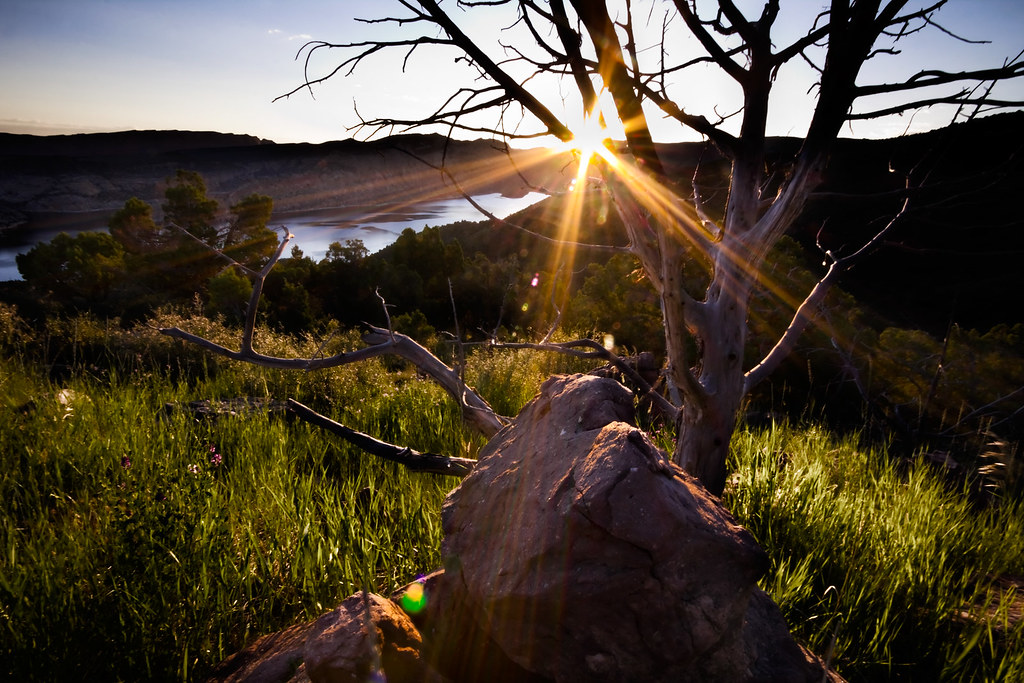
Only recently have I developed an interest in the history of the region, most notably the 1869 Powell expedition that resulted in the naming of most topography along what was then the Green River. Powell saw this stretch of rock, with its brilliant red face gleaming in the sun and named it Flaming Gorge. From this, the reservoir draws its name.
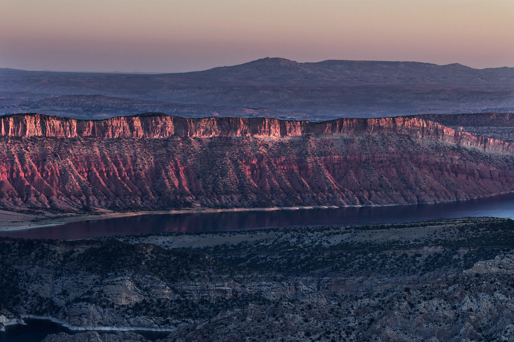
First light on Flaming Gorge by ashergrey, on Flickr
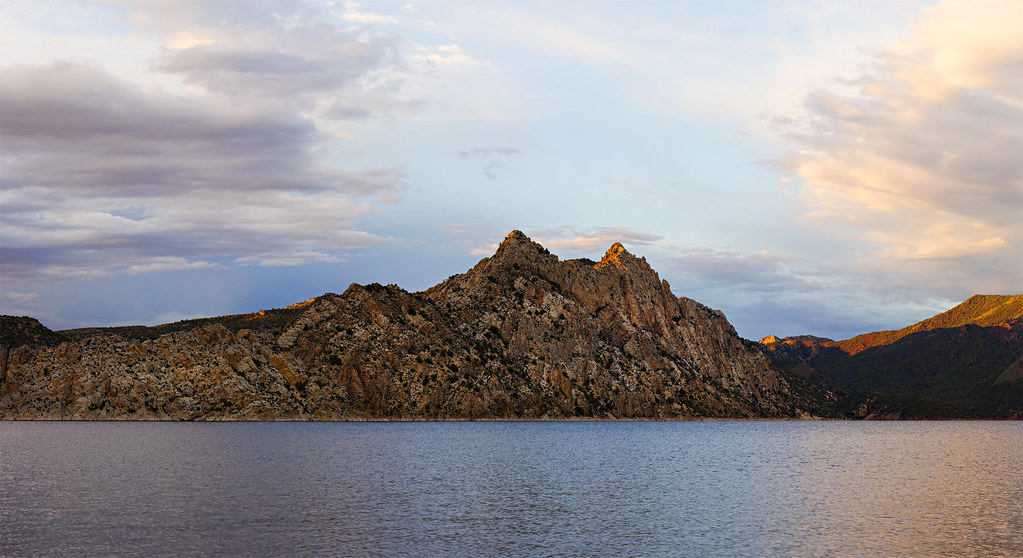
In 1964 the U.S. Bureau of Reclamation and its contractors completed construction on the Flaming Gorge Dam, impounding the Green River and creating a reservoir stretching back 90+ miles into Wyoming. The reservoir's main draw today is the fishing and water sports. The region surrounding the reservoir is now designated the Flaming Gorge National Recreation Area and is managed by the Ashley National Forest.
I will focus on the Utah side.
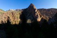
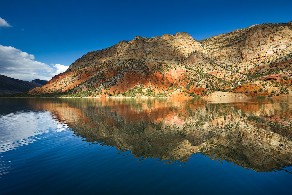
Powell's Amphitheater by ashergrey, on Flickr
Flaming Gorge is largely fed by snowmelt from the north slope of the Uintas (Blacks Fork and Henrys Fork) and from the Wind River range. So when you're out backpacking in those areas, think of all that snow and water eventually funneling through the reservoir… down the Green and into Canyonlands, Grand Canyon and beyond.
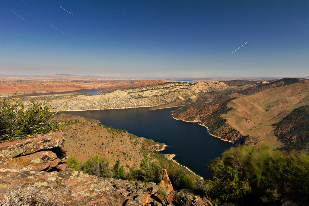
One of the smaller tributaries to the reservoir is Sheep Creek. It flows out of the north-eastern edge of the Uintas into Flaming Gorge just south of Manila. Before the coming of the reservoir, it joined the Green River near what Powell had named Beehive Point. Now, it forms a narrow bay accessible by boat ramp from Utah SR 44.
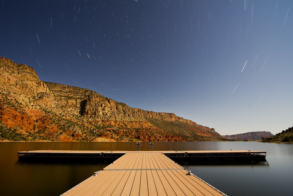
Sittin' on the dock of the bay... by ashergrey, on Flickr
Sheep Creek is a great access point for those seeking a simple launch without the services of a full-fledged marina (Lucerne and Cedar Springs, primarily). It's also the nearest launch point to the most scenic parts of the lake: the Flaming Gorge, Horseshoe Canyon, Hideout Draw and Red Canyon.
Sheep Creek by ashergrey, on Flickr
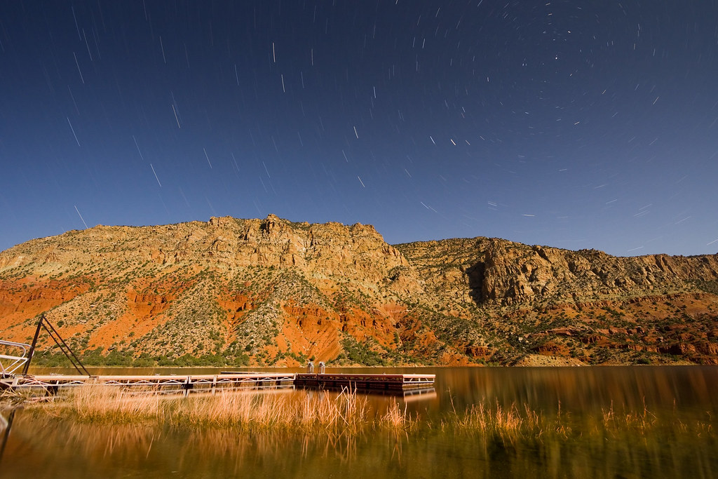
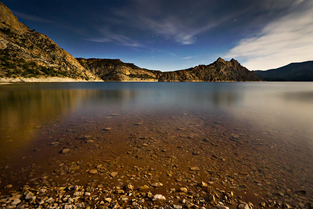
Sheep Creek by Moonlight by ashergrey, on Flickr
But Sheep Creek is also notable for its geological value upstream. A scenic backway creates a loop with SR 44, providing a path into the Sheep Creek Canyon Geological Area.

A short dirt road splits off the scenic loop road and heads to the Ute Lookout, an historic fire lookout tower situated on Ute Mountain. From here, forest service rangers observed the north-eastern portion of the Uintas, making weather and wildfire observations while living in an elevated room. The tower, first constructed in the 1930s by the Civilian Conservation Corps, has fallen into disrepair.
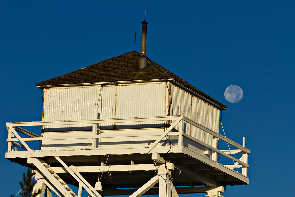
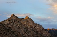
The Moon over Ute Mountain by ashergrey, on Flickr
Visitors were once allowed up on the tower, but the lower portion of the staircase has been removed. This is reportedly to allow for renovation work, but there are no signs at the site to indicate any such work is underway.
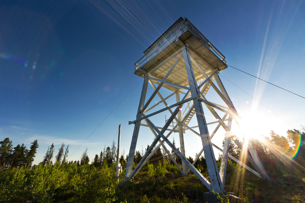
Ute Fire Tower by ashergrey, on Flickr
Pallisades Memorial Park sits in the geological area. It was once a campground, but has been restricted to daylight use only since June 9, 1969. That's when a debris flow swept through the canyon during the after dark hours, killing seven campers and destroying miles of road.

Also in the geological area is Sheep Creek cave. The opening is a maw visible right from the roadway. I'm not well informed as to the nature of the cave.

Sheep Creek Canyon and the greater Flaming Gorge region provide critical habitat to a host of wildlife, most notably the Rocky Mountain Bighorn. Which makes sense, given the name of the creek. Bighorn sheep can on occasion be sighted clamoring across the steep, rocky pitches above the reservoir.
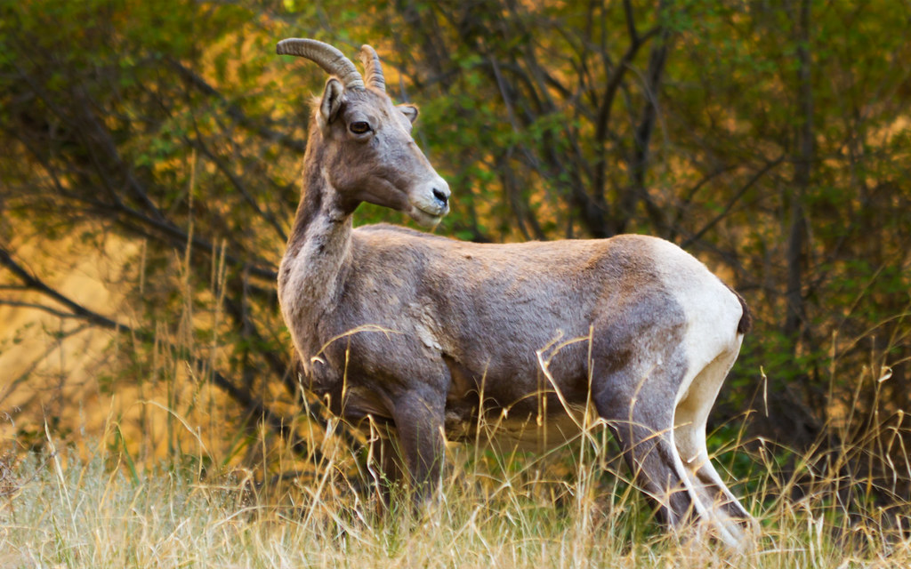
What are ewe looking at? by ashergrey, on Flickr
The Flaming Gorge region was also once home to grizzlies, waterfowl and other fauna. Today, the grizzlies are gone. A few black bear haunt the area. Osprey thrive on the rocky ledges with fish close by. They often wheel high over the water, returning to their nests year after year to raise new broods of young.
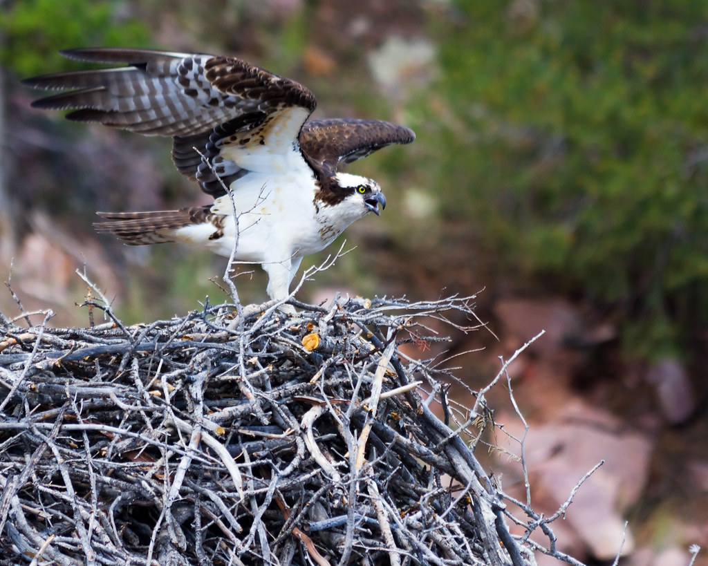
In Defense of the Nest by ashergrey, on Flickr
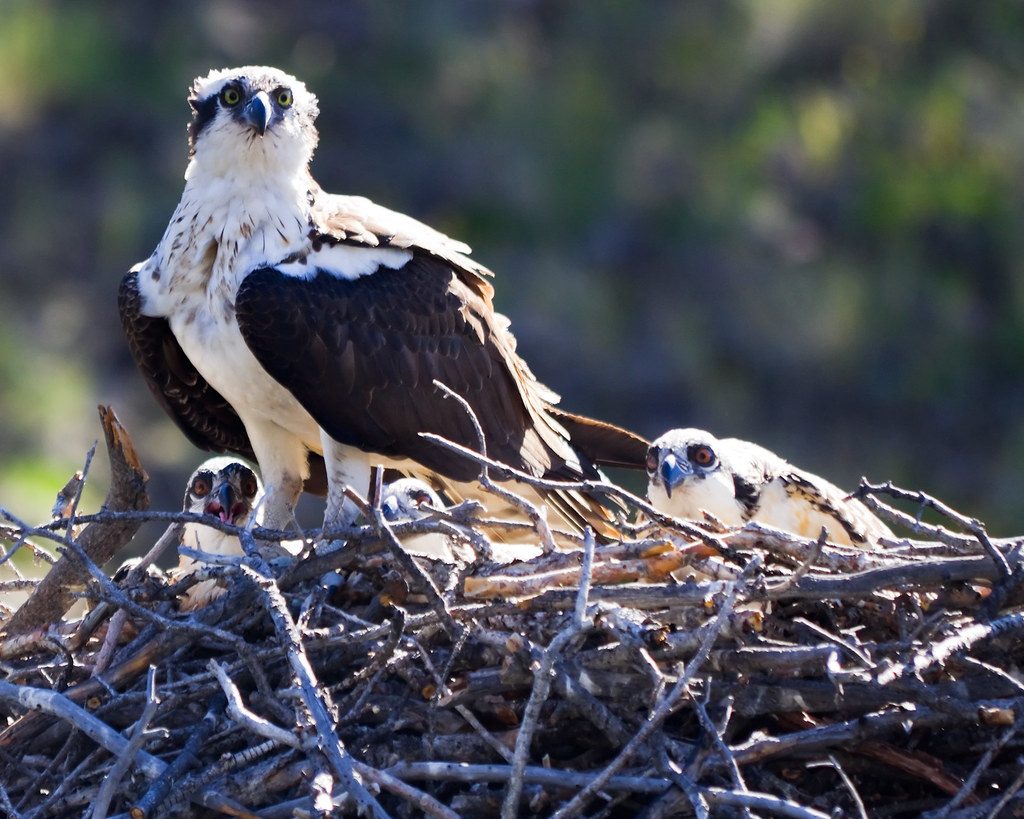
The Brood by ashergrey, on Flickr
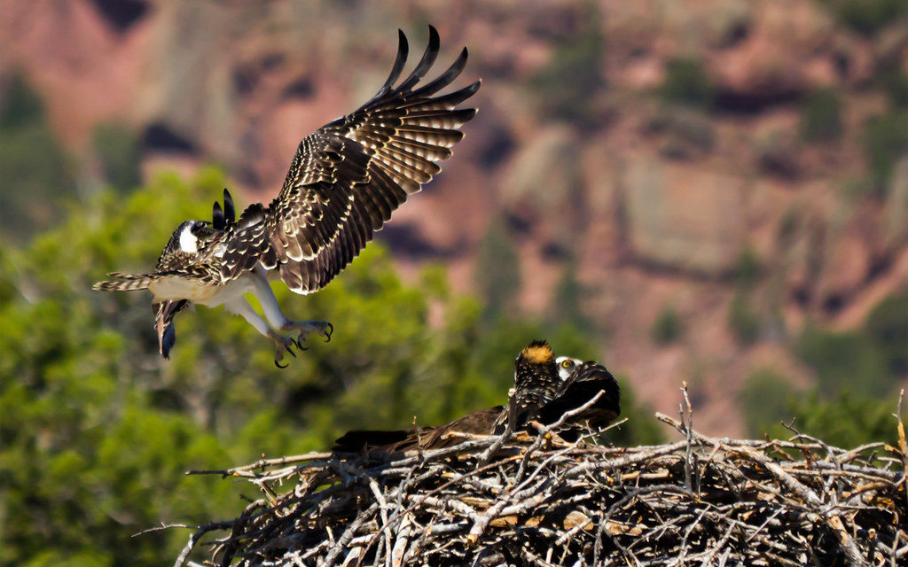
Lunchtime for Osprey by ashergrey, on Flickr
The transition of Flaming Gorge from a river canyon to a reservoir has also led to the introduction of other critters, like crayfish. These mud bugs now swarm the lakebed and can be captured by the crateful, especially right after dark. They go after nearly any bait and will fight one another for a taste.
Most camping along the reservoir, at least on the Utah side, takes places at Kingfisher Island (between Sheep Creek and Horseshoe Canyon), in or around the Hideout boat camp and at Jarvies Canyon. A boat dock once sat at Goosenecks below the Red Canyon Overlook, but it has since been removed and the campsite returned to a more natural state.
For car campers, campgrounds with drive-up access are located near the dam, at Cedar Springs and Dutch John.
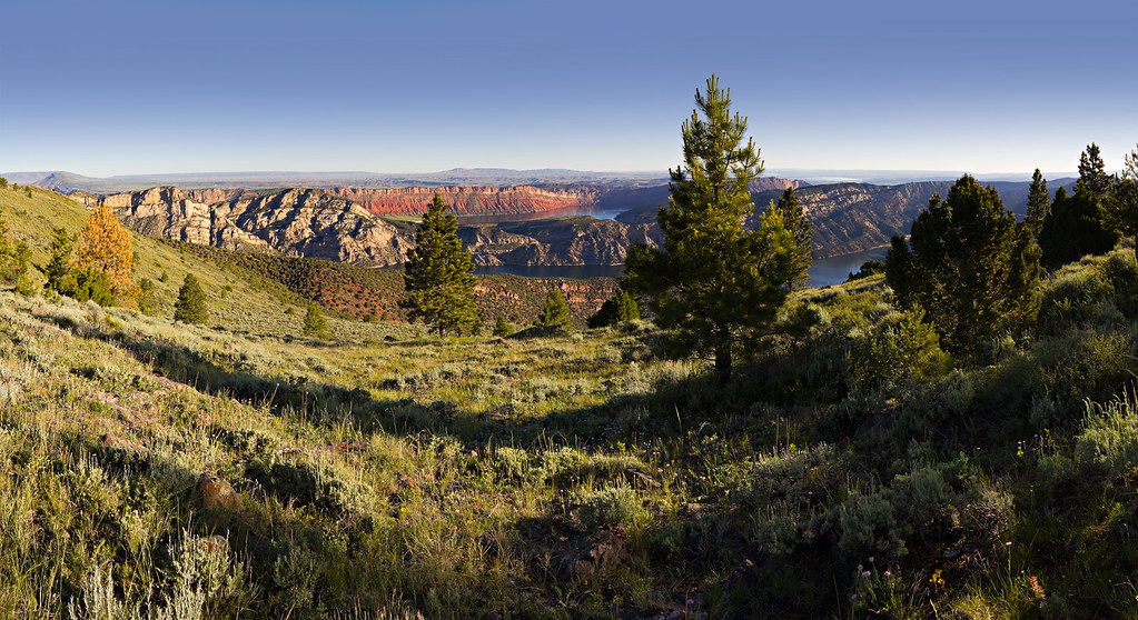
Hideout has the highest capacity of the on-the-water campgrounds. It also provides excellent views of the stark Weber Sandstone and glimpses of the Uinta Mountain Group quartzite of Red Canyon.
Dusk on Hideout Bay by ashergrey, on Flickr
Moonlit Hideout Bay by ashergrey, on Flickr

Hideout Bay by ashergrey, on Flickr
A lightly-used trail connects the Hideout boat camp (roughly 6040 feet above sea level, depending on reservoir capacity) to the Dowd Mountain overlook (7675 feet). It can be hiked in either direction, though the logistics make it a less-than-popular destination for anyone not planning on camping at Hideout.
[PARSEHTML]<iframe src="http://www.mappingsupport.com/p/gmap4.php?q=http://dl.dropbox.com/u/3847512/GPS/Dowd_Mountain.kml&t=t4" frameborder="0" marginheight="0" scrolling="no" width="600" height="600"></iframe><br><br>[/PARSEHTML]The trail climbs from water level across desert terrain, briefly entering a wooded section of Hideout Draw before ascending through a section of forest destroyed by wildfire.

The path switches back through fields of brushy wildflowers and grasses, offering views north and east of the lake.
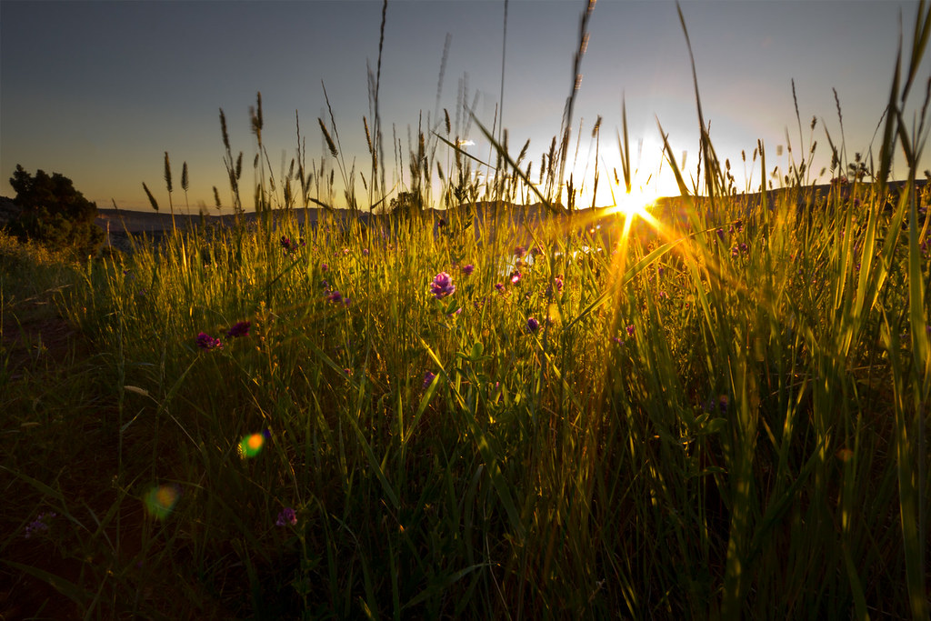
Green River Sunrise by ashergrey, on Flickr

Summer Sunrise by ashergrey, on Flickr
Dowd Mountain by ashergrey, on Flickr
The hike isn't too taxing, unless it's hot. There is very little cover from the sun, so it's best done at dawn or dusk.
For those not inclined to hiking, Dowd Mountain Overlook can be reached by way of a short dirt road spurring off SR 44.
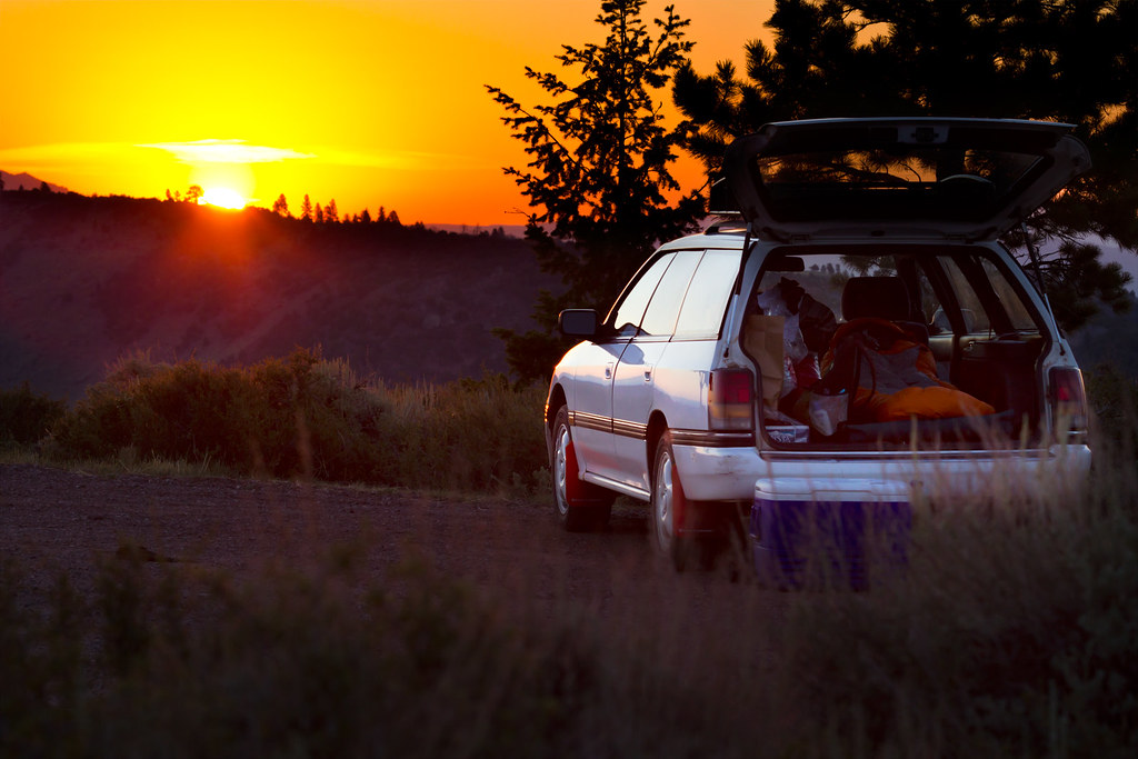
Car camping by ashergrey, on Flickr
Manila by Moonlight by ashergrey, on Flickr
Modern man only really came to know the canyons of Flaming Gorge during a window lasting little more than 100 years. And while I wish I could have seen them in their natural state, I will accept and enjoy the place as it is now. I'm not much of a fisherman, so that means water sport.

One concern though is Daggett County's desire to further develop the shores of Flaming Gorge, trading the property we own as citizens of the United States in order to create a private lakeside resort. Development along Flaming Gorge may be inevitable, but in my view should be done in a way that preserves as much as possible the natural character of the place.
Featured image for home page:

Only recently have I developed an interest in the history of the region, most notably the 1869 Powell expedition that resulted in the naming of most topography along what was then the Green River. Powell saw this stretch of rock, with its brilliant red face gleaming in the sun and named it Flaming Gorge. From this, the reservoir draws its name.
First light on Flaming Gorge by ashergrey, on Flickr
In 1964 the U.S. Bureau of Reclamation and its contractors completed construction on the Flaming Gorge Dam, impounding the Green River and creating a reservoir stretching back 90+ miles into Wyoming. The reservoir's main draw today is the fishing and water sports. The region surrounding the reservoir is now designated the Flaming Gorge National Recreation Area and is managed by the Ashley National Forest.
I will focus on the Utah side.
Powell's Amphitheater by ashergrey, on Flickr
Flaming Gorge is largely fed by snowmelt from the north slope of the Uintas (Blacks Fork and Henrys Fork) and from the Wind River range. So when you're out backpacking in those areas, think of all that snow and water eventually funneling through the reservoir… down the Green and into Canyonlands, Grand Canyon and beyond.
One of the smaller tributaries to the reservoir is Sheep Creek. It flows out of the north-eastern edge of the Uintas into Flaming Gorge just south of Manila. Before the coming of the reservoir, it joined the Green River near what Powell had named Beehive Point. Now, it forms a narrow bay accessible by boat ramp from Utah SR 44.
Sittin' on the dock of the bay... by ashergrey, on Flickr
Sheep Creek is a great access point for those seeking a simple launch without the services of a full-fledged marina (Lucerne and Cedar Springs, primarily). It's also the nearest launch point to the most scenic parts of the lake: the Flaming Gorge, Horseshoe Canyon, Hideout Draw and Red Canyon.
Sheep Creek by ashergrey, on Flickr
Sheep Creek by Moonlight by ashergrey, on Flickr
But Sheep Creek is also notable for its geological value upstream. A scenic backway creates a loop with SR 44, providing a path into the Sheep Creek Canyon Geological Area.
A short dirt road splits off the scenic loop road and heads to the Ute Lookout, an historic fire lookout tower situated on Ute Mountain. From here, forest service rangers observed the north-eastern portion of the Uintas, making weather and wildfire observations while living in an elevated room. The tower, first constructed in the 1930s by the Civilian Conservation Corps, has fallen into disrepair.
The Moon over Ute Mountain by ashergrey, on Flickr
Visitors were once allowed up on the tower, but the lower portion of the staircase has been removed. This is reportedly to allow for renovation work, but there are no signs at the site to indicate any such work is underway.
Ute Fire Tower by ashergrey, on Flickr
Pallisades Memorial Park sits in the geological area. It was once a campground, but has been restricted to daylight use only since June 9, 1969. That's when a debris flow swept through the canyon during the after dark hours, killing seven campers and destroying miles of road.
Also in the geological area is Sheep Creek cave. The opening is a maw visible right from the roadway. I'm not well informed as to the nature of the cave.
Sheep Creek Canyon and the greater Flaming Gorge region provide critical habitat to a host of wildlife, most notably the Rocky Mountain Bighorn. Which makes sense, given the name of the creek. Bighorn sheep can on occasion be sighted clamoring across the steep, rocky pitches above the reservoir.
What are ewe looking at? by ashergrey, on Flickr
The Flaming Gorge region was also once home to grizzlies, waterfowl and other fauna. Today, the grizzlies are gone. A few black bear haunt the area. Osprey thrive on the rocky ledges with fish close by. They often wheel high over the water, returning to their nests year after year to raise new broods of young.
In Defense of the Nest by ashergrey, on Flickr
The Brood by ashergrey, on Flickr
Lunchtime for Osprey by ashergrey, on Flickr
The transition of Flaming Gorge from a river canyon to a reservoir has also led to the introduction of other critters, like crayfish. These mud bugs now swarm the lakebed and can be captured by the crateful, especially right after dark. They go after nearly any bait and will fight one another for a taste.
Most camping along the reservoir, at least on the Utah side, takes places at Kingfisher Island (between Sheep Creek and Horseshoe Canyon), in or around the Hideout boat camp and at Jarvies Canyon. A boat dock once sat at Goosenecks below the Red Canyon Overlook, but it has since been removed and the campsite returned to a more natural state.
For car campers, campgrounds with drive-up access are located near the dam, at Cedar Springs and Dutch John.
Hideout has the highest capacity of the on-the-water campgrounds. It also provides excellent views of the stark Weber Sandstone and glimpses of the Uinta Mountain Group quartzite of Red Canyon.
Dusk on Hideout Bay by ashergrey, on Flickr
Moonlit Hideout Bay by ashergrey, on Flickr
Hideout Bay by ashergrey, on Flickr
A lightly-used trail connects the Hideout boat camp (roughly 6040 feet above sea level, depending on reservoir capacity) to the Dowd Mountain overlook (7675 feet). It can be hiked in either direction, though the logistics make it a less-than-popular destination for anyone not planning on camping at Hideout.
[PARSEHTML]<iframe src="http://www.mappingsupport.com/p/gmap4.php?q=http://dl.dropbox.com/u/3847512/GPS/Dowd_Mountain.kml&t=t4" frameborder="0" marginheight="0" scrolling="no" width="600" height="600"></iframe><br><br>[/PARSEHTML]The trail climbs from water level across desert terrain, briefly entering a wooded section of Hideout Draw before ascending through a section of forest destroyed by wildfire.
The path switches back through fields of brushy wildflowers and grasses, offering views north and east of the lake.
Green River Sunrise by ashergrey, on Flickr
Summer Sunrise by ashergrey, on Flickr
Dowd Mountain by ashergrey, on Flickr
The hike isn't too taxing, unless it's hot. There is very little cover from the sun, so it's best done at dawn or dusk.
For those not inclined to hiking, Dowd Mountain Overlook can be reached by way of a short dirt road spurring off SR 44.
Car camping by ashergrey, on Flickr
Manila by Moonlight by ashergrey, on Flickr
Modern man only really came to know the canyons of Flaming Gorge during a window lasting little more than 100 years. And while I wish I could have seen them in their natural state, I will accept and enjoy the place as it is now. I'm not much of a fisherman, so that means water sport.
One concern though is Daggett County's desire to further develop the shores of Flaming Gorge, trading the property we own as citizens of the United States in order to create a private lakeside resort. Development along Flaming Gorge may be inevitable, but in my view should be done in a way that preserves as much as possible the natural character of the place.
Featured image for home page: