Escalante: Neon Canyon and Islomania Dome advice?

wohl

Member
Joined
Nov 16, 2013
Messages
9
I'd appreciate advice on some day hikes along Hole-in-the-Rock Road. There's some useful information on the forums here and elsewhere, but since we'll be hiking with children (ages 7 and 10), I'm trying to find the easiest routes possible. In particular:
  • Neon Canyon: There seem to be a few different routes, of varying difficulty and length, to the Golden Cathedral. Any recommendations for the best route to take when hiking with children? We will have GPS navigation, so a poorly marked route should not be problematic. Can anyone who has done this hike with young children comment on the difficulty?
  • Islomania Dome (aka Escavolcano, Red Breaks Crater, Cosmic Navel, or Cosmic Ashtray): One can hike South from a trailhead on Old Sheffield Rd, or North from a trailhead off Harris Wash Rd (itself off Hole-in-the-Rock Rd). Based on postings on these forums, it seems that the Old Sheffield Rd trailhead is at 37.709191,-111.344671, but it was not clear from the discussion whether Old Sheffield Rd is actually open up to this point. The situation on the Harris Wash Rd is even less clear. The official trailhead is at 37.6346,-111.340384, but that is quite a bit further from the dome (37.683141,-111.315494) than the Old Sheffield Rd trailhead. There are reports, however, that it is possible to drive further along the Harris Wash Rd as far as 37.662234,-111.328261, or even to 37.666616,-111.327016; these would be closer than the trailhead on Old Sheffield Rd, but there was also some debate as to whether the road is open past the official trailhead. Can anyone who has recent experience comment on which of these trailheads is indeed accessible by car, and which is the most convenient?
 
Wohl,

I have not hiked to Insomnia Dome so, no opinion. I've been to Neon a couple of times. The route down to the Escalante and to the base of the Golden Cathedral is non-technical and pretty straight forward. The available written descriptions are pretty easy to follow if memory serves. I think there are two approaches from the west side. The descent of Neon is technical with potential keeper potholes and multiple rapplels. It requires you to attain the east rim of the escalante and then hike to the back of Neon typically. That's all I have. Have fun!

You've been to Peekaboo/Spooky and Brimstone I hope. Great kid hikes it seems to me.
 
Wohl,
The Old Sheffield Rd is open all the way to the TH you indicated (37.709191,-111.344671). I was there in April.
I have also read about the Harris Wash Rd access in Michael R. Kelsey book and asked a ranger at the Escalante BLM office and she couldn't tell me if it was open or not or even legal. I would be interested in knowing if this option is open.
 
Art: Thanks for your comments on Neon Canyon and the suggestion of the Dry Fork slots. To clarify, do you mean that the route is easy as far as Golden Cathedral, but becomes more difficult further down Neon? Yes, we have been to Peekaboo/Spooky, as well as Zebra, which is also an excellent hike with kids.

Cool Danish: Thanks for the confirmation on the Old Sheffield Rd trailhead; good to know that there's at least one better option than the official Harris Wash Rd trailhead.
 
here's the deal with the Harris Wash road:
there is a WSA/ no motor vehicles sign just beyond actual Harris Wash just past the trailhead but the road is not physically blocked.
the area which the old road enters is most definitely a Wilderness Study Area. (the entire Red Breaks and the V area are WSA's as is easily seen on any map of the area which has WSA's listed)
whether or not it is legal is not really in question, as it is unquestionably illegal to take ANY motorized vehicles into WSA's.
Whether or not one gets a ticket or in trouble is simply a matter of whether one is caught doing so or not and if that is the way in which one make's their decisions in terms of their ethics and actions, i would suggest that such individuals do not belong anywhere near WSA's or sensitive nature areas and should stay at home.
I know of one person that attempted to irresponsibly drive a lifted 4x4 suburban down that road and very quickly got stuck in a sand trap in which he had to wait hours for someone to come from town in order to winch him out after having a passenger hike to high ground to get a cell signal and make an emergency call.
this section of road is not maintained (i have hiked it) and there are a few spots with washed out culverts which would require drive arounds which would produce additional damage.
the best bet for driving as close as you can is the Old Sheffield Road option.
the last bit of track is known for sand traps there as well, but should not be too much of a problem and parking at the road split at the juniper does not add an extensive amount of walking distance (and it is easy two track road walking).
 
intuitive cat: Thanks for the comments on Harris Wash. As I recall, in a previous thread on this subject, there was some speculation that the road in question should now be legally accessible due to a recent court case by the local county and state against the BLM, but the discussion ended without any conclusion on that question. On the subject of Old Sheffield Road: are the sand traps there reasonably obvious and easily avoided? If not any advice for driving along that section of the road?
 
There are two approaches from the west side to Neon and the Golden Cathedral. The 'b-line' takes a direct route across the bench heading straight toward neon dome. The other follows Fence Canyon down it's north side and down to the river. Both are easy and straight forward for anyone used to traveling without a trail.

Check out this trip report of mine for a track. I followed the b-line route almost all the way out except I should have stayed high instead of skirting around that little mesa about half way through. It would have been hard to make the wrong choice heading in that way.

http://backcountrypost.com/forum/threads/egypt-loop-escalante.1547/
 
Oh, and I don't have kids or anything but I would consider either route totally kid-friendly. The crux would be the depth of the Escalante River at the time of your visit.
 
Oh, and I don't have kids or anything but I would consider either route totally kid-friendly. The crux would be the depth of the Escalante River at the time of your visit.

wohl, Nick had some great add'l info above... To attempt to clarify. Neon is on the east side of the Escalante. Golden Cathedral is virtually at the bottom of it maybe a few hundred yards from the E. river. It is a simple, safe walk up the Neon creek to the GC. The Escalante is almost always an easy crossing - even dry feet sometimes. Nick correctly points out that is not easy and sometimes not even safe due to deep, fast water. The normal approach involves driving down the Hole in the Rock road and then out a spur to the trailhead. Then two relatively easy walks down to the mouth of Neon outlined by Nick above get you to the E. river at the mouth of Neon.
 
I went into the Escavolcano from The Sheffield rd this fall. Really no big deal to drive out to the spot you talk about . I didn't think there was any problem getting past the sand.
 
Nick and Art: Thanks for the additional information on Neon Canyon.
powderglut: Thanks for your comments on the driving conditions on Old Sheffield Rd.

If we're going to be hiking to Islomania Dome from the North, it's tempting to try to include Red Breaks, but it seems the whole slot would be too difficult for children. Are there any significant sections that are both worth seeing (particularly for photography) and easy enough for children?
wohl, I don't know how strong a hikers your kids are. Getting to the Dome will take about 2 1/2 hours of up and down slickrock and sand walking. (from Sheffield parking spot) That is at a steady adult pace. The route is not marked and using a topo to minimize the ups and downs is essential. Not saying you couldn't add a little exploring in the east fork. But you may find... just getting to the Dome and all the colorful rock, is day enuf for the kids.
 
powderglut: Good point; if the hike at an adult pace is 5 hours round trip, I guess we shouldn't expect to have time for any significant detours.
 
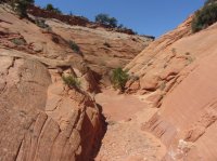
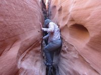
I wouldn't try to combine Red Breaks and Escavolcano, especially traveling with kids. Red Breaks may not be a technical slot, but it's not a walk-through slot either.
 
ashergrey: Point taken. Do you think Red Breaks would be worth doing as a separate hike? It looks as if the whole slot would be too difficult, but perhaps there are worthwhile sections that would still be feasible?
 
I went with a friend to Red Breaks and the Big West Fork in October. Originally we wanted to combine this hike with the Cosmic Ashtray, but were running out of time. We then did the Cosmic Ashtray the other day via Old Sheffield Road.
Red Breaks was a long day with a lot of boulders and stemming, it took a while to get through it. Even the Cosmic Ashtray took us (both strong hikers) about 5 hours round trip.

I loved both hikes and at the end I'm more than happy we did it on two separate days
 
IMG_4507.JPG We went into Red Breaks from the Spencer Flat drill hole site ( complete opposite side of the Sheffield rd ) on the west side. This is not to bad an up climb to the Big West Fork. You can explore the upper end and return when it starts to get to be too tough to travel with the kids. Nice slots and great colors. I agree with @Miss Buffalo about doing 2 separate days. Exploring the slots and the Escavolcano in the same day is for the young and burly. 10+ hr hiking and scrambling.


IMG_4501.JPG
 
ashergrey: Point taken. Do you think Red Breaks would be worth doing as a separate hike? It looks as if the whole slot would be too difficult, but perhaps there are worthwhile sections that would still be feasible?

I originally tried to do the Red Breaks+ hike based on a loop route I'd seen on summitpost. I never even made it all the way through Red Breaks as the weather turned while I was in the main fork. Red Breaks is a cool slot and worth doing, but does include some challenging chockstones.
 
Miss Buffalo, powderglut, and ashergrey : Thanks for your comments.

powderglut: Where is the Spencer Flat drill hole site? Do you have coordinates?
 
However many miles into Sheffield road, you will come to a split in the road once you are near the raised upper end of Red Breaks. Following Old Sheffield road to the left, gives you access to the upper end of East Red Breaks and the volcano. Going right, to the end, gives you access to the west side on Spencer Flat rd. Just follow it to the end where it does a little turn around.
I believe this is correct or at least pretty close.
37 40 32.32 N
111 20 57.26 W
 
Similar threads
Thread starter Title Forum Replies Date
Joey Silver Falls, Choprock Canyon, Neon Canyon, Escalante River Loop Backpacking 38
D Harris Wash to Neon Canyon - Escalante Backpacking Backpacking 3
B Is there water at Colt Mesa tank - Escalante Trip Planning 7
desertvic The Grand Staircase Escalante NM needs you! Meet Up (Members Only) 1
TrailScot Hole-in-the-Rock Road - Escalante General Discussion 11
G Escalante area 4-5 night backpack trip suggestions in late September. Loop if possible. Limit technical sections if any. Thanks! Backpacking 6
canadug Escalante area exploring Trip Planning 0
TrailScot Escalante Loop via Dry Hollow and Boulder Mail Trail - September 2023 Backpacking 8
Kullaberg63 Suggestions for Escalante east of river, south of Choprock Trip Planning 4
fossana A challenging week on the Escalante Overland Route Backpacking 21
fossana Public comment for revised Grand Staircase Escalante NM management plan (comments open 11 Aug - 9 Nov) General Discussion 11
BJett Part 3 - Tour de Canyon Country. Lower Escalante Loop Hiking & Camping 0
radioradio Sad Cowboy Traverse - A Week in Escalante Backpacking 12
F Upper Escalante River Backpack conditions Trip Planning 6
radioradio Anxious About Escalante Trip Planning 64
regehr Escalante dumpsters Trip Planning 9
regehr potable water in Escalante town? Trip Planning 6
D Fox Canyon Escalante? General Discussion 7
Janice Water questions - Escalante area Trip Planning 38
Duketogo13 BMT- Death Hollow-Escalante Triangle loop Trip Planning 20
Janice Cosmic Ashtray via Wolverine/Little Death Hollow & Escalante River? Trip Planning 16
Duketogo13 Questions about packrafting the Escalante/Lake Powell in September. Need help! Trip Planning 5
priz1234 The Gulch Escalante 4/17-4/18 Backpacking 2
RyanP Conditions (water/bugs) for Escalante/Death Hollow Trip Planning 27
J Escalante Natl. Mon. to Bryce N.P. the (unknown) Final Dayhikes April 15-16, 2021 Hiking & Camping 9
Bob Lost in the Escalante .......... Blast from the Past Backpacking 6
Bob A short Escalante trip end of April Backpacking 5
swmalone Restaurant Suggestions for Escalante or Boulder General Discussion 11
S Packrafting Escalante - FiftyMile Creek and low water level Lake Powell Trip Planning 8
swmalone Camping suggestions for Escalante in May Trip Planning 2
Muddy Waters Stevens, Fold, Escalante River, Fools, Kings Mesa Trip Reports 3
W 9 Days Solo Escalante Loop in October (water advice) - Stevens Canyon, Baker Route over Waterpocket fold, Halls Narrows to Moody Canyons Trip Planning 11
T Status of Traffic - Hole in the rock road - Escalante - September? Trip Planning 2
ramblinman Boulder Creek Day Hike, Escalante National Monument Hiking & Camping 5
M Ideas for 4 nights in Escalante Trip Planning 30
M Non-technical 1-2 night backpacking w dogs and kids - Escalante-ish area in April? Trip Planning 14
A 1st time backpacker in Escalante, UT Trip Planning 13
Stephanie B Grand Staircase Escalante National Monument - Kanab Area Hiking & Camping 2
Titans Permits car camping Grand Staircase Escalante NM? Trip Planning 6
Devin Ashby The Lower Gulch - Escalante (Seeking info on the route) Trip Planning 14
R Escalante River / Calf Creek Falls Current Conditions Trip Planning 10
cmgz Boulder Mail Trail - Escalante Trailhead to Mamie Creek Hiking & Camping 1
W Escalante River Backpacking Trip Planning 12
ADubs Looking for info from anyone who has done the Egypt loop and exited via 25mile wash (Escalante). Trip Planning 3
swmalone Rain, Mud, and Wind....First Trip to Escalante Area Hiking & Camping 16
canadug Current Escalante and Cap Reef Road conditons Trip Planning 17
JDWalters Access to Escalante River/Lake Powell near Cathedral in the Desert Trip Planning 7
regehr Escalante Jan 19 2019 Trip Planning 2
Jazzy Joe Looking for Escalante Area Short Backpacking Suggestions Early Spring Trip Planning 21
Nick Me love me some Escalante!! Backpacking 24

Similar threads

Back
Top