Udink
Still right here.
- Joined
- Jan 17, 2012
- Messages
- 1,692
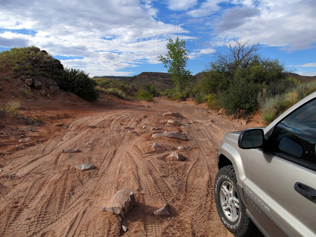
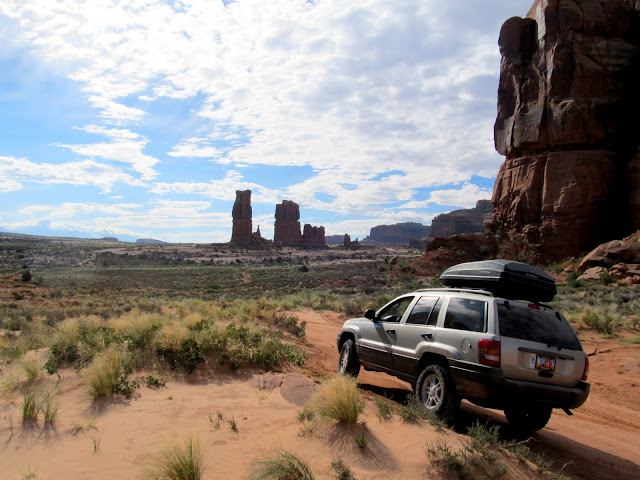
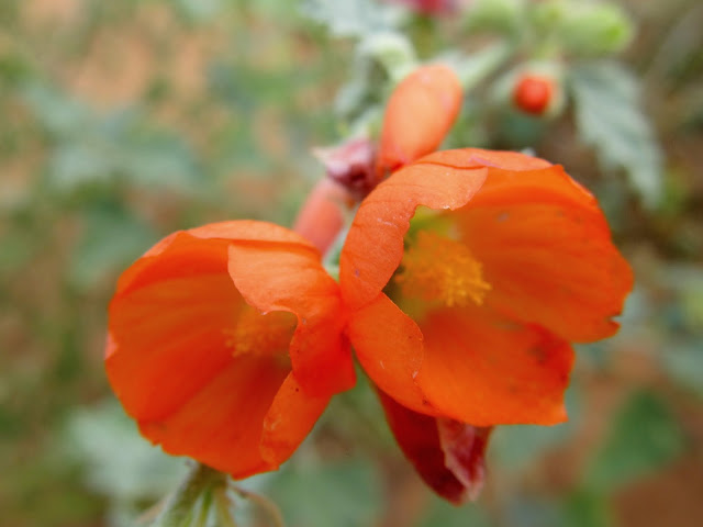
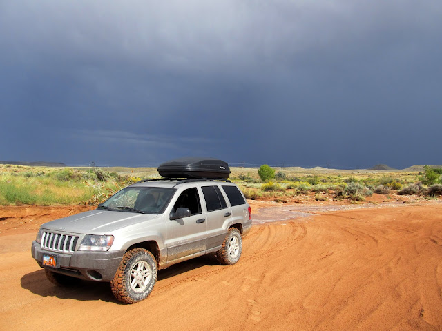
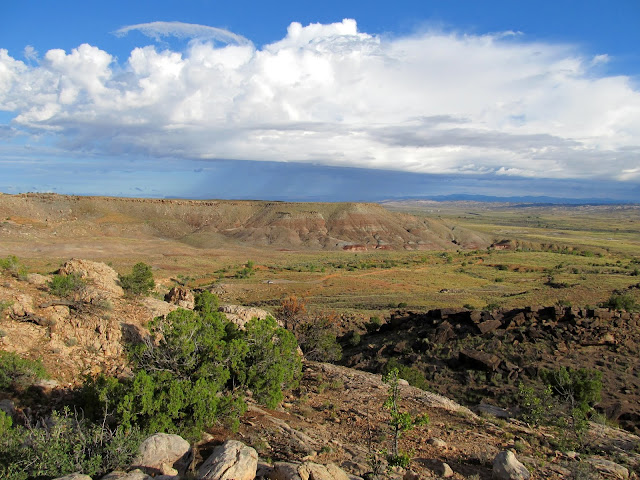
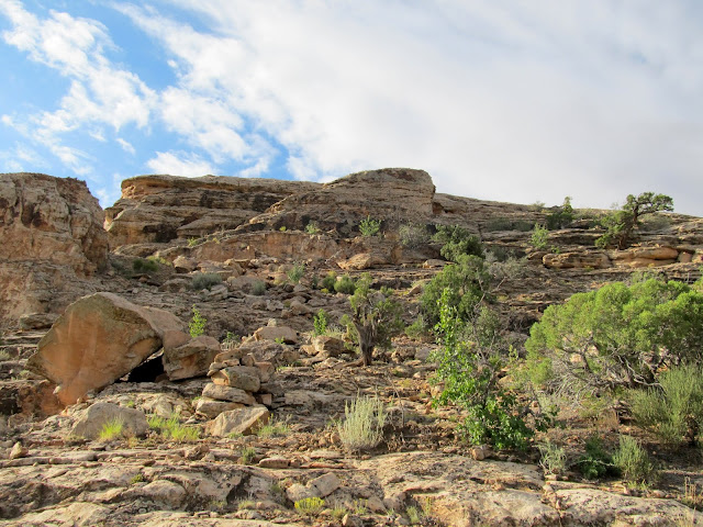
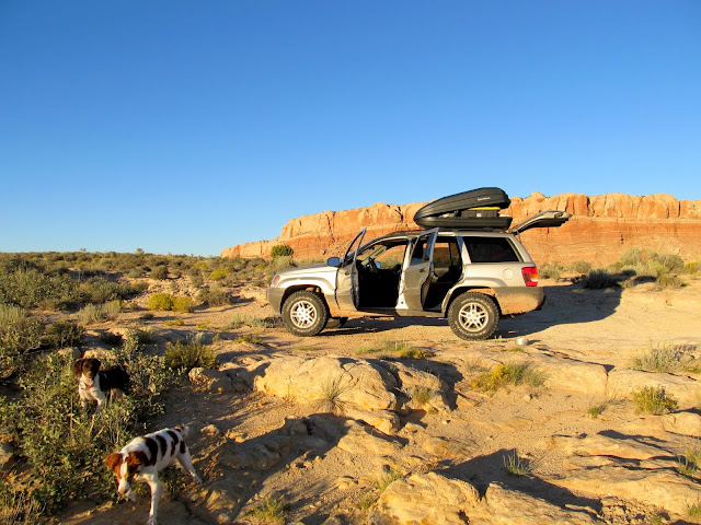
I stayed in town on Saturday to cheer my son on during back-to-back soccer games, but took some time off early the next week so I could spend a few days in southeastern Utah. I left home early Sunday and headed toward the Moab area. I wanted to explore the area around upper Courthouse Wash, beginning with the drive up Tusher Canyon. I'd consulted the BLM's travel maps for the area and chosen the routes I wanted to drive, but I didn't really know whether my Grand Cherokee was suitable for them. Tusher Canyon was moderately difficult. I didn't need 4WD, but it was a tight squeeze in some narrow spots lower in the canyon. I made a short side trip to Determination Towers using 4-Low to climb some steep sandstone with a couple of small ledges, and there I hiked a short distance between the towers to find a geocache. From there I took an easy, sandy road south across Courthouse Pasture, where there were still flowers in bloom, toward Monitor and Merrimac buttes.
Entering Tusher Canyon
After the skinny part of Tusher Canyon
View down the left fork of Tusher Canyon
Nearing Determination Towers
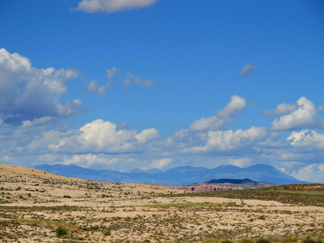
View toward Arches National Park and the La Sal Mountains

Short, steep climb to Determination Towers
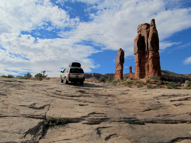
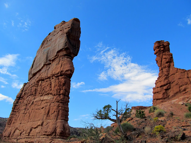
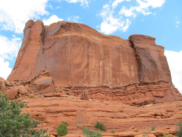
Determination Towers
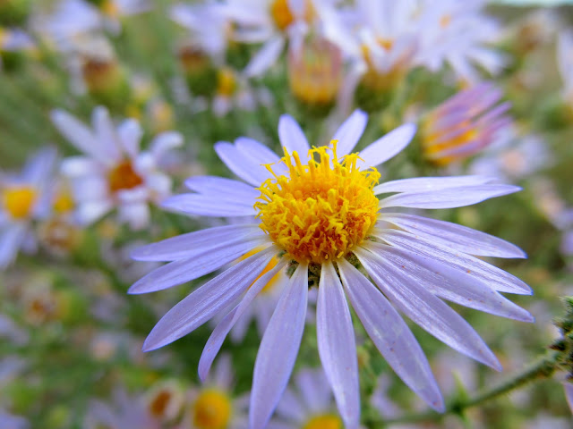
Purple aster
Low shrubs with berries(?)
Globemallow
Signage
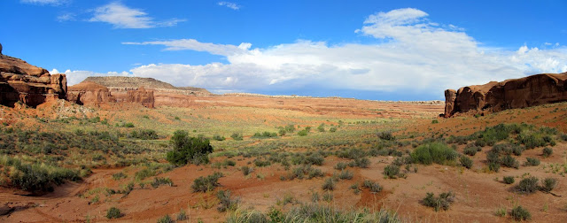
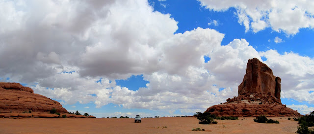
Monitor and Merrimac buttes are prominent landmarks often seen from the south and I'd done so many times from UT-313 and while hiking Sevenmile Canyon. I've long wanted to visit them up close. I hiked again to find a geocache on the north side of Merrimac Butte and then drove and parked between the buttes for a quick lunch stop. Then I drove north over a different road across Courthouse Pasture while some very dark storm clouds moved in from the west.
Parked below Merrimac Butte
Moni-Torrey and Boulder-Mac at a geocache, http://coord.info/GCR202
Merrimac Butte
Parked between the buttes
Monitor Butte
Field of globemallow in Courthouse Pasture
Heading north while the storm follows
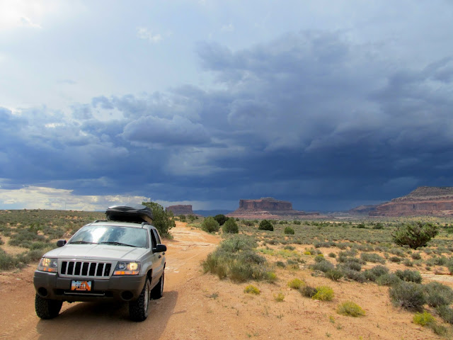
Storm moving in
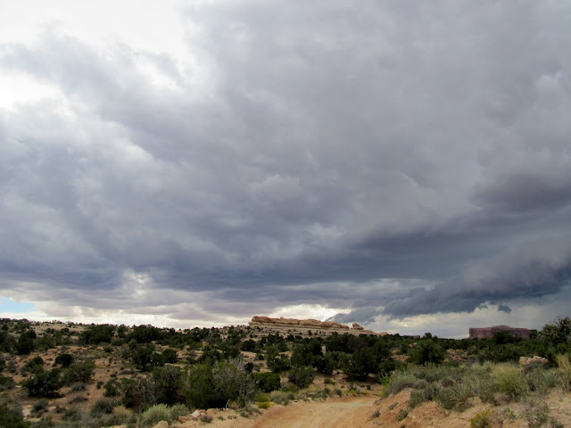
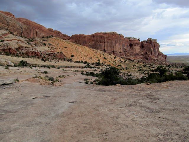
Signage near Courthouse Rock
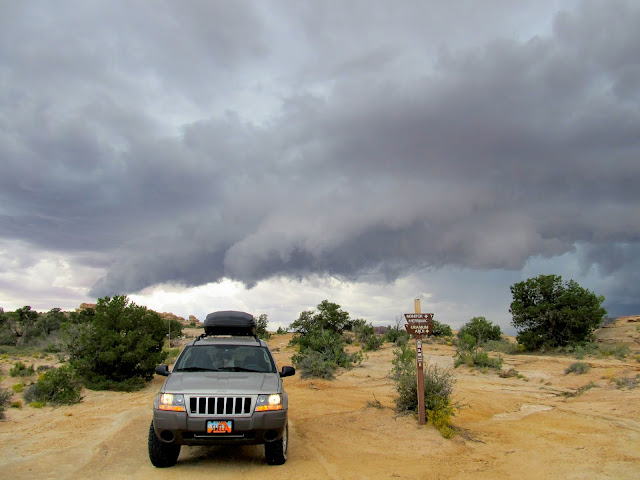
As I descended along the east side of Courthouse Rock the rain hit. It had been sunny just 45 minutes earlier. The trail lost elevation and crossed a lot of bare slickrock, and I shifted into 4-Low just to avoid riding the brakes all the way down. I got back to the main gravel road and planned on finding a spot to park and wait out the storm so I could go for a hike after the rain let up.
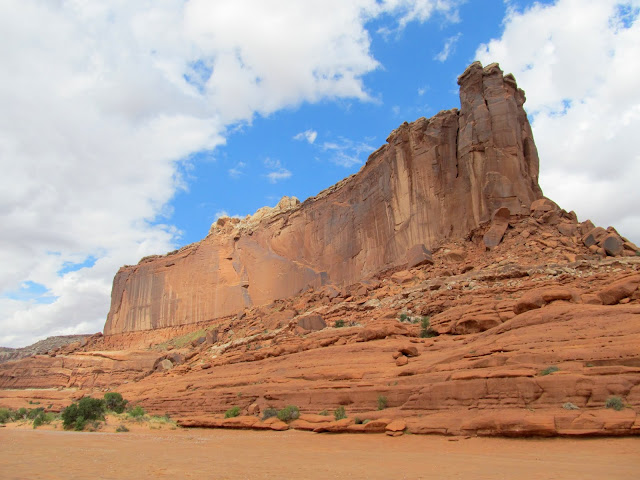
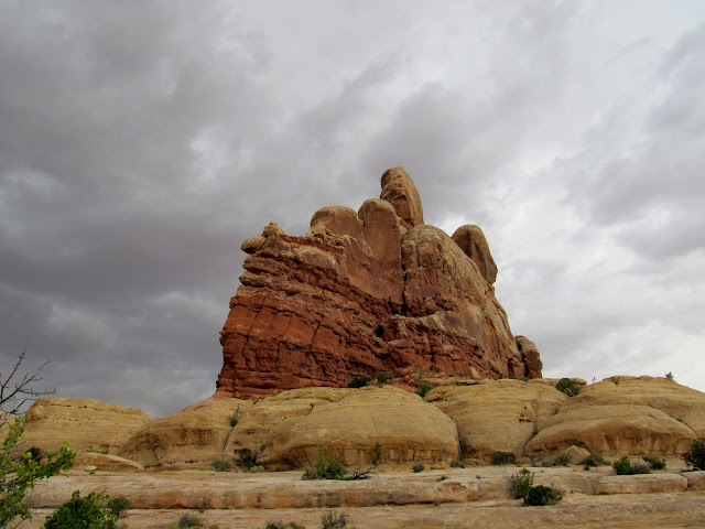
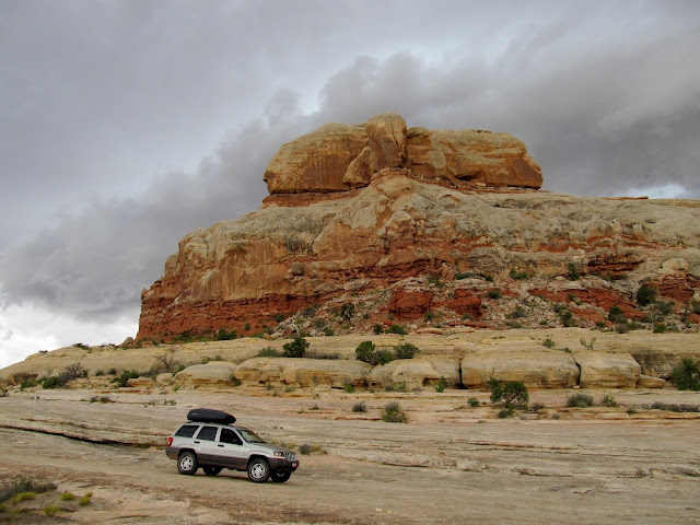
Courthouse Rock
Trail on the east side of Courthouse Rock
Courthouse Rock
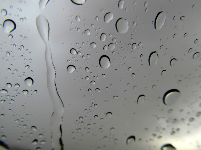
Hard rain
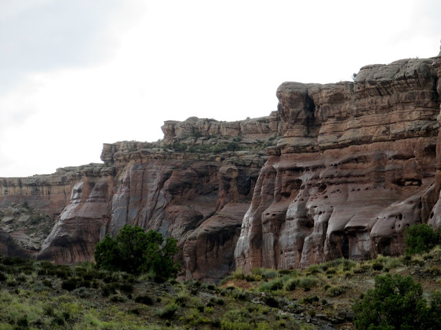
Wet canyon walls in Courthouse Wash
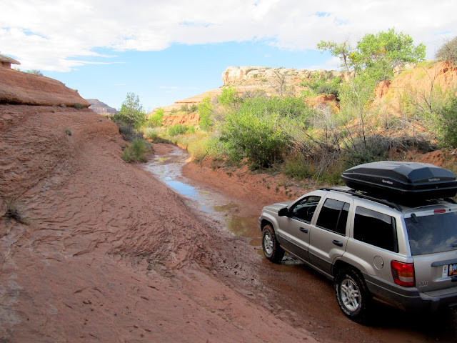
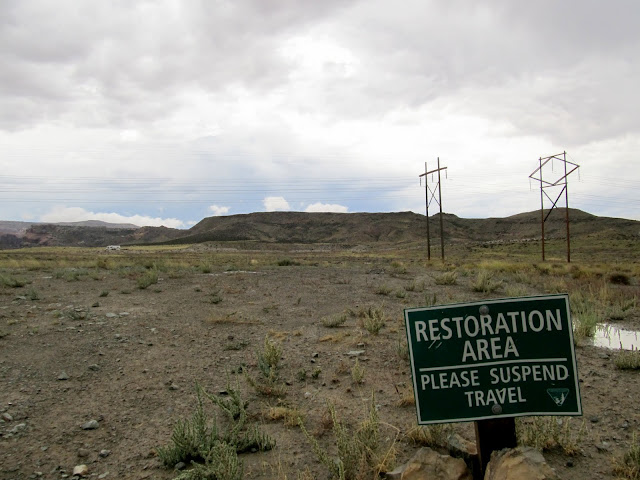
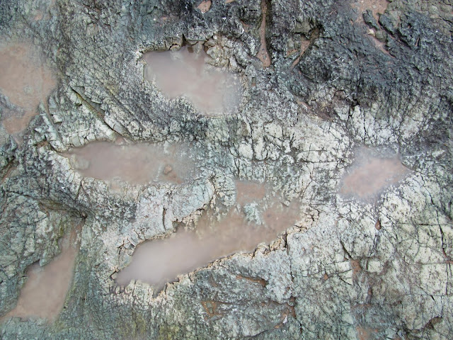
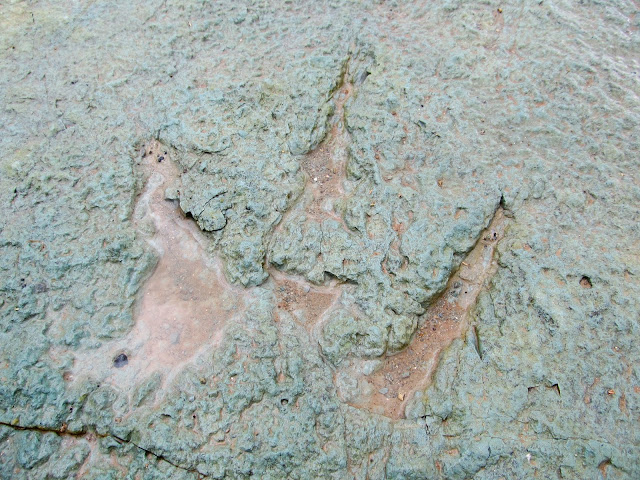
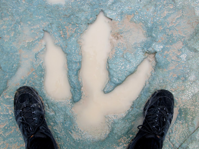
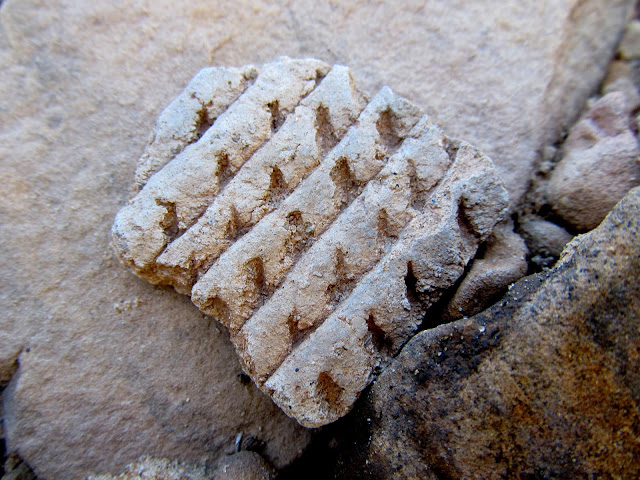
On my way to a parking area that I'd passed earlier in the morning I spotted a familiar scene. In the news recently there have been stories about a "new" dinosaur trackway discovered near Moab, and while they didn't reveal the exact location, the video shows a fenced-off area below some power lines. I saw the fence and power lines, but the sign saying to keep out is what really led me to walk over and take a look. I found the dinosaur tracks there--many filled with water--and a little water flowing through the wash. While I was there a couple in a RZR rode over from a nearby campground. They said they'd heard of a nearby tracksite but didn't know precisely where it was, and they were hoping that was the reason they saw me skulking around the wash in the rain. I was on my way out while they were walking in, so after a little chatting they continued to the dinosaur tracks and I continued to the parking area and waited for the rain to stop.
An invitation to explore behind this sign!
Small drainage north of Mill Canyon
Dinosaur track near Mill Canyon
Dinosaur track near Mill Canyon
Dinosaur track near Mill Canyon with some size 12s for scale
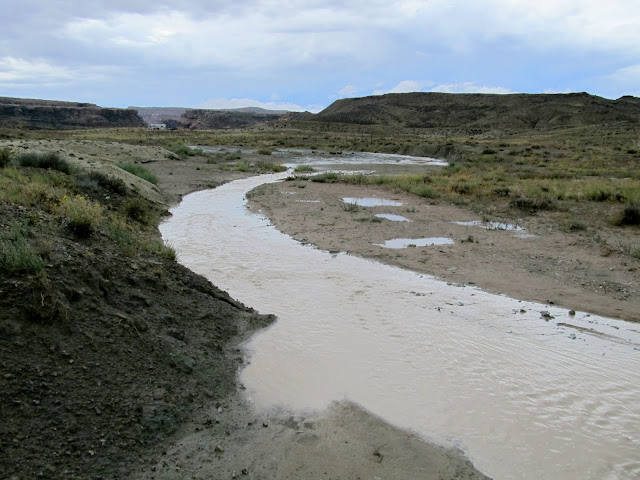
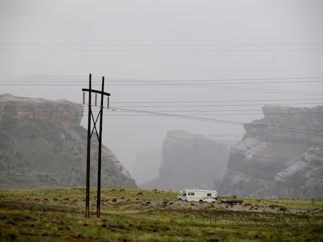
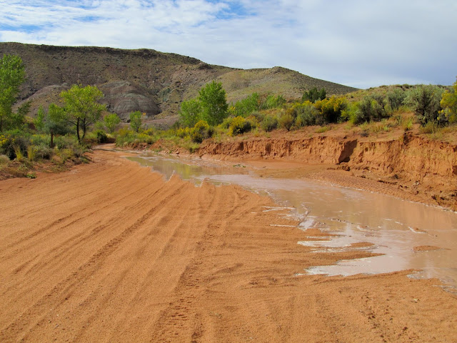
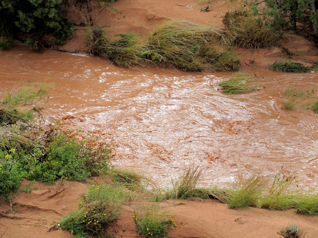
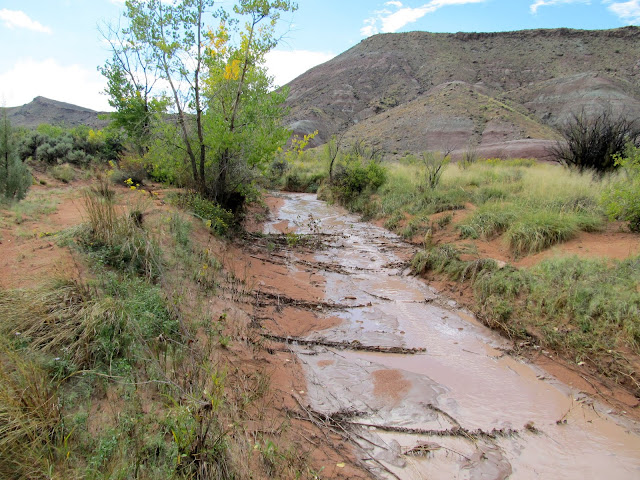
I rested for a while to the sound of rain drops on the Jeep. When the clouds began breaking up I drove a short distance to check out the Halfway Stage Station. The sun reappeared while I was there, so I drove into Mill Canyon to begin a hike. The road goes through the Mill Canyon wash for a short distance before climbing above the wash and dead-ending. I got to the dead end and noticed that the wash below was flowing quite heavily compared to when I had driven through it just minutes earlier. I hurriedly drove back to where the road entered the wash and found still just a trickle. That meant the leading edge of a flash flood was on its way, so I backed up a bit and parked the Jeep on higher ground, then walked to the edge of the wash to catch the flood on video. The leading edge wasn't terribly spectacular, but eventually the flow built up enough that I wasn't sure I would be able to leave the area until the water subsided. My Jeep was trapped on a road section between two wash crossings, so I couldn't drive to where I'd planned to begin the hike and I couldn't leave in the other direction without driving through the water. While mentally debating what to do, I heard an OHV approaching. It was the couple whom I'd met at the dinosaur tracks--they'd been driving around and saw my tire tracks going into the flood water in Mill Canyon, so they drove through the water to check things out. I was grateful that they did so because they confirmed that the water level wasn't too deep for me to drive through. I spent enough time waiting between the flooded wash crossings that I didn't want to risk running out of daylight for the hike, so I decided to drive downstream through the wash and find a place to camp.
Torrey while waiting out the rain
Rain in Mill Canyon
Halfway Stage Station
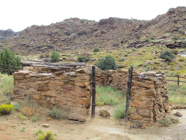
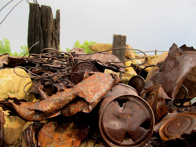
Old metal junk at Halfway Stage Station
Road through Mill Canyon
A trickle of water in Mill Canyon
Mill Canyon
Flash flood in Mill Canyon
Trickle in Mill Canyon
Flash flood in Mill Canyon
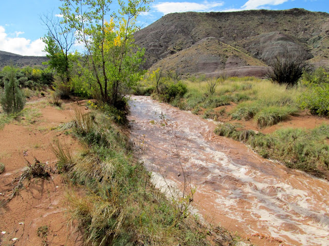
Flash flood in Mill Canyon
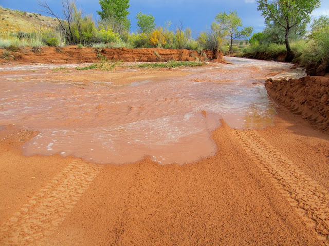
Flash flood over the road through Mill Canyon
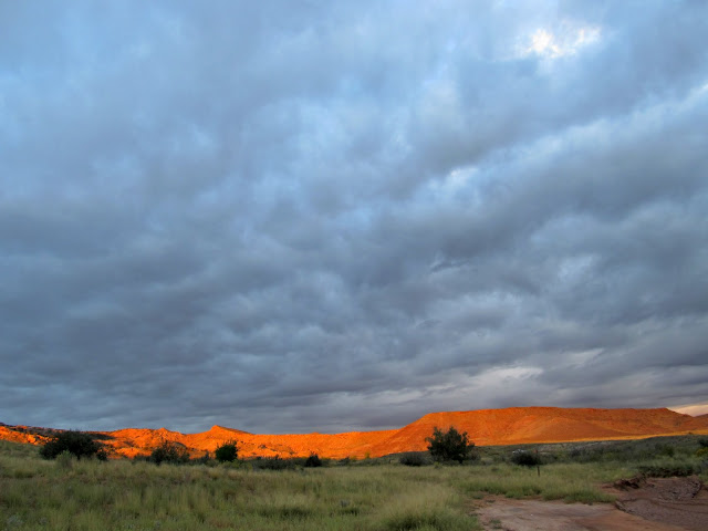
I secured a nice spot along Courthouse Wash, started a fire with some wood that somebody left behind, and fed the dogs and myself some dinner. I read a book alongside the camp fire for a while, then retired to my sleeping quarters in the Jeep and read some more until it was time for bed around 10:30. I was awakened at 4:30 by rain coming through the open window, so I rolled it up and slept well for another couple of hours until my alarm went off at 7:00. Breakfast consisted of oatmeal and coffee. It was very overcast all morning, but while I was heating water for breakfast I was startled by some nice light on the cliffs and hills to the south and west. I hurriedly grabbed my camera for a few photos then went back to breakfast.
Camp along Courthouse Wash
Camp sign at Courthouse Wash
Sunset
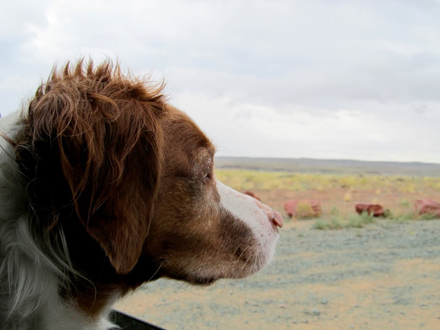
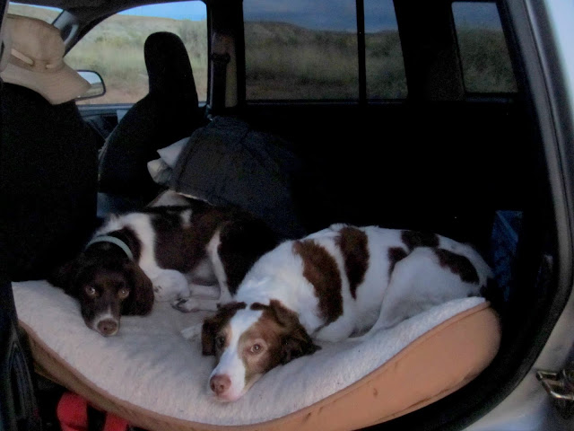
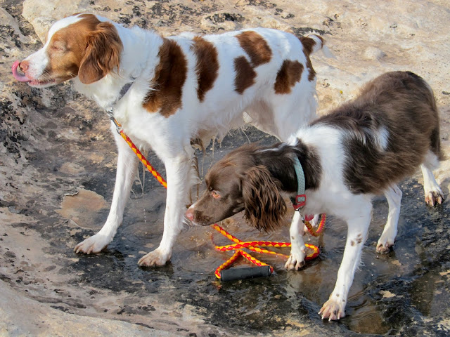
Boulder and Torrey resting in the Jeep
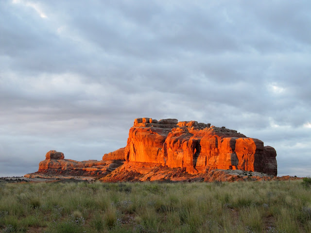
Courthouse Rock at sunrise
Clouds at sunrise
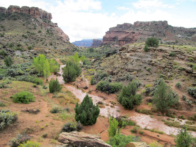
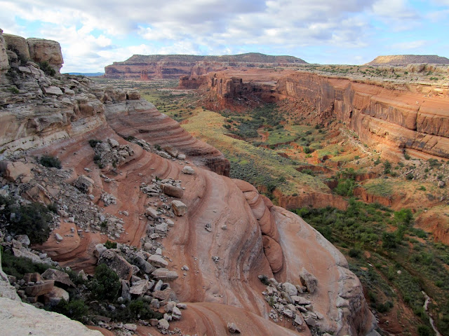
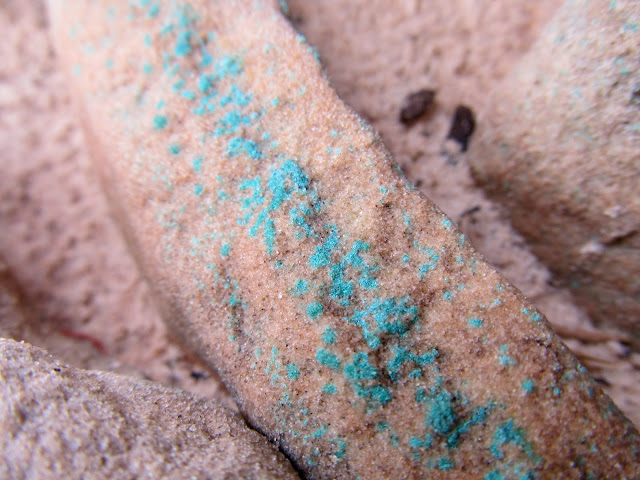
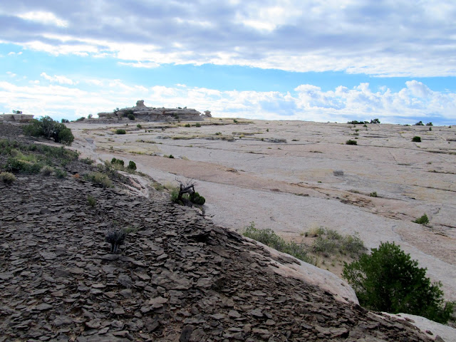
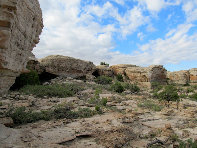
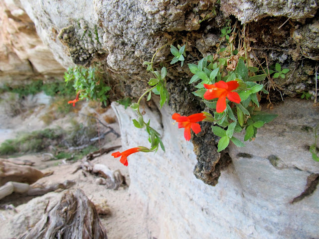
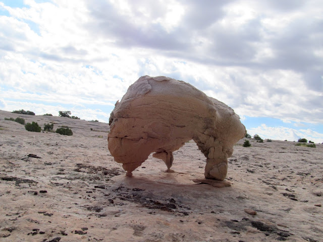
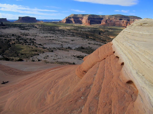
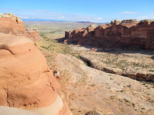
After I packed up camp I drove back to the dead end in Mill Canyon to start the hike I'd missed out on the evening before. I wanted to hike the mesa between Courthouse Wash and Mill Canyon. Routefinding looked difficult from the bottom of the mesa but it turned out to be fairly straightforward. Once on top there were plenty of full potholes for the dogs to drink from. The top of the mesa was rough with large eroded joints in the sandstone, but navigation wasn't too bad. I explored some rock formations with several small caves/alcoves but didn't find much of interest except some hanging gardens with pretty reddish-orange flowers.
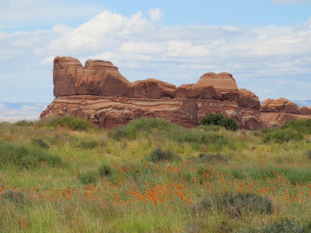
The mesa between Mill Canyon and Courthouse Wash
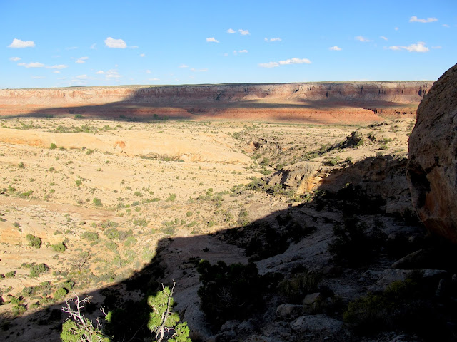
View north from the mesa
Final climb to the top of the mesa
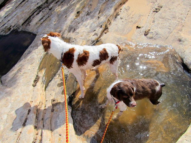
Torrey and Boulder after drinking from a pothole
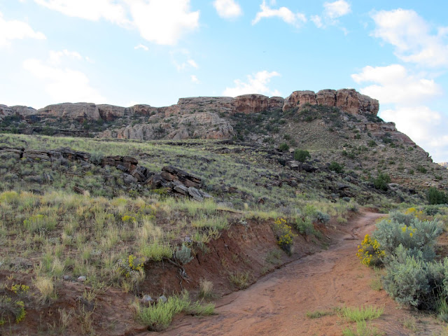
Mill Canyon
Top of the mesa
Copper in the sandstone
Slickrock area on top of the mesa
Interesting area with many small alcoves
Hanging garden
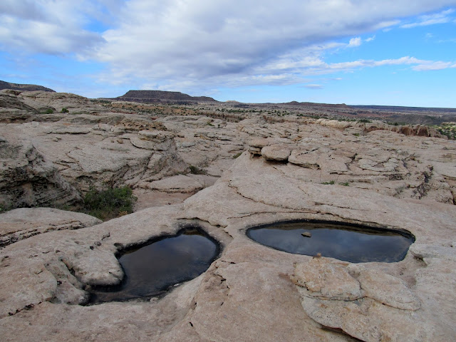
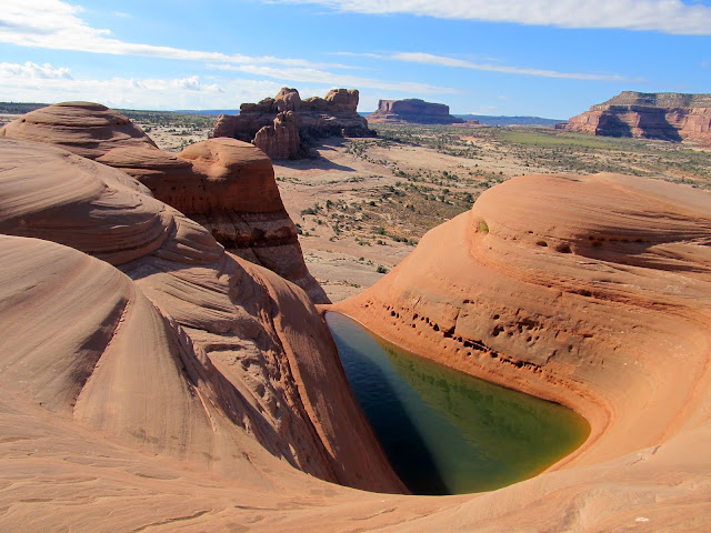
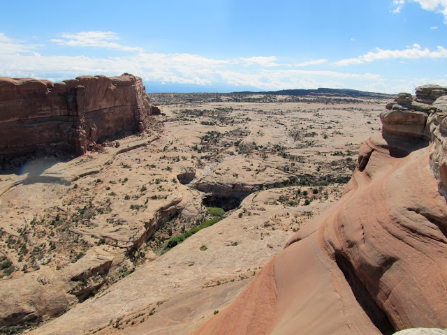
I walked to the south edge of the mesa and found what I was looking for--the "Delta Pool," a roughly-triangular pool of water on the edge of the mesa overlooking some nice country in Courthouse Pasture and beyond. I took a snack/rest break in the shade then returned to the Jeep via a slightly different route than I'd taken up.
Tripod rock
View southwest from the mesa
Delta Pool
Courthouse Wash
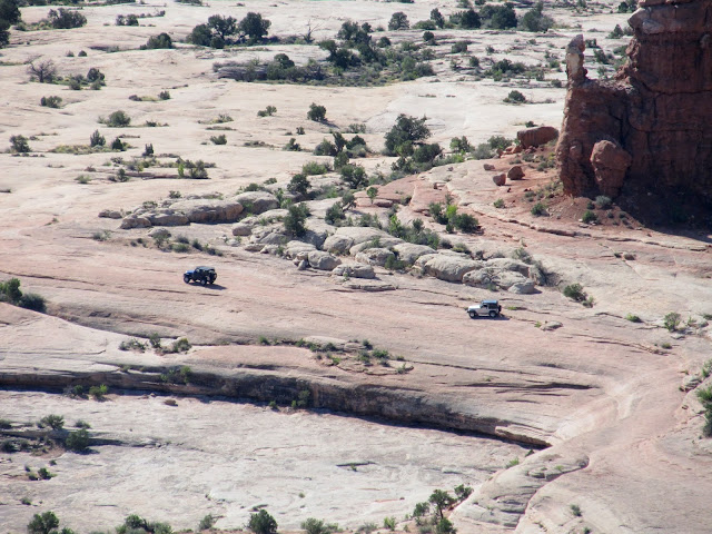
Two Jeeps whose drivers I'd talked to earlier in Mill Canyon
Rock pillar that made a nice shady spot for a snack break
Upper Courthouse Wash
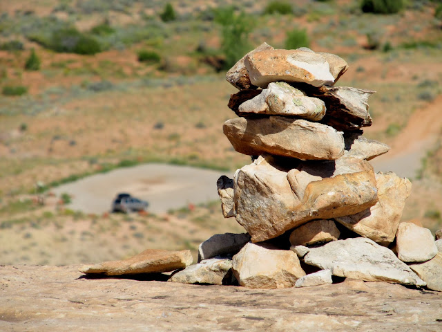
Cairn at the top of the mesa with Jeep in the background
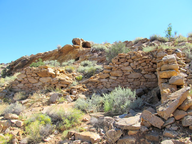
Remains of an old copper mill in Mill Canyon
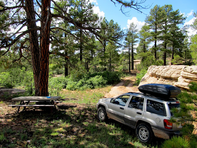
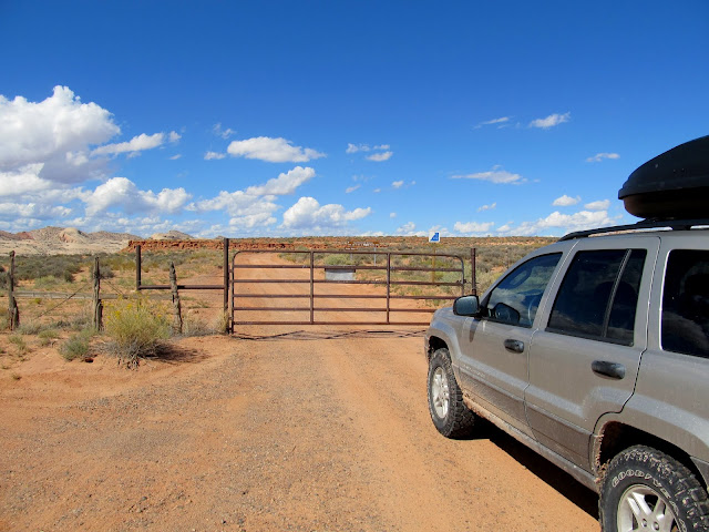
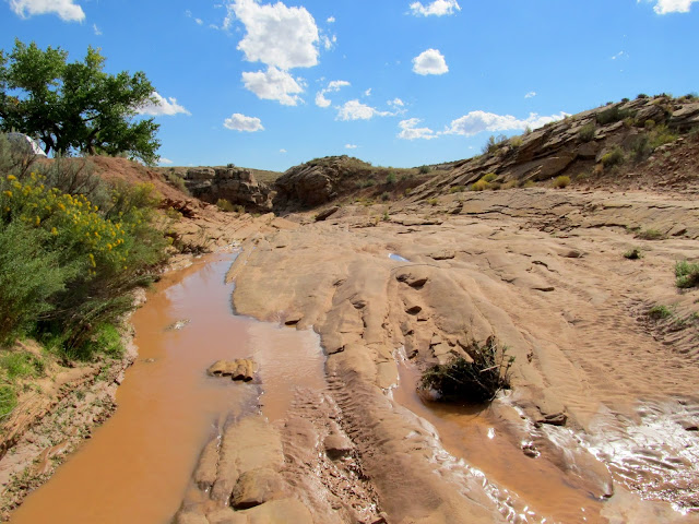
I hadn't planned much beyond what I'd already accomplished. While driving out of the area I decided to take a somewhat long drive to Butler Wash to find some rock art I'd seen photos of online. I had never been south of the Indian Creek turnoff on US-191 and I was fascinated by the country around Monticello, Blanding, and Bluff. During the drive south I discovered a really nice lunch spot at the head of Bullpup Canyon just south of Monticello. When I got to the Butler Wash turnoff and got out of the Jeep to open the gate it was <i>hot</i>. The spot where I wanted to begin my hike was occupied by two vehicles and a few tents. I didn't want to walk through their camp so I tried finding a different way across Butler Wash. The wash was flowing with shin-deep water which made finding a crossing difficult. Eventually I gave up and just walked right past the camp, but the occupants were friendly and waved and I went past with my dogs. The was crossing was easy there and I started heading up Comb Ridge.
Super sweet lunch spot at the head of Bullpup Canyon, south of Monticello
Entering the Butler Wash road
Abajo Mountains
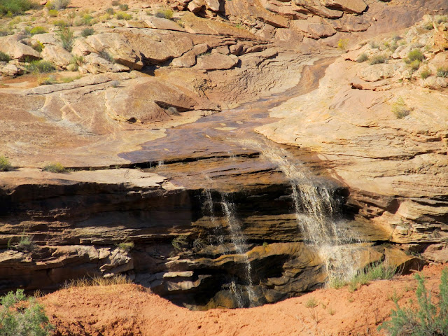
Falls along Butler Wash
Crossing Butler Wash
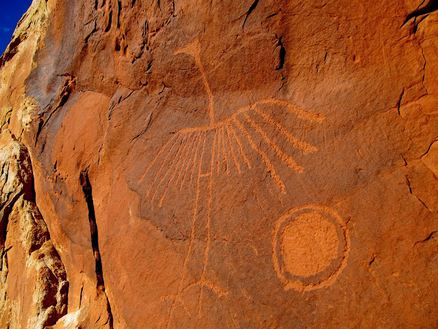
The petroglyphs I was looking for weren't far from where I'd parked. I was disappointed, though, because many of the tool marks appeared to be made by a chisel instead of the usual round-pecking found in genuine petroglyphs. I'm still not sure what to think about that. It was such a short hike that I decided to hike farther up Comb Ridge. I rounded a promontory and then curved around to the north and then back east down a different drainage in Comb Ridge. In that canyon I spotted a new-looking circular petroglyph, probably very modern, and an ancient potsherd in the bottom of the canyon.
Hiking up Comb Ridge
The dogs in a pothole
The Crane
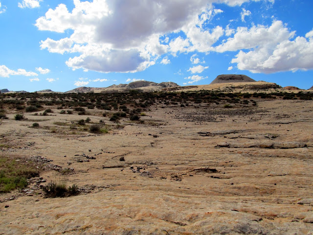
View up Comb Ridge
View down Comb Ridge
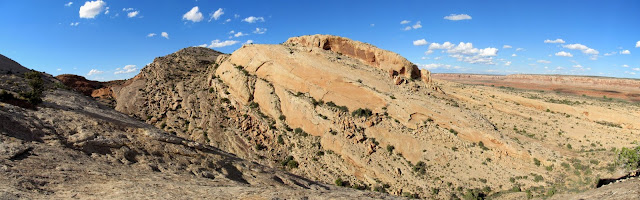
Comb Ridge panorama
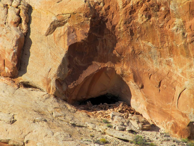
Cave with rocks stacked in the entrance and a soot-stained ceiling
View down my exit canyon
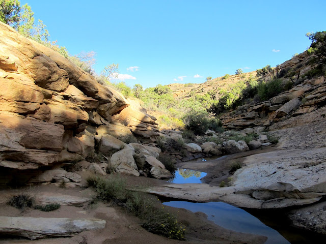
Water in the canyon
Potsherd
After returning to the Jeep and chatting with the occupants of the camp for a few minutes, I drove north along the Butler Wash road looking for a spot to camp. Most of the sites I pulled into were small and surrounded by a lot of stickery weeds. I finally found a spot that was free of stickers, but as soon as the sun sank behind Comb Ridge the mosquitoes came out in force. While the sun was still up I'd left the Jeep wide open to cool it off inside, but afater the sun went down I found that it was uninhabitable, being filled with dozens of mosquitoes. At that point I called it a day and decided to head home. I drove home at 70 MPH with the windows down to keep the mosquitoes at bay, but I still ended up swatting at them for some time while driving. In hindsight I should have just stayed in the Moab area, or at least stopped and camped there on my way back from Butler Wash. Still, it seemed like a long two days and I felt quite fulfilled with what I'd seen and done.
The spot where I almost camped
Abajo Mountains and Tank Mesa after sunset
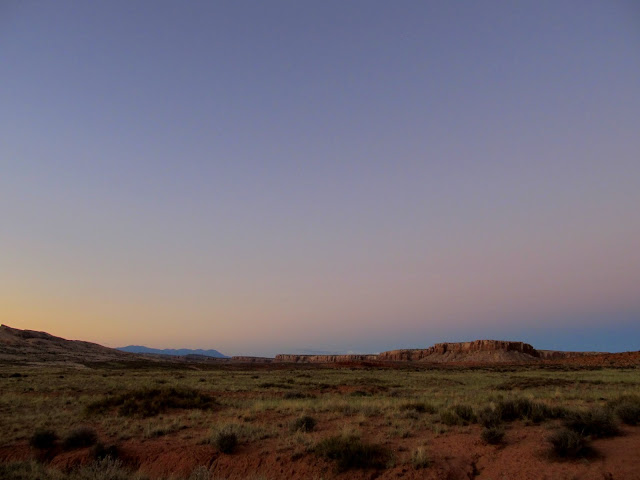
Photo Gallery: Courthouse and the Butler
GPS Tracklog and Photo Waypoints:
[Google Earth KMZ] [Google Maps] [Gmap4 Topo]
Featured image for home page:

Entering Tusher Canyon
After the skinny part of Tusher Canyon
View down the left fork of Tusher Canyon
Nearing Determination Towers
View toward Arches National Park and the La Sal Mountains
Short, steep climb to Determination Towers
Determination Towers
Purple aster
Low shrubs with berries(?)
Globemallow
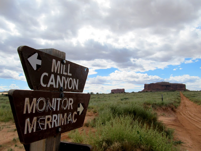
Signage
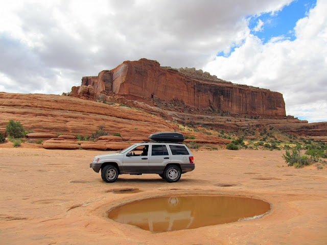
Monitor and Merrimac buttes are prominent landmarks often seen from the south and I'd done so many times from UT-313 and while hiking Sevenmile Canyon. I've long wanted to visit them up close. I hiked again to find a geocache on the north side of Merrimac Butte and then drove and parked between the buttes for a quick lunch stop. Then I drove north over a different road across Courthouse Pasture while some very dark storm clouds moved in from the west.
Parked below Merrimac Butte
Moni-Torrey and Boulder-Mac at a geocache, http://coord.info/GCR202
Merrimac Butte
Parked between the buttes
Monitor Butte
Field of globemallow in Courthouse Pasture
Heading north while the storm follows
Storm moving in
Signage near Courthouse Rock
As I descended along the east side of Courthouse Rock the rain hit. It had been sunny just 45 minutes earlier. The trail lost elevation and crossed a lot of bare slickrock, and I shifted into 4-Low just to avoid riding the brakes all the way down. I got back to the main gravel road and planned on finding a spot to park and wait out the storm so I could go for a hike after the rain let up.
Courthouse Rock
Trail on the east side of Courthouse Rock
Courthouse Rock
Hard rain
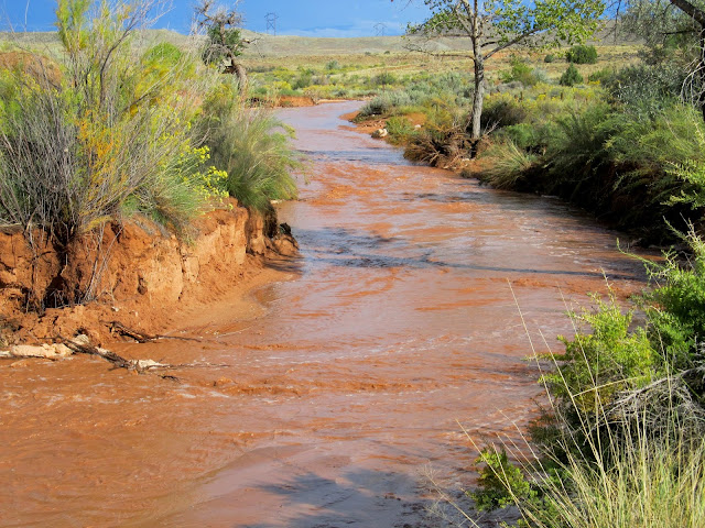
Wet canyon walls in Courthouse Wash
On my way to a parking area that I'd passed earlier in the morning I spotted a familiar scene. In the news recently there have been stories about a "new" dinosaur trackway discovered near Moab, and while they didn't reveal the exact location, the video shows a fenced-off area below some power lines. I saw the fence and power lines, but the sign saying to keep out is what really led me to walk over and take a look. I found the dinosaur tracks there--many filled with water--and a little water flowing through the wash. While I was there a couple in a RZR rode over from a nearby campground. They said they'd heard of a nearby tracksite but didn't know precisely where it was, and they were hoping that was the reason they saw me skulking around the wash in the rain. I was on my way out while they were walking in, so after a little chatting they continued to the dinosaur tracks and I continued to the parking area and waited for the rain to stop.
An invitation to explore behind this sign!
Small drainage north of Mill Canyon
Dinosaur track near Mill Canyon
Dinosaur track near Mill Canyon
Dinosaur track near Mill Canyon with some size 12s for scale
I rested for a while to the sound of rain drops on the Jeep. When the clouds began breaking up I drove a short distance to check out the Halfway Stage Station. The sun reappeared while I was there, so I drove into Mill Canyon to begin a hike. The road goes through the Mill Canyon wash for a short distance before climbing above the wash and dead-ending. I got to the dead end and noticed that the wash below was flowing quite heavily compared to when I had driven through it just minutes earlier. I hurriedly drove back to where the road entered the wash and found still just a trickle. That meant the leading edge of a flash flood was on its way, so I backed up a bit and parked the Jeep on higher ground, then walked to the edge of the wash to catch the flood on video. The leading edge wasn't terribly spectacular, but eventually the flow built up enough that I wasn't sure I would be able to leave the area until the water subsided. My Jeep was trapped on a road section between two wash crossings, so I couldn't drive to where I'd planned to begin the hike and I couldn't leave in the other direction without driving through the water. While mentally debating what to do, I heard an OHV approaching. It was the couple whom I'd met at the dinosaur tracks--they'd been driving around and saw my tire tracks going into the flood water in Mill Canyon, so they drove through the water to check things out. I was grateful that they did so because they confirmed that the water level wasn't too deep for me to drive through. I spent enough time waiting between the flooded wash crossings that I didn't want to risk running out of daylight for the hike, so I decided to drive downstream through the wash and find a place to camp.
Torrey while waiting out the rain
Rain in Mill Canyon
Halfway Stage Station
Old metal junk at Halfway Stage Station
Road through Mill Canyon
A trickle of water in Mill Canyon
Mill Canyon
Flash flood in Mill Canyon
Trickle in Mill Canyon
Flash flood in Mill Canyon
Flash flood in Mill Canyon
Flash flood over the road through Mill Canyon
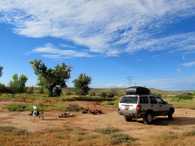
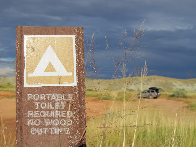
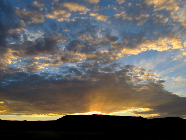
I secured a nice spot along Courthouse Wash, started a fire with some wood that somebody left behind, and fed the dogs and myself some dinner. I read a book alongside the camp fire for a while, then retired to my sleeping quarters in the Jeep and read some more until it was time for bed around 10:30. I was awakened at 4:30 by rain coming through the open window, so I rolled it up and slept well for another couple of hours until my alarm went off at 7:00. Breakfast consisted of oatmeal and coffee. It was very overcast all morning, but while I was heating water for breakfast I was startled by some nice light on the cliffs and hills to the south and west. I hurriedly grabbed my camera for a few photos then went back to breakfast.
Camp along Courthouse Wash
Camp sign at Courthouse Wash
Sunset
Boulder and Torrey resting in the Jeep
Courthouse Rock at sunrise
Clouds at sunrise
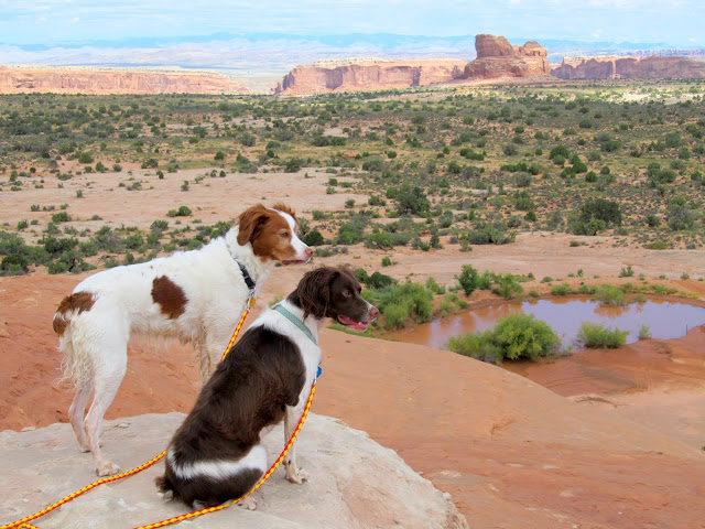
After I packed up camp I drove back to the dead end in Mill Canyon to start the hike I'd missed out on the evening before. I wanted to hike the mesa between Courthouse Wash and Mill Canyon. Routefinding looked difficult from the bottom of the mesa but it turned out to be fairly straightforward. Once on top there were plenty of full potholes for the dogs to drink from. The top of the mesa was rough with large eroded joints in the sandstone, but navigation wasn't too bad. I explored some rock formations with several small caves/alcoves but didn't find much of interest except some hanging gardens with pretty reddish-orange flowers.
The mesa between Mill Canyon and Courthouse Wash
View north from the mesa
Final climb to the top of the mesa
Torrey and Boulder after drinking from a pothole
Mill Canyon
Top of the mesa
Copper in the sandstone
Slickrock area on top of the mesa
Interesting area with many small alcoves
Hanging garden
I walked to the south edge of the mesa and found what I was looking for--the "Delta Pool," a roughly-triangular pool of water on the edge of the mesa overlooking some nice country in Courthouse Pasture and beyond. I took a snack/rest break in the shade then returned to the Jeep via a slightly different route than I'd taken up.
Tripod rock
View southwest from the mesa
Delta Pool
Courthouse Wash
Two Jeeps whose drivers I'd talked to earlier in Mill Canyon
Rock pillar that made a nice shady spot for a snack break
Upper Courthouse Wash
Cairn at the top of the mesa with Jeep in the background
Remains of an old copper mill in Mill Canyon
I hadn't planned much beyond what I'd already accomplished. While driving out of the area I decided to take a somewhat long drive to Butler Wash to find some rock art I'd seen photos of online. I had never been south of the Indian Creek turnoff on US-191 and I was fascinated by the country around Monticello, Blanding, and Bluff. During the drive south I discovered a really nice lunch spot at the head of Bullpup Canyon just south of Monticello. When I got to the Butler Wash turnoff and got out of the Jeep to open the gate it was <i>hot</i>. The spot where I wanted to begin my hike was occupied by two vehicles and a few tents. I didn't want to walk through their camp so I tried finding a different way across Butler Wash. The wash was flowing with shin-deep water which made finding a crossing difficult. Eventually I gave up and just walked right past the camp, but the occupants were friendly and waved and I went past with my dogs. The was crossing was easy there and I started heading up Comb Ridge.
Super sweet lunch spot at the head of Bullpup Canyon, south of Monticello
Entering the Butler Wash road
Abajo Mountains
Falls along Butler Wash
Crossing Butler Wash
The petroglyphs I was looking for weren't far from where I'd parked. I was disappointed, though, because many of the tool marks appeared to be made by a chisel instead of the usual round-pecking found in genuine petroglyphs. I'm still not sure what to think about that. It was such a short hike that I decided to hike farther up Comb Ridge. I rounded a promontory and then curved around to the north and then back east down a different drainage in Comb Ridge. In that canyon I spotted a new-looking circular petroglyph, probably very modern, and an ancient potsherd in the bottom of the canyon.
Hiking up Comb Ridge
The dogs in a pothole
The Crane
View up Comb Ridge
View down Comb Ridge
Comb Ridge panorama
Cave with rocks stacked in the entrance and a soot-stained ceiling
View down my exit canyon
Water in the canyon
Potsherd
After returning to the Jeep and chatting with the occupants of the camp for a few minutes, I drove north along the Butler Wash road looking for a spot to camp. Most of the sites I pulled into were small and surrounded by a lot of stickery weeds. I finally found a spot that was free of stickers, but as soon as the sun sank behind Comb Ridge the mosquitoes came out in force. While the sun was still up I'd left the Jeep wide open to cool it off inside, but afater the sun went down I found that it was uninhabitable, being filled with dozens of mosquitoes. At that point I called it a day and decided to head home. I drove home at 70 MPH with the windows down to keep the mosquitoes at bay, but I still ended up swatting at them for some time while driving. In hindsight I should have just stayed in the Moab area, or at least stopped and camped there on my way back from Butler Wash. Still, it seemed like a long two days and I felt quite fulfilled with what I'd seen and done.
The spot where I almost camped
Abajo Mountains and Tank Mesa after sunset
Photo Gallery: Courthouse and the Butler
GPS Tracklog and Photo Waypoints:
[Google Earth KMZ] [Google Maps] [Gmap4 Topo]
Featured image for home page: