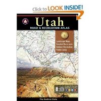
Benchmark Atlas

DesertXJ

Member
Joined
Jan 5, 2015
Messages
11
image.jpg

I recently read a trip report and at the he gave some of literature he used, one of them was a Benchmark Atlas. I searched it out and read reviews about them which I would say were 95% positive. My question is what do the Back Country guru think of them? My use would be 70% off-road use and 30% hiking etc. do they really give a good view of off beaten trails etc as the reviews claim.
 
I used to use them when I started four-wheeling years ago. Can't say I've touched one in a long time...there are much better options for backcountry travel.
 
For certain areas in Utah and Colorado I like the Latitude 40 maps. Plus I have a bunch of Trails Illustrated maps that are usually pretty good. USGS Topo maps are always a good choice, too.
 
I love the Trails Illustrated maps for overviews of an area. For more detailed maps, I mostly just use GPS Gaia with cached maps on my iPhone for hiking or iPad for car/boat camping. I used to print out my own topos for each trip, but it became less convenient to do and GPS Gaia has been great.
 
I have some Trail illustrated maps and I also use Gaia which is great, I looked at the Lat 40 maps they have a lot for Colo but only listed Moab trails for Utah. I'm a Garmin user and I use a Oregon 450 handheld with topo maps installed, and Nuvi 465 with topo in my Jeep.
 
My 450 stopped working reliably this year. Seems like the antenna was going out. I'm just fine with that though. I much prefer using my iPhone.
 
What's nice about Gaia is that I can track my trip with my Oregon and then upload the tracking info to Gaia with my waypoints and it will show up on my iPhone or iPad

@Nick i just got my iPhone 6+ (thanks to wifey letting me use her upgrade) I'm dying to try out Gaia on it.
 
I have always liked them! (the benchmark atlas) While I don't think they are "all inclusive" in the back roads department, (the kind of roads that have grass growing between the tire tracks) they do provide a nice all in one reference to whats out there! .... I carry one for Utah, Montana in the truck,... They have been helpful for subterfuge routes ... a topo can give you a quick go/no go idea.... they are not that expensive....

A couple years ago we used one to find a back road, (any back road) having just traveled to a general area in southern Utah, on a totally off the cuff trip. woke up to an Awesome vista!
 

Similar threads

Back
Top