Smokey
Member
- Joined
- Jan 17, 2012
- Messages
- 5
On May 26th I decided on a whim to knock a mountain that pesters all Loganites. Mt Beirdneau isn't even in the top three highest peaks in the area, but its symmetrical shape is mesmerizing. It's hard for me to say exactly how far the distance is because my internal odometer kind of failed me on this trip. What I mean is that I can usually count on clocking two miles per hour as I hump my way up a hill and might make two and a half if I'm skipping down a ridge line. This hike slowed below those typical speeds due to chaffing, lack of sleep, a blister, and overall exhaustion. So I hiked for nine and a half hours, taking one hour in breaks. That would usually be equal to a seventeen mile trip. I don't think it was that far, but who's counting anyway?
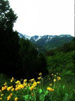
This was a strenuous hike! I like that about it. It is also appreciable that you can't drive to the top like nearby Mt Logan. I started at the wind caves trail head and a mile or so up too the right fork at a clearly marked wind caves trail marker. From there you work your way far left and then far right in gigantic switch backs up steep fields full of yellow arrowleaf bolsomroot littered with 30 to 60 foot cliffs. There is a nice chill out spot at the saddle where the the trail "ridges out" surrounded by aspens and pines.
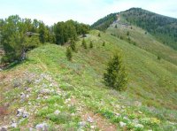
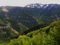
Hiking up the ridge is a pleasant relief from the steep climb up. There is a pretty distinct trail the whole way which conveniently bypasses past quite a few sucker peaks along the ridge line. The brush wash quite thick in spots and my legs got a good exfoliation hiking through in shorts. The final push up to the summit was the only place where I encounter navigational issues. The trail goes straight across the south west bowl of the peak and then disappears on the south ridge. I found that the main west ridge is the better route.
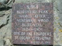
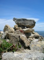
At the peak there was a cairn covered in lady bugs, and slightly below that was a plaque. A little further down the north ridge and you could look down into the east bowl of Mt fuquitcha. This is the avalanche prone face above wood camp hollow. From here you can also see where green canyon "saddles out" and get a glimpse over towards Mt Elmer and Mt Jardine. Finally, looking back down the west ridge that "bottoms out" way down in the foothills of Logan. You can notice an enormous "false peak" along this ridge. Luckily, that is right where the wind caves trail head route "ridges out".
I followed the same route back down to the trail head. I was exhausted and soar and crept past about a dozen different groups of hikers going up to the wind caves looking like a crippled fool. But I made it, and boy was it worth it! I would highly recommend this hike to anyone looking for a pre- season peak hike. With the snow along the shady side of the upper peak to provide water, I would consider making this a comfortable backpack.
View Larger Map
Featured image for home page:

This was a strenuous hike! I like that about it. It is also appreciable that you can't drive to the top like nearby Mt Logan. I started at the wind caves trail head and a mile or so up too the right fork at a clearly marked wind caves trail marker. From there you work your way far left and then far right in gigantic switch backs up steep fields full of yellow arrowleaf bolsomroot littered with 30 to 60 foot cliffs. There is a nice chill out spot at the saddle where the the trail "ridges out" surrounded by aspens and pines.

Hiking up the ridge is a pleasant relief from the steep climb up. There is a pretty distinct trail the whole way which conveniently bypasses past quite a few sucker peaks along the ridge line. The brush wash quite thick in spots and my legs got a good exfoliation hiking through in shorts. The final push up to the summit was the only place where I encounter navigational issues. The trail goes straight across the south west bowl of the peak and then disappears on the south ridge. I found that the main west ridge is the better route.

At the peak there was a cairn covered in lady bugs, and slightly below that was a plaque. A little further down the north ridge and you could look down into the east bowl of Mt fuquitcha. This is the avalanche prone face above wood camp hollow. From here you can also see where green canyon "saddles out" and get a glimpse over towards Mt Elmer and Mt Jardine. Finally, looking back down the west ridge that "bottoms out" way down in the foothills of Logan. You can notice an enormous "false peak" along this ridge. Luckily, that is right where the wind caves trail head route "ridges out".

I followed the same route back down to the trail head. I was exhausted and soar and crept past about a dozen different groups of hikers going up to the wind caves looking like a crippled fool. But I made it, and boy was it worth it! I would highly recommend this hike to anyone looking for a pre- season peak hike. With the snow along the shady side of the upper peak to provide water, I would consider making this a comfortable backpack.

View Larger Map
Featured image for home page:


