klank
one step at a time
- Joined
- Jul 29, 2013
- Messages
- 77
This past weekend I made my first adventure into the Eastern Sierras. For my solo trip this year I chose Sabrina Basin in the John Muir Wilderness. SR 168 runs west on a beautiful paved road out of Bishop, CA. En route to TH there are about 5 campgrounds one could crash if need to acclimate or arriving late. Most if not all are FCFS. Overnight parking is located .5 miles from TH. Permits can be obtained through White Mountain Ranger station. Best to start before 10 am or wait till 4pm as trail is very exposed; once past Blue Lake there are areas that offer no wind.
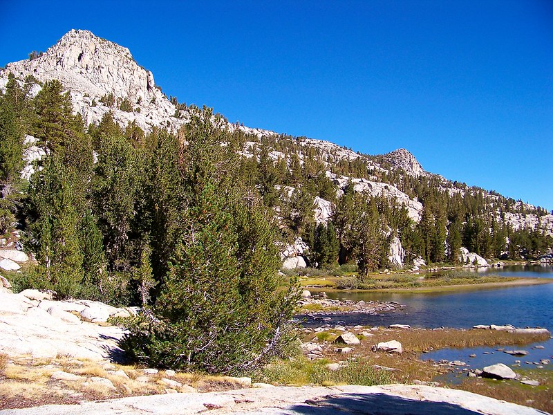
Starting off around 9 am trail begins climbing immediately as rounds the southeast side of Lake Sabrina. Trail is well kept all throughout basin with gorgeous cut steps. Work begins once enter designated wilderness.
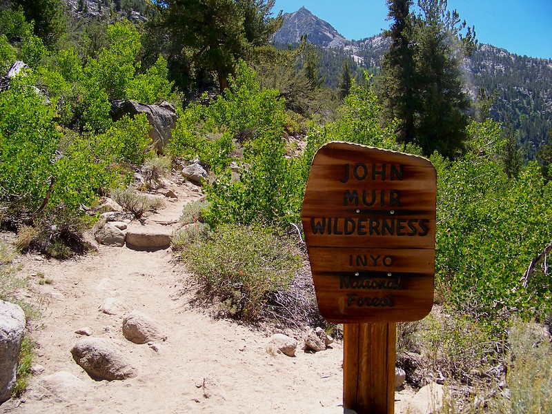
John Muir Wilderness Boundry by clifton dobbie, on Flickr
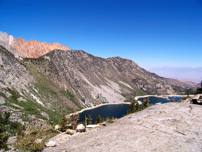
Lake Sabrina by clifton dobbie, on Flickr
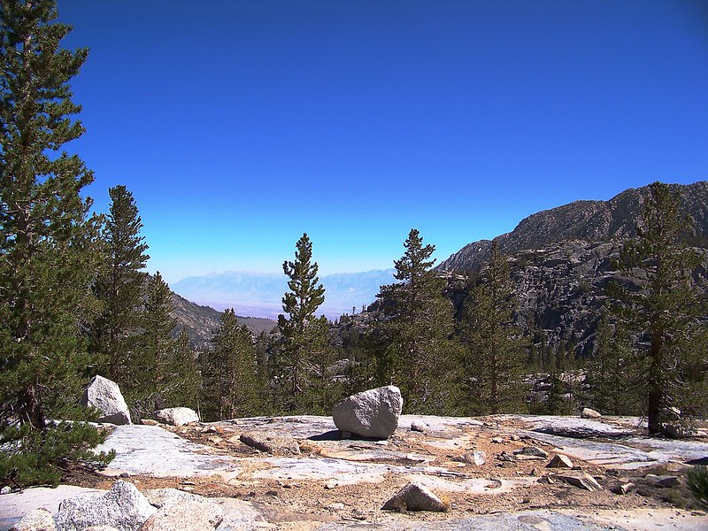
onward and upward by clifton dobbie, on Flickr
Blue Lake has many spots for camping. One near outlet with most being found on the backside. I found the outlet a good spot to fill up water and rehydrate.
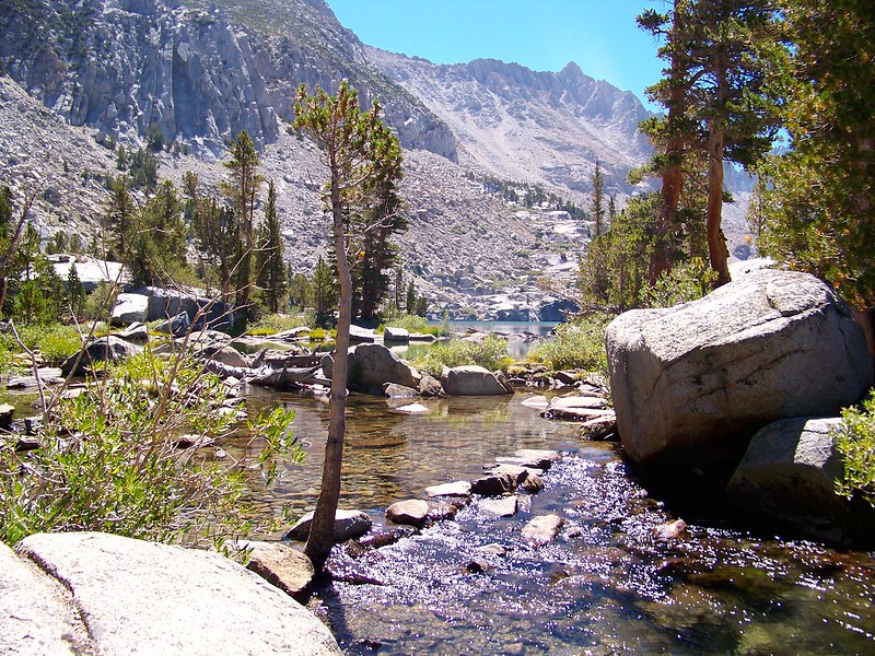
outlet of Blue Lake by clifton dobbie, on Flickr
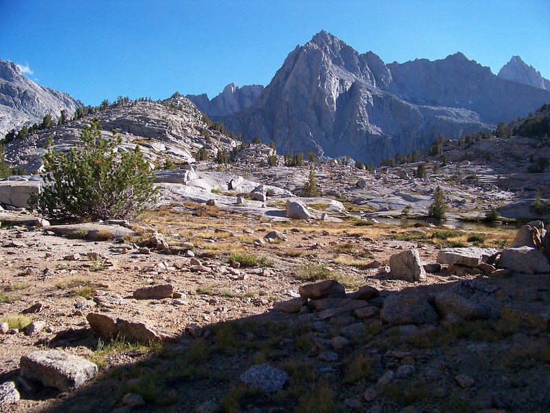
Rounding Blue Lake gives opportunity to catch breath before climb to Dingleberry Lake. Trip was my first time hiking/camping above 10K ft; needless to say the going was slow. Dingleberry offers many spots for camping; I found a few prime spots near the backend where trail splits for hikers and stock. As for stock.. Sabrina Basin is heavily used with stock. When.. if.. lose trail just follow your nose. More on them later.
inlet Dingleberry Lake by clifton dobbie, on Flickr
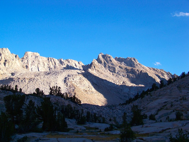
Departing the Dingleberry work continues as head to Sailor. The climb to Sailor took everything out of me. At one point above Topsy Turvey Lake a thought crept in that it was Sailor. Break was in need to ponder; I decided to continuing moving knowing that if it was I would be camping at Hungry Packer. Shortly after break I ran into the stock train causing mess along trail. Doing right I quickly sat down allowing em to pass; 5 horses guiding a set of 4 porter donkeys. Cowboys had been out for 14 days.
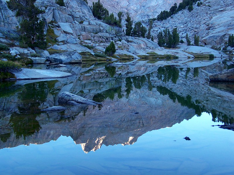
Sailor Lake is best fit as a base camp more so then a destination lake. I met 4 fella's taking a break so I took the opportunity to ask if what looked as a small chain of lakes to be Sailor; they confirmed. They pointed me in direction off use trail to where some artists had camped the prior night. Heading in that direction I was not pleased with location and shot of Clyde Spires & Mt. Wallace. As headed south closer to lake found a couple ok spots but never 110% in love with. Mark, my buddy who normally is partner in crime, spoke to me. I dropped pack and continued to look around. Finally, found a beautiful flat spot with one stool and few recliners. Directly behind was a gigantic boulder that blocked wind and allowed a "kitchenette" setup on the backside with a perfect view of Mt. Wallace.
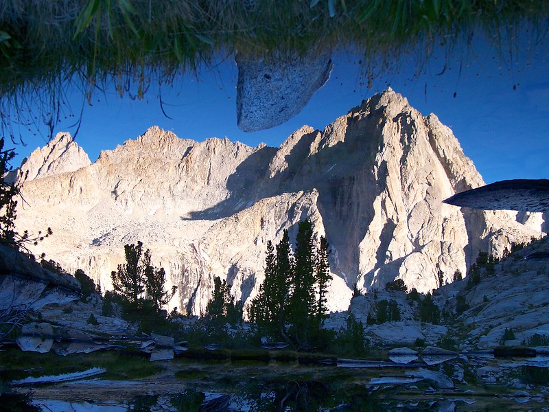
Mount Wallace by clifton dobbie, on Flickr
Clyde Spires by clifton dobbie, on Flickr
reflections with Clyde by clifton dobbie, on Flickr
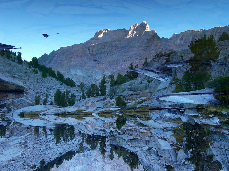
Clyde Spires reflection by clifton dobbie, on Flickr
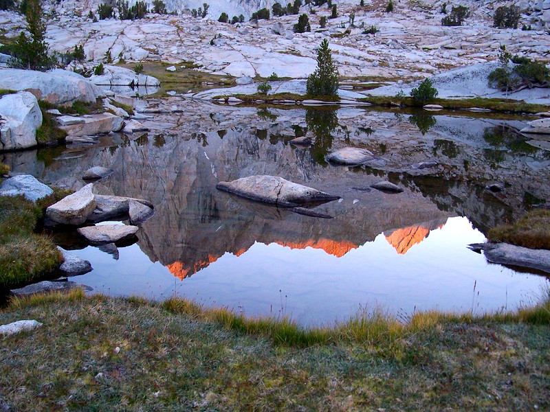
coffee with Mount Wallace by clifton dobbie, on Flickr
Mount Wallace by clifton dobbie, on Flickr
Exploring of basin will happen next year with Mark. This trip was more of a reconnaissance mission.
Starting elevation: 9,000 ft
Highest Elevation: 11,045 ft
Mileage: 11.8
Featured image for home page:

Starting off around 9 am trail begins climbing immediately as rounds the southeast side of Lake Sabrina. Trail is well kept all throughout basin with gorgeous cut steps. Work begins once enter designated wilderness.
John Muir Wilderness Boundry by clifton dobbie, on Flickr
Lake Sabrina by clifton dobbie, on Flickr
onward and upward by clifton dobbie, on Flickr
Blue Lake has many spots for camping. One near outlet with most being found on the backside. I found the outlet a good spot to fill up water and rehydrate.
outlet of Blue Lake by clifton dobbie, on Flickr
Rounding Blue Lake gives opportunity to catch breath before climb to Dingleberry Lake. Trip was my first time hiking/camping above 10K ft; needless to say the going was slow. Dingleberry offers many spots for camping; I found a few prime spots near the backend where trail splits for hikers and stock. As for stock.. Sabrina Basin is heavily used with stock. When.. if.. lose trail just follow your nose. More on them later.
inlet Dingleberry Lake by clifton dobbie, on Flickr
Departing the Dingleberry work continues as head to Sailor. The climb to Sailor took everything out of me. At one point above Topsy Turvey Lake a thought crept in that it was Sailor. Break was in need to ponder; I decided to continuing moving knowing that if it was I would be camping at Hungry Packer. Shortly after break I ran into the stock train causing mess along trail. Doing right I quickly sat down allowing em to pass; 5 horses guiding a set of 4 porter donkeys. Cowboys had been out for 14 days.
Sailor Lake is best fit as a base camp more so then a destination lake. I met 4 fella's taking a break so I took the opportunity to ask if what looked as a small chain of lakes to be Sailor; they confirmed. They pointed me in direction off use trail to where some artists had camped the prior night. Heading in that direction I was not pleased with location and shot of Clyde Spires & Mt. Wallace. As headed south closer to lake found a couple ok spots but never 110% in love with. Mark, my buddy who normally is partner in crime, spoke to me. I dropped pack and continued to look around. Finally, found a beautiful flat spot with one stool and few recliners. Directly behind was a gigantic boulder that blocked wind and allowed a "kitchenette" setup on the backside with a perfect view of Mt. Wallace.
Mount Wallace by clifton dobbie, on Flickr
Clyde Spires by clifton dobbie, on Flickr
reflections with Clyde by clifton dobbie, on Flickr
Clyde Spires reflection by clifton dobbie, on Flickr
coffee with Mount Wallace by clifton dobbie, on Flickr
Mount Wallace by clifton dobbie, on Flickr
Exploring of basin will happen next year with Mark. This trip was more of a reconnaissance mission.
Starting elevation: 9,000 ft
Highest Elevation: 11,045 ft
Mileage: 11.8
Featured image for home page:
Last edited:
")