Weird Map Stuff

Rabbit Valley....check out the Castle Rock and Knowles Overlook campsites. I've never seen anyone else at either of them. Take the Rabbit Valley exit and follow the McDonald Creek Road back towards Utah a few miles.

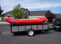
Thanks, Randy. How are the roads out there? I see their website recommends no campers/travel trailers, but would my truck with a raft trailer like this probably do ok?
upload_2016-7-13_23-49-49.png
 
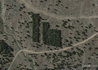
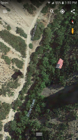
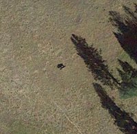
It's probably on a cable spanning the canyon. There's one like that over a canyon in Sandy.
Must not always be out. I've hiked that canyon a few times now and have never noticed anything like that hanging above. I'll have to keep an eye up when I do it again.

Sent from my SM-G920P using Tapatalk
 
Maybe they put it up and it came down soon after. To be honest, I don't think it's appropriate. I love this country as much as the next guy, but I don't want flags flapping around 100 feet in the air when I'm enjoying the outdoors.
 
I have wondered what these lines were for awhile now. They crisscross Cedar Mesa in various spots.


I00009lYE.FxcvlU.jpg
 
  • Like
Reactions: Jmr
The long road like features almost mirror utility lines and the roads that are created by them, the way they do no deviate much at all when jumping over steep inclines up to higher levels or going through draws. The series of six cross slashes are probe areas? I don't know but intriguing.
 
I didn't even notice the crisscross lines on the road....
 
Similar threads
Thread starter Title Forum Replies Date
DiscGo Weird Twangy Sound During Descent General Discussion 4
fossana Favorite map resources General Discussion 17
W Paper map for Teton Wilderness (Younts Peak) Gear 4
Bob Smoke Map ........ 2023 Trip Planning 24
J Needles Dist 2022 BC Zone Map Resource Discussions 1
kansas Good map of Grand Canyon-Parashant National Monument? Trip Planning 5
Bob Drought map General Discussion 6
fossana Anyone know what happened to the USGS topo map API? General Discussion 12
Bob Map Download for Avenza Trip Planning 0
blueeyes What does this mean on a map? Trip Planning 9
3 Grand Canyon Traverse - Map? Trip Planning 0
N Caltopo map scale for backpacking trip Resource Discussions 7
Artemus Grizzly Bear Expansion Map General Discussion 23
Mike Jones Built a Custom Map Board for protecting my maps while hiking Gear 9
Nick New Snotel Map Resource General Discussion 4
DrNed Map for Coyote Gulch Trip Planning 6
Jammer Across Utah Map Trip Planning 7
Aldaron Trimble Map/Battery Gear 6
Aldaron Open Street Map General Discussion 5
Nick Uintas Mega Map Trip Planning 28
uintahiker Map Exchange Trip Planning 1
intuitive cat Escalante River System Springs & Surface Water Map Trip Planning 6
westy Stuff to let go - pack, tent, jacket Gear Market: Buy, Sell, Trade 0
C The Wave and stuff Trip Reports 6
Mikjik86 Good car camping? Stuff to do near Goblin Valley area Feb 24,25,26? Trip Planning 15
Bob Klymit stuff Gear 6
Parma Stuff, roll, or fold Gear 23
Tye Dye Twins Where to Post Backcountry skiing stuff? Questions, Suggestions & Support 8

Similar threads

Back
Top