Tobacco Root Mountains, Lady of the Lake/North Meadow Creek

John Goering

Member
Joined
Sep 30, 2014
Messages
484
A few photos from the past Wednesday and Thursday. We day hiked this on the 4th of July, but a much better experience with an over-nighter. For location info, check some of my previous North Meadow Creek thrreads.

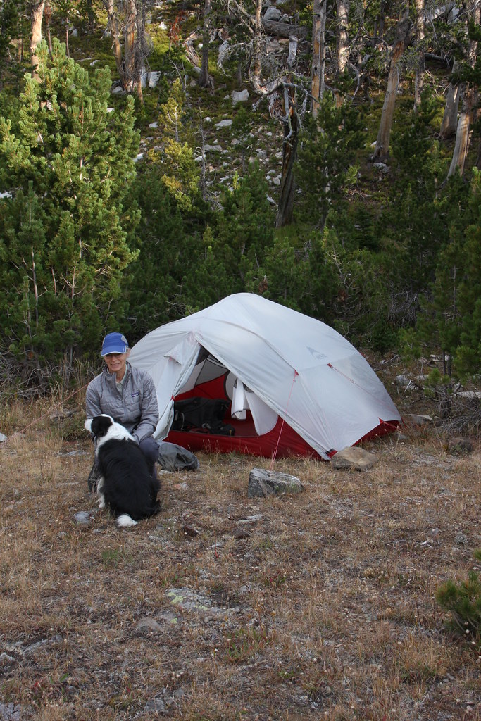
My wife and the first use of the new tent (MSR Mutha Hubba NX). It was a good test of the tent-probably a 25 mph wind when we set it up and it kept getting stronger all night. It stayed put. And damn, it's nice to use a tent that has very thoughtfully placed zippers that actually work-even if it does weight 7 oz more than what it replaced.
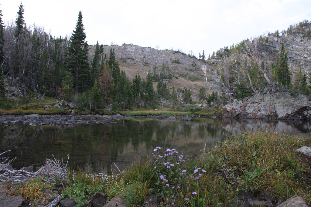
21007613909_e265d9e436_b.jpg


Lake outlet.
21006292850_a0553cc45e_b.jpg

21184072572_d40fc4f4c5_b.jpg


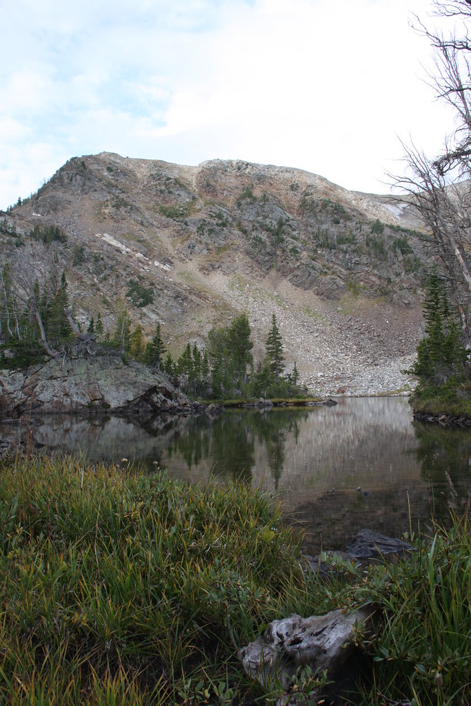
Lake-lots of fish (Yellowstone cuts) but my wife didn't keep any for the frying pan.
21184029532_a509cf36a3_b.jpg


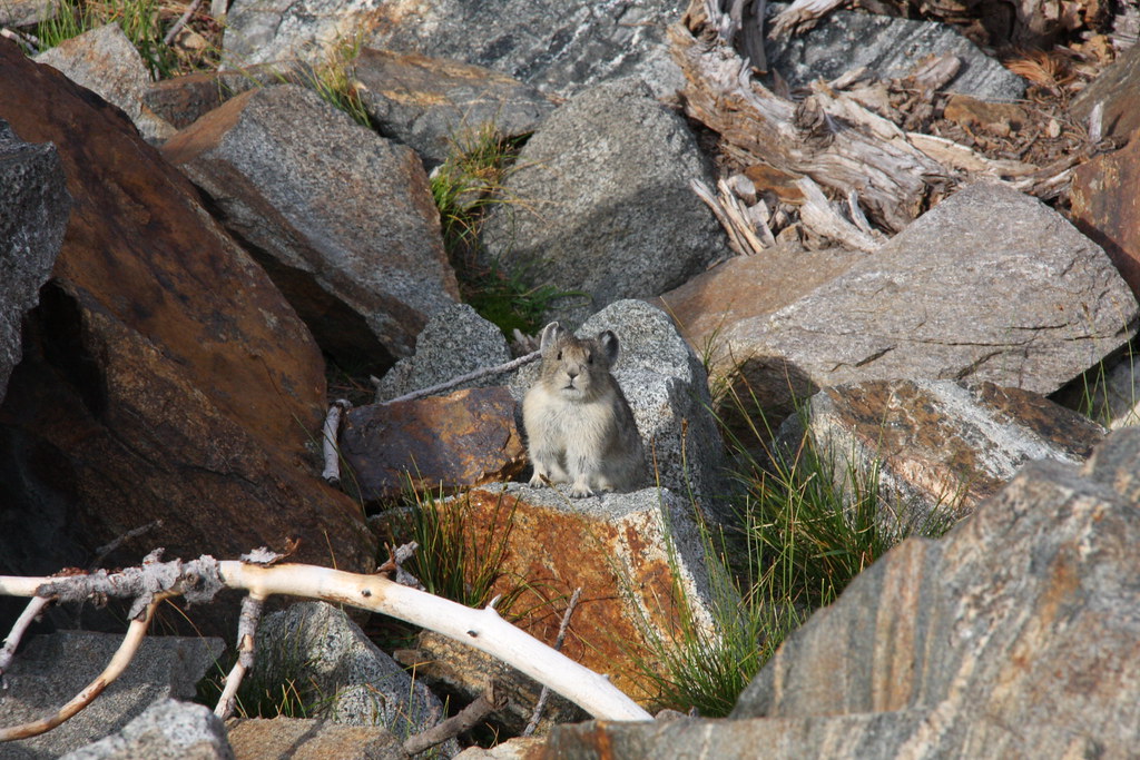
Always see a few of these guys there.
20571671894_368e809c4b_b.jpg


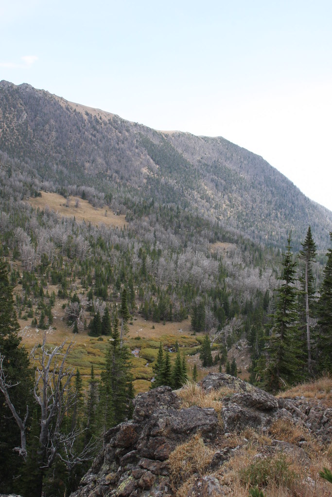
Bradley Meadows. Not much green left after a very dry summer.
20573191783_fc3ca13557_b.jpg


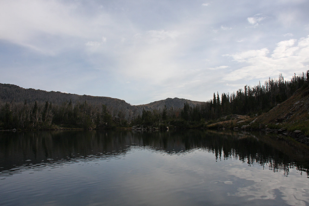
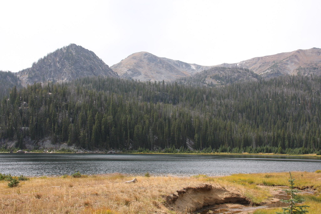
Upper Twin Lake on the way back to the Jeep. Still a little smoke but a lot less than the last few weeks.
21183977052_941a6f215e_b.jpg


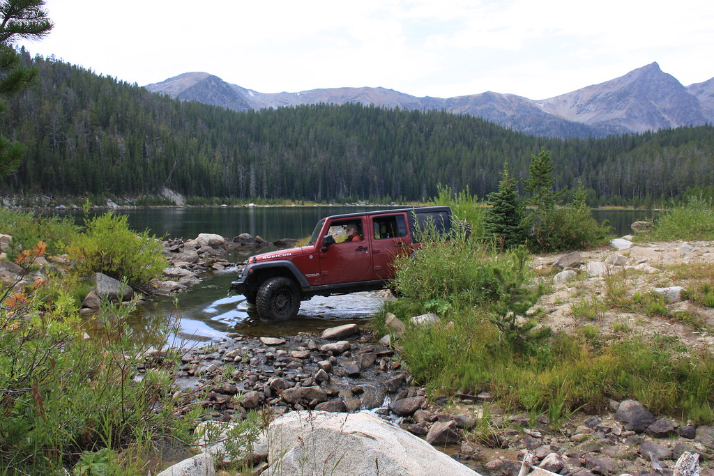
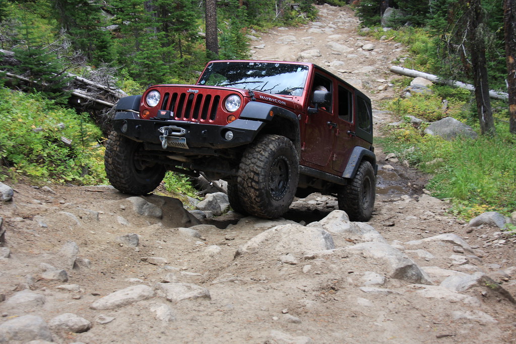
A few Jeep trail photos. I like the backpacking portion of this the best but North Meadow is a very fun Jeep trail. At the outlet of Lower Twin Lake.
21168057736_1b8188028b_b.jpg


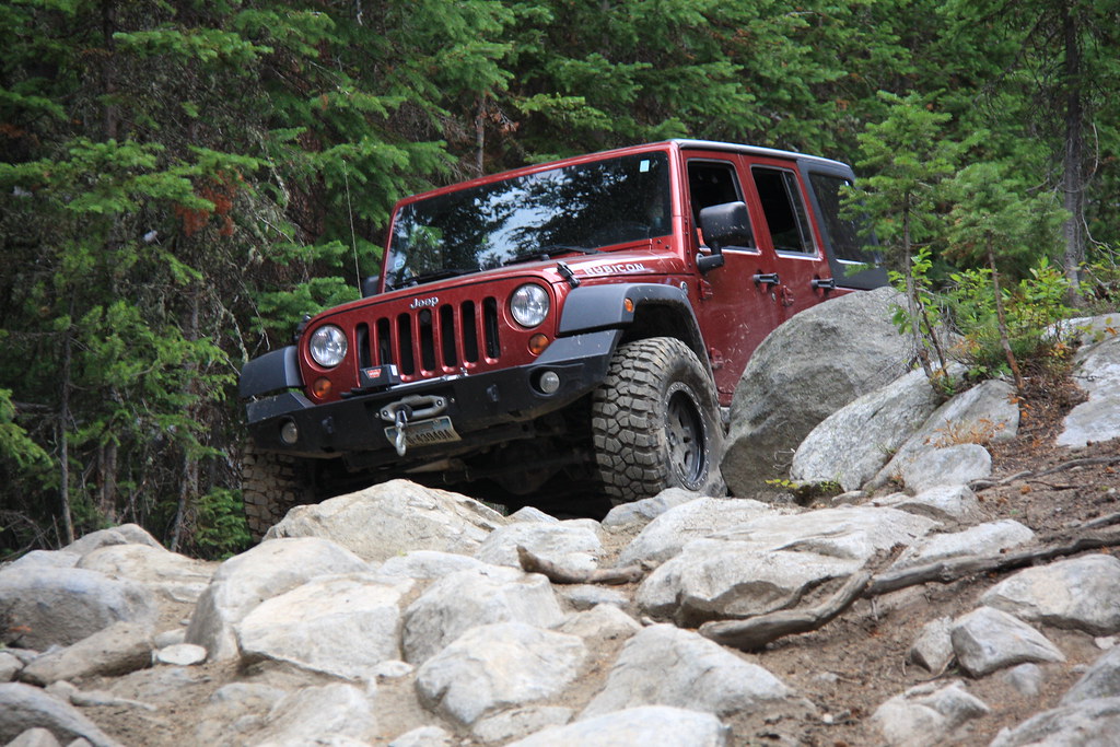
Trail shots. You have to like rock and best to have some low gearing for this, not to mention ample ground clearance.
21194520025_0c9a0dd5c8_b.jpg


21168270296_4def862bc0_b.jpg


20573311963_a22dec89e9_b.jpg


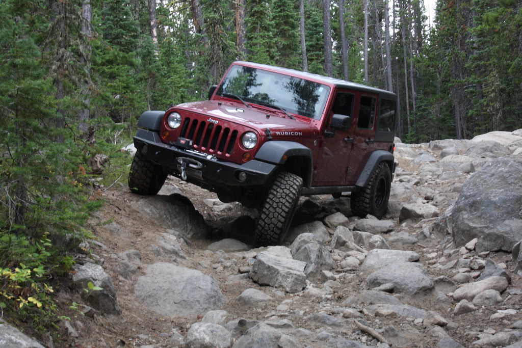
And my biannual North Meadow Creek shot.
21202346261_e5de25f77c_b.jpg


It was a good trip despite the wind the first day. The wind was forecast and I did throw in a chainsaw for the way out (it was needed). Bumped bottom twice-left front control arm and the front diff bottom but didn't hurt anything.
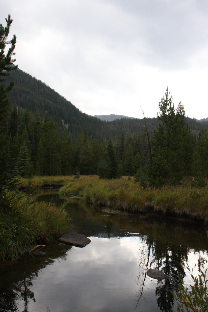
 
Looks like a great trip! Coincidentally, I went back up the South Fork today and did Curly up the Lake Trail. I think it's a nicer hike than the Creek Trail. The campgrounds were loaded with the opening of bow season and the holiday weekend. No one else drove the extra half mile of bad road to the Lake trail. I'll have to drive up to Sailer if there's good hiking up there. It was a little nippy this morning, at 35 when parked.

I really like my '15 JKUHR. I put Toyo AT2 285x75x17s on, and they're great, though the road to the Curly trail isn't that bad, anyway. I suspect it gets worse after that. Your third Jeep pic looks like it got a little challenging. I pack a portable winch for the rear, just in case :) Thanks for the post. I attached a pic from the meadow above Curly by the creek, for those who don't get out to this country. No more smoke!!!DSC00011.jpg
 
Looks like a great trip! Coincidentally, I went back up the South Fork today and did Curly up the Lake Trail. I think it's a nicer hike than the Creek Trail. The campgrounds were loaded with the opening of bow season and the holiday weekend. No one else drove the extra half mile of bad road to the Lake trail. I'll have to drive up to Sailer if there's good hiking up there. It was a little nippy this morning, at 35 when parked.

I really like my '15 JKUHR. I put Toyo AT2 285x75x17s on, and they're great, though the road to the Curly trail isn't that bad, anyway. I suspect it gets worse after that. Your third Jeep pic looks like it got a little challenging. I pack a portable winch for the rear, just in case :) Thanks for the post. I attached a pic from the meadow above Curly by the creek, for those who don't get out to this country. No more smoke!!!View attachment 34235
Our favorite camp site is only about 150 yds to the right and uphill from your photo, if that is taken from where I think it is. As far as Jeep trails go, that trail isn't much of a challenge all the way to the trailhead below Sailor Lake. Low range and something more than a Subaru and you're good to go.
 
Thanks. I just happened to use my brand new Garmin Oregon 450 GPS. Takes pretty good pictures and records the GPS data.

GPSLatitude - N 45 37 31.73 (45.625481)
GPSLongitude - W 112 4 46.61 (112.079614)
GPSAltitude - 2592.26 m
GPSImgDirection - 218.90
 
Thanks. I just happened to use my brand new Garmin Oregon 450 GPS. Takes pretty good pictures and records the GPS data.

GPSLatitude - N 45 37 31.73 (45.625481)
GPSLongitude - W 112 4 46.61 (112.079614)
GPSAltitude - 2592.26 m
GPSImgDirection - 218.90

Wow that picture you posted was taken on a GPS? I'm impressed.

Another nice report John.
 
Similar threads
Thread starter Title Forum Replies Date
John Goering Boulder Lakes, Tobacco Root Mountains Off Road 0
John Goering Tobacco Root Mountains South Meadow Creek Off Road 1
John Goering Albro Lake, Tobacco root Mountains Off Road 1
John Goering Tobacco Root Mountains day hikes Hiking & Camping 3
John Goering Year's initial foray to the Tobacco Root Mountains Hiking & Camping 3
John Goering Tobacco Root Mountains 2017 Hiking & Camping 10
John Goering Tobacco Root Mountains South Willow Creek-Camp Creek Reservoir day hike Hiking & Camping 2
John Goering Tobacco Root Mountains Wisconsin Creek day hike Hiking & Camping 1
John Goering Tobacco Root Mountains, South Willow Creek-Granite Lake Hiking & Camping 0
John Goering Tobacco Root Mountains, Indian Creek day hike Hiking & Camping 1
John Goering Tobacco Root Mountains, annual 4th trip to North Meadow Creek Hiking & Camping 4
John Goering Tobacco Root Mountains, Rock Creek Lake-Hells Hole Hiking & Camping 2
John Goering Tobacco Root Mountains-Leggat Creek, Upper Mill Creek Hiking & Camping 1
John Goering South Boulder River (Tobacco Root Mountains) day hikes. Hiking & Camping 8
John Goering Tobacco Root Mountains, Wisconsin Creek, Mud and Sunrise Lakes Hiking & Camping 1
John Goering Tobacco Root Mountains, South Fork Indian Creek-Thompson Reservoir Backpacking 1
John Goering Tobacco Root Mountains, North Willow Creek Backpacking 3
John Goering Tobacco Root Mountains North Meadow Creek 2015 Hiking & Camping 5
John Goering North Fork Indian Creek, Tobacco Root Mountains, Montana Backpacking 4
John Goering Tobacco Root Mountains, South Willow Creek Hiking & Camping 1
John Goering Quartz Creek/Johnson Creek, Tobacco Root Mountains Backpacking 3
John Goering Tobacco Root Mountains, Indian Creek Backpacking 6
John Goering Tobacco Root Mountains, Mason Lakes Hiking & Camping 3
John Goering Tobacco Root Mountains, the other side of North Meadow Creek Hiking & Camping 6
John Goering Tobacco Root Mountains, Mill Creek Backpacking 4
John Goering Tobacco root Mountains, Wisconsin Creek Hiking & Camping 2
John Goering Tobacco Root Mountains Noble Fork Backpacking 0
John Goering Tobacco Root Mountains Sailor, Globe, Brannan Lakes Backpacking 7
John Goering Tobacco Root Mountains Curly Lake Backpacking 3
John Goering Tobacco Root Mountains Lost Cabin Lake Backpacking 0
John Goering Tobacco Root Mountains, South Meadow Creek Hiking & Camping 5
John Goering Tobacco Root Mountains Louise Lake trip Backpacking 6
John Goering Tobacco Root recon run Off Road 7
John Goering Tobacco Root Willys trip Off Road 0
John Goering Tobacco Root (North Meadow Creek) trip Backpacking 8
JimmyW Tobacco Roots - Brownback/Pole Canyon Trail Hiking & Camping 0
JimmyW Day trip to Rock Creek Lake - Tobacco Roots Hiking & Camping 2
Bob Sawtooth Mountains ........... Get ready for summer Backpacking 11
BobFink Goschute Mountains, NV , Pisgah Peak, Hawk Watch Migration Site Everything Else 3
westy San Juan mountains, Colorado Hiking & Camping 8
M Backpacking 50 miles in the Uinta Mountains for 5 days with ~50 pound pack Backpacking 4
kansas good place to watch sunrise in the La Sal mountains Trip Planning 0
NorthwestWanderer First time in the High Uintas | Red Castle SNEAK Loop | I give these mountains 5 out of 5 stars Backpacking 7
westy Wallowa Mountains, Oregon Trip Planning 3
John Goering Pioneer Mountains, Montana <50" UTV trip Off Road 3
Kerrie at Thru We Go Packraft Trip in the Sierra Nevada Mountains Trip Reports 3
C Utah Mountains in Late May Trip Planning 12
S Mentasta Mountains, Wrangell St. Elias National Park and Preserve- family backpack Backpacking 1
Noun Sequitur Magdalena Mountains, Mesa Trail Loop Hiking & Camping 3
Mountain Wanderer Four Lakes Basin in the Southern Cabinet Mountains - Montana Backpacking 12

Similar threads

Back
Top