muir_mountain
Wilderness Seeker
- Joined
- Apr 16, 2016
- Messages
- 121
This was a 4-day backpacking adventure to the Titcomb Basin I went on with my parents. Titcomb Basin is a huge mountain valley in the Wind River Range of Wyoming, and it's filled with gigantic lakes and some of the best scenery in the whole range. It is one of the most popular destinations in the Wind Rivers. Unfortunately, I happened to pick the worst week of the summer to visit...
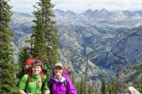
We started up the trail in good weather from the Elkhart Park trailhead. We passed a few people in Miller Park who said "Titcomb Basin will send chills down your spine, it's so beautiful." My family and I were definitely excited to get to see it; neither of us had hiked here before. Nearly five miles in, we were treated to nice views of the northern part of the range at "Photographers Point." I'm on the left, mom on right.
The only day with nice weather was that first day. Little did we know, we were headed into a storm that would hover over the Winds for a week...
We kept trekking up the trail past Eklund, Barbara, and Hobbs Lakes.
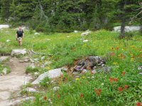
The wildflowers were amazing the whole way. We made all the way to Seneca Lake on the first day (9 miles)! I was pretty proud of my parents, because they aren't major backpackers. They hike a lot, but me dragging them to Wyoming is about the only backpacking trip they enjoy per year. I keep telling them they should get out more!
The best camp spot at Seneca Lake is on the bench on the west shore. Right when the trail first overlooks the lake, go down towards the lake for a beautiful, secluded spot. That's Fremont Peak in the center.
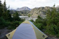
By this time, we could tell that a storm was coming. It was getting cloudy, and Titcomb Basin looked to be socked-in. We decided to put up the rainfly just in case (good thing we did). They had their 2-person tent, and my 1-person tent is just out of view.
Dad and I decided to try our luck at fishing. He proved to be the lucky one this time. This in NO WAY proves he is the better fisherman...
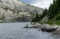
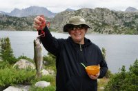
There's nothing better than fresh mountain trout for dinner...
The next day was a really short one. We just moved our camp 3 miles down the trail to Island Lake. Although it was rainy, cold, and miserable for the remainder of the trip, it was still beautiful. Most people don't get to see the basin like this, and for that, I feel blessed. Also, every backpacking trip from now on will seem like a piece of cake!!
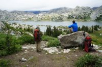
Here's Dad and I overlooking Island Lake:
Here's my parent's tent at Island Lake:
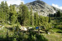
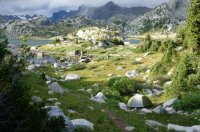
I set up my tent a little downhill from my parent's tent. That day at Island Lake, the weather morphed drastically at least a dozen times. Super cloudy and dark, to patches of sunlight, to an orange hue with rainbows... It was fascinating!
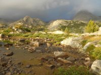
Dad and I tried our luck at fishing again. This time, we were equally skunked; just a couple of small trout we threw back. Nothing picture-worthy.
The next day (3rd day), even though the weather was getting worse, we decided it would be our last chance to get to the basin. The hike to Titcomb Basin from Island Lake is definitely longer than the guidebooks make it seem. It's at least 3 miles...
My parents can't say they'd rather be on a beach! Possibly the coldest and snowiest beach in the US... But hey, they're at a beach, RIGHT?!?!
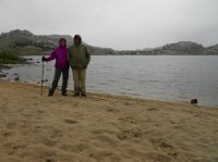
I might add, in good weather, I'd prefer this beach at Island Lake to any ocean beach. Call me crazy, I guess.
My dad admiring the view on the way to the basin:
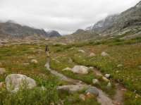
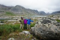
My dad couldn't believe that the towers of Titcomb Basin rose another 1000+ feet over what we could see. I was kind of disappointed that I couldn't show off just how amazing the basin could be (see, I had to brag all winter in order for them to come along), but it was still awe-inspiring. On the plus side, we had the basin all to ourselves! No one else was crazy enough to ascend from Island Lake that day! We had to set up the camera on a rock because there was no one else to take our picture.
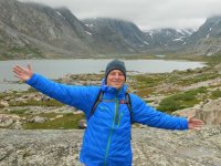
Back at camp, it started snowing!! I just set up my camp chair and enjoyed the view.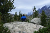
My parents were impressed with how big Twin Glacier was above the basin. When I told them there were insanely large glaciers covering the other side of the divide for miles, they were shocked. I showed them the map, and they became more shocked. Many people don't know the largest glaciers in the American Rockies reside in the Winds.
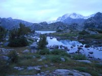
We decided to cut our trip short by a couple of days. The weather kept deteriorating, and we were all pretty miserable. Both my parents boots were soaked and freezing. So on the fourth day, we hiked all 12 miles from Island to the Elkhart Park trailhead. "Hiked" isn't the correct term. "Slogged" is much more appropriate, since the trails were a muddy mess. It snowed on us the whole time! Again, my parents and I were stunned because we couldn't believe there was snow in August.
That morning, Fremont Peak looked like the stairway to Heaven:
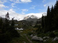
Snow at Eklund Lake on the hike out:
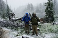
Miller Park:
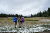
The kind family that took this picture said this was the worst bout of weather they'd run into in 10 years in the Winds... Go figure...
So a couple of things learned: Truly expect ANY weather at ANY time. Be more prepared, and especially bring waterproof boots and gloves.
But all in all, it was a nice trip, and I'd do it again in a heartbeat. Although I'm not sure my parents would say the same thing... haha. And no matter how much Dad rubs in that fish he caught, he isn't a better fisherman than I.
We started up the trail in good weather from the Elkhart Park trailhead. We passed a few people in Miller Park who said "Titcomb Basin will send chills down your spine, it's so beautiful." My family and I were definitely excited to get to see it; neither of us had hiked here before. Nearly five miles in, we were treated to nice views of the northern part of the range at "Photographers Point." I'm on the left, mom on right.

The only day with nice weather was that first day. Little did we know, we were headed into a storm that would hover over the Winds for a week...
We kept trekking up the trail past Eklund, Barbara, and Hobbs Lakes.

The wildflowers were amazing the whole way. We made all the way to Seneca Lake on the first day (9 miles)! I was pretty proud of my parents, because they aren't major backpackers. They hike a lot, but me dragging them to Wyoming is about the only backpacking trip they enjoy per year. I keep telling them they should get out more!
The best camp spot at Seneca Lake is on the bench on the west shore. Right when the trail first overlooks the lake, go down towards the lake for a beautiful, secluded spot. That's Fremont Peak in the center.

By this time, we could tell that a storm was coming. It was getting cloudy, and Titcomb Basin looked to be socked-in. We decided to put up the rainfly just in case (good thing we did). They had their 2-person tent, and my 1-person tent is just out of view.
Dad and I decided to try our luck at fishing. He proved to be the lucky one this time. This in NO WAY proves he is the better fisherman...


There's nothing better than fresh mountain trout for dinner...
The next day was a really short one. We just moved our camp 3 miles down the trail to Island Lake. Although it was rainy, cold, and miserable for the remainder of the trip, it was still beautiful. Most people don't get to see the basin like this, and for that, I feel blessed. Also, every backpacking trip from now on will seem like a piece of cake!!
Here's Dad and I overlooking Island Lake:

Here's my parent's tent at Island Lake:

I set up my tent a little downhill from my parent's tent. That day at Island Lake, the weather morphed drastically at least a dozen times. Super cloudy and dark, to patches of sunlight, to an orange hue with rainbows... It was fascinating!


Dad and I tried our luck at fishing again. This time, we were equally skunked; just a couple of small trout we threw back. Nothing picture-worthy.
The next day (3rd day), even though the weather was getting worse, we decided it would be our last chance to get to the basin. The hike to Titcomb Basin from Island Lake is definitely longer than the guidebooks make it seem. It's at least 3 miles...
My parents can't say they'd rather be on a beach! Possibly the coldest and snowiest beach in the US... But hey, they're at a beach, RIGHT?!?!

I might add, in good weather, I'd prefer this beach at Island Lake to any ocean beach. Call me crazy, I guess.
My dad admiring the view on the way to the basin:

My dad couldn't believe that the towers of Titcomb Basin rose another 1000+ feet over what we could see. I was kind of disappointed that I couldn't show off just how amazing the basin could be (see, I had to brag all winter in order for them to come along), but it was still awe-inspiring. On the plus side, we had the basin all to ourselves! No one else was crazy enough to ascend from Island Lake that day! We had to set up the camera on a rock because there was no one else to take our picture.


Back at camp, it started snowing!! I just set up my camp chair and enjoyed the view.

My parents were impressed with how big Twin Glacier was above the basin. When I told them there were insanely large glaciers covering the other side of the divide for miles, they were shocked. I showed them the map, and they became more shocked. Many people don't know the largest glaciers in the American Rockies reside in the Winds.

We decided to cut our trip short by a couple of days. The weather kept deteriorating, and we were all pretty miserable. Both my parents boots were soaked and freezing. So on the fourth day, we hiked all 12 miles from Island to the Elkhart Park trailhead. "Hiked" isn't the correct term. "Slogged" is much more appropriate, since the trails were a muddy mess. It snowed on us the whole time! Again, my parents and I were stunned because we couldn't believe there was snow in August.
That morning, Fremont Peak looked like the stairway to Heaven:

Snow at Eklund Lake on the hike out:

Miller Park:

The kind family that took this picture said this was the worst bout of weather they'd run into in 10 years in the Winds... Go figure...
So a couple of things learned: Truly expect ANY weather at ANY time. Be more prepared, and especially bring waterproof boots and gloves.
But all in all, it was a nice trip, and I'd do it again in a heartbeat. Although I'm not sure my parents would say the same thing... haha. And no matter how much Dad rubs in that fish he caught, he isn't a better fisherman than I.
