- Joined
- Jul 23, 2013
- Messages
- 1,655
Trying out my first TR with the BBCode converter and a new blog I just started (wasatch-will.blogspot.com)...
Being my first post of this new blog in which I intend to document what I hope to be many hiking and backpacking adventures throughout Utah's famed Wasatch Mountains, other parts of Utah's backcountry and beyond, I thought: What better way to start the blog off with than with a chronicle of a trip up what is arguably the crown jewel of the Wasatch Range – Mount Timpanogos?
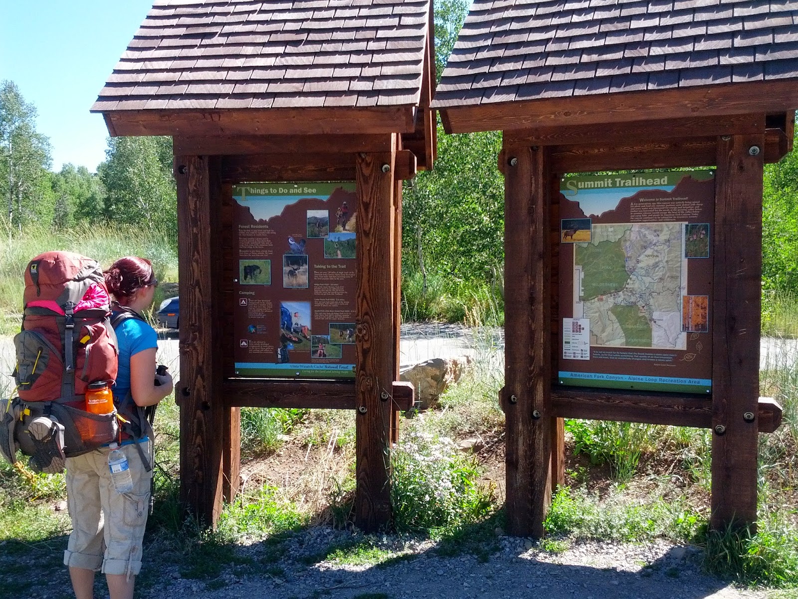
This past Friday, my wife, Jessica, and I set out for an overnighter up the mountain we locals like to call "Timp". I have hiked the summit a couple times in years past, including once with Jessica when we were dating. Most of those hikes had always been up and back down the Timpooneke trail from American Fork Canyon. I had never took a pack up to stay the night, however. For this hike, we thought it would be a great loop to do if we parked at the Summit Trailhead along the Alpine Scenic Byway and started from there.
The Summit Trailhead lies at the summit of the Alpine Scenic Byway as it runs along the eastern side of Mount Timpanogos connecting American Fork Canyon with Provo Canyon. It's approximately halfway between the two more popular trailheads for hiking Timp, Timpooneke (American Fork Canyon) and Aspen Grove (Provo Canyon - North Fork).

Currently I own a Mountainsmith Maverick and my wife, a Mountainsmith Circuit II (Women's). These look like a bit much for just an overnight trip, but I still haven't figured out how to make everything fit better. We only took the essentials: sleeping bags, pads, inflatable pillow, extra set of clothing and socks, tent (w/o the fly), stove, cook set, meals and snacks, water filter, water bottles, flashlights, multi-tool, bandanas, first-aid kit, personal toiletries, and sandals. Somehow it all still filled our packs to capacity.
I must say here that during this trip, we also came to the conclusion that we're going to want to upgrade to new packs in the very near future. Mine is a fixed size and has turned out to be just too small for my torso to allow for effective use of the load lifters. Jessica's has an adjustable torso for her but she still had some hot spots and pressure points that became too sore and the pack is starting to come undone at some of the seams. We've been doing research and testing out Osprey, Gregory, REI, and Teton Sports brands this last week for new pack options.
Anyway, moving on....
From the Summit Trailhead, we followed the Willow Hollow Trail (#159). It leads into Salamander Flat, a primitive campground, and then onward to the junction with Timpooneke Trailhead.
Along the way between Salamander Flat and Timpooneke TH, the trail opens up to a magnificent view of the eastern face of Timp and what we were soon to be hiking up.
The view is then quickly lost as the trail descends a bit into some dense forest of pine, fir, and aspen trees. This was a welcome break from the sun as the trees provided shade and a soft trail.
Before reaching Timpooneke, the trail crosses the highway for a second time. Apparently pedestrians don't have the right of way in the wilderness as they do in the cities and suburbs.
After a couple of miles, we reached Timpooneke Trailhead. Here we took a restroom break, had a snack, and topped off our hydration bladders.

A few miles up the Timpooneke trail lies a short little spur trail to Scout Falls. This is a great place to stop and take your pack off for a rest and get a picture or two, especially if the area isn't too crowded.
As the trail continues up past Scout Falls, it eventually crosses through a wide open meadow. Here you can look back and see a great view of various other peaks of the Wasatch Range including Twin Peaks, Sugarloaf Mountain, and Sunset Peak.

After the trail continues up another series of switch backs, it finally brings you to the edge of Timpanogos Basin. In the basin, there are a few trail junctions that intersect trails leading around the basin toward the saddle and summit or directly through the basin and up and over to Emerald Lake. We of course opted for the lake in order to set up camp nearby knowing that there were reliable sources of water in the Emerald Lake area.
Unfortunately, however, lots of other people like to camp right around the lake and along the trail, probably for much the same reason, as well for quick access to the trail to summit the next morning. Without settling right along the edge of the lake, it proved hard to find any smooth flat surfaces to comfortably set our tent that was near enough while still providing at least an ounce of privacy. We then thought about moving down into the Hidden Lakes area beyond Emerald Lake. Being a bit tired and sore when reaching Emerald Lake however, we dropped our packs near there and I descended down the trail to see if it'd be worth it to go further on to Hidden Lakes. After assessing the steepness of the trail down to Hidden Lakes and the extra distance, we decided against it and sacrificed privacy for comfort of being able to keep our packs off and getting camp set up as quickly as possible. As luck would have it, it wasn't until some further exploring the next day in an area still near Emerald Lake but a bit further above and back from where we did camp that I found at least 3 incredibly good camp sites with tons of tall and thick pine trees to provide some shelter from the wind, some privacy, better tent sites, and logs and rocks a plenty for sitting and cooking on. I was really bummed that I didn't scout further into that area before we laid out camp.
Our campsite did have one perk though. Shortly after settling in, we were greeted by a massive welcoming committee of mountain goats. Several dozen goats paraded around all sides of our camp, many coming right up to the edge of our camp not more than five to ten feet away from us. Many seemed to be playing peek-a-boo with us from around and over the bushes surrounding our camp. Others seemed to willingly pose for pictures. Timpanogos, like most any wilderness area, is full of wildlife. Also seen during our time on the mountain was a deer, some hummingbirds, swarms of butterflies, American pikas, and Uinta ground squirrels.


After the goats moved on, we had our dinner. Before we started, I was hoping to hike up to the saddle to catch the sunset and city lights after dinner and then night-hike back to camp. Being a bit more tired than we anticipated however, we opted to just jump in our tent and go to sleep early.
The next morning we woke up bright and early. We had plenty of alarms as several groups of early morning hikers passed nearby laughing along their way and what not. When we had gone to bed at about dusk the night before, there had only been two other groups of campers in the vicinity that we could see and two more that were just pulling in. When we awoke, there were at least 4 other groups that had moved into the area sometime through the night. I was actually expecting to find a lot more with it being a Friday night, but all in all, it wasn't as bad as it could've been.
After some breakfast it was off toward the saddle. As expected, the trail was quite crowded with groups passing by one way or the other at least every 5 minutes or so. Some groups ranged from 15 to 30 people. The saddle is another one of those popular rest spots where people often pause to put on some additional layers (for those smart enough to bring such), have a snack, take some pictures, and gather themselves together before ascending the cliff hanging trail up to the summit. How so many groups of people going opposite directions on that part of the trail are able to safely pass around each other still amazes me since there's very little wiggle room and places for pull-outs.

Given the crowds all along the ridge to the summit, and having both done the summit before, we opted to visit an area neither of us had been to yet – the crash site of a B-25 Bomber.
Apparently, on March 9, 1955, a B-25 bomber from Montana had made a fuel stop at Hill AFB in Ogden, Utah before departing for Riverside, California. Somehow it fell out of contact and off radar just after dark and got caught up in a severe snowstorm that may have caused it to veer off course. Some search parties were sent out and the wreckage was located from the air the next day. All five people aboard the plane, including two civilians, were killed in the crash. More info can be found here and here.

It seemed only fitting that the area of the crash, where both military servicemen and civilians lost their lives, be surrounded by an abundance of flowers.

After the crash site, the day was already starting to elude us. We had lunch on a large rock outcropping down slope from the crash site and headed back to take down camp and head on down toward Aspen Grove. Before breaking camp, we paused for a moment to check out the shelter next to Emerald Lake and take in the views of the picturesque blue waters of the lake.
You can tell from the picture above that we had very little snow in our mountains this past winter and have had a hotter than average summer resulting in very little snow left on what's usually a large snow field, often mistakenly called a glacier, that feeds into the lake.
Right below our camp was this waterfall fed by the stream running out of Emerald Lake.

Along the way down, it was neat to look out toward the Uintas and see the peak we hope to bag in a couple of weeks: Mount Agassiz.
The rest of the hike down the Timpanogos trail to the Aspen Grove trailhead turned out to be a bit disappointing from what I was hoping for. While the view down was still great, nearly all of the upper washes were dry. Had it been a year with average to above average snowfall, there probably would have been trickling waterfalls at every other switchback on the way down. Not only was there a lack of waterfalls, the trail was a lot rockier and uneven than I remember from when I ran down much of it in high school. This made for very sore feet in addition to sore shoulders for the latter half of the hike down. It wasn't until further down the cirque that we passed some reliable waterfalls. Most were fed be trickling streams and then there was the grandest of them all as pictured below.

At last, we reached the border of the wilderness area and knew that the Aspen Grove Trailhead was now very near. For my wife, this meant a welcome restroom break, and for both of us, a place to top off our water-bottles with cold tap water and some Gatorade mix, not to mention packs off of our shoulders.

At this point we had decided not only to take a break at the Aspen Grove trailhead, but also for Jess to wait at the trailhead there with our packs while I hiked solo the additional three or so miles back to the Summit trailhead to pick up the car. We figured we could make better time if I hiked pack-less back to the car. So with a freshly filled bottle of Gatorade, a trekking pole (for some kind of personal defense), and a change from boots to sandals on my feet, I was on my way up Lame Horse Trail (#55).


Finally, I was there. The loop was complete and into my car I went. Upon driving down and picking up Jessica and our packs, we popped open our little cooler and busted out some post-hike drinks – Sobes. Not quite as cold as we had hoped for, but still refreshing nonetheless.
Here's a brief video highlighting the trip...
And finally, here's a map showing the routes we took...
View larger map.
Featured image for home page:

Being my first post of this new blog in which I intend to document what I hope to be many hiking and backpacking adventures throughout Utah's famed Wasatch Mountains, other parts of Utah's backcountry and beyond, I thought: What better way to start the blog off with than with a chronicle of a trip up what is arguably the crown jewel of the Wasatch Range – Mount Timpanogos?
This past Friday, my wife, Jessica, and I set out for an overnighter up the mountain we locals like to call "Timp". I have hiked the summit a couple times in years past, including once with Jessica when we were dating. Most of those hikes had always been up and back down the Timpooneke trail from American Fork Canyon. I had never took a pack up to stay the night, however. For this hike, we thought it would be a great loop to do if we parked at the Summit Trailhead along the Alpine Scenic Byway and started from there.
The Summit Trailhead lies at the summit of the Alpine Scenic Byway as it runs along the eastern side of Mount Timpanogos connecting American Fork Canyon with Provo Canyon. It's approximately halfway between the two more popular trailheads for hiking Timp, Timpooneke (American Fork Canyon) and Aspen Grove (Provo Canyon - North Fork).
Summit Trailhead
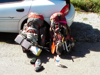
Currently I own a Mountainsmith Maverick and my wife, a Mountainsmith Circuit II (Women's). These look like a bit much for just an overnight trip, but I still haven't figured out how to make everything fit better. We only took the essentials: sleeping bags, pads, inflatable pillow, extra set of clothing and socks, tent (w/o the fly), stove, cook set, meals and snacks, water filter, water bottles, flashlights, multi-tool, bandanas, first-aid kit, personal toiletries, and sandals. Somehow it all still filled our packs to capacity.

Our Packs
I must say here that during this trip, we also came to the conclusion that we're going to want to upgrade to new packs in the very near future. Mine is a fixed size and has turned out to be just too small for my torso to allow for effective use of the load lifters. Jessica's has an adjustable torso for her but she still had some hot spots and pressure points that became too sore and the pack is starting to come undone at some of the seams. We've been doing research and testing out Osprey, Gregory, REI, and Teton Sports brands this last week for new pack options.
Anyway, moving on....
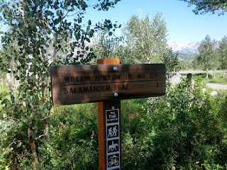
From the Summit Trailhead, we followed the Willow Hollow Trail (#159). It leads into Salamander Flat, a primitive campground, and then onward to the junction with Timpooneke Trailhead.
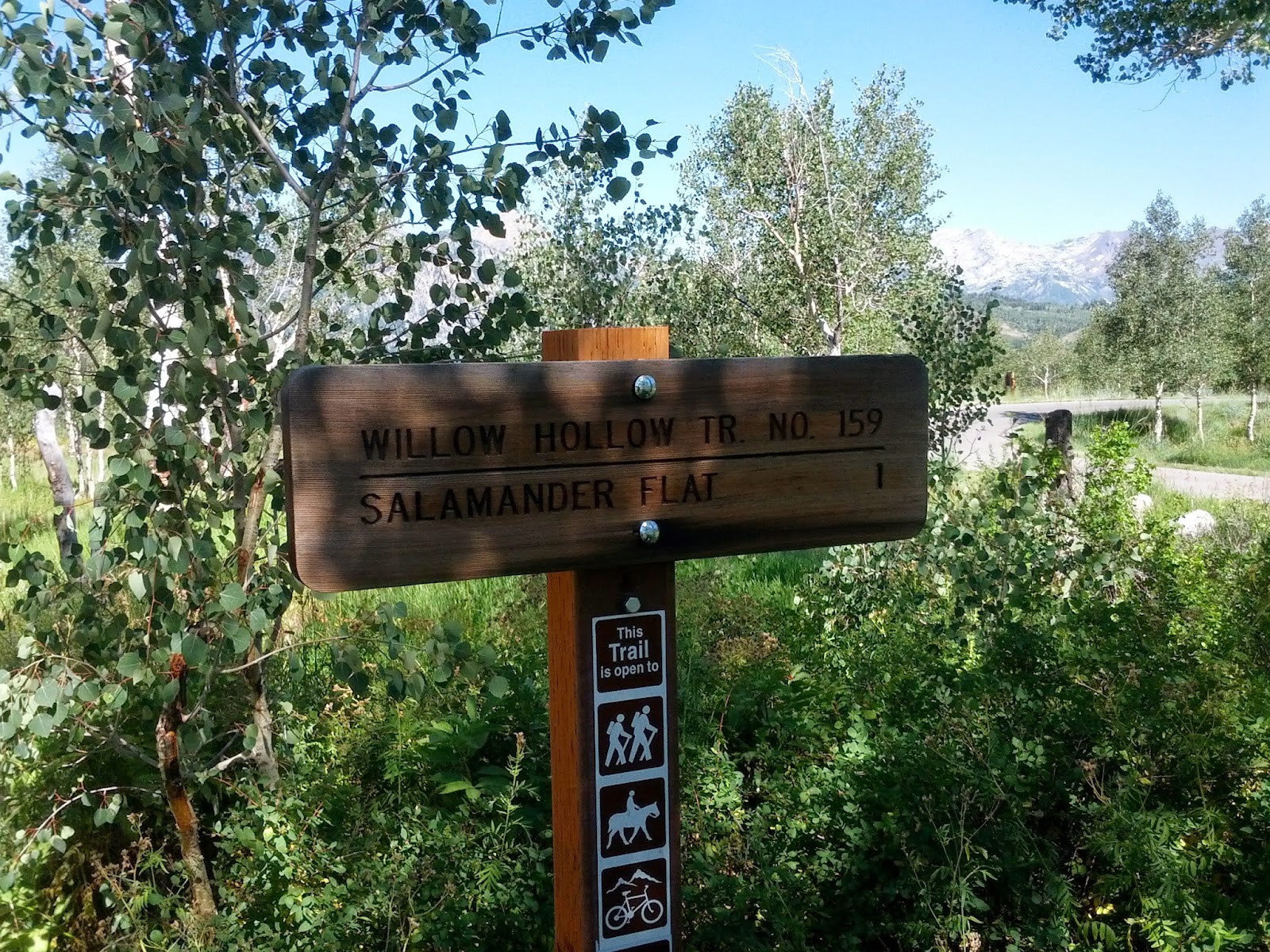
Willow Hollow Trail Sign at Summit Trailhead
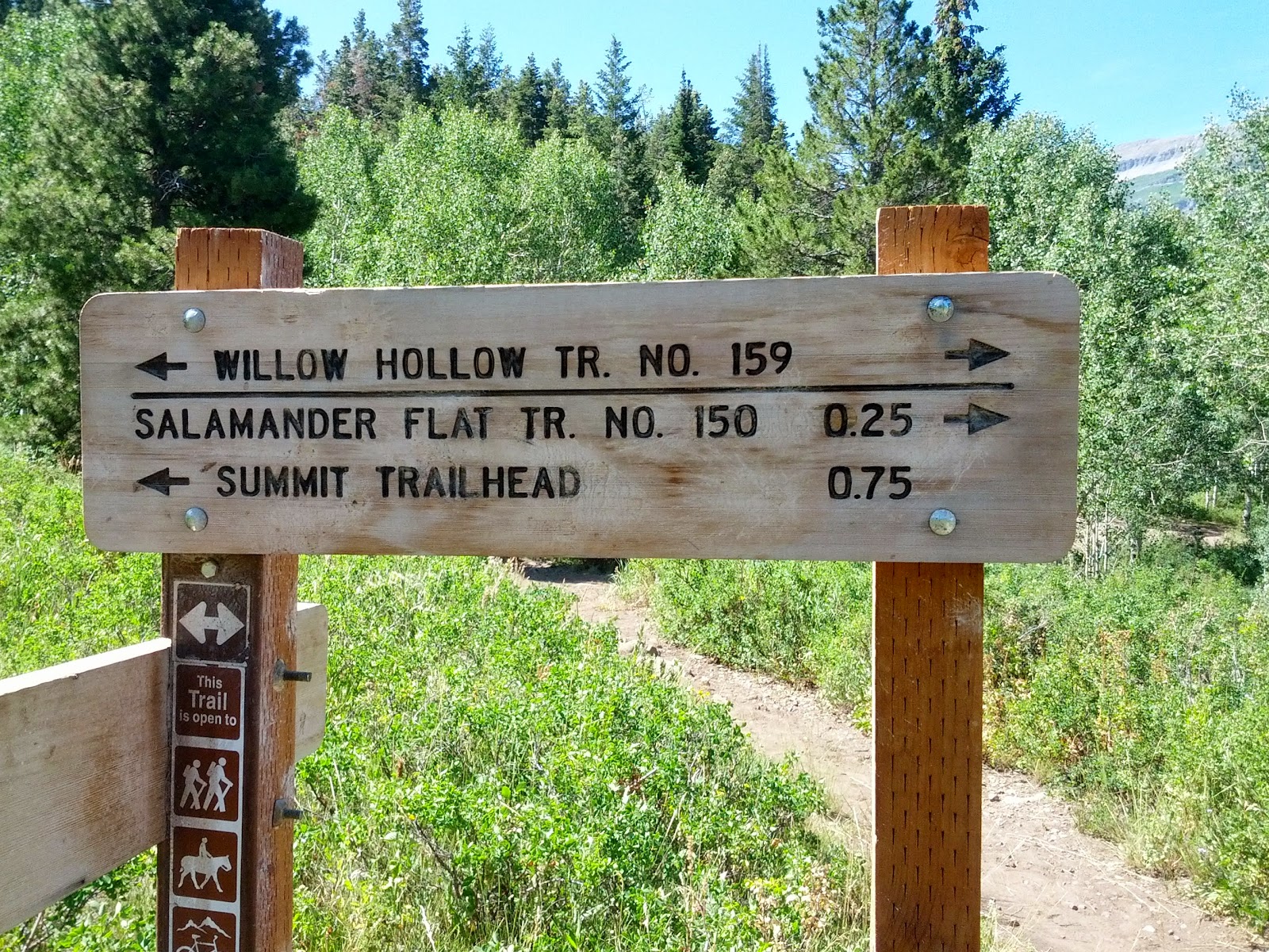
Approaching Salamander Flat
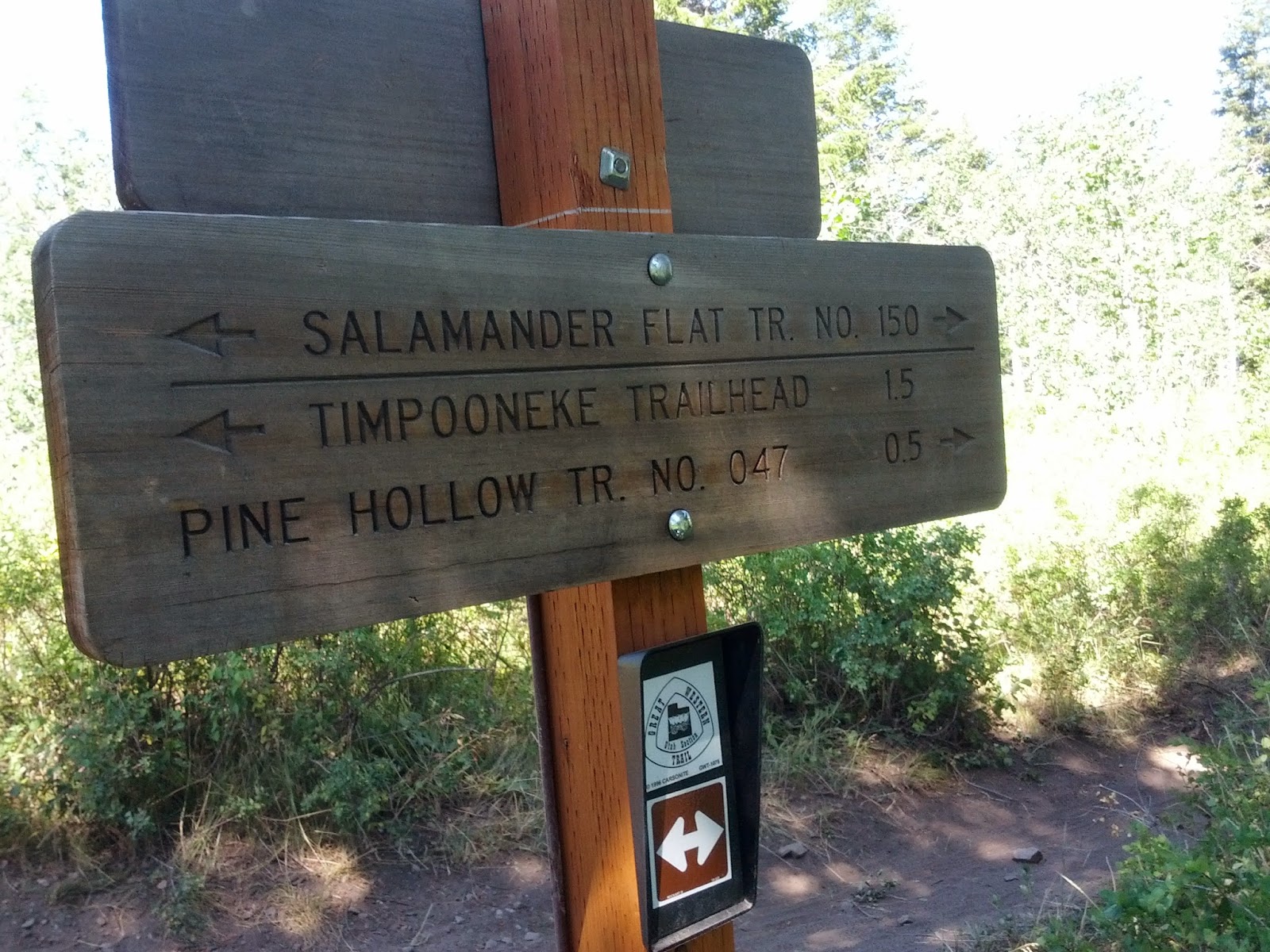
Leaving Salamander Flat
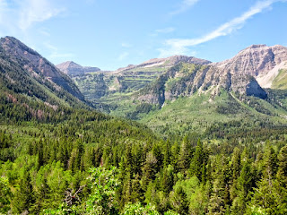
Along the way between Salamander Flat and Timpooneke TH, the trail opens up to a magnificent view of the eastern face of Timp and what we were soon to be hiking up.
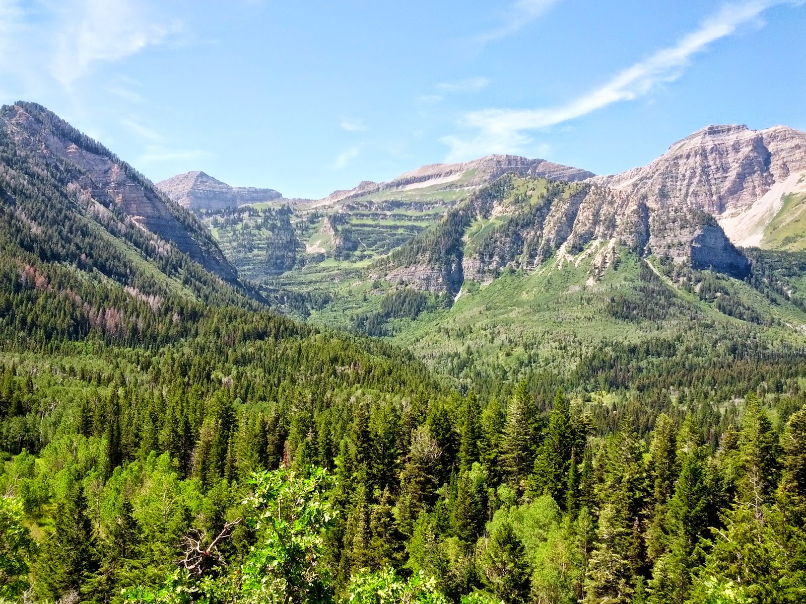
East Face of Mount Timponogas
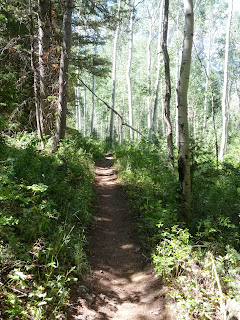
The view is then quickly lost as the trail descends a bit into some dense forest of pine, fir, and aspen trees. This was a welcome break from the sun as the trees provided shade and a soft trail.
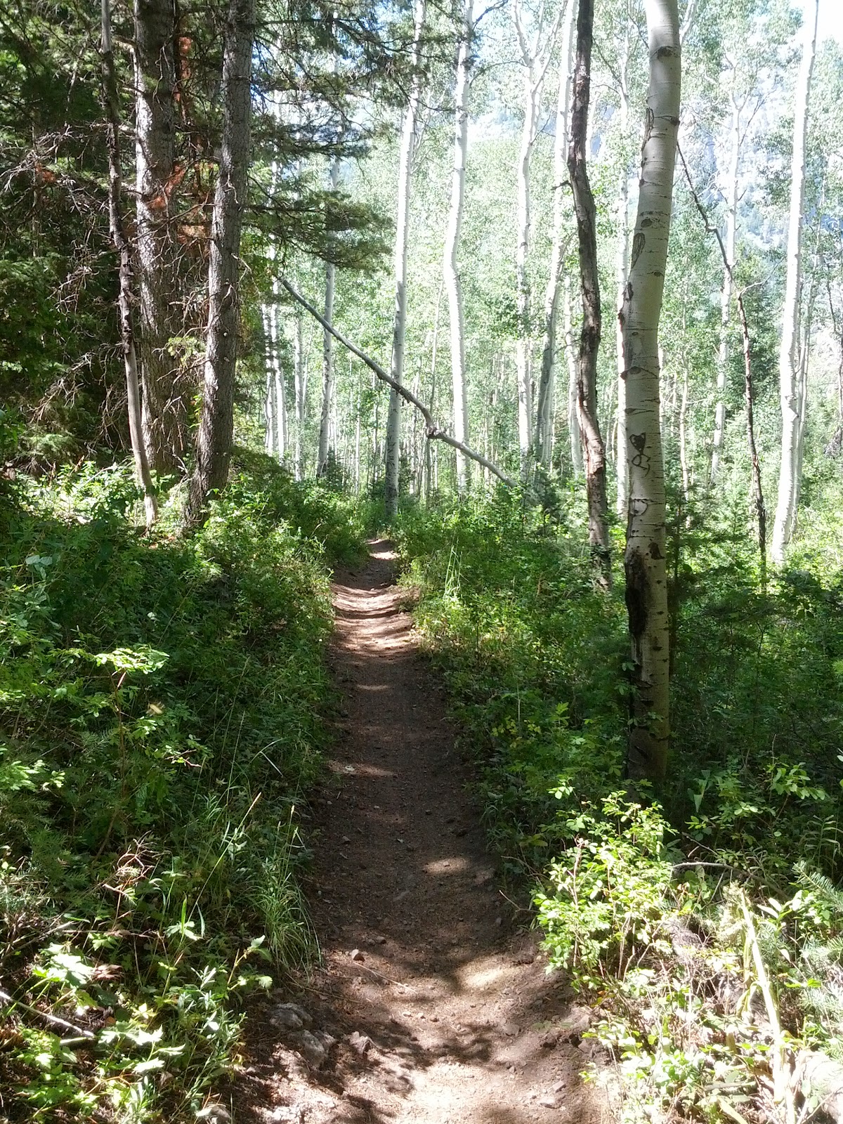
Along the Willow Hollow Trail
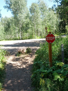
Before reaching Timpooneke, the trail crosses the highway for a second time. Apparently pedestrians don't have the right of way in the wilderness as they do in the cities and suburbs.
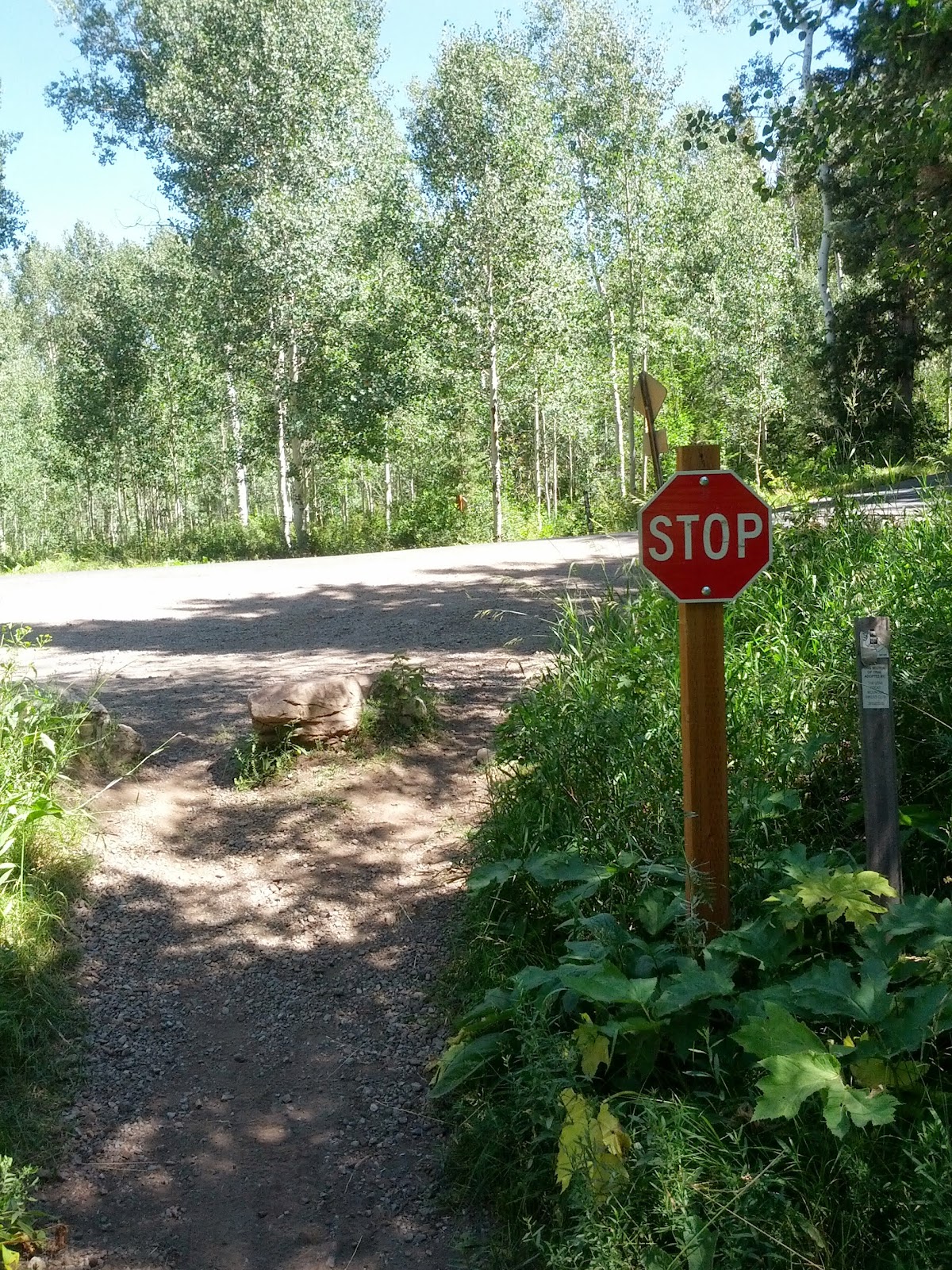
Stop for Cars
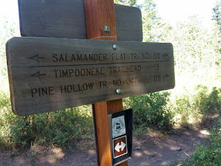
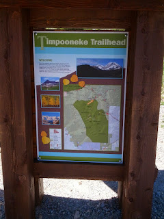
After a couple of miles, we reached Timpooneke Trailhead. Here we took a restroom break, had a snack, and topped off our hydration bladders.

Timpooneke Trailhead
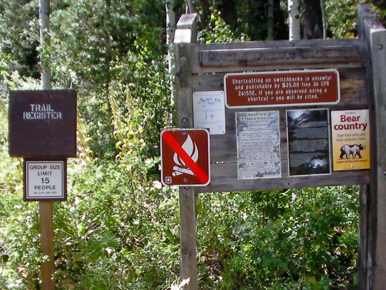
Trail Register
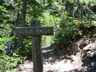
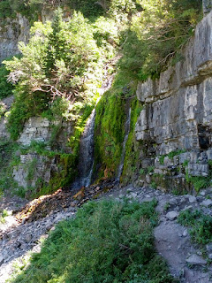
A few miles up the Timpooneke trail lies a short little spur trail to Scout Falls. This is a great place to stop and take your pack off for a rest and get a picture or two, especially if the area isn't too crowded.
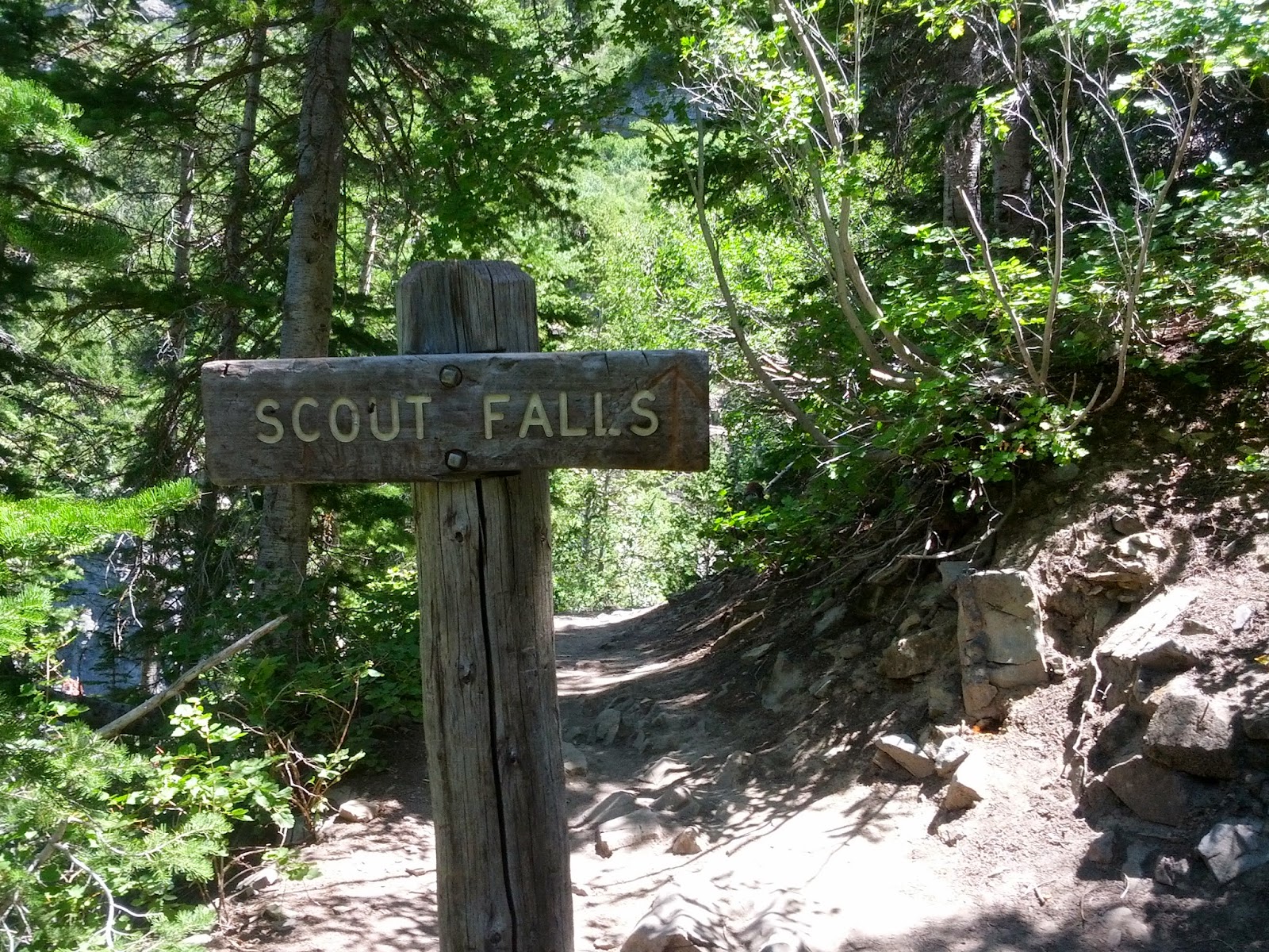
Sign leading the way to Scout Falls
Scout Falls
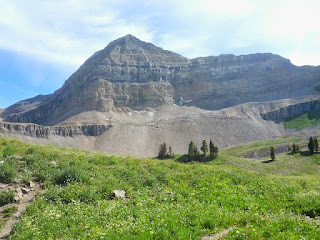
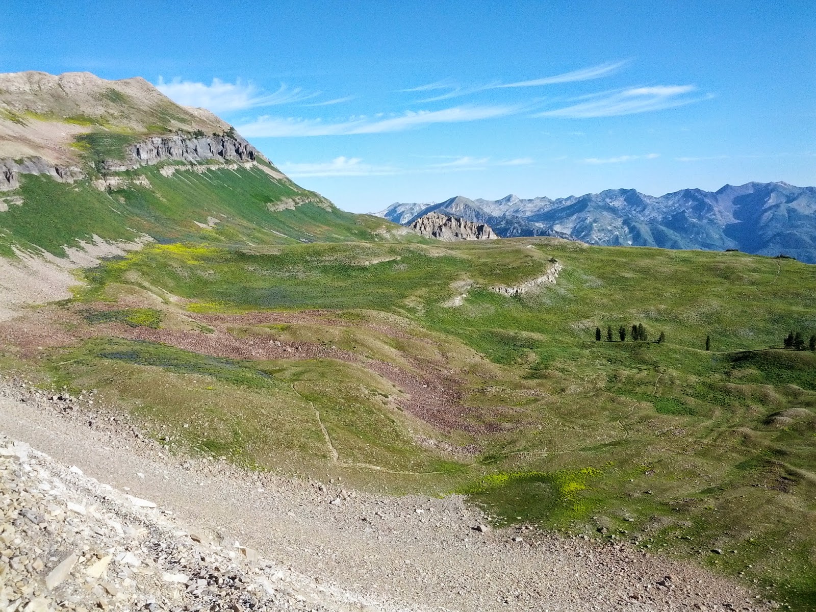
As the trail continues up past Scout Falls, it eventually crosses through a wide open meadow. Here you can look back and see a great view of various other peaks of the Wasatch Range including Twin Peaks, Sugarloaf Mountain, and Sunset Peak.
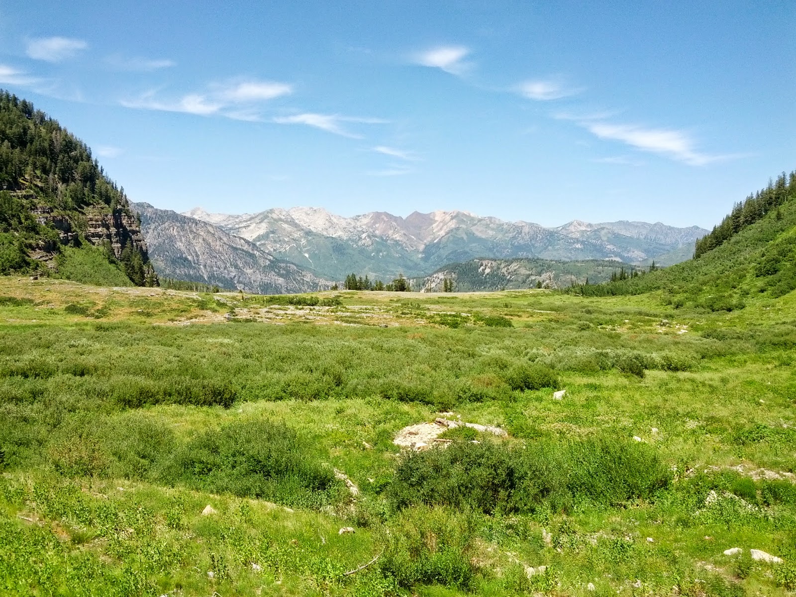
Central Wasatch Peaks
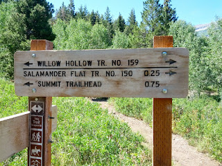
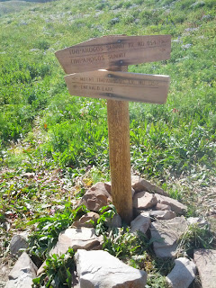
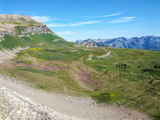
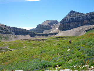
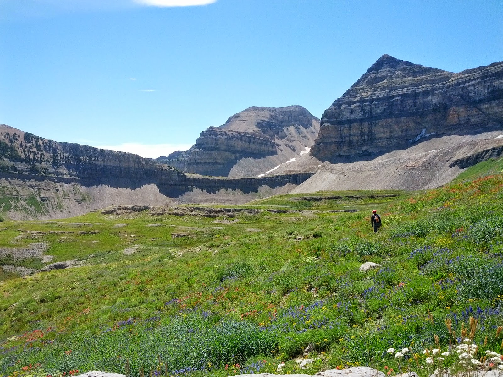
After the trail continues up another series of switch backs, it finally brings you to the edge of Timpanogos Basin. In the basin, there are a few trail junctions that intersect trails leading around the basin toward the saddle and summit or directly through the basin and up and over to Emerald Lake. We of course opted for the lake in order to set up camp nearby knowing that there were reliable sources of water in the Emerald Lake area.
Timpanogos Basin
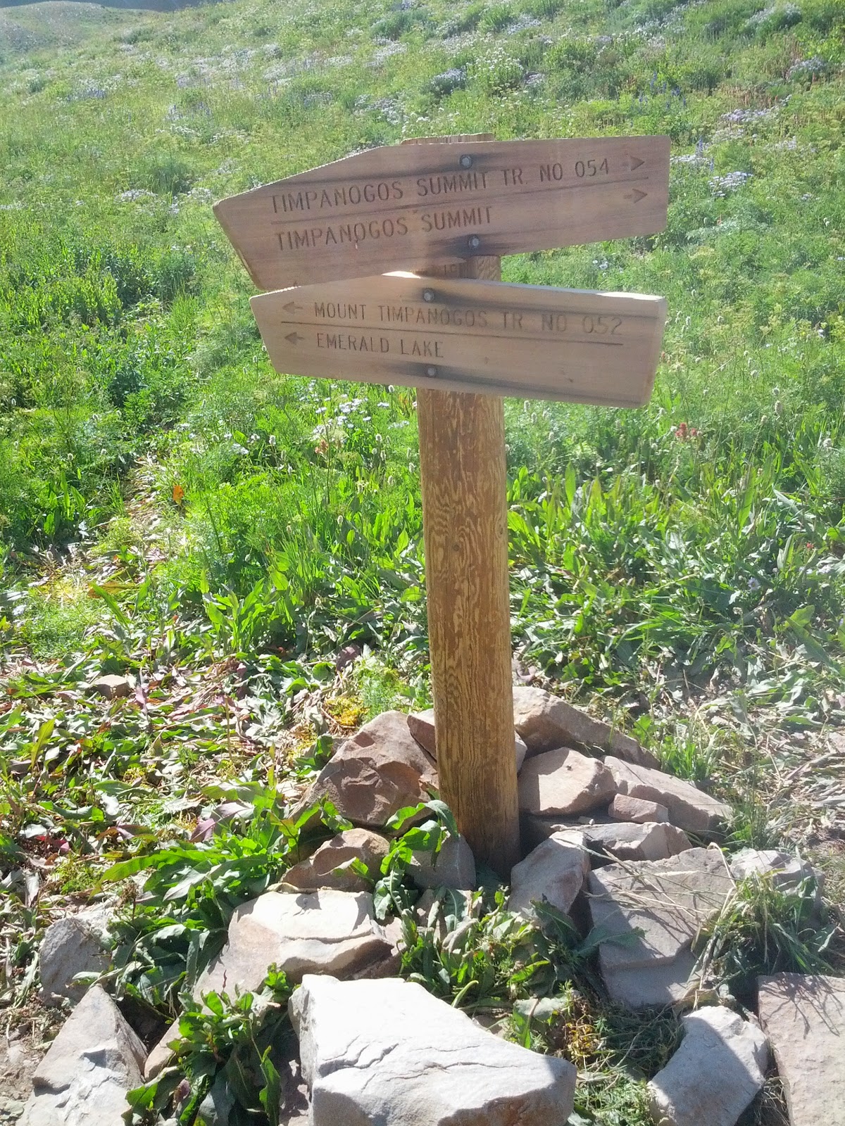
Eastern junction of Summit and Emerald Lake trails
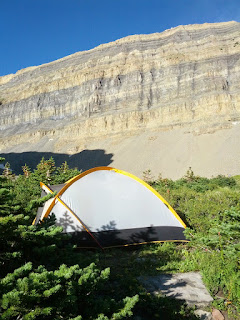
Unfortunately, however, lots of other people like to camp right around the lake and along the trail, probably for much the same reason, as well for quick access to the trail to summit the next morning. Without settling right along the edge of the lake, it proved hard to find any smooth flat surfaces to comfortably set our tent that was near enough while still providing at least an ounce of privacy. We then thought about moving down into the Hidden Lakes area beyond Emerald Lake. Being a bit tired and sore when reaching Emerald Lake however, we dropped our packs near there and I descended down the trail to see if it'd be worth it to go further on to Hidden Lakes. After assessing the steepness of the trail down to Hidden Lakes and the extra distance, we decided against it and sacrificed privacy for comfort of being able to keep our packs off and getting camp set up as quickly as possible. As luck would have it, it wasn't until some further exploring the next day in an area still near Emerald Lake but a bit further above and back from where we did camp that I found at least 3 incredibly good camp sites with tons of tall and thick pine trees to provide some shelter from the wind, some privacy, better tent sites, and logs and rocks a plenty for sitting and cooking on. I was really bummed that I didn't scout further into that area before we laid out camp.
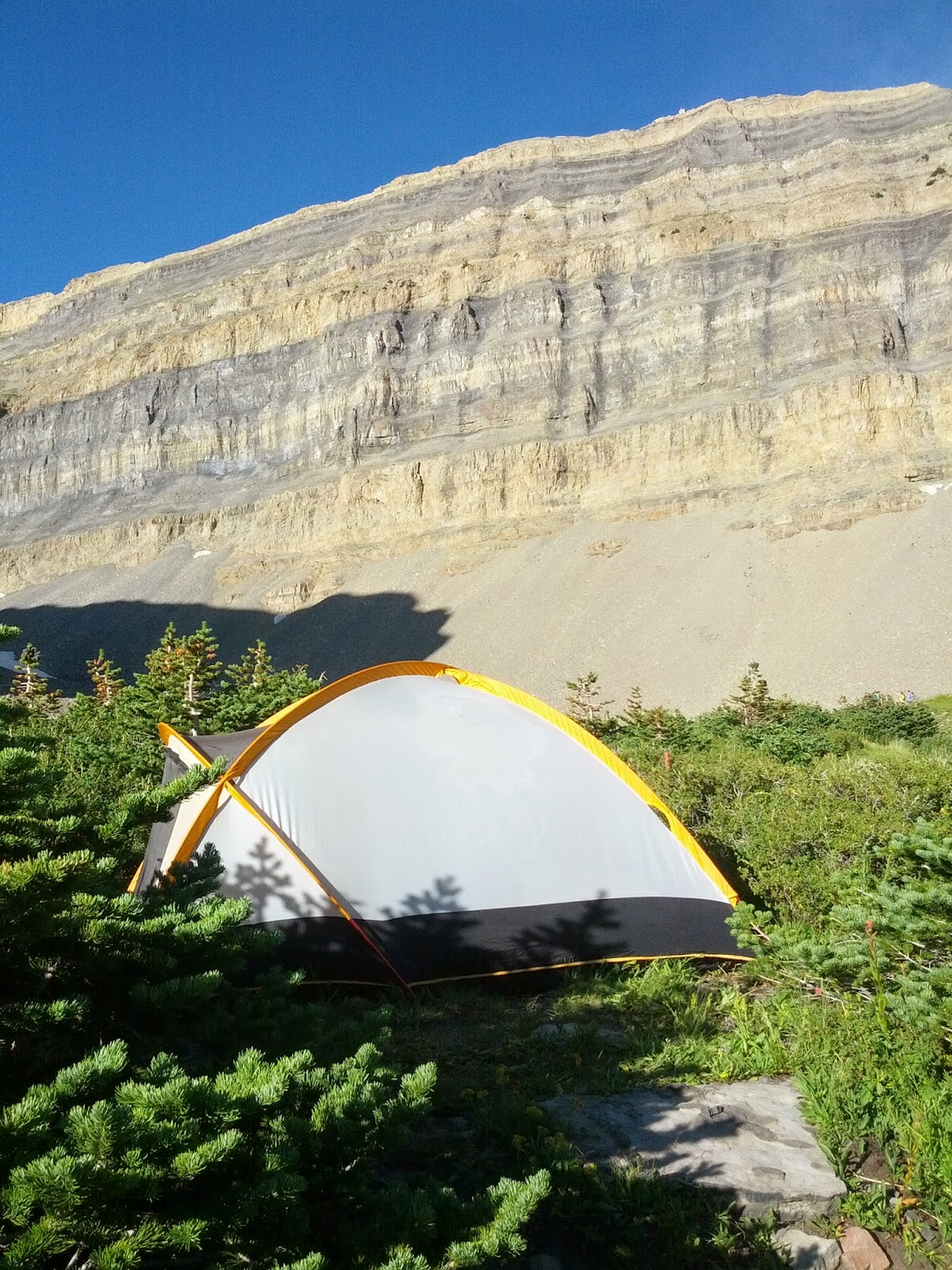
Camp
Our campsite did have one perk though. Shortly after settling in, we were greeted by a massive welcoming committee of mountain goats. Several dozen goats paraded around all sides of our camp, many coming right up to the edge of our camp not more than five to ten feet away from us. Many seemed to be playing peek-a-boo with us from around and over the bushes surrounding our camp. Others seemed to willingly pose for pictures. Timpanogos, like most any wilderness area, is full of wildlife. Also seen during our time on the mountain was a deer, some hummingbirds, swarms of butterflies, American pikas, and Uinta ground squirrels.
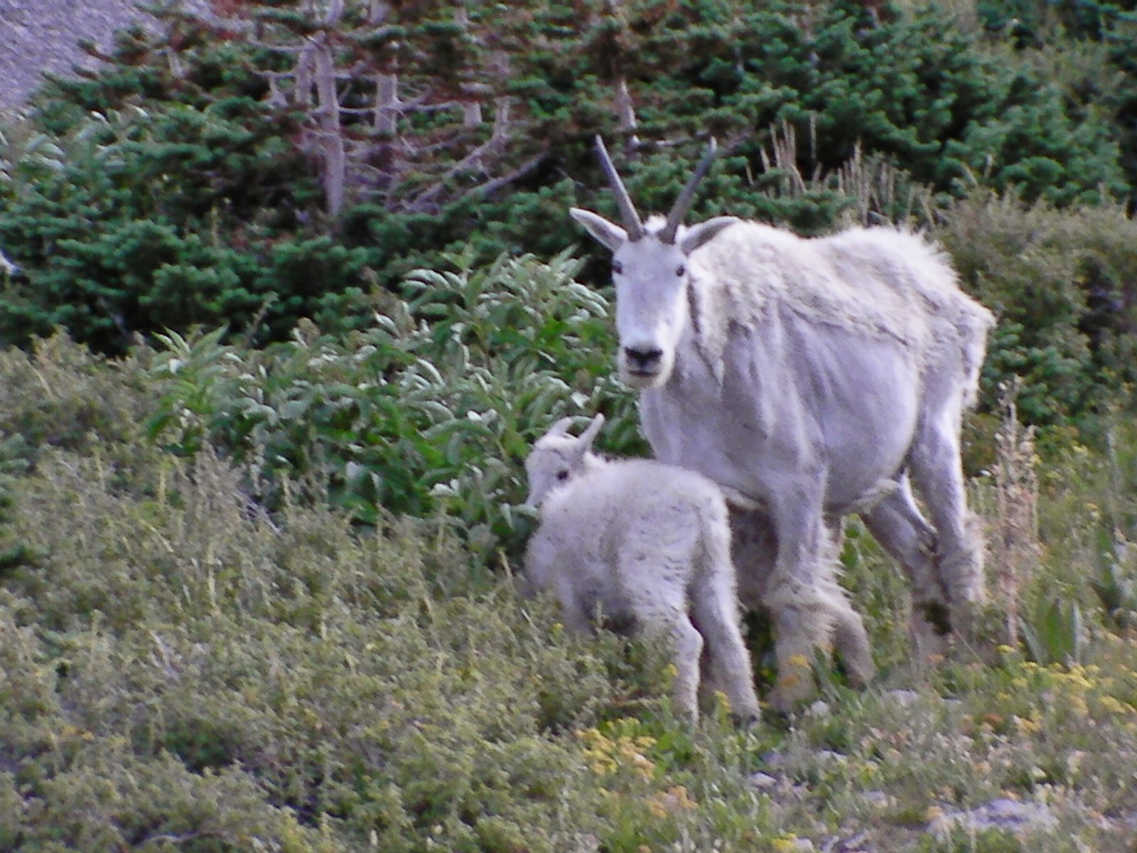
Mother and Baby
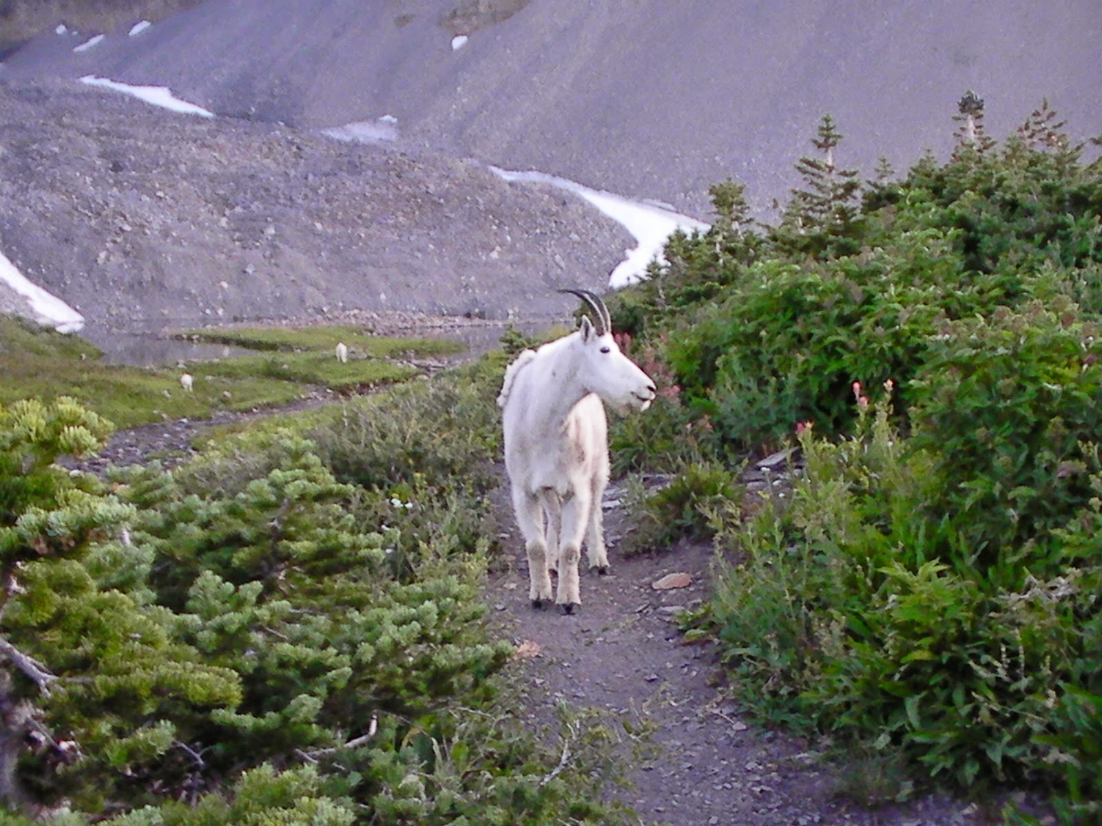
Mountain Goat Posing
After the goats moved on, we had our dinner. Before we started, I was hoping to hike up to the saddle to catch the sunset and city lights after dinner and then night-hike back to camp. Being a bit more tired than we anticipated however, we opted to just jump in our tent and go to sleep early.
The next morning we woke up bright and early. We had plenty of alarms as several groups of early morning hikers passed nearby laughing along their way and what not. When we had gone to bed at about dusk the night before, there had only been two other groups of campers in the vicinity that we could see and two more that were just pulling in. When we awoke, there were at least 4 other groups that had moved into the area sometime through the night. I was actually expecting to find a lot more with it being a Friday night, but all in all, it wasn't as bad as it could've been.
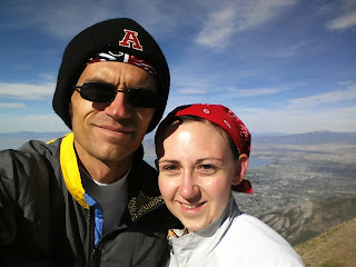
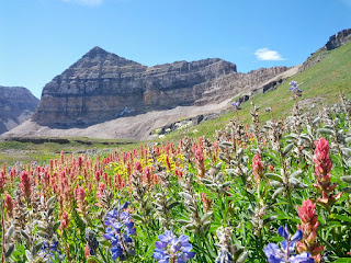
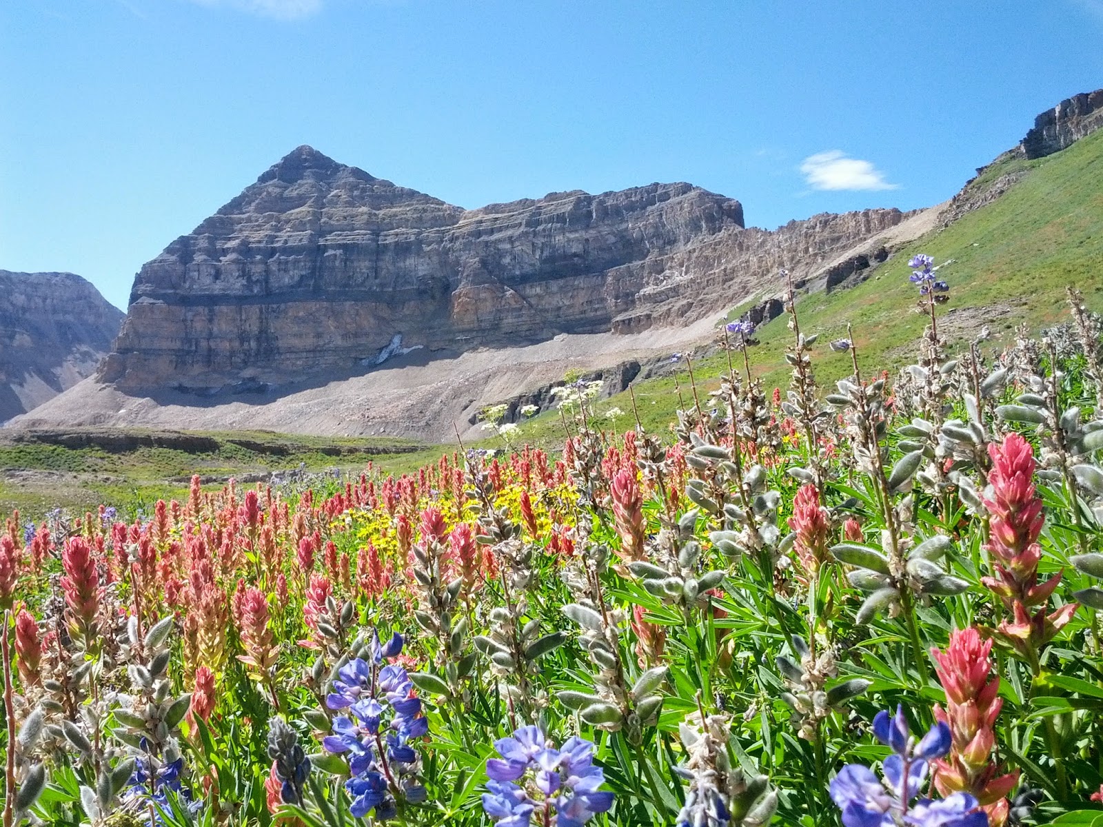
After some breakfast it was off toward the saddle. As expected, the trail was quite crowded with groups passing by one way or the other at least every 5 minutes or so. Some groups ranged from 15 to 30 people. The saddle is another one of those popular rest spots where people often pause to put on some additional layers (for those smart enough to bring such), have a snack, take some pictures, and gather themselves together before ascending the cliff hanging trail up to the summit. How so many groups of people going opposite directions on that part of the trail are able to safely pass around each other still amazes me since there's very little wiggle room and places for pull-outs.
Looking east from the Saddle

Myself & Jessica
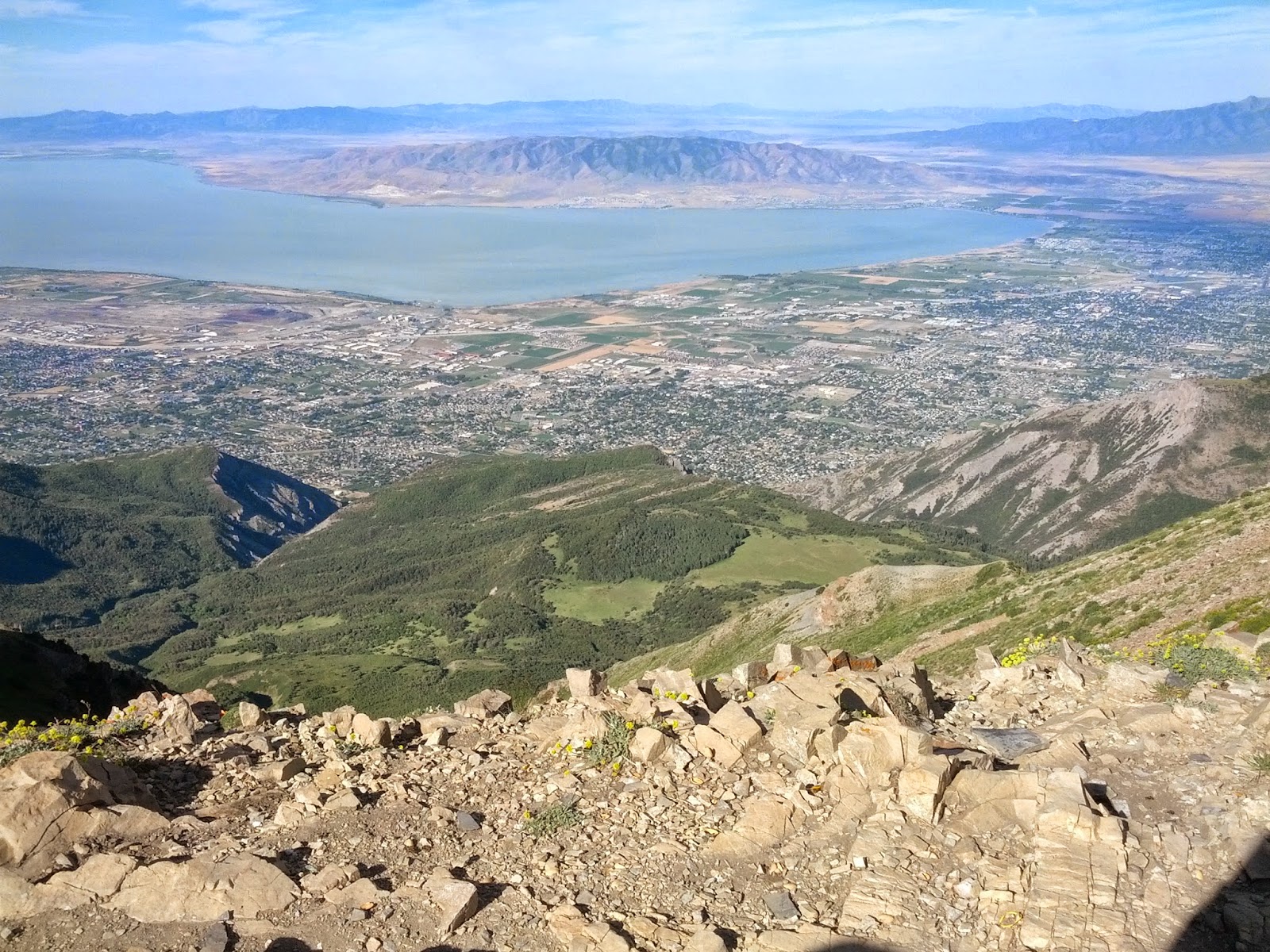
Looking West over Utah Valley from the Saddle
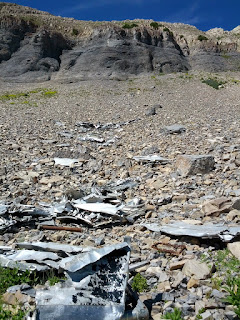
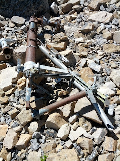
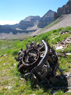
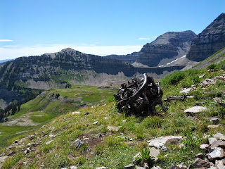
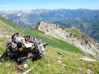
Given the crowds all along the ridge to the summit, and having both done the summit before, we opted to visit an area neither of us had been to yet – the crash site of a B-25 Bomber.
Apparently, on March 9, 1955, a B-25 bomber from Montana had made a fuel stop at Hill AFB in Ogden, Utah before departing for Riverside, California. Somehow it fell out of contact and off radar just after dark and got caught up in a severe snowstorm that may have caused it to veer off course. Some search parties were sent out and the wreckage was located from the air the next day. All five people aboard the plane, including two civilians, were killed in the crash. More info can be found here and here.
Bomber Wreckage
More wreckage scattered up the slope
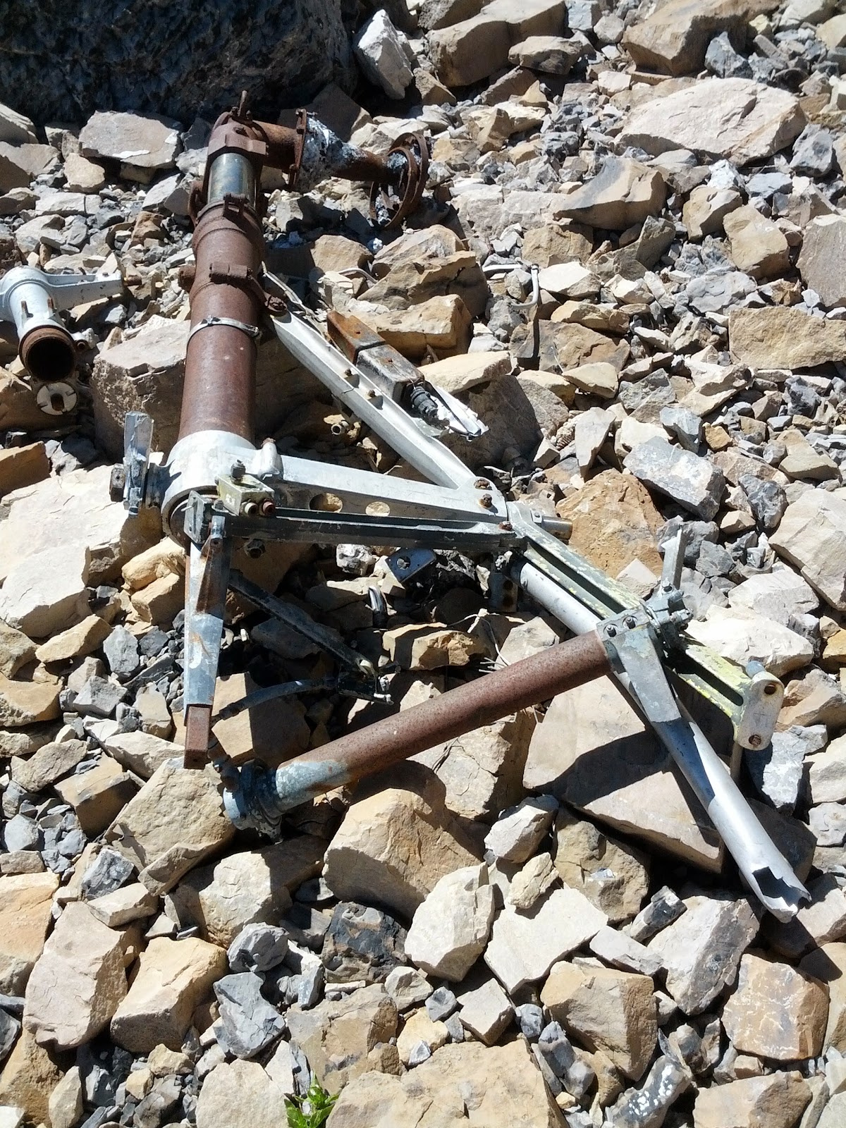
Some piping from the bomber

One of the engines

B-25 Engine, Looking South

B-25 Engine, Looking North
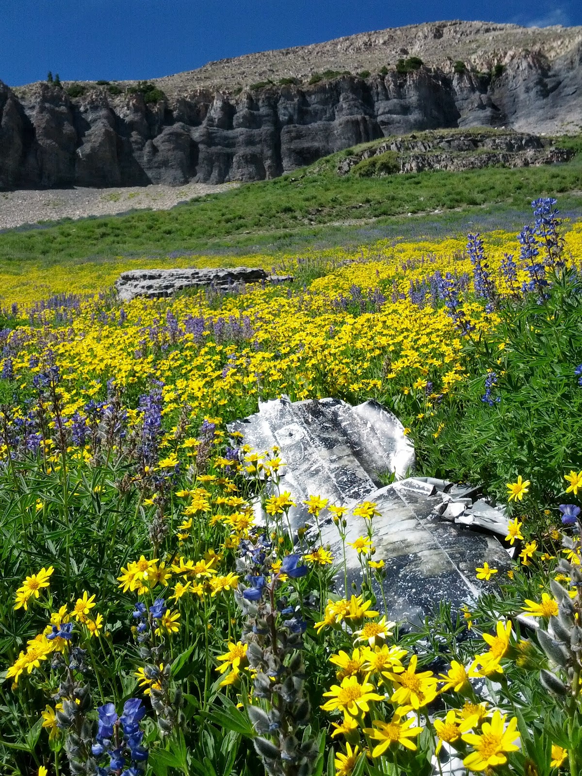
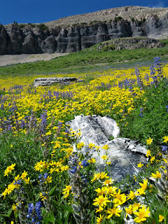
More wreckage among flowers
It seemed only fitting that the area of the crash, where both military servicemen and civilians lost their lives, be surrounded by an abundance of flowers.
Wildflowers
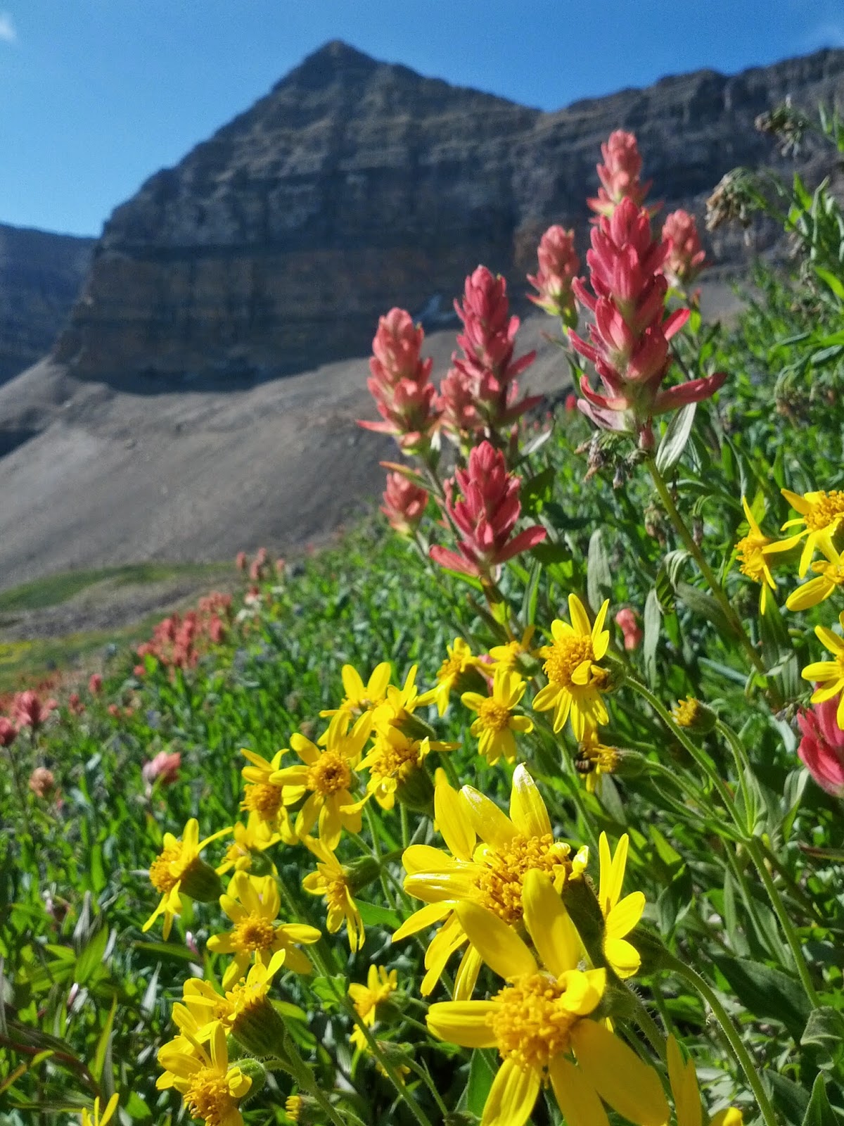
More Wildflowers
Looking south down from crash site w/ Jessica in the distance
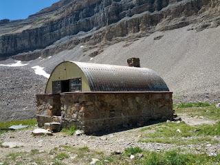
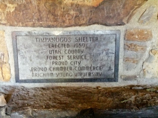
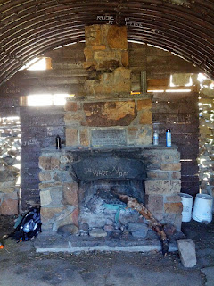
After the crash site, the day was already starting to elude us. We had lunch on a large rock outcropping down slope from the crash site and headed back to take down camp and head on down toward Aspen Grove. Before breaking camp, we paused for a moment to check out the shelter next to Emerald Lake and take in the views of the picturesque blue waters of the lake.

Timpanogos Shelter

Timpanogos Shelter Plaque

Inside Timpanogos Shelter
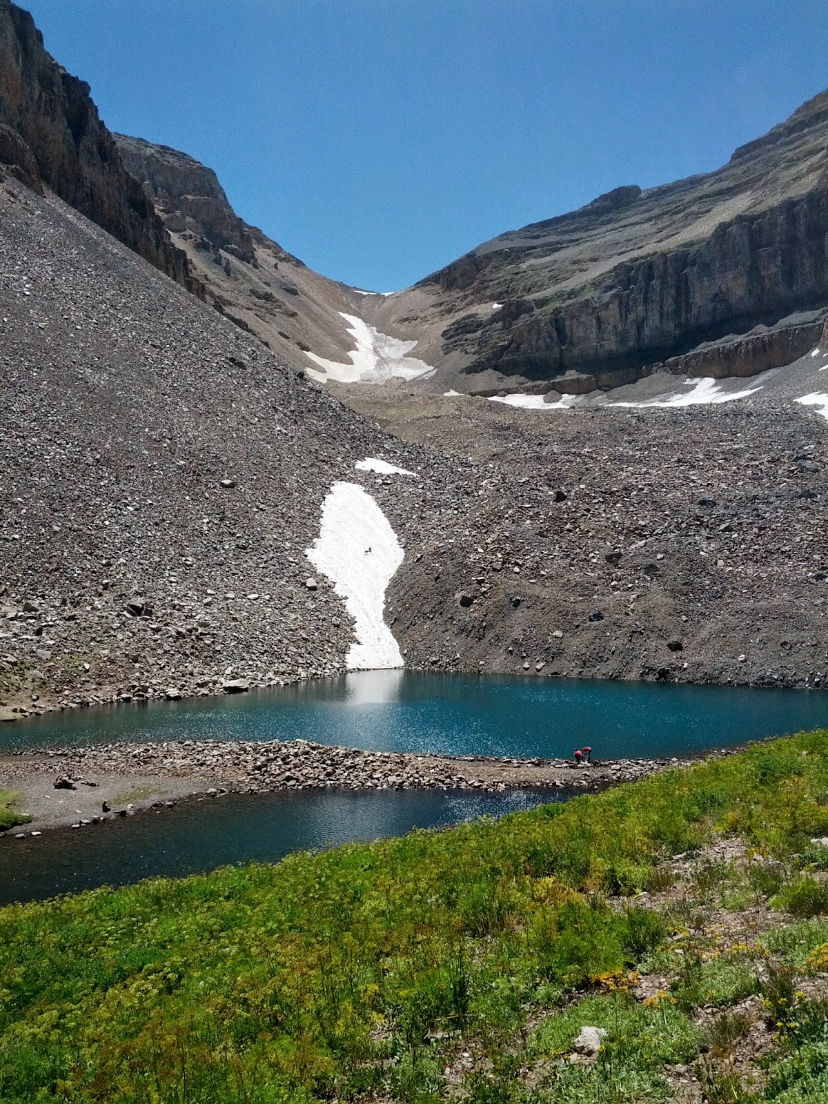
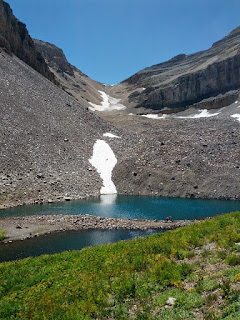
Emerald Lake
You can tell from the picture above that we had very little snow in our mountains this past winter and have had a hotter than average summer resulting in very little snow left on what's usually a large snow field, often mistakenly called a glacier, that feeds into the lake.
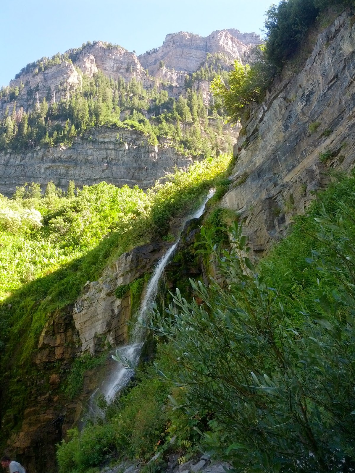
Right below our camp was this waterfall fed by the stream running out of Emerald Lake.
Waterfall below Emerald Lake
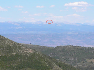
Along the way down, it was neat to look out toward the Uintas and see the peak we hope to bag in a couple of weeks: Mount Agassiz.

Mount Agassiz
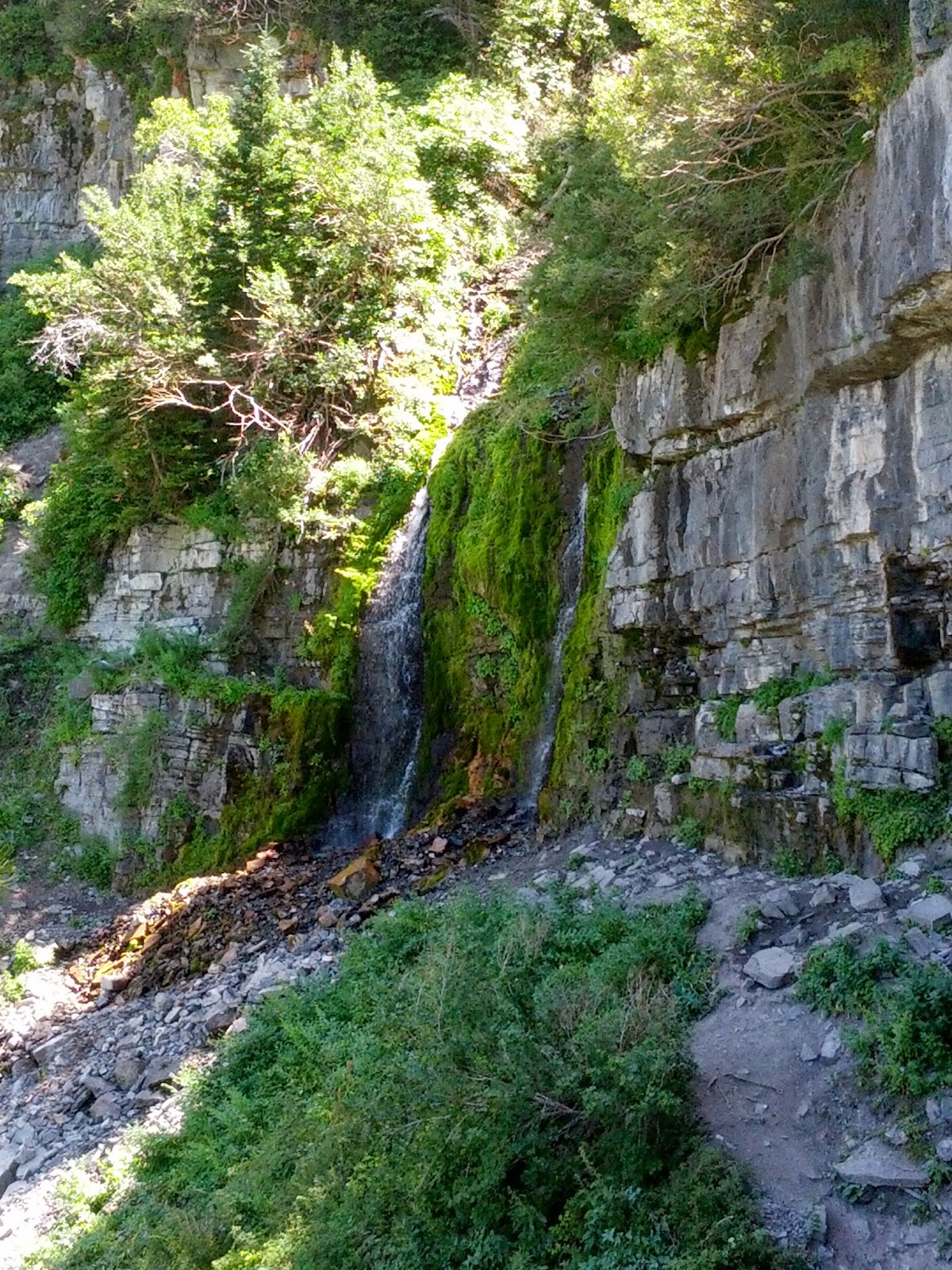
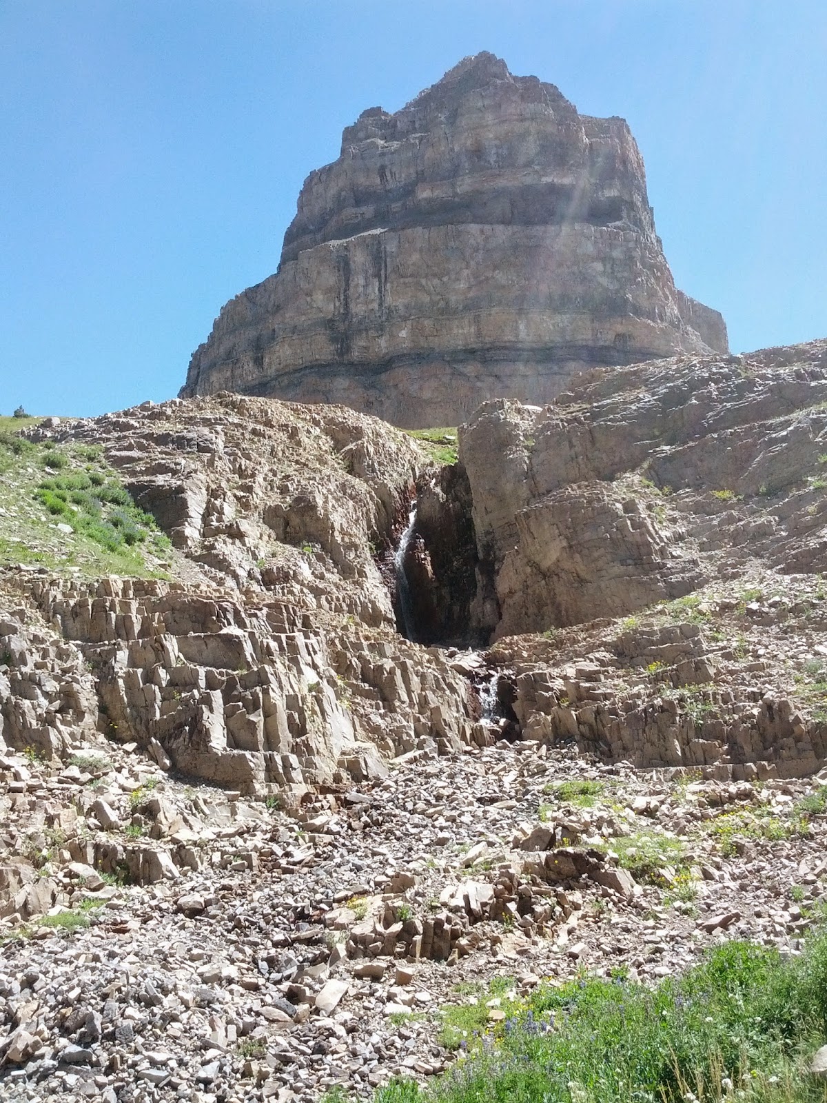
The rest of the hike down the Timpanogos trail to the Aspen Grove trailhead turned out to be a bit disappointing from what I was hoping for. While the view down was still great, nearly all of the upper washes were dry. Had it been a year with average to above average snowfall, there probably would have been trickling waterfalls at every other switchback on the way down. Not only was there a lack of waterfalls, the trail was a lot rockier and uneven than I remember from when I ran down much of it in high school. This made for very sore feet in addition to sore shoulders for the latter half of the hike down. It wasn't until further down the cirque that we passed some reliable waterfalls. Most were fed be trickling streams and then there was the grandest of them all as pictured below.
Waterfall along Timpanogos Trail above Aspen Grove
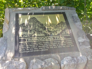
At last, we reached the border of the wilderness area and knew that the Aspen Grove Trailhead was now very near. For my wife, this meant a welcome restroom break, and for both of us, a place to top off our water-bottles with cold tap water and some Gatorade mix, not to mention packs off of our shoulders.
Timpanogos Wilderness Boundary

Timpanogos Trail Plaque
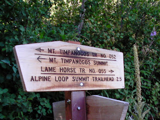
At this point we had decided not only to take a break at the Aspen Grove trailhead, but also for Jess to wait at the trailhead there with our packs while I hiked solo the additional three or so miles back to the Summit trailhead to pick up the car. We figured we could make better time if I hiked pack-less back to the car. So with a freshly filled bottle of Gatorade, a trekking pole (for some kind of personal defense), and a change from boots to sandals on my feet, I was on my way up Lame Horse Trail (#55).
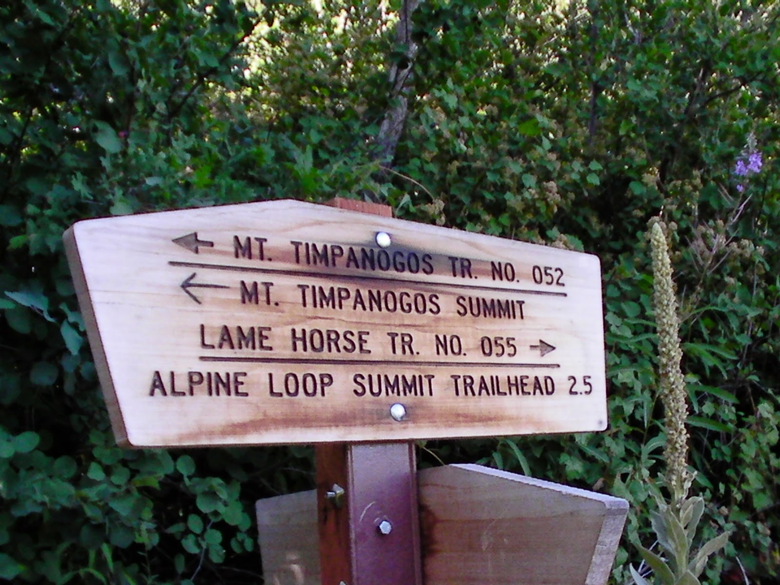
Trail Junction for Lame Horse and Timpanogos
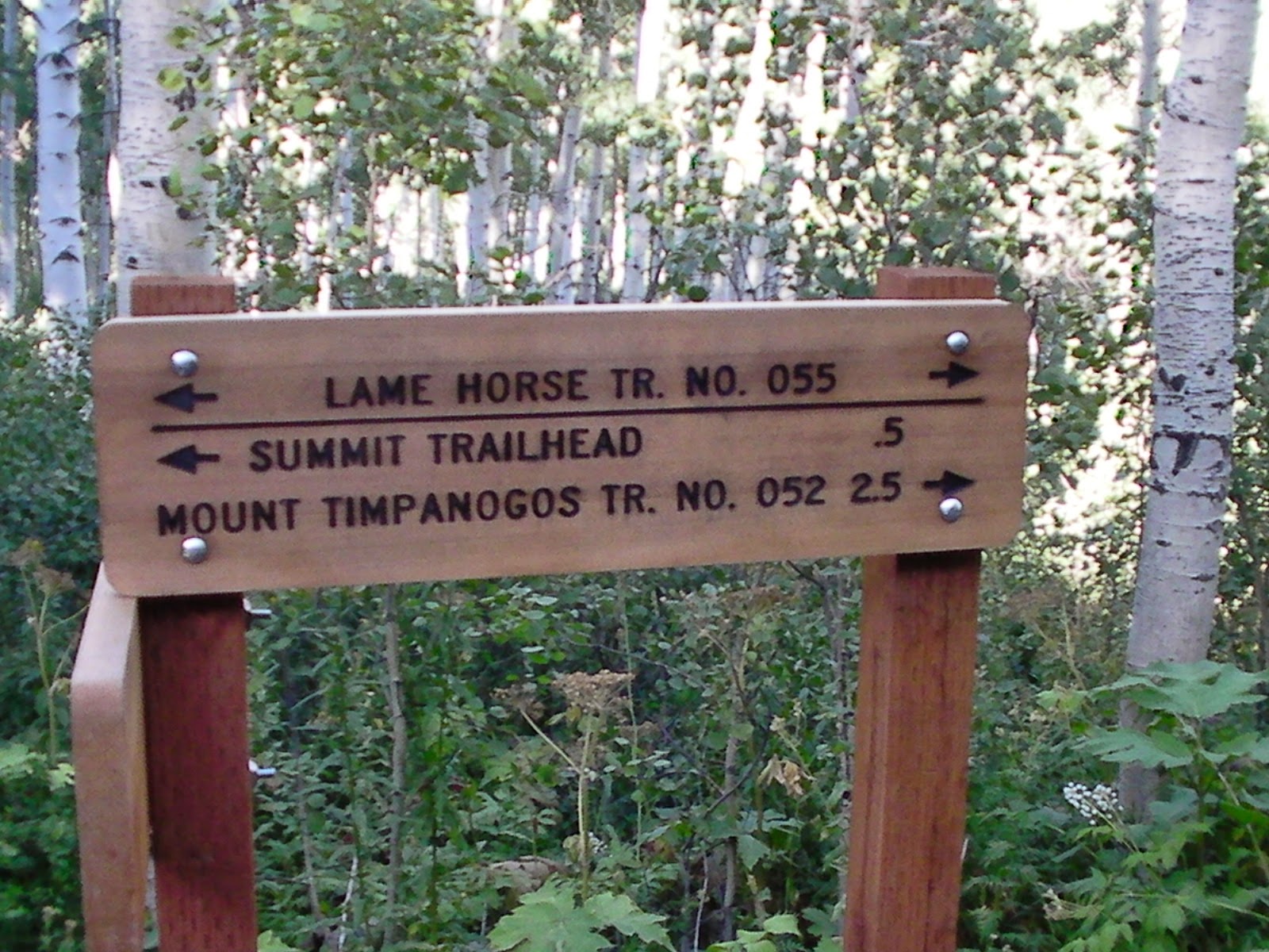
Half a mile to go
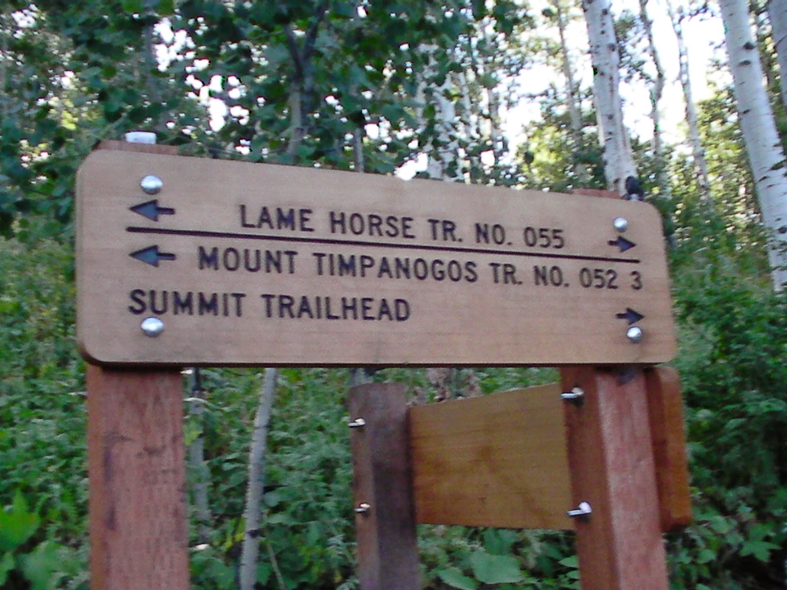
So close to Summit, there's no distance posted
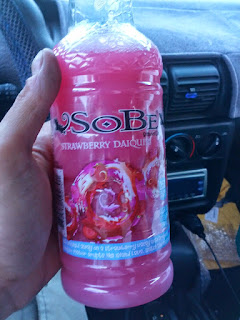
Finally, I was there. The loop was complete and into my car I went. Upon driving down and picking up Jessica and our packs, we popped open our little cooler and busted out some post-hike drinks – Sobes. Not quite as cold as we had hoped for, but still refreshing nonetheless.

Mmmm
Here's a brief video highlighting the trip...
And finally, here's a map showing the routes we took...
View larger map.
Featured image for home page:
