Scott Chandler
Wildness is a necessity- John Muir
- Joined
- Jan 4, 2014
- Messages
- 1,099
"What the heck am I doing?! This is ridiculous! This is AMAZING!"
I'm not sure if this actually escaped my mouth halfway up the mountain, I may have been gasping too hard, but it is a phrase that sticks out in my head. It was essentially the mantra of this entire adventure.
________
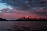
Mt Katolinat dominates the view east from Brooks Camp. It's very impressive, towering 4700' seemingly straight up from Naknek Lake. It also seems unattainable, distant, wild. So when a group was forming to summit the monster and I was invited I quickly jumped on board. Literally, I jumped onto a boat.
In order to maximize off time, we set off in the early afternoon to camp out on a small island near the head of Naknek Lake. Again, island. Brooks Camp is an amazing place in itself but to get away you have to jump through some different hoops. Like jumping into a tiny boat on the fourth largest lake in Alaska. Yeah, it's pretty surreal. As you boat away from camp it literally feels like you're leaving everything behind. After a while on the water we spotted our shelter and settled in for the evening. What an evening! Good company and an epic sunset.
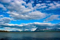
The view east from Spruce Island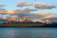
Mt Ikigluik, a different view from that seen at the VTTS
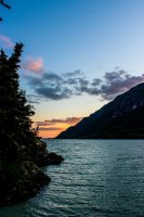
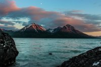
Glow on Mt Katolinat
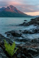
The next morning dawned glorious. Excitedly we broke down camp and hopped into the boat... and within minutes were socked into dense fog. Whoops. We proceeded to spend a couple hours sitting in the boat waiting for the fog to thin enough for us to cross the lake. Without sight of the mountain we would have no idea where we were. It's not like we were following a trail or anything. An exclamation happens, the shadow of a peak has appeared. Off we scoot across the lake!
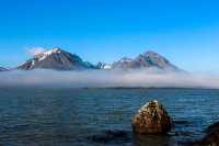
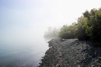
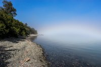
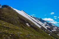
Reaching the other side of the lake, it's off through the brush we go! Grass brushes the face. Alders have to be rounded. A rushing creek is crossed. Swarms of whitesocks, bloodsucking devil spawns that bit me so much to make me resemble The Hunchback of Notre Dame or Phantom of the Opera, are unrelenting. Steadily up we go. We're beelining for "The Cheeks," a posterior resembling ridge that offers the easiest slope up the mountain. I shudder to think what harder would be like. The final bit up would have been vertical had it gotten any steeper.
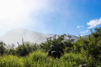
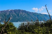
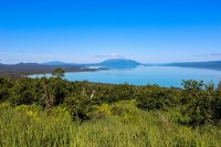
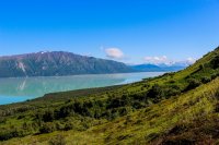
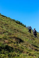
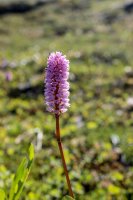
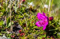
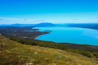
Briefly rested, we continue up. The world really does fall away sometimes. The monumentalness of this whole adventure continually cycles through my head. Remote only scratches the surface of how out there we are. When a visitor center could sit right on the lake and a trail could switchback up this mountain, that will NEVER happen because WE have chosen to leave this wild as designated wilderness. This is entirely our experience. This is the Final Frontier, Alaska at its finest.
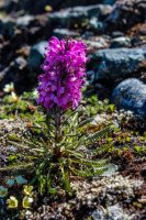
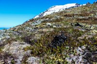
Yep, bear scat. They're everywhere!!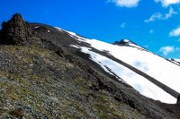
Eventually we hit the top of the ridge. A massive valley extends below us and the peak finally seems nearby. The easiest walking of the trek is upon us.
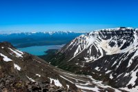
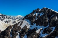
Mt Katolinat's Summit and Mt Grggs. 4700' vs 7600'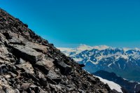
Snow Bunting (on left rocks) and Mt Martin
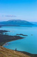
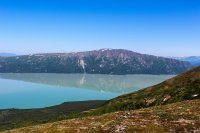
Reaching the top is surreal. The countryside is amazingly vast. Naknek Lake stretches out below, still so vast that we can't see all of it. In the distance is Brooks Camp. To the east is the Valley of 10,000 Smokes, seemingly small up here. Volcanoes dominate the skyline. I'm not sure if I've been on a summit that has felt bigger. I'm sure they are out there, but I haven't been on their tops.
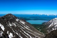
View North, the island we camped on is visible.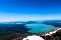
View west. Naknek Lake sprawling below. Lake Brooks and Dumpling Mountain out there a ways. Margot Creek close.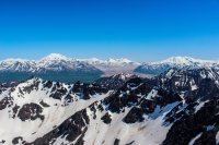
View east. The Valley of 10,000 Smokes looks small up here.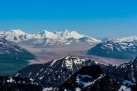
Close up of the VTTS. The eruption at Novarupta came from between the brown hills (Baked and Broken Mtns) and the white peaks behind them (Trident Volcano). Kodiak Island is visible through Katmai Pass (right of Trident)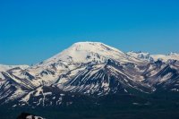
Mt Griggs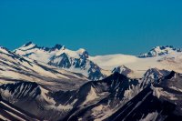
Collapsed Mt Katmai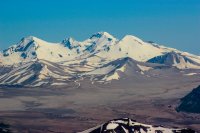
Closeup of the eruption area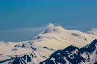
Mt Martin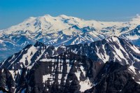
Mountain layers all the way to Mt Magiek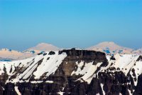
Two volcanoes to the north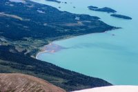
Margot Creek mixing with Naknek Lake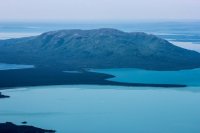
Close up of Brooks Camp
I'm not sure if I've ever felt more wild.
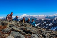
I'm not sure if this actually escaped my mouth halfway up the mountain, I may have been gasping too hard, but it is a phrase that sticks out in my head. It was essentially the mantra of this entire adventure.
________

Mt Katolinat dominates the view east from Brooks Camp. It's very impressive, towering 4700' seemingly straight up from Naknek Lake. It also seems unattainable, distant, wild. So when a group was forming to summit the monster and I was invited I quickly jumped on board. Literally, I jumped onto a boat.
In order to maximize off time, we set off in the early afternoon to camp out on a small island near the head of Naknek Lake. Again, island. Brooks Camp is an amazing place in itself but to get away you have to jump through some different hoops. Like jumping into a tiny boat on the fourth largest lake in Alaska. Yeah, it's pretty surreal. As you boat away from camp it literally feels like you're leaving everything behind. After a while on the water we spotted our shelter and settled in for the evening. What an evening! Good company and an epic sunset.

The view east from Spruce Island

Mt Ikigluik, a different view from that seen at the VTTS


Glow on Mt Katolinat

The next morning dawned glorious. Excitedly we broke down camp and hopped into the boat... and within minutes were socked into dense fog. Whoops. We proceeded to spend a couple hours sitting in the boat waiting for the fog to thin enough for us to cross the lake. Without sight of the mountain we would have no idea where we were. It's not like we were following a trail or anything. An exclamation happens, the shadow of a peak has appeared. Off we scoot across the lake!


Reaching the other side of the lake, it's off through the brush we go! Grass brushes the face. Alders have to be rounded. A rushing creek is crossed. Swarms of whitesocks, bloodsucking devil spawns that bit me so much to make me resemble The Hunchback of Notre Dame or Phantom of the Opera, are unrelenting. Steadily up we go. We're beelining for "The Cheeks," a posterior resembling ridge that offers the easiest slope up the mountain. I shudder to think what harder would be like. The final bit up would have been vertical had it gotten any steeper.


Briefly rested, we continue up. The world really does fall away sometimes. The monumentalness of this whole adventure continually cycles through my head. Remote only scratches the surface of how out there we are. When a visitor center could sit right on the lake and a trail could switchback up this mountain, that will NEVER happen because WE have chosen to leave this wild as designated wilderness. This is entirely our experience. This is the Final Frontier, Alaska at its finest.


Yep, bear scat. They're everywhere!!

Eventually we hit the top of the ridge. A massive valley extends below us and the peak finally seems nearby. The easiest walking of the trek is upon us.


Mt Katolinat's Summit and Mt Grggs. 4700' vs 7600'

Snow Bunting (on left rocks) and Mt Martin
Reaching the top is surreal. The countryside is amazingly vast. Naknek Lake stretches out below, still so vast that we can't see all of it. In the distance is Brooks Camp. To the east is the Valley of 10,000 Smokes, seemingly small up here. Volcanoes dominate the skyline. I'm not sure if I've been on a summit that has felt bigger. I'm sure they are out there, but I haven't been on their tops.

View North, the island we camped on is visible.

View west. Naknek Lake sprawling below. Lake Brooks and Dumpling Mountain out there a ways. Margot Creek close.

View east. The Valley of 10,000 Smokes looks small up here.

Close up of the VTTS. The eruption at Novarupta came from between the brown hills (Baked and Broken Mtns) and the white peaks behind them (Trident Volcano). Kodiak Island is visible through Katmai Pass (right of Trident)

Mt Griggs

Collapsed Mt Katmai

Closeup of the eruption area

Mt Martin

Mountain layers all the way to Mt Magiek

Two volcanoes to the north

Margot Creek mixing with Naknek Lake

Close up of Brooks Camp
I'm not sure if I've ever felt more wild.

