- Joined
- Aug 9, 2007
- Messages
- 12,949
After two trips in a row of soggy wet weather, I was stoked to see the extended forecast showed nothing but sunshine and warm weather for our planned early June jaunt to Glen Canyon. This trip it was Audra and I along with our friend Jen and her friend Stefanie from Germany that she had met while traveling in Mongolia last year. For Stefanie this would be the last adventure after a full year of exploring the planet before heading home to Germany.
But if I've learned anything from the spring of 2015, expect rain. With just a few days left before our trip, the forecast went from totally clear to totally rainy. A couple of decaying tropical storms were set to send a plume of moisture right into the Colorado Plateau. While I enjoyed the last two rainy trips and all the cool flooding and waterfalls, this was a definite downer. Our plan was to do some serious hiking, and this was not gelling with that at all. We were so close to just canceling. But at the same time, our boat had been in at a canvas shop for the last two weeks getting a custom enclosure sewn so that we could weather just this kind of thing. In fact, it wouldn't be done until the day we originally intended to leave. How could we go to all that trouble and expense to rain-proof the boat and then turn away at the sight of a shitty forecast? The trip would go on!
We arrived on Thursday afternoon and launched out of Bullfrog. The drive down lake was pleasant and the weather was hot and sunny. It was a bit late in the day to find a good campsite, and sure enough, they were pretty much all full in Iceberg Canyon. We found a spot out on the main channel but I was worried about the impending storms so we decided to take one that wouldn't usually be one we'd take. It was a fine beach, but we had neighbors across the channel and down aways in a houseboat. We beached and went for a swim and thought about wether or not we should stay there. I'm used to having it all to myself out there, usually no one else in sight, much less people within earshot. But eventually we decided to settle in. It was a great beach right at the head of one of the forks of Iceberg that we intended to hike. It also seemed to be a great, safe place to be when the storms came.
The view down channel from camp on the first night, our neighbors in the distance.
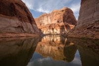
The first night was nice, but some big wind moved in just after dark. We put up the new enclosure for the first time that night, knowing that the rain may start overnight. Might as well get it up now before the storms start. And sure enough, it started raining around the time we went to bed. I slept on the boat that night. It was still so hot and muggy out that having the enclosure on was not ideal.
The next morning we woke to sunny skies but that quickly deteriorated into the first of many storms we would experience over the next couple of days. The champagne and orange juice quickly came out and we sat and watched waterfalls come down the canyon walls in the comfort of our little floating living room.
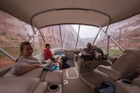
Nothing huge, but a good introduction of the sights to come.
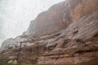
But then it cleared out and the sun was shining.
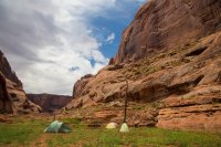
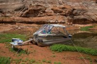
Our new enclosure from the outside. It's like a greenhouse when the sun comes out, but so good when it's cold or rainy.
With the sun out, the talk of a hike began. But first, a paddle. Audra was going to stick around and watch the old dog and the boat. I wasn't sure if Jen, Stef and I could all fit in the Sea Eagle, but sure enough...
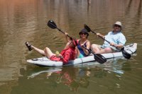
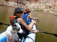
With cocktails in hand, we set out to explore the upper forks of Iceberg by kayak. I decided to leave Sage in camp because the boat was already so full, but as we paddled up the next fork, we looked over to see what looked like a beaver swimming across the lake. Nope! That's Sage!! I would have put her in her life jacket if I'd known she was coming, but hey. She was happy to join us and we were happy to have her. Beautiful paddling weather. I left my camera in camp but Jen passed her waterproof camera around during the paddle and let me use some pics, some of which I actually took.
The third fork we explored was one of our intended hikes. This fork has a natural rockfall dam that creates a lake behind it. Like Lake Powell but tiny and NATURAL!
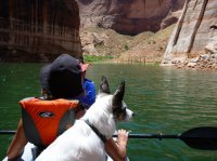
Looking up the rockfall dam. So many cottonwoods in upper Iceberg. I would love to see what this canyon looked like before the dam.
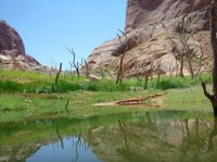
Stef and I walking up through the thick vegetation on the rockfall dam. There were so many little streams braided down through the slope. For those who end up here, stay on the wall to the left when looking up canyon. The rest is a mess.
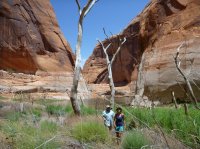
Grasses and wetlands and lots of toads were found along the slope of the rockfall dam.
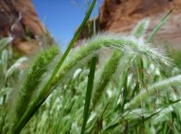
I didn't really intend on hiking when we started the paddle, but eventually we made it to the top of the rockfall dam and had a nice view of the lake that formed behind it. It was a good place to finally finish the cocktail I'd been sipping in the boat!
We discussed bringing the kayak up here after the storms passed to access the rest of the canyon, but cairns indicated a possible route to the left and Kelsey's book confirmed it.
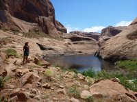
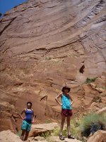
Stef and Jen standing below the wall that the rockfall came from. Judging by the varnish, it's been quite some time since this happened. Nothing like the freshly exposed rock in the Mystery Canyon rockfall that happened in the 70's.
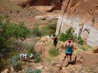
Hiking back down to the kayak.
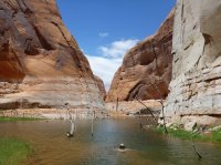
And of course I had to cool off before the paddle back.
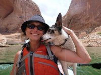
Sage being a super cute kayaking dog with Stef.
As we paddled back to camp, the weather went from beautiful to bad almost instantly. We paddled hard into the wind and got back to the boat just in time to pile in before the next storm hit. But when this one hit, the wind came with a vengeance. I'd guess at the very least it was packing 60mph wind gusts, if not more. It pushed so much water up into our camp that the boat was no longer beached and it was quickly getting pushed sideways. I turned on the engine and tried to pin it onto the shore. Meanwhile, it picked up our camp table and stove and sent it flying into the air. It was chaos. Jen was outside picking up the stuff that went flying while Stef and Audra frantically tried to zip up open panels on the enclosure while I just kept the boat pinned to the beach with the throttle. I must have gotten a little carried away, because we ended up with probably 3/4 of the boat out of the water and on the beach. This won't mean much to most of you, but the captain's chair on my boat was sitting above dry ground. That's WAY beached! I was pretty nervous about getting it back off and into the water, but at least we weren't going anywhere and I knew the lake was on the rise and we had a good shovel.
Meanwhile, our tents were taking a beating. Jen's bent over and flattened out and Stef's ended up with a broken pole. Our Base Camp 4 held up great but ended up with bent poles that we didn't notice. In retrospect it probably would have been fine if we'd just guyed it out.
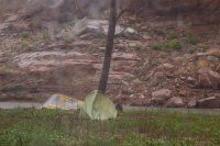
And of course this storm came with more waterfalls. There's Sage in her favorite spot as the sun breaks with waterfalls pouring in the distance.
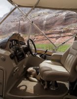
After the storm, we headed out on a cruise to see the remnant waterfalls. The ones near our camp would turn off about as quick as the rain stopped, while many of the others nearby would go for hours.
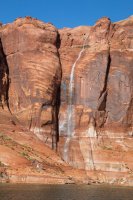
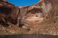
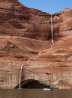
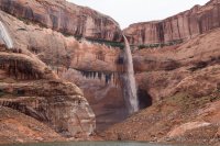
It was still a bit cold and rainy out and the enclosure made life so nice.
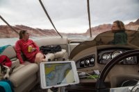
A short clip while cruising back to camp. I shot this for some other folks to show how the enclosure performed, but it seems good to add here as well.
The next day was the day we expected the worst weather. I woke up around 6am to the sound of violent splashing in the water. I looked around and accounted for all but one dog, but she was in the tent with Audra. What the hell is that sound?! Back to sleep.
Splish splash thrash kaploosh! Something hits the side of the boat. I crawl out of bed to see a fish thrashing in the submerged foliage next to the boat. And another across the channel. And another up lake. Could it be a striper school has found it's way into the top of the canyon and they are having breakfast on a school of shad?! I quickly climb out to the back of the boat and grab a fishing rod. I was expecting no less than to reel in a giant striped bass there in my skivvies, but no go. Cast again, and again. What the hell. Nothing.
I put on some clothes and walk the shore for a while trying to catch a fish while they thrash about all around me. I've never seen anything like this. But then one flops out right in front of me and I got a good look at it. Carp. Dammit! I'm still not sure what exactly they were eating. We speculated maybe the freshly submerged plants and maybe they were fighting for them. I don't know, but it was pretty crazy to watch.
I put the pole away and went back to sleep for an hour or so. When the others woke up, they told me they thought I was out swimming, splashing around in the lake, and were rather annoyed by it. Ha!
We ate breakfast and had coffee as our neighbors threw lines and left, although not without some troubles with their stuck houseboat. And then stuck again after unsticking it. I was about to head over to help when they finally got out of there. We would have the cove to ourselves after that.
The storm was coming, but the sun was shining, might as well get in a little hike before it hits, so Stef, Jen, Sage and I loaded into the kayak and paddled a few hundred yards to the end of the lake. Just as we got there, the clouds moved in and started spitting on us. This shot is looking back at our camp from the end of the lake.
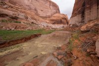
Walking up canyon with a little sprinkle coming down.
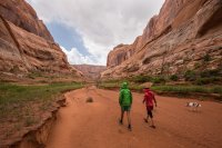
Pooled up flood waters in a little slot.
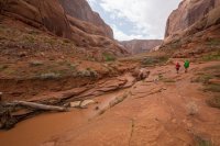
The rain got a bit stronger so we hid in this little arch/alcove for a bit.
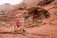
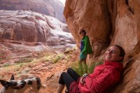
And almost as quick as it started, it stopped. The rocks and soil were soaked and the sun came out to bake them dry. The humidity and heat was stifling as we continued up canyon.
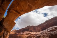
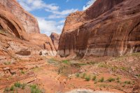
Looking back down toward camp.
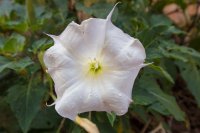
Some interesting steps cut into the rock right near the high water mark of the lake. They looked too big to be moqui steps, and they went to nowhere.
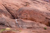
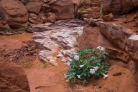
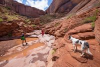
There are two alcoves at the top of this canyon. They both have curious names from what I've found. From the source I read from, this one is known as Doug's Sound Cave due to it's crazy echoes (very crazy, BTW) and the next is known as Doug's Cathedral. Maybe Doug was a great guy who did great things, but I'm not that inclined to keep those names going. So I'll call this the Iceberg Sound Cave until someone tells me who Doug is and why he deserves his name on this stuff. It turns out the sound cave is really damn hard to get to. Springs are abundant up here and the overgrowth is too. We tried a few ways and got shut out by dense vegetation and a steep drop into the watercourse. After hiking back down, we figured we might be able to get up around high on the left, but by this time we decided to just go for the Cathedral and do this if we had enough time afterward.
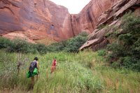
The approach to the Iceberg Cathedral was much more pleasant than it was to the Sound Cave.
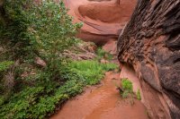
Stef and Jen enter the Iceberg Cathedral. This is getting interesting.
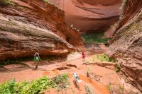
After passing through a little corridor, we found ourselves in a very unique and fascinating place. It's so hard to capture in photographs, but it was a circular bowl with a nearly flat stone floor. Water seeped in from all around and smashed boulders littered the floor where the ephemeral waterfall would normally land. The walls were upward of 500-700 feet high.
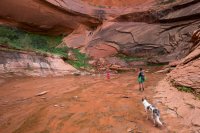
A vertical panorama of the cathedral.
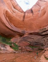
Near the top of the cathedral is a flat-ish rock formation that looks almost like an altar. I sat on it and took in the sights. Photos cannot begin to capture what a unique place this is.
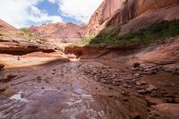
A cool breeze swirled into the cathedral and the sun went away. Jen said we should get back. By the time we made it back out to the main canyon, we were looking at a vicious storm on the horizon. This was not good. We still had a good little hike ahead of us. I hiked as fast as my gimpy knee could take me, which was surprisingly fast! I knew we could hide out form a storm along the way, but I also knew Audra was down there with the boat by herself. I didn't want to be separated if things got crazy.
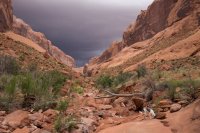
It rained a bit as we hustled through the bottom of the canyon, then back into the kayak and back to camp. Just in time for another storm to hit. Back in the shelter of the boat, we mixed up some mimosas and made lunch and watched the waterfalls come down. Audra had been listening to the weather radio before we got there and had heard reports of golf ball sized hail near Escalante. We found out later that a tornado had actually touched down in San Juan county not that far from where we were. That does not happen out here!
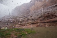
The rain got stronger and stronger and soon the hail came. I had bad visions of golf ball sized hail shredding the canvas to pieces on the boat, but thankfully it was all quite small. But then we unzipped a bit of the enclosure to take some photos and saw this. A brown plume of water ripping down the side of the canyon and major flood rapids heading right toward us. No more pleasant little waterfalls, this shit was getting real.
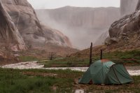
The lake had nearly 300 yards before it ended. I didn't think we were in any danger. But as the water pushed past the boat and swirled behind it, I started getting worried. We watched as a giant tree branch swirled around behind the boat. It's girthy trunk appeared to have been snapped by a giant.
The rain was letting up so we hopped out of the boat to take a look. We evaluated the situation and decided that we should be safe where we are. The current was hitting the opposite side of the canyon and we were protected in the eddy. We could still have left at that point, but we chose to stay.
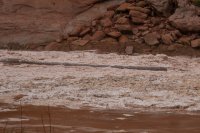
And then we realized that white stuff wasn't just foam. That's hail!! A raging river of it! Satisfied with our decision to stay put, my mind shifted into awe of what was happening in front of us. A river of literal ice and mud was raging at our feet. Almost encircling us. What the hell is going on here!?
Looking up into the Iceberg Sound Cave and a massive waterfall pouring off. I would LOVE to see what the Cathedral looked like right now.
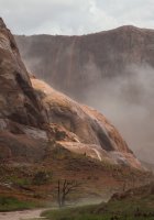
The icebergs start to form behind the boat.
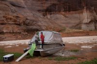
And more icebergs flow in. The speed of the flood got bigger and bigger and my mind was completely blown. Thoughts of the water overtaking our beach came to mind. We even thought about moving tents, but what's the point in that at this point? We had high ground if we needed it. Tents aren't that important. And I figured if the water did breach the beach, there's no way it could come across as fast as it is in the main channel. I hoped.
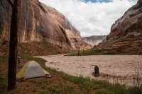
I admired this old beaver-chewed stump before the storm, but even more so now that a torrent of ice was curling up around it.
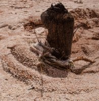

And then the sun came out. I don't know how many times I screamed obscenities during this event, but it was a lot. A whole lot. Mind blown doesn't even come close to explaining how I felt in this moment.
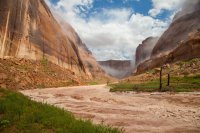
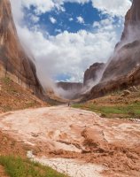
Back on the other side of the beach. The flow had pushed the water level down and beached the boat way more than it was to begin with. I was busy on the other side, but the ladies told me later that a ton of carp ended up on the shore next to the boat as the flood came in. They must have just been running for their lives. They said you could have just picked them up.
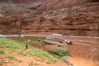
All of those trillions of pieces of hail compiled into the lake and formed a giant, impenetrable field of icebergs. IN ICEBERG EFFING CANYON! ?!?!? !!!!!! !?!?!? ??????
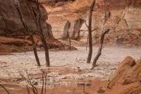
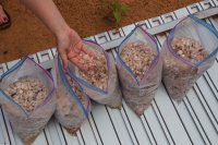
Earlier in the day we'd realized our frozen water jugs were not holding up like they should. Usually they keep the coolers cold for a week in summer temps, but we had only frozen them for 2 days. We thought we might have to head up to Halls Crossing for ice, but mother nature delivered us a limitless supply. We bagged it up and used it to keep our food and drink cold for the rest of the trip.
And here is my video of the footage that I already posted in this thread. There are more photos of the flooding in that thread for those that didn't already see them.
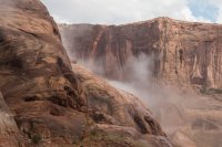
Soon the flow slowed down and we started to relax. The waterfalls still raged in the alcoves above.
Our neighbors in the next canyon over were brave enough to get through the ice. It wasn't nearly as dense out in the main channel. They got through but the boat behind them got stuck. We saw him out there for at least an hour shoveling ice out of the way with what looked like a wakeboard.
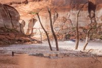
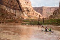
Jen and Stef paddling up the lake where the flood was raging just a few hours earlier. Waterfall still going in the distance.
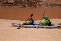
The ice had turned a bit brown, but it was still dense as the day ended. No getting out of here that night.
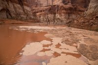
The weather cleared and we finally had a starry night. It was tough getting out of camp that morning. The ice was gone but there were trees and debris in abundance. Soon enough we were on our way for a long day of hiking and exploring and thankfully, no more storms!
We stopped in Bowns to see our old waterfall flowing once again.
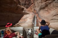
And then to the Cathedral in The Desert where we dropped off Jen and Steff to hike up canyon. There was a huge pile of debris floating in the cathedral that they had to swim through, then climb up the waterfall.
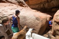
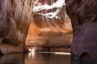
Crazy patterns in the water while we fished and waited for them.
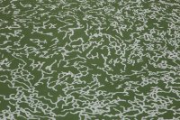
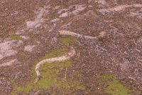
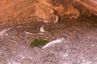
When we went to go get them, some other folks had gone in and pushed all the debris right into the waterfall with their engines. They also had a bunch of kids clogging up the route so we encouraged Jen and Stef to just jump in so we could get out of there. Jen pointed out the abundance of prickly pear cactus floating in the debris field and refused to jump until we cleared them a hole. Fair enough. They both jumped and climbed into the boat just as we saw something moving right where they had just climbed out. A rattle snake, and one of the largest I've ever seen on the Colorado Plateau. And it was pissed. We stuck a pole down by it and it bit the hell out of it. It had gotten swept into the lake with the flood and was stuck in the debris pile. A half dozen kids had just swam right past this guy. We pointed it out to their people waiting in boats, so hopefully they avoided it.
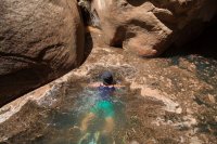
Jen and Stef were cold from trying to climb a waterfall further up Clear Creek, so we found a nice beach and took a lunch break. After all the rain, it was so good to just marinate in the pool and soak in the sun.
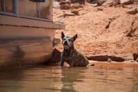
Sage pondering the age old question of stick or ball.
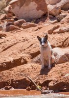
Next up we took a quick drive into Davis Gulch. Last month I wanted to hike to La Gorce Arch but there were 3 boats parked at the top of the canyon. This month I was able to boat right up to it. Good to see it, finally.
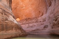
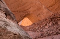
Next we went back to the main channel and then south to see Hole-in-the-Rock. After that, we went up to Bowns and Long Canyon. We'd been taking our sweet time getting back because we hoped to pick up @slc_dan at the head of Long Canyon that evening. At the very last minute, he decided to set out on a solo trip across the top of the Waterpocket Fold, relying on us to pick him up there in Long Canyon. Perhaps that night, perhaps the next day (when we headed home). I really wanted to get him that night so he could come back to camp and have beer and good food to end his trip, so we milked every bit of time we could. After checking for him once, we dropped off Jen and Stef and they hiked up into Bowns Canyon. There they are on the rim.
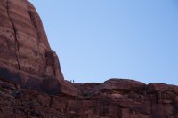
Meanwhile Audra and I fished and drifted around admiring the late evening light on the canyon walls.
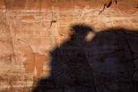
As the day winded down, Jen and Stef made it back to the boat and we decided to take one last drive up to the top of Long to check for Dan before we went back to camp. As we rounded the corner, there he was. I knew he had sent out a Spot message that morning from WAY far away, so I was honestly pretty shocked that he had made it that far. We got him and Maya on the boat and raced back to camp as the Wingate walls of the Rincon took on a purple glow.
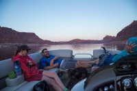
Getting back into camp was tricky. More trees and debris had settled in and I had to jump in and push some out of the way. After that it was a fantastic night out on the boat drinking and talking about Dan's wild adventure and our own. I still could hardly believe the river of ice that had come through the day before, and most of all that all of us were happy and safe after experiencing such a thing. Dan's trip sounded every bit as epic. He basically knocked out 45-50 miles in the span of 2 days and change through extraordinarily difficult terrain. He's out exploring Iceland right now, but we're all in for a treat when he posts that trip report. As for me, I'm ready for some dry weather.
If you'd like to see the full set of photos from this trip: https://goo.gl/photos/gd5hrJJAFSAhvN586
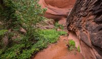
Featured image for home page:
But if I've learned anything from the spring of 2015, expect rain. With just a few days left before our trip, the forecast went from totally clear to totally rainy. A couple of decaying tropical storms were set to send a plume of moisture right into the Colorado Plateau. While I enjoyed the last two rainy trips and all the cool flooding and waterfalls, this was a definite downer. Our plan was to do some serious hiking, and this was not gelling with that at all. We were so close to just canceling. But at the same time, our boat had been in at a canvas shop for the last two weeks getting a custom enclosure sewn so that we could weather just this kind of thing. In fact, it wouldn't be done until the day we originally intended to leave. How could we go to all that trouble and expense to rain-proof the boat and then turn away at the sight of a shitty forecast? The trip would go on!
We arrived on Thursday afternoon and launched out of Bullfrog. The drive down lake was pleasant and the weather was hot and sunny. It was a bit late in the day to find a good campsite, and sure enough, they were pretty much all full in Iceberg Canyon. We found a spot out on the main channel but I was worried about the impending storms so we decided to take one that wouldn't usually be one we'd take. It was a fine beach, but we had neighbors across the channel and down aways in a houseboat. We beached and went for a swim and thought about wether or not we should stay there. I'm used to having it all to myself out there, usually no one else in sight, much less people within earshot. But eventually we decided to settle in. It was a great beach right at the head of one of the forks of Iceberg that we intended to hike. It also seemed to be a great, safe place to be when the storms came.
The view down channel from camp on the first night, our neighbors in the distance.

The first night was nice, but some big wind moved in just after dark. We put up the new enclosure for the first time that night, knowing that the rain may start overnight. Might as well get it up now before the storms start. And sure enough, it started raining around the time we went to bed. I slept on the boat that night. It was still so hot and muggy out that having the enclosure on was not ideal.
The next morning we woke to sunny skies but that quickly deteriorated into the first of many storms we would experience over the next couple of days. The champagne and orange juice quickly came out and we sat and watched waterfalls come down the canyon walls in the comfort of our little floating living room.

Nothing huge, but a good introduction of the sights to come.

But then it cleared out and the sun was shining.

Our new enclosure from the outside. It's like a greenhouse when the sun comes out, but so good when it's cold or rainy.

With the sun out, the talk of a hike began. But first, a paddle. Audra was going to stick around and watch the old dog and the boat. I wasn't sure if Jen, Stef and I could all fit in the Sea Eagle, but sure enough...

With cocktails in hand, we set out to explore the upper forks of Iceberg by kayak. I decided to leave Sage in camp because the boat was already so full, but as we paddled up the next fork, we looked over to see what looked like a beaver swimming across the lake. Nope! That's Sage!! I would have put her in her life jacket if I'd known she was coming, but hey. She was happy to join us and we were happy to have her. Beautiful paddling weather. I left my camera in camp but Jen passed her waterproof camera around during the paddle and let me use some pics, some of which I actually took.

The third fork we explored was one of our intended hikes. This fork has a natural rockfall dam that creates a lake behind it. Like Lake Powell but tiny and NATURAL!

Looking up the rockfall dam. So many cottonwoods in upper Iceberg. I would love to see what this canyon looked like before the dam.

Stef and I walking up through the thick vegetation on the rockfall dam. There were so many little streams braided down through the slope. For those who end up here, stay on the wall to the left when looking up canyon. The rest is a mess.

Grasses and wetlands and lots of toads were found along the slope of the rockfall dam.

I didn't really intend on hiking when we started the paddle, but eventually we made it to the top of the rockfall dam and had a nice view of the lake that formed behind it. It was a good place to finally finish the cocktail I'd been sipping in the boat!
We discussed bringing the kayak up here after the storms passed to access the rest of the canyon, but cairns indicated a possible route to the left and Kelsey's book confirmed it.

Stef and Jen standing below the wall that the rockfall came from. Judging by the varnish, it's been quite some time since this happened. Nothing like the freshly exposed rock in the Mystery Canyon rockfall that happened in the 70's.

Hiking back down to the kayak.

And of course I had to cool off before the paddle back.

Sage being a super cute kayaking dog with Stef.

As we paddled back to camp, the weather went from beautiful to bad almost instantly. We paddled hard into the wind and got back to the boat just in time to pile in before the next storm hit. But when this one hit, the wind came with a vengeance. I'd guess at the very least it was packing 60mph wind gusts, if not more. It pushed so much water up into our camp that the boat was no longer beached and it was quickly getting pushed sideways. I turned on the engine and tried to pin it onto the shore. Meanwhile, it picked up our camp table and stove and sent it flying into the air. It was chaos. Jen was outside picking up the stuff that went flying while Stef and Audra frantically tried to zip up open panels on the enclosure while I just kept the boat pinned to the beach with the throttle. I must have gotten a little carried away, because we ended up with probably 3/4 of the boat out of the water and on the beach. This won't mean much to most of you, but the captain's chair on my boat was sitting above dry ground. That's WAY beached! I was pretty nervous about getting it back off and into the water, but at least we weren't going anywhere and I knew the lake was on the rise and we had a good shovel.
Meanwhile, our tents were taking a beating. Jen's bent over and flattened out and Stef's ended up with a broken pole. Our Base Camp 4 held up great but ended up with bent poles that we didn't notice. In retrospect it probably would have been fine if we'd just guyed it out.

And of course this storm came with more waterfalls. There's Sage in her favorite spot as the sun breaks with waterfalls pouring in the distance.

After the storm, we headed out on a cruise to see the remnant waterfalls. The ones near our camp would turn off about as quick as the rain stopped, while many of the others nearby would go for hours.


It was still a bit cold and rainy out and the enclosure made life so nice.

A short clip while cruising back to camp. I shot this for some other folks to show how the enclosure performed, but it seems good to add here as well.
The next day was the day we expected the worst weather. I woke up around 6am to the sound of violent splashing in the water. I looked around and accounted for all but one dog, but she was in the tent with Audra. What the hell is that sound?! Back to sleep.
Splish splash thrash kaploosh! Something hits the side of the boat. I crawl out of bed to see a fish thrashing in the submerged foliage next to the boat. And another across the channel. And another up lake. Could it be a striper school has found it's way into the top of the canyon and they are having breakfast on a school of shad?! I quickly climb out to the back of the boat and grab a fishing rod. I was expecting no less than to reel in a giant striped bass there in my skivvies, but no go. Cast again, and again. What the hell. Nothing.
I put on some clothes and walk the shore for a while trying to catch a fish while they thrash about all around me. I've never seen anything like this. But then one flops out right in front of me and I got a good look at it. Carp. Dammit! I'm still not sure what exactly they were eating. We speculated maybe the freshly submerged plants and maybe they were fighting for them. I don't know, but it was pretty crazy to watch.
I put the pole away and went back to sleep for an hour or so. When the others woke up, they told me they thought I was out swimming, splashing around in the lake, and were rather annoyed by it. Ha!
We ate breakfast and had coffee as our neighbors threw lines and left, although not without some troubles with their stuck houseboat. And then stuck again after unsticking it. I was about to head over to help when they finally got out of there. We would have the cove to ourselves after that.
The storm was coming, but the sun was shining, might as well get in a little hike before it hits, so Stef, Jen, Sage and I loaded into the kayak and paddled a few hundred yards to the end of the lake. Just as we got there, the clouds moved in and started spitting on us. This shot is looking back at our camp from the end of the lake.

Walking up canyon with a little sprinkle coming down.

Pooled up flood waters in a little slot.

The rain got a bit stronger so we hid in this little arch/alcove for a bit.


And almost as quick as it started, it stopped. The rocks and soil were soaked and the sun came out to bake them dry. The humidity and heat was stifling as we continued up canyon.

Looking back down toward camp.


Some interesting steps cut into the rock right near the high water mark of the lake. They looked too big to be moqui steps, and they went to nowhere.


There are two alcoves at the top of this canyon. They both have curious names from what I've found. From the source I read from, this one is known as Doug's Sound Cave due to it's crazy echoes (very crazy, BTW) and the next is known as Doug's Cathedral. Maybe Doug was a great guy who did great things, but I'm not that inclined to keep those names going. So I'll call this the Iceberg Sound Cave until someone tells me who Doug is and why he deserves his name on this stuff. It turns out the sound cave is really damn hard to get to. Springs are abundant up here and the overgrowth is too. We tried a few ways and got shut out by dense vegetation and a steep drop into the watercourse. After hiking back down, we figured we might be able to get up around high on the left, but by this time we decided to just go for the Cathedral and do this if we had enough time afterward.

The approach to the Iceberg Cathedral was much more pleasant than it was to the Sound Cave.

Stef and Jen enter the Iceberg Cathedral. This is getting interesting.

After passing through a little corridor, we found ourselves in a very unique and fascinating place. It's so hard to capture in photographs, but it was a circular bowl with a nearly flat stone floor. Water seeped in from all around and smashed boulders littered the floor where the ephemeral waterfall would normally land. The walls were upward of 500-700 feet high.

A vertical panorama of the cathedral.

Near the top of the cathedral is a flat-ish rock formation that looks almost like an altar. I sat on it and took in the sights. Photos cannot begin to capture what a unique place this is.

A cool breeze swirled into the cathedral and the sun went away. Jen said we should get back. By the time we made it back out to the main canyon, we were looking at a vicious storm on the horizon. This was not good. We still had a good little hike ahead of us. I hiked as fast as my gimpy knee could take me, which was surprisingly fast! I knew we could hide out form a storm along the way, but I also knew Audra was down there with the boat by herself. I didn't want to be separated if things got crazy.

It rained a bit as we hustled through the bottom of the canyon, then back into the kayak and back to camp. Just in time for another storm to hit. Back in the shelter of the boat, we mixed up some mimosas and made lunch and watched the waterfalls come down. Audra had been listening to the weather radio before we got there and had heard reports of golf ball sized hail near Escalante. We found out later that a tornado had actually touched down in San Juan county not that far from where we were. That does not happen out here!

The rain got stronger and stronger and soon the hail came. I had bad visions of golf ball sized hail shredding the canvas to pieces on the boat, but thankfully it was all quite small. But then we unzipped a bit of the enclosure to take some photos and saw this. A brown plume of water ripping down the side of the canyon and major flood rapids heading right toward us. No more pleasant little waterfalls, this shit was getting real.

The lake had nearly 300 yards before it ended. I didn't think we were in any danger. But as the water pushed past the boat and swirled behind it, I started getting worried. We watched as a giant tree branch swirled around behind the boat. It's girthy trunk appeared to have been snapped by a giant.
The rain was letting up so we hopped out of the boat to take a look. We evaluated the situation and decided that we should be safe where we are. The current was hitting the opposite side of the canyon and we were protected in the eddy. We could still have left at that point, but we chose to stay.
And then we realized that white stuff wasn't just foam. That's hail!! A raging river of it! Satisfied with our decision to stay put, my mind shifted into awe of what was happening in front of us. A river of literal ice and mud was raging at our feet. Almost encircling us. What the hell is going on here!?

Looking up into the Iceberg Sound Cave and a massive waterfall pouring off. I would LOVE to see what the Cathedral looked like right now.

The icebergs start to form behind the boat.

And more icebergs flow in. The speed of the flood got bigger and bigger and my mind was completely blown. Thoughts of the water overtaking our beach came to mind. We even thought about moving tents, but what's the point in that at this point? We had high ground if we needed it. Tents aren't that important. And I figured if the water did breach the beach, there's no way it could come across as fast as it is in the main channel. I hoped.

I admired this old beaver-chewed stump before the storm, but even more so now that a torrent of ice was curling up around it.

And then the sun came out. I don't know how many times I screamed obscenities during this event, but it was a lot. A whole lot. Mind blown doesn't even come close to explaining how I felt in this moment.


Back on the other side of the beach. The flow had pushed the water level down and beached the boat way more than it was to begin with. I was busy on the other side, but the ladies told me later that a ton of carp ended up on the shore next to the boat as the flood came in. They must have just been running for their lives. They said you could have just picked them up.

All of those trillions of pieces of hail compiled into the lake and formed a giant, impenetrable field of icebergs. IN ICEBERG EFFING CANYON! ?!?!? !!!!!! !?!?!? ??????

Earlier in the day we'd realized our frozen water jugs were not holding up like they should. Usually they keep the coolers cold for a week in summer temps, but we had only frozen them for 2 days. We thought we might have to head up to Halls Crossing for ice, but mother nature delivered us a limitless supply. We bagged it up and used it to keep our food and drink cold for the rest of the trip.

And here is my video of the footage that I already posted in this thread. There are more photos of the flooding in that thread for those that didn't already see them.
Soon the flow slowed down and we started to relax. The waterfalls still raged in the alcoves above.

Our neighbors in the next canyon over were brave enough to get through the ice. It wasn't nearly as dense out in the main channel. They got through but the boat behind them got stuck. We saw him out there for at least an hour shoveling ice out of the way with what looked like a wakeboard.

Jen and Stef paddling up the lake where the flood was raging just a few hours earlier. Waterfall still going in the distance.


The ice had turned a bit brown, but it was still dense as the day ended. No getting out of here that night.

The weather cleared and we finally had a starry night. It was tough getting out of camp that morning. The ice was gone but there were trees and debris in abundance. Soon enough we were on our way for a long day of hiking and exploring and thankfully, no more storms!
We stopped in Bowns to see our old waterfall flowing once again.

And then to the Cathedral in The Desert where we dropped off Jen and Steff to hike up canyon. There was a huge pile of debris floating in the cathedral that they had to swim through, then climb up the waterfall.


Crazy patterns in the water while we fished and waited for them.

When we went to go get them, some other folks had gone in and pushed all the debris right into the waterfall with their engines. They also had a bunch of kids clogging up the route so we encouraged Jen and Stef to just jump in so we could get out of there. Jen pointed out the abundance of prickly pear cactus floating in the debris field and refused to jump until we cleared them a hole. Fair enough. They both jumped and climbed into the boat just as we saw something moving right where they had just climbed out. A rattle snake, and one of the largest I've ever seen on the Colorado Plateau. And it was pissed. We stuck a pole down by it and it bit the hell out of it. It had gotten swept into the lake with the flood and was stuck in the debris pile. A half dozen kids had just swam right past this guy. We pointed it out to their people waiting in boats, so hopefully they avoided it.


Jen and Stef were cold from trying to climb a waterfall further up Clear Creek, so we found a nice beach and took a lunch break. After all the rain, it was so good to just marinate in the pool and soak in the sun.

Sage pondering the age old question of stick or ball.

Next up we took a quick drive into Davis Gulch. Last month I wanted to hike to La Gorce Arch but there were 3 boats parked at the top of the canyon. This month I was able to boat right up to it. Good to see it, finally.


Next we went back to the main channel and then south to see Hole-in-the-Rock. After that, we went up to Bowns and Long Canyon. We'd been taking our sweet time getting back because we hoped to pick up @slc_dan at the head of Long Canyon that evening. At the very last minute, he decided to set out on a solo trip across the top of the Waterpocket Fold, relying on us to pick him up there in Long Canyon. Perhaps that night, perhaps the next day (when we headed home). I really wanted to get him that night so he could come back to camp and have beer and good food to end his trip, so we milked every bit of time we could. After checking for him once, we dropped off Jen and Stef and they hiked up into Bowns Canyon. There they are on the rim.

Meanwhile Audra and I fished and drifted around admiring the late evening light on the canyon walls.

As the day winded down, Jen and Stef made it back to the boat and we decided to take one last drive up to the top of Long to check for Dan before we went back to camp. As we rounded the corner, there he was. I knew he had sent out a Spot message that morning from WAY far away, so I was honestly pretty shocked that he had made it that far. We got him and Maya on the boat and raced back to camp as the Wingate walls of the Rincon took on a purple glow.
Getting back into camp was tricky. More trees and debris had settled in and I had to jump in and push some out of the way. After that it was a fantastic night out on the boat drinking and talking about Dan's wild adventure and our own. I still could hardly believe the river of ice that had come through the day before, and most of all that all of us were happy and safe after experiencing such a thing. Dan's trip sounded every bit as epic. He basically knocked out 45-50 miles in the span of 2 days and change through extraordinarily difficult terrain. He's out exploring Iceland right now, but we're all in for a treat when he posts that trip report. As for me, I'm ready for some dry weather.

If you'd like to see the full set of photos from this trip: https://goo.gl/photos/gd5hrJJAFSAhvN586
Featured image for home page:

