John Fowler
Member
- Joined
- Jan 17, 2012
- Messages
- 217
Brother Jim and his partner Walter flew out for a week of immersion in the southwestern backcountry. I drove out from Placitas, NM, to meet them in Vegas on Oct. 10. The idea was to see as much as we could in the time allotted. They had a rental car and I drove my home-away-from-home ’03 Tundra because I was going to hang around for a few days after they left.
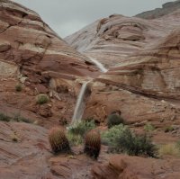
The weather didn’t seem to be cooperating. The forecast was for two days of sometimes hard rain. I stood by the motel window in North Las Vegas and watched the hail come down. Nevertheless, early the next morning we drove out to Valley of FIre State Park. The sky was mostly clear until we got there; then the clouds began moving in. I had two extra ponchos for the guys, so they put those on and we descended on the rocks and formations trying to get in some photo ops before serious rain came. By the time we got to the Fire Wave it had been raining for a while, and we were treated to the sight of a waterfall running off the western side of the formation.
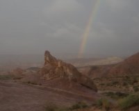
Later in the afternoon, the sun came through for a little rainbow before the rain began again. We drove on to St. George for the night.
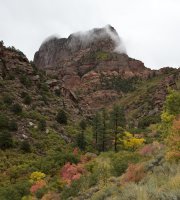
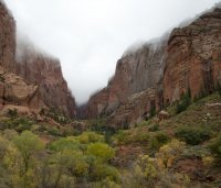
The next morning we drove up to the northwest corner of Zion, intending to take the trail out to Double Arch Alcove. Checking with the ranger at the visitor center, we learned that the trail would be very muddy. So we revised our plan and just drove along the scenic route to the end. We did get some nice shots of the clouds drooping over the canyons, with some fall color below.
After that, we entered the main part of Zion and took the shuttle out to the Narrows and back. Then we continued on to Page for the night.
The next morning, as the weather was improving, we drove up to Big Water for the five-mile (one-way) hike up to the Wahweap Hoodoos. Near the trailhead we met a local guy on his dune buggy who told us that it would be muddy. “Get your wellies on”, he said. I had to ask Jim what a wellie was. He told me it was a contraction for “Wellington”, which is a kind of mud boot. Well, we didn’t have any wellies but we continued on. We crossed the creek maybe 10 times and were able to avoid most of the mud. At one point I tried to jump over the creek, which was about five feet across, and my foot slipped on the far edge. I went down hard on my left forearm, which became swollen and turned purple over the next few days. But there never was any pain, and the bruising has almost gone. My mind, as they say, is writing checks my body can’t cash.
There are three groups of hoodoos, and the best are in the last group. We were late in the year for the best light; after summer, the sun is too low in the sky and most of the hoodoos are in shadow. But we did get a good shot or two.
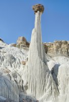
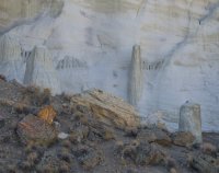
The following morning we drove over to Horseshoe Bend and took a few shots. Then we got our permits for Waterholes Canyon. This was my first time there. In spite of the previous rain, the canyon floor was mostly dry with only a few pools of water to circumnavigate. We came upon a handmade sign saying that the ladder was broken and we should turn around. A bit later we came to a 10-foot climb with only the lower half of a ladder to assist. Jim climbed up and pulled himself to the top, and Walter and I followed. We continued on until we came to a big puddle. A couple who had passed us earlier was returning and they said that we would soon encounter a difficult obstacle, so we decided to turn around at that point.
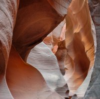
Our next destination was White Pocket, where we would camp for two nights. It was late in the afternoon, and I really wanted to get out there before dark. On the way down House Rock Valley road, near the state line, Jim got a flat tire. There was a half-inch gash right through the tread. I had a can of Fix-a-Flat, so we tried that but it didn’t seal the leak. As Jim and Walter put on the spare, several cars came by and all of them stopped to assist. We told them that we were doing OK.
By the time the tire was installed, the sun was near the horizon. We turned at Lone Tree Reservoir, which was full of water, and we got to White Pocket in time to put the tent up with the last rays of twilight. The next two mornings we were up before sunrise for the good light. I was hoping for some standing water for reflection shots, but on the front side I couldn’t find much. Jim told me that he had found some nice pools on the back side. The formations aren’t quite as colorful there, but we took some photos anyway.
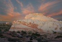
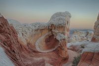
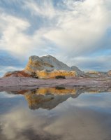
This was Jim and Walter’s first trip to White Pocket. I’ve been there five times now and have gotten quite used to the roads. I was a little worried about Jim in the rental vehicle (Ford Expedition) with no spare tire, but he did fine and we had no problems. During the day we drove over to Cottonwood Cove, where I had a permit for the three of us. Then we drove back to White Pocket for the second night of camping. As we were preparing to leave for the cove, a convoy of about 10 four-wheelers drove up. They were all from Montana. We saw lots of folks on dune buggy type four-wheelers out there. Mostly they just seem to drive around.
This was the guys’ first time at Coyote Buttes South and I showed them the highlights. The next morning it was time for them to leave and I followed them out to the pavement. Then I headed to Page for a night in a motel.
The following morning I drove up to the White Rocks north of Church Wells and hiked over to the east in the direction of Sidestep Canyon. It’s about two and a half miles one-way, and not difficult. I didn’t spend much time there. Coming in from the west, I reached Sidestep at the narrow point where the western part of Sidestep almost meets the eastern part of White Rocks canyon. I didn’t spend much time there.
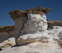
Next I drove up to Cottonwood Canyon to check on the fall colors.
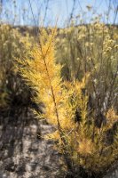
My final destination for the next three days was Coyote Buttes South. I spent the first night in the parking area at Paw Hole. I walked out to the northwest for a sunset shot.
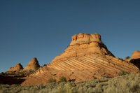
Here’s a twilight shot where I used my flashlight to illuminate the formations.
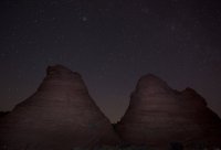
The next morning, I hiked around the Paw Hole area before driving out to Cottonwood Cove for the next two days and nights. I parked down the road near the Chess Queen formation. It is past the sign that warns about deep sand, so not many vehicles come down that far. I only saw one the whole time I was there. And it came along while I was drying off after my Sun Shower. I don’t know if they noticed me or not.
The next couple of days I was out for the good light times and was not disappointed. Here’s a sunset photo.
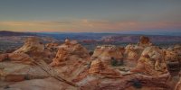
And here’s the sunrise the next morning.
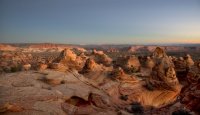
I have to give credit to Laurent Martres for showing this location in his excellent book, “Photographing the Southwest, vol. 2”.
The fantastic layers and folds in the rocks at Coyote Buttes cannot be seen properly without the depth perception of binocular vision. Here’s a stereo pair that illustrates this. It’s a “crossed-eyed” version, meaning that you have to cross your eyes so that the right eye sees the left image and vice-versa.

After doing my sunrise shoot on the last morning, Oct. 20, I packed up the truck and headed home. It was a very rewarding 11-day trip, one that I won’t soon forget.
Featured image for home page:
The weather didn’t seem to be cooperating. The forecast was for two days of sometimes hard rain. I stood by the motel window in North Las Vegas and watched the hail come down. Nevertheless, early the next morning we drove out to Valley of FIre State Park. The sky was mostly clear until we got there; then the clouds began moving in. I had two extra ponchos for the guys, so they put those on and we descended on the rocks and formations trying to get in some photo ops before serious rain came. By the time we got to the Fire Wave it had been raining for a while, and we were treated to the sight of a waterfall running off the western side of the formation.

Later in the afternoon, the sun came through for a little rainbow before the rain began again. We drove on to St. George for the night.

The next morning we drove up to the northwest corner of Zion, intending to take the trail out to Double Arch Alcove. Checking with the ranger at the visitor center, we learned that the trail would be very muddy. So we revised our plan and just drove along the scenic route to the end. We did get some nice shots of the clouds drooping over the canyons, with some fall color below.


After that, we entered the main part of Zion and took the shuttle out to the Narrows and back. Then we continued on to Page for the night.
The next morning, as the weather was improving, we drove up to Big Water for the five-mile (one-way) hike up to the Wahweap Hoodoos. Near the trailhead we met a local guy on his dune buggy who told us that it would be muddy. “Get your wellies on”, he said. I had to ask Jim what a wellie was. He told me it was a contraction for “Wellington”, which is a kind of mud boot. Well, we didn’t have any wellies but we continued on. We crossed the creek maybe 10 times and were able to avoid most of the mud. At one point I tried to jump over the creek, which was about five feet across, and my foot slipped on the far edge. I went down hard on my left forearm, which became swollen and turned purple over the next few days. But there never was any pain, and the bruising has almost gone. My mind, as they say, is writing checks my body can’t cash.
There are three groups of hoodoos, and the best are in the last group. We were late in the year for the best light; after summer, the sun is too low in the sky and most of the hoodoos are in shadow. But we did get a good shot or two.


The following morning we drove over to Horseshoe Bend and took a few shots. Then we got our permits for Waterholes Canyon. This was my first time there. In spite of the previous rain, the canyon floor was mostly dry with only a few pools of water to circumnavigate. We came upon a handmade sign saying that the ladder was broken and we should turn around. A bit later we came to a 10-foot climb with only the lower half of a ladder to assist. Jim climbed up and pulled himself to the top, and Walter and I followed. We continued on until we came to a big puddle. A couple who had passed us earlier was returning and they said that we would soon encounter a difficult obstacle, so we decided to turn around at that point.

Our next destination was White Pocket, where we would camp for two nights. It was late in the afternoon, and I really wanted to get out there before dark. On the way down House Rock Valley road, near the state line, Jim got a flat tire. There was a half-inch gash right through the tread. I had a can of Fix-a-Flat, so we tried that but it didn’t seal the leak. As Jim and Walter put on the spare, several cars came by and all of them stopped to assist. We told them that we were doing OK.
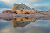
By the time the tire was installed, the sun was near the horizon. We turned at Lone Tree Reservoir, which was full of water, and we got to White Pocket in time to put the tent up with the last rays of twilight. The next two mornings we were up before sunrise for the good light. I was hoping for some standing water for reflection shots, but on the front side I couldn’t find much. Jim told me that he had found some nice pools on the back side. The formations aren’t quite as colorful there, but we took some photos anyway.


This was Jim and Walter’s first trip to White Pocket. I’ve been there five times now and have gotten quite used to the roads. I was a little worried about Jim in the rental vehicle (Ford Expedition) with no spare tire, but he did fine and we had no problems. During the day we drove over to Cottonwood Cove, where I had a permit for the three of us. Then we drove back to White Pocket for the second night of camping. As we were preparing to leave for the cove, a convoy of about 10 four-wheelers drove up. They were all from Montana. We saw lots of folks on dune buggy type four-wheelers out there. Mostly they just seem to drive around.
This was the guys’ first time at Coyote Buttes South and I showed them the highlights. The next morning it was time for them to leave and I followed them out to the pavement. Then I headed to Page for a night in a motel.
The following morning I drove up to the White Rocks north of Church Wells and hiked over to the east in the direction of Sidestep Canyon. It’s about two and a half miles one-way, and not difficult. I didn’t spend much time there. Coming in from the west, I reached Sidestep at the narrow point where the western part of Sidestep almost meets the eastern part of White Rocks canyon. I didn’t spend much time there.

Next I drove up to Cottonwood Canyon to check on the fall colors.

My final destination for the next three days was Coyote Buttes South. I spent the first night in the parking area at Paw Hole. I walked out to the northwest for a sunset shot.

Here’s a twilight shot where I used my flashlight to illuminate the formations.

The next morning, I hiked around the Paw Hole area before driving out to Cottonwood Cove for the next two days and nights. I parked down the road near the Chess Queen formation. It is past the sign that warns about deep sand, so not many vehicles come down that far. I only saw one the whole time I was there. And it came along while I was drying off after my Sun Shower. I don’t know if they noticed me or not.
The next couple of days I was out for the good light times and was not disappointed. Here’s a sunset photo.

And here’s the sunrise the next morning.

I have to give credit to Laurent Martres for showing this location in his excellent book, “Photographing the Southwest, vol. 2”.
The fantastic layers and folds in the rocks at Coyote Buttes cannot be seen properly without the depth perception of binocular vision. Here’s a stereo pair that illustrates this. It’s a “crossed-eyed” version, meaning that you have to cross your eyes so that the right eye sees the left image and vice-versa.

After doing my sunrise shoot on the last morning, Oct. 20, I packed up the truck and headed home. It was a very rewarding 11-day trip, one that I won’t soon forget.
Featured image for home page:

