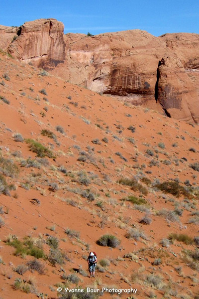
Coyote Gulch Route?

here is a shot halfway up the dune.

i-mtD6FHQ-L.jpg


Edit: Nick was a tick faster than I with posting a shot :)
 
And this of course was the hardest part for me. I didn't fit through the crack so I had to climb up that fin. Easy to get on to and not too hard to cross the top of, but lots of exposure. Lots of people would not be okay with having to do that, but most regular people should fit through the crack.

5076830611_0a59e76910_b.jpg
 
Ask and you shall receive. Thanks you guys you are amazing. I think this will help to alleviate my history of death marches.:devil:
 
So funny... I just went digging for a pic of the crack -- but now I see Nick beat me to it.

I was also going to add that if anyone in your group was extremely claustrophobic or had a fairly big frame -- it might be a small challenge.

You are a brave one Nick for climbing that. When I was leaving once there was a group RAPPING off the top of the crack. More for fun than necessity I believe, though one in the group was a fairly big fella.

- Jamal
 
=
You are a brave one Nick for climbing that. When I was leaving once there was a group RAPPING off the top of the crack. More for fun than necessity I believe, though one in the group was a fairly big fella.


When the choice is go over and have cold beer in 2 miles or turn around and hike back 20 some odd miles, it's not too scary.

Some more detailed shots of climbing over it.

Me standing at the top of the fairly easy climb up onto it:
5077424258_927de042ce_b.jpg


And then one of me crossing over the scary exposed part.Now that I have a lot of stemming and squeezing experience, I might just choose to wedge into the top of that slot try to get through that way, avoiding the exposure. Might have been too tight for that though.
5077425492_b837941d3e_b.jpg
 
We floated the Escalante and used the Crack route to haul everything out. I also used the fin so that I could just wear my backpack rather than drag it up the rock with a rope. Probably not for everyone, but it's not bad.
 
Maybe you guys would do better up the dune, but it's pretty strenuous. Personally I wouldn't want to exit that way again. Though I'm sure that the heat really compounded matters. Granted it was June 1st, but we woke up at 5:00 a.m. and still didn't manage to beat the sun by the time we started up the dune.
 
Great stuff you guys. Nice shot of the crack Jammer.:twothumbs:
I think we can avoid your fin climb Nick. I don't want to hear anyone scream for mommy!:eek:
Yvonne, I needed a shot like yours, showing that the hike is traversed and not straight up the sand.:twothumbs:
Video of the Crack, ashergrey. Now that takes some patience!! Really nice job!
Thanks! I think I have enuf to give the few worried about this access, something to chew on.
 
I am 6'4" and 220 lbs. I fit through the crack with no problems.
 
This is some awesome Info. I hiked CG with my Scout troop when I was 11, and again when I was 12 with my family of 6.

I'm thinking about starting at the crack, head up Steven's Canyon, and exiting out Coyote Gulch might be a very nice trip.
 
One thing that might should be mentioned in this thread. For those that don't mind a bit of exposure. There is another exit/entrance near the infamous Hamblin Arch exit that exits the canyon to the north. If you're combining this with something like Steven's Canyon or other areas north of Coyote, it can make for a good route back to Forty Mile Ridge. The north Hamblin route just follows the top of the arch right down to the canyon bottom. I have not attempted it, but I've seen some photos and it looks like just a few spots of class 4/5 that could be a serious problem for most groups. I'll see if I can't find the link to that a bit later.
 
I had one other question. You guys mentioned that a pit toilet had burned down. There was no such thing when I first went thru. Are there a series of these things thru out the canyon, from Hurricane Wash to Escalante River? Just curious.
 
There were two of them. One of the nicest pit toilets I've ever used. This is the one that burnt down, just down stream from Lobo Arch. The other one is in the lower 1/3 of the canyon and should still be there.

5077358252_0ce8fd4667_b.jpg
 
thanks for the shots Ericephoto,

I think I will definitely exit that route in October, it looks less steep than a few descends I've done so far.
Maybe not suitable for everyone but for me it seems absolutely okay.
For comparison, I descended via this crack the past weekend and had absolutely no problems. It was something between class III and IV, steep, but absolutely doable.

i-DmmnCr5-L.jpg
 
Unfortunately most of my crew would be uncomfortable doing either route. We'll be sticking to more traditional walking and slight scrambling routes.
I love seeing some of the different ways people come into and out of this canyon. No mistakes on either with a big backpack. "Fo" "sho"!!
 
thanks for the shots Ericephoto,

I think I will definitely exit that route in October, it looks less steep than a few descends I've done so far.
Maybe not suitable for everyone but for me it seems absolutely okay.
For comparison, I descended via this crack the past weekend and had absolutely no problems. It was something between class III and IV, steep, but absolutely doable.

Even a moderate class 3 descent can look vertical from straight ahead. And that photo looking down at the bathroom is not at all representative of what it actually is. The Hamblin route is a solid class 4 but that's not the bad part from what I understand. It's the exposure. There might be decent hand holds and such, but if the penalty points are critical injury or death, that might up the pucker factor (but not the rating). I look forward to trying the Hamblin route myself sometime, especially with this reputation it has developed. And I love hearing back from others what they thought about it. I haven't heard many (any?) people say good things about it though. Definitely something to be approached with a great deal of humility and a plan B.
 
Similar threads
Thread starter Title Forum Replies Date
RyanP Coyote Gulch to Halls Creek via Steven's Canyon and the Baker Route (car/key swap) Meet Up (Members Only) 8
Janice Coyote Gulch Plus... Trip Planning 21
XID_AZ Coyote Gulch Northish Side Canyons Trip Planning 0
A Coyote Gulch crowds? Trip Planning 0
C Coyote Gulch via Chimney rock trail Trip Planning 0
J Trip first week of April 2021 Southern UT/Anywhere AZ - Death Hollow, Coyote Gulch, or other suggestions? Trip Planning 9
D Coyote Gulch to Lake Powell Trip Planning 8
D Coyote Gulch additional parking Trip Planning 3
RyanP Coyote Gulch to Halls Creek via Stevens Canyon Trip Planning 28
F Coyote Gulch via Dry Fork? Trip Planning 2
Jon Carbaugh A Leisurely Stroll Through Coyote Gulch Backpacking 11
DrNed Coyote Gulch Pit Toilet Trip Planning 14
Mikjik86 Backpacking Coyote Gulch, 3 Days, 2 Nights- October 2018 Backpacking 2
cjhaines Coyote Gulch Trailhead Trip Planning 2
Stephanie Quick trip to Coyote Gulch via Red Well Trip Planning 4
C New Member - Coyote Gulch Solo Trip Noobs: Introduce yourself! 8
Devin Ashby Coyote Gulch Loop Starting From Water Tanks Trip Planning 4
Eric_LV Hiker Coyote Gulch trip May 20-23 Trip Planning 16
Nick New Waste Disposal Requirements for Coyote Gulch Visitors General Discussion 11
J Big Escalante Backpack Loop: Stevens/Fold/Bobway/Coyote Gulch April 25-30, 2015 Backpacking 8
mike54704 Backpacking in Coyote Gulch the first week of March Trip Planning 26
slc_dan Too Good for the Cinema Thread-Andrew Bird in Coyote Gulch! General Discussion 3
steve Coyote Gulch Backpacking 10
natylka Backpacking: Hurricane Wash into Coyote Gulch of 26 miles back in May Backpacking 3
IntrepidXJ Coyote Gulch Backpacking 18
BrendanLB Coyote gulch via 40 mile ridge road Trip Planning 17
DrNed Coyote Gulch April 10-12 Backpacking 27
DrNed Springs in Coyote Gulch Trip Planning 2
DrNed Map for Coyote Gulch Trip Planning 6
Tater Head Coyote Gulch... Trip Planning 11
Bob Coyote Gulch Resource Discussions 0
M Coyote Gulch next week and footwear recommendations? Trip Planning 1
Howells Outdoors Coyote Gulch Backpacking 15
powderglut Return To Coyote Gulch Backpacking 7
Aldaron Coyote Gulch Backpacking 4
NAYR Coyote Gulch Backpacking 7
Dave Coyote Gulch, March 22-24 2013 Backpacking 22
Ericephoto Coyote Gulch via Jacob Hamblin Arch trail and Crack in the Wall Backpacking 11
Nick Coyote Gulch Pit Toilet Destroyed? General Discussion 32
J Coyote Gulch btw 22 and 27 May - anyone wanna share a ride? Trip Planning 0
Bill Coyote Gulch Conditions 7.2012 Trip Planning 0
Nurrgle Backpacker's America's Best Camp Sites - Coyote Gulch General Discussion 7
wes242 First time to Coyote Gulch Backpacking 4
Tyler Coyote Gulch, Escalante Utah - 5 year anniversary backpacking trip Backpacking 6
Yvonne Invite Coyote Gulch Meet Up (Members Only) 49
gloo Coyote Gulch Trip Planning 20
Nick Coyote Gulch Loop Backpacking 20
SteveR Coyote Buttes South- New Daily Permit Process Trip Planning 8
S Driving to poverty flats (South Coyote Buttes) on AWD Trip Planning 11
Janice Vermillion Cliffs Trip - Part 2 - White Pocket & Coyote Buttes South Hiking & Camping 7

Similar threads

Back
Top