- Joined
- Aug 9, 2007
- Messages
- 12,949
January 2012
After spending New Years Eve at The White Pocket, we raced over to Cottonwood Cove for a day of exploring the Coyote Buttes South permit area. Coyote Buttes South(CBS) is famous mostly because it's neighbor to the north, Coyote Buttes North(CBN), the home of the famous Wave formation. People come from all over the world, planning entire vacations around the incredibly rare opportunity to hike to The Wave in Coyote Buttes North. Meanwhile, Coyote Buttes South gets hardly any love in comparison.
The permit system in place for both areas limit human traffic to no more than 20 people per day. For Coyote Buttes North, 10 of those permits are awarded through the online lottery system while the other 10 are allocated for walk-in customers the prior day, most often through a lottery with most people walking away dissapointed. It took me years of failed lottery applications before I finally won my first permits to CBN last December. And for the prime months, the chances are even more dismal. I did a research paper last year on the subject and with the limited amount of data the BLM would supply, I was able to ascertain that the chances of winning a permit in a month like May is in the range of 2-6%, at best.
Coyote Buttes South on the other hand is relatively easy to get a permit for. There is no online lottery system, just choose your dates up to 4 months ahead of time from the online calendar system or pickup in person at the BLM's Kanab Field office or Paria Contact Station, depending on time of year.
The popularity and iconic nature of The Wave is likely the predominant reason that permits to CBS are so much easier to come by, but not the only one. A limiting factor for many is that the two key trailheads for Coyote Buttes South, Cottonwood Cove and Paw Hole, are both accessed through the network of roads on the Paria Plateau west of House Rock Valley. An area infamous for it's deep, soft sand that has been known to trap it's fair share of capable 4WD vehicles. If the sand is wet, it's pretty easy, but if it's hot and dry, all bets are off. Heading out there without a good 4WD vehicle, an experienced driver and recovery tools such as a winch, compressor, shovel, etc. is not advised. And remember, momentum is the key to surviving soft sand. Don't be afraid of that gas pedal.
Cottonwood Cove
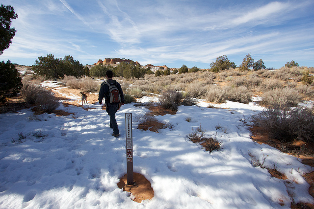
So now that all that back story is behind us, on to the trip report. We started our day in the Cottonwood Cove area. I was surprised to find that there isn't any official trailhead. Just a sandy dirt road with a few well worn pull-outs where you can park and start hiking. There are no trails or routes other than the occasional social trail. Just go. With that said, plan wisely if you're going to CBS. Load up the GPS and I would even highly recommend bringing a photo of the satellite imagery in addition to a map. The teepees and hoodoos aren't all that easy to spot on a topo map but are much easier to ID with a satellite image. Also, it was surprisingly easy to miss where parked our car. Both Nilauro and I ended up either too far up or down the road. In retrospect a quick tag with the GPS would have been smart.
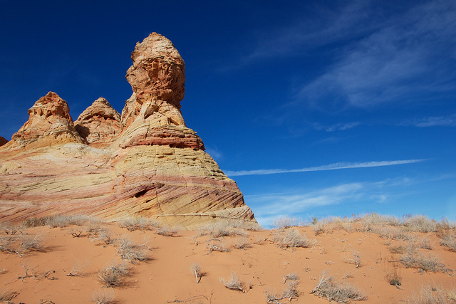
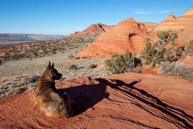
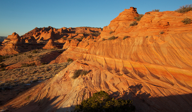
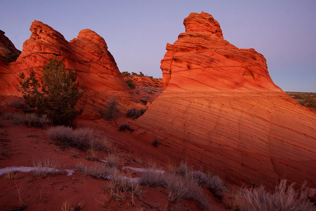
We decided to start by hiking towards the south end of the Cottonwood Cove formations and work our way north where the teepees looked more dramatic. It didn't look like much as we set out from the car.
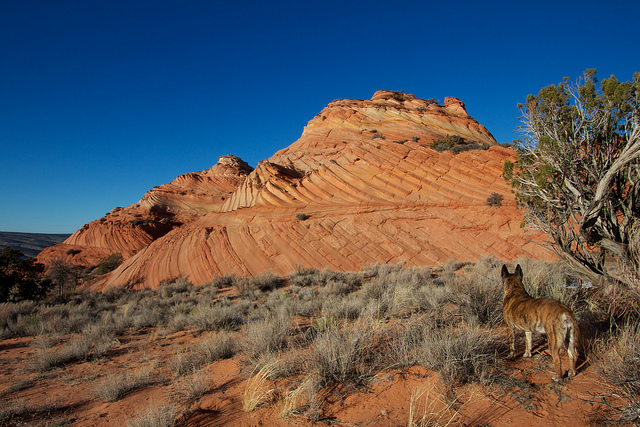
Formations started to appear out of the sand as we got closer.
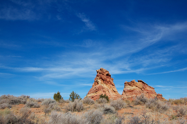
The far south end was interesting but not particularly photogenic so I decided to start north while Nilauro took photos. I found this interesting formation along the way.
I found my way in and out of the hoodoos and teepees but the light tricky for getting good shots.
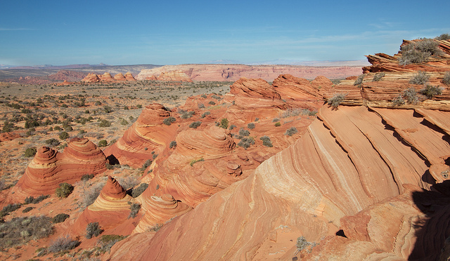
Eventually I made it to the far north end of the Cottonwood Cove formation. I sat down and had some lunch and soaked in the view.
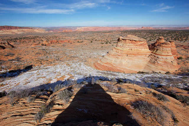
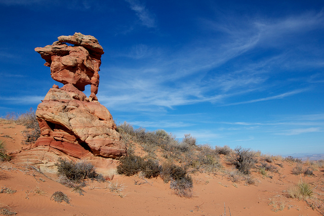
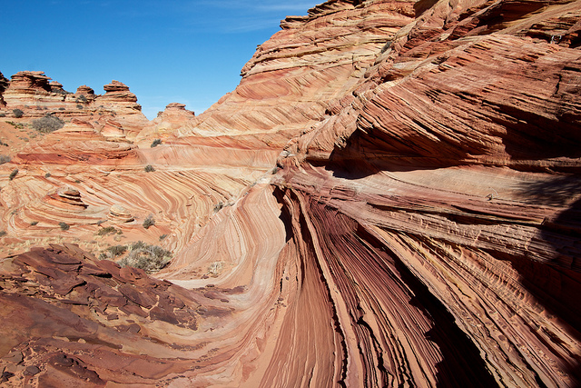
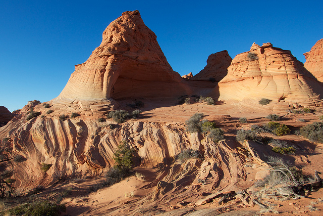
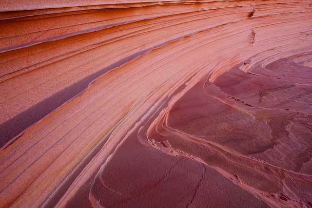
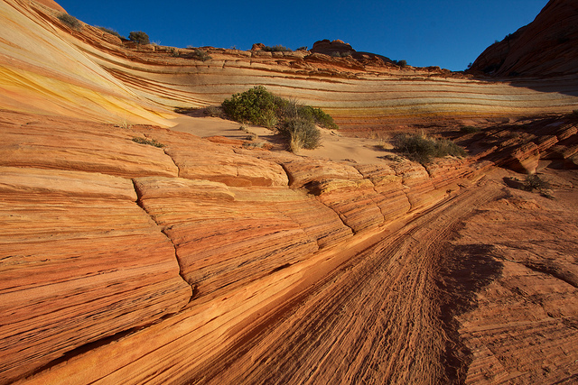
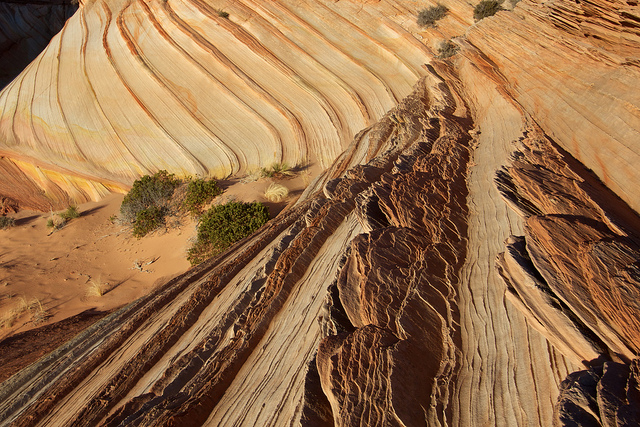
Next I started south again but more to the west where I found some incredible formations.
This canyon was a lot lower in elevation than I was but it was worth hiking down to.

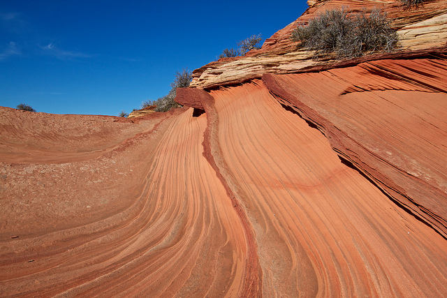
I found some good light in this area.
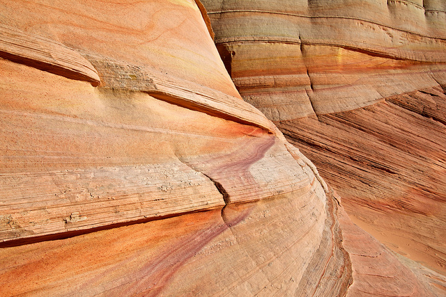
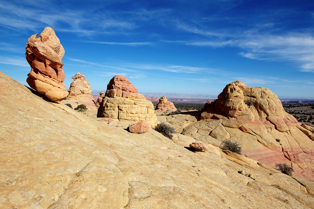
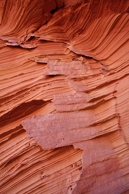
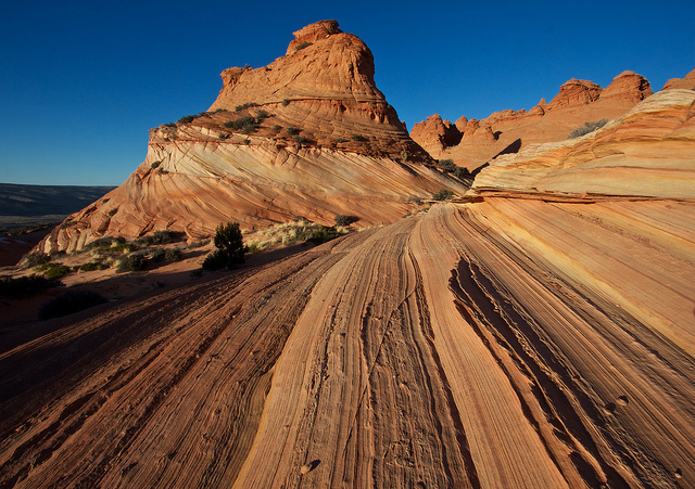
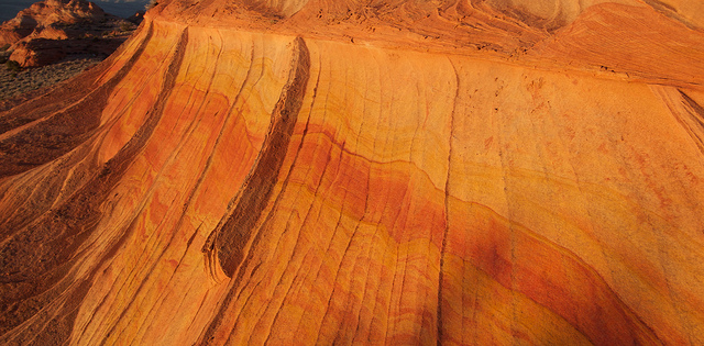
Eventually the canyon left me farther north than my lunch spot, out in the open sand and sage brush of the Paria Desert. There were a few more patches of slick rock further north so I decided to walk to it. What I found was incredibly delicate, thin layers of sandstone that had seen few footsteps. I wish I could say I didn't do any damage but by the time I realized what I was standing on, it was too late.
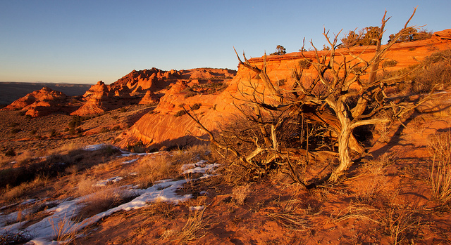
We spent several hours at Cottonwood Cove and it was nowhere near enough. There was a lot we missed in the area we were in and in addition to that, there was another large and interesting area east of the dirt road that contains a formation known as The Queen. I could see it on my walk back to the car, it looked awesome, must be 20+ feet high and very much like a queen chess piece. Next time.
We made it back to the truck around 2:30, just in time to meet a friendly BLM ranger who checked our permits and helped us out with a question about our permit to The Wave for the next day. So there you have it folks, the really DO check permits! Don't poach it!
Paw Hole
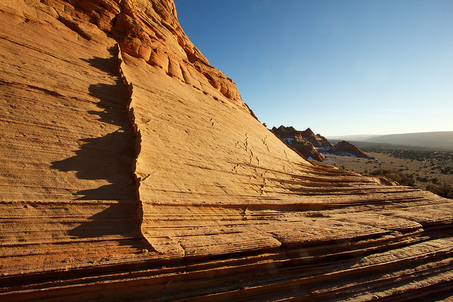
After Cottonwood Cove, we hurried over to Paw Hole where I had been told the light is fantastic late in the day. We were not disappointed! The Paw Hole formations are situated on a ridge, to the west is House Rock Valley, to the east the Paria Plateau. Perfect place for sunset or sunrise, just pick the side of the ridge that works best. No obstructions, good low angle light from either direction.
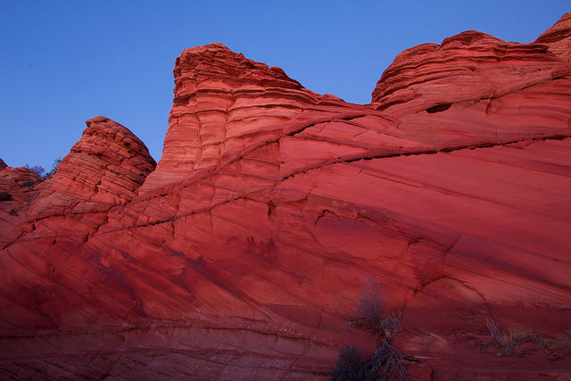
The rocks right near the trailhead are a deep red, quite different from the Cottonwood Cove area. There is very large corral built into the teepees in this area. If you're coming for sunset, I would reccomend not going into the corral, if you do, you'll need to get through some barbed wire further up the hill. Instead, go around the teepees to the west. Make your way up through the teepees as the sights entice you but the best stuff is probably 1.5-2 miles in. You can't miss it.
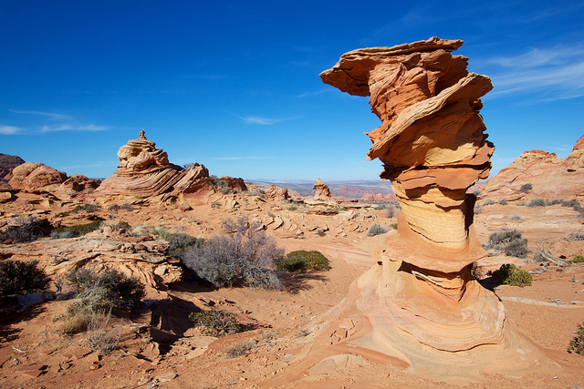
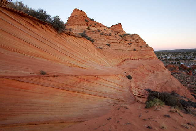
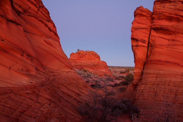
We stopped at a high point about a half mile in to get a look. You can't see the really good stuff in this shot, it's on the other side of that big teepee.
We poked around near that highpoint for a little while but eventually I found my way around that big teepee above to where I could see some tantalizing terrain. It was far away and Nick and Nilauro were M.I.A. so I decided to just start walking. The distance was deceiving as it ended up being at least a mile or so. Eventually we were there.
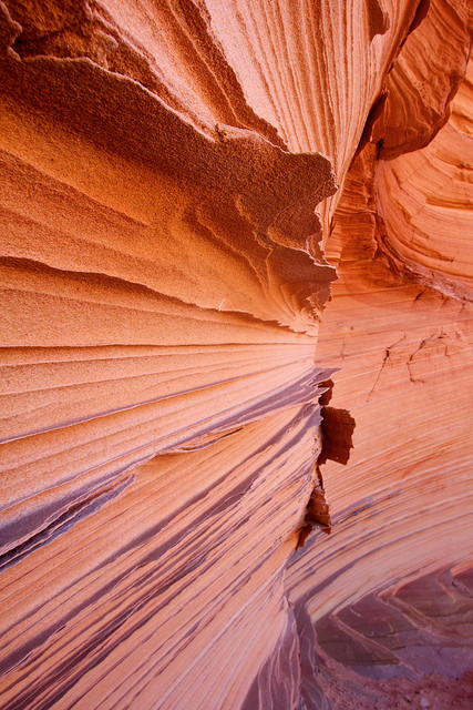
I only explored a small corner of this pocket but it was fantastic. Notice the large teepee in this photo, it is hollowed out on the back side like a small alcove.
I walked up into the Hollow Teepee where I found some amazingly delicate sandstone formations. Here are a few shots.
From Hollow Teepee I made my way through the rocks towards the sunlight. It was now nearly sunset and the light was incredible. It was a surprise around every corner.

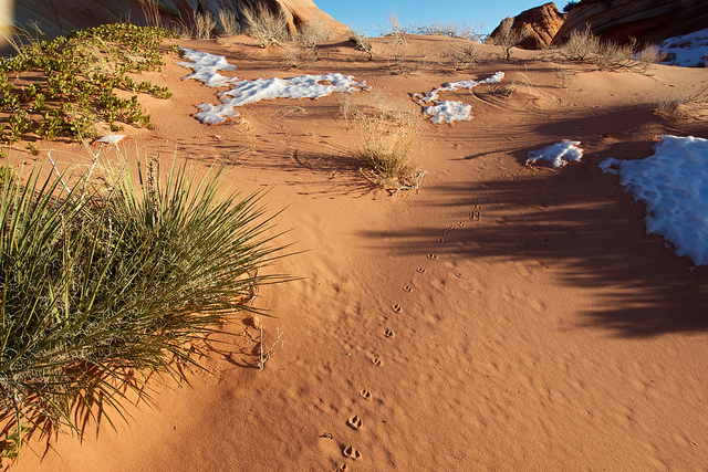
Something else had been through here.
I was feeling quite accomplished as I left my little magical spot to head back and find the guys. I was half way through the field when I heard Nilauro holler from above. I had noticed the ridge was easy to get onto at this point and I guess they did too. We caught the last bit of light as we ascended the ridge and found some incredible formations.
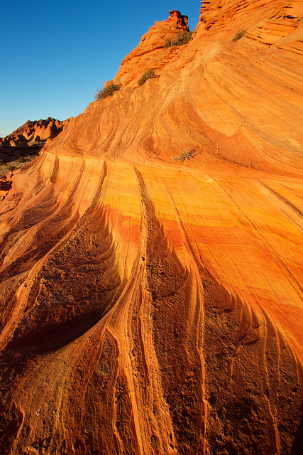
Near the top of the ridge and that last moment of light. The rocks in the distance are the ones I hiked out to alone.
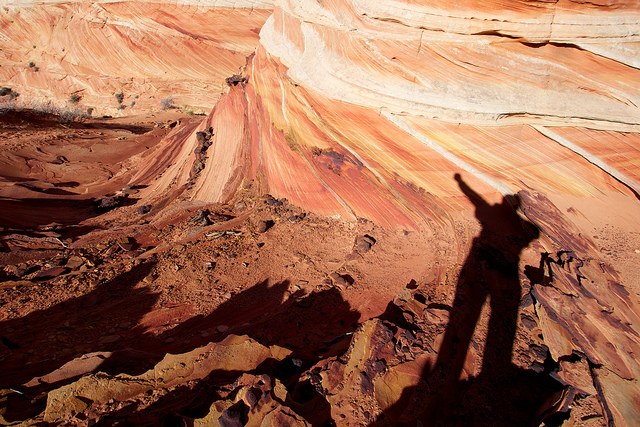
After the sun went down, we decided to ascend the ridge and drop down the east side to return to the car. The light was gone but there were still a lot of beautiful rocks along the way.
Just before dark, the rocks picked up this amazing light. It took 10-20 second exposures to capture but it was well worth it.
We made it back to the truck well after dark. I beat the guys back by a few minutes and warmed up the truck. They somehow went to far west on their route, fortunately Nilauro had tagged the truck on his phone and used it to find their way back. I can't emphasize how strongly I recommend going into this area with a good GPS and the key waypoints marked.
We drove down into the House Rock Valley where we had already picked out a campsite in day light. Again, great use of a GPS. I hate trying to find a good spot in the dark. We got to our spot, kicked a few cows out and got an early night so that we could start our pre-dawn hike into Coyote Buttes North and The Wave. That trip report will be coming soon.
After spending New Years Eve at The White Pocket, we raced over to Cottonwood Cove for a day of exploring the Coyote Buttes South permit area. Coyote Buttes South(CBS) is famous mostly because it's neighbor to the north, Coyote Buttes North(CBN), the home of the famous Wave formation. People come from all over the world, planning entire vacations around the incredibly rare opportunity to hike to The Wave in Coyote Buttes North. Meanwhile, Coyote Buttes South gets hardly any love in comparison.
The permit system in place for both areas limit human traffic to no more than 20 people per day. For Coyote Buttes North, 10 of those permits are awarded through the online lottery system while the other 10 are allocated for walk-in customers the prior day, most often through a lottery with most people walking away dissapointed. It took me years of failed lottery applications before I finally won my first permits to CBN last December. And for the prime months, the chances are even more dismal. I did a research paper last year on the subject and with the limited amount of data the BLM would supply, I was able to ascertain that the chances of winning a permit in a month like May is in the range of 2-6%, at best.
Coyote Buttes South on the other hand is relatively easy to get a permit for. There is no online lottery system, just choose your dates up to 4 months ahead of time from the online calendar system or pickup in person at the BLM's Kanab Field office or Paria Contact Station, depending on time of year.
The popularity and iconic nature of The Wave is likely the predominant reason that permits to CBS are so much easier to come by, but not the only one. A limiting factor for many is that the two key trailheads for Coyote Buttes South, Cottonwood Cove and Paw Hole, are both accessed through the network of roads on the Paria Plateau west of House Rock Valley. An area infamous for it's deep, soft sand that has been known to trap it's fair share of capable 4WD vehicles. If the sand is wet, it's pretty easy, but if it's hot and dry, all bets are off. Heading out there without a good 4WD vehicle, an experienced driver and recovery tools such as a winch, compressor, shovel, etc. is not advised. And remember, momentum is the key to surviving soft sand. Don't be afraid of that gas pedal.
Cottonwood Cove
So now that all that back story is behind us, on to the trip report. We started our day in the Cottonwood Cove area. I was surprised to find that there isn't any official trailhead. Just a sandy dirt road with a few well worn pull-outs where you can park and start hiking. There are no trails or routes other than the occasional social trail. Just go. With that said, plan wisely if you're going to CBS. Load up the GPS and I would even highly recommend bringing a photo of the satellite imagery in addition to a map. The teepees and hoodoos aren't all that easy to spot on a topo map but are much easier to ID with a satellite image. Also, it was surprisingly easy to miss where parked our car. Both Nilauro and I ended up either too far up or down the road. In retrospect a quick tag with the GPS would have been smart.
We decided to start by hiking towards the south end of the Cottonwood Cove formations and work our way north where the teepees looked more dramatic. It didn't look like much as we set out from the car.
Formations started to appear out of the sand as we got closer.
The far south end was interesting but not particularly photogenic so I decided to start north while Nilauro took photos. I found this interesting formation along the way.
I found my way in and out of the hoodoos and teepees but the light tricky for getting good shots.
Eventually I made it to the far north end of the Cottonwood Cove formation. I sat down and had some lunch and soaked in the view.
Next I started south again but more to the west where I found some incredible formations.
This canyon was a lot lower in elevation than I was but it was worth hiking down to.
I found some good light in this area.
Eventually the canyon left me farther north than my lunch spot, out in the open sand and sage brush of the Paria Desert. There were a few more patches of slick rock further north so I decided to walk to it. What I found was incredibly delicate, thin layers of sandstone that had seen few footsteps. I wish I could say I didn't do any damage but by the time I realized what I was standing on, it was too late.
We spent several hours at Cottonwood Cove and it was nowhere near enough. There was a lot we missed in the area we were in and in addition to that, there was another large and interesting area east of the dirt road that contains a formation known as The Queen. I could see it on my walk back to the car, it looked awesome, must be 20+ feet high and very much like a queen chess piece. Next time.
We made it back to the truck around 2:30, just in time to meet a friendly BLM ranger who checked our permits and helped us out with a question about our permit to The Wave for the next day. So there you have it folks, the really DO check permits! Don't poach it!
Paw Hole
After Cottonwood Cove, we hurried over to Paw Hole where I had been told the light is fantastic late in the day. We were not disappointed! The Paw Hole formations are situated on a ridge, to the west is House Rock Valley, to the east the Paria Plateau. Perfect place for sunset or sunrise, just pick the side of the ridge that works best. No obstructions, good low angle light from either direction.
The rocks right near the trailhead are a deep red, quite different from the Cottonwood Cove area. There is very large corral built into the teepees in this area. If you're coming for sunset, I would reccomend not going into the corral, if you do, you'll need to get through some barbed wire further up the hill. Instead, go around the teepees to the west. Make your way up through the teepees as the sights entice you but the best stuff is probably 1.5-2 miles in. You can't miss it.
We stopped at a high point about a half mile in to get a look. You can't see the really good stuff in this shot, it's on the other side of that big teepee.
We poked around near that highpoint for a little while but eventually I found my way around that big teepee above to where I could see some tantalizing terrain. It was far away and Nick and Nilauro were M.I.A. so I decided to just start walking. The distance was deceiving as it ended up being at least a mile or so. Eventually we were there.
I only explored a small corner of this pocket but it was fantastic. Notice the large teepee in this photo, it is hollowed out on the back side like a small alcove.
I walked up into the Hollow Teepee where I found some amazingly delicate sandstone formations. Here are a few shots.
From Hollow Teepee I made my way through the rocks towards the sunlight. It was now nearly sunset and the light was incredible. It was a surprise around every corner.
Something else had been through here.
I was feeling quite accomplished as I left my little magical spot to head back and find the guys. I was half way through the field when I heard Nilauro holler from above. I had noticed the ridge was easy to get onto at this point and I guess they did too. We caught the last bit of light as we ascended the ridge and found some incredible formations.
Near the top of the ridge and that last moment of light. The rocks in the distance are the ones I hiked out to alone.
After the sun went down, we decided to ascend the ridge and drop down the east side to return to the car. The light was gone but there were still a lot of beautiful rocks along the way.
Just before dark, the rocks picked up this amazing light. It took 10-20 second exposures to capture but it was well worth it.
We made it back to the truck well after dark. I beat the guys back by a few minutes and warmed up the truck. They somehow went to far west on their route, fortunately Nilauro had tagged the truck on his phone and used it to find their way back. I can't emphasize how strongly I recommend going into this area with a good GPS and the key waypoints marked.
We drove down into the House Rock Valley where we had already picked out a campsite in day light. Again, great use of a GPS. I hate trying to find a good spot in the dark. We got to our spot, kicked a few cows out and got an early night so that we could start our pre-dawn hike into Coyote Buttes North and The Wave. That trip report will be coming soon.