Cottonwood Cove

Scott Chandler

Wildness is a necessity- John Muir
Joined
Jan 4, 2014
Messages
1,099
Sandstone can be downright weird...

01/17/2015

About a year ago my dad had visited the Coyote Buttes South special permit area, specifically the Pawhole Trailhead. While it was neat, he had heard that the Cottonwood Cove TH had far better. Rivals The Wave better. But he despaired, for the road out to Cottonwood Cove would be too much for his car.

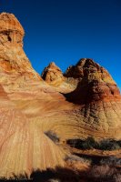
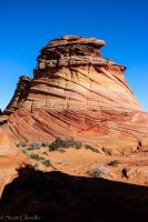
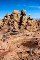
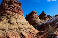
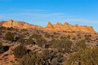
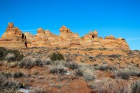
Fast forward to today and through some "luck" I am around, with my crossover, and we're driving the sand to Cottonwood Cove. The road wasn't the worst I've driven. Lots of sand, in some places deep, using all those eight inches of clearance my Mitsubishi has. I hit a few rocks way too hard because none of them looked as bad as they were. Did I mention lots of sand? Down a hill and voila! A bunch of rocky towers loomed. And what a bunch of rocky towers!!!!
Coyote South-2.jpg
Coyote South-4.jpg

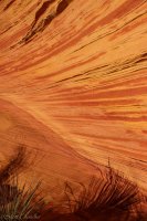
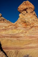
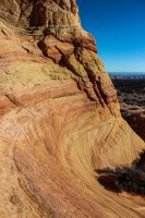
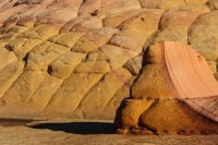
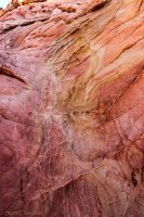
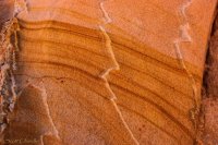
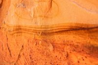
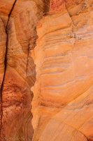
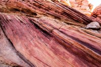
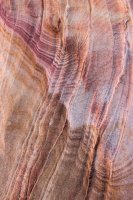
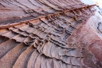
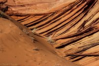
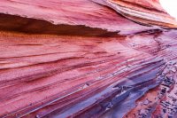
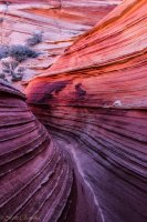
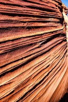
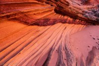
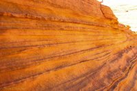
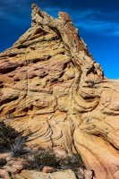
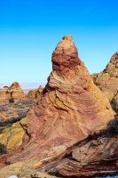
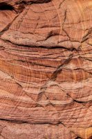
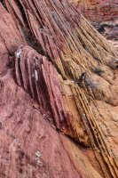
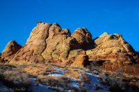
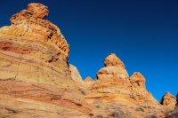
Cottonwood Cove is a land of pastel coloration and crazy sandstone formations. Around every corner is a new image, a new detail, a new take on color. There is no trail and it is a pure discovery paradise.
Coyote South-7.jpg Coyote South-8.jpg

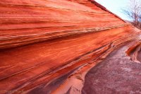
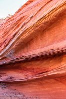
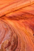
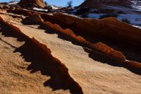
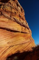
Walking around the initial teepees we found a series of undulating coves. The waves of striations and colors were so fun to follow.
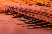
Coyote South-12.jpg Coyote South-13.jpg Coyote South-14.jpg Coyote South-16.jpg Coyote South-17.jpg Coyote South-20.jpg

I called this "The Tongue" for the coloration's resemblance to an open mouth with the tongue hanging out.
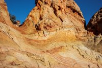
Coyote South-21.jpg

Venturing into the teepees I stumbled across the rock I've heard called "Half and half." Its a fitting name and this rock is truly otherworldly!
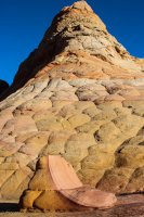
Coyote South-28.jpg Coyote South-29.jpg

"Half and half" sits by a crazy area of definite purple and yellow color divisions that I think of as "WillyWonkaLand". We explored it later in the day
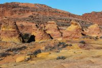
Coyote South-30.jpg

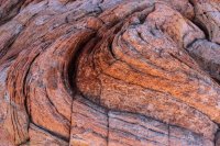
I was far more interested in finding "The Tongue" and seeing what was in it!
Coyote South-33.jpg

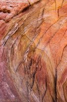
When I got in The Tongue I was amazed at the details!
Coyote South-36.jpg Coyote South-37.jpg Coyote South-38.jpg Coyote South-39.jpg Coyote South-40.jpg

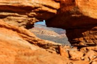
Leaving The Tongue I found a small window with a good view of Top Rock to the north.
Coyote South-42.jpg

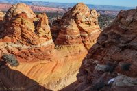
Venturing north we passed some sweet details headed towards what would be the farthest of the main teepees.
Coyote South-49.jpg Coyote South-52.jpg Coyote South-53.jpg Coyote South-54.jpg Coyote South-58.jpg

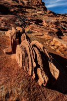
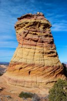
I've seen this called "The Control Tower." Its a fitting name as this hoodoo sits all by lonesome in and amongst it all.
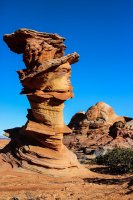
Coyote South-63.jpg

As we reached the northern teepees we hit a sweet transition gully full of striation goodness. Because of how similar it is to "The Passage" by The Wave, I call this spot "The Cottonwood Passage." It is a much bigger passage though.
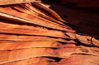
Coyote South-65.jpg Coyote South-67.jpg Coyote South-68.jpg Coyote South-69.jpg Coyote South-70.jpg
Coyote South-72.jpg Coyote South-73.jpg Coyote South-75.jpg

Venturing into the northern teepees we found what I call "The Pastel Hallway" and some downright circusy teepees.
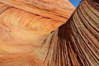
Coyote South-80.jpg Coyote South-81.jpg Coyote South-83.jpg Coyote South-84.jpg

We then headed south to the "Land of Sandstone on Drugs."
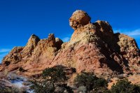
Coyote South-92.jpg Coyote South-94.jpg Coyote South-95.jpg Coyote South-96.jpg

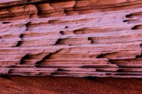
The sandstone had such weird form!

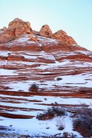
Headed east again from here we found a sweet hillside with a light coating of snow.
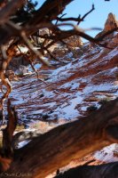
Coyote South-99.jpg Coyote South-100.jpg

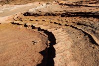
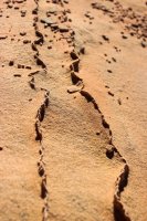
And past that was a crazy area of minute fins that I call "Scoopland" because it is like an ice cream scoop got drug over the rock.
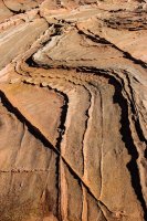
Coyote South-106.jpg Coyote South-107.jpg Coyote South-109.jpg Coyote South-110.jpg

From there we finally ventured over to Willy Wonka Land to round out Cottonwood Cove.
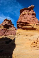
Coyote South-114.jpg Coyote South-116.jpg Coyote South-117.jpg Coyote South-118.jpg Coyote South-119.jpg Coyote South-120.jpg

All I can really finish with is wow. It is amazing what exits in this downright desolate environment. Cottonwood Cove and all the gems of the Vermillion Cliffs National Monument are certainly some of the coolest country around.

Featured image for home page:
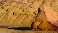
slide.jpg
 
Beautiful impressions, Scott! :)
'Forget' The Wave. The CBS are one of the scenic places on the Paria Plateau.
Especially in the light of the winter sun.

Thanks for sharing.


Gesendet von iPad mit CrapaTalk
 
This is probably a dumb question but is that area really referred to as the land of sandstone on drugs?

LOL not dumb at all.

I made up all my place names off of what came to my mind about their characteristics. That particular section reminded me of those old anti-drug ads: "This is your brain, this is your brain on drugs." This area was like that. Everything was so intricate and complex, except for this one section where everything looked like a mess.
 
Sweet TR...Thanks for posting. Headed down there sometime next week. BTW....Did you have an online permit or did you get a walkin? Were they pretty busy down there? Thx
 
Wow, wow, wow..... Stunning photos @Scott Chandler ! What a gorgeous day with your dad in another serene location.
This is above and beyond what I imagined Cottonwood Cove would be like. I could spent weeks there, if that was allowed....

Got some permits for Coyote Butte South for a day in the first week of December and another day in the second week of December.
I think I understand the different trailheads (Lonetree TH / Cottonwood Cove TH / Pawhole TH), how the roads connect, which roads requires 4W/high clearance, which don't, which steep hills to avoid and what direction to drive between Pawhole and Cottonwood Cove, etc.

I'm confused about why they ask and require to know the trailhead entry & exit for a day permit to Coyote Butte SOUTH?
I wasn't sure which TH entry/exit to choose when I paid for the permits and maybe it doesn't matter. I know the fines for trespassing are steep in Coyote Butte North and it is more clear what is and what is not allowed from Wirepass TH, but it's really not so clear to me, why they require an entry/exit trailhead on a day permit in Coyote Butte South.

For instance, if we went to Cottonwood Cove in 4W/high clearance for the day, parked before the infamous steep sandy hill (that your dad @chandlerwest and I would think about all day while hiking), then hiked around Cottonwood Cove and later drove back and stopped at the Pawhole TH for a sunset picture (suggested by @Nick ). Instead of choosing Cottonwood Cove as 'entry/exit', would I choose "Cottonwood Cove" as entry and Pawhole as "Exit" ?
Do you know? Does it matter? @Nick , @IntrepidXJ any comments?

Likewise I got a permit for another day for just the Lonetree TH (entry/exit) to spend a full day like suggested by @chandlerwest at Pawhole. But now we are likely acquiring a 4W/high clearance vehicle before this trip, so then we might drive from the Lonetree TH and park at Pawhole TH instead (but our permit would be for Lonetree TH entry/exit).
 
why they ask and require to know the trailhead entry & exit for a day permit to Coyote Butte SOUTH?

Visitor Use Statistics and Emergency Response. I'm fairly confident that their permits are for the areas of Coyote Buttes North and Coyote Buttes South, not so much entrances. Although it would be interesting if they had a CBNorth permit with an entrance of Cottonwood Cove. Hopefully someone would catch that. But yeah, it helps them understand how many people are going to certain places and gives them a place to start if a loved one calls in distressed.
 
Visitor Use Statistics and Emergency Response. I'm fairly confident that their permits are for the areas of Coyote Buttes North and Coyote Buttes South, not so much entrances. Although it would be interesting if they had a CBNorth permit with an entrance of Cottonwood Cove. Hopefully someone would catch that. But yeah, it helps them understand how many people are going to certain places and gives them a place to start if a loved one calls in distressed.

Thanks @Scott Chandler . Ok, I understand now, it makes a lot of sense what you say....
 
Thanks @Scott Chandler . Ok, I understand now, it makes a lot of sense what you say....

The best is when people fill that information in with "none of your business"... Like they are really making a significant statement. Used to see that with wilderness permits and some of the grumps I would run into.

Then there are the people who aren't sure what to put so they put in every possible entry/exit.

Permits are an eternally interesting thing LOL

whoa....! Last year at a coastal trailhead in Crescent City, California, (but almost in Oregon) we saw an out of state SUV with smashed widows and a note on the dashboard. The owners had written a note with dates, detailing where they were planning to hike and when they were planning on coming back from the coastal trail. Someone else found that info too tempting, smashed a window and searched the car. Sad.... Luckily we haven't seen that in Utah along trailheads.

Search and Rescue is a very real scenario in Coyote Butte and many other places. Thanks for clarifying permit entry/exit situations, it was very helpful to understand it all from a Search and Rescue perspective.

Hope to park at Cottonwood Cove before the final steep sandy hill ( that you describe here and your dad talked about elsewhere).
But- the other second tricky steep sandy downhill everyone talks about is along the short piece of road between Cottonwood TH and Pawhole TH, right?
It's not between Lonetree TH and Pawhole TH, correct? So, in a Jeep we should be able to get from Lonetree TH to Pawhole TH without getting stuck (I know, it depends and in theory), but we shouldn't go from Pawhole TR to Cottonwood TH via the short route, we need to drive the long route to Cottonwood Cove. Hope I got that right... it's kind of hard to describe when I haven't' actually been there ....:rolleyes:
You are correct about the sandy hill being between Cottonwood and Pawhole. Getting up to Pawhole from Lonetree gets sandy but not at a steep enough pitch to hinder something with a bit of bite to it. I walked the road because my Hyundai Sonata didn't have anything to prove by trying it.
 
Thanks! I expected us to park at Lonetree TH and do what you recommended to Pawhole, but now the prospect of a 4W/high clearance is changing all that. We have 5-6" clearance under our car now (with 'a lot of bite' to it), but the lack of clearance is really limiting us from many areas of the Arizona strip and Canyonlands. Looks like you just had a wonderful trip!
 
Similar threads
Thread starter Title Forum Replies Date
dhertbag Camping at Cottonwood Cove - Coyote Buttes South Trip Planning 11
D Coyote Buttes South Paw Hole or Cottonwood Cove (or both) Trip Planning 3
D Access Recommendations to Cottonwood Cove , South Coyote Buttes Trip Planning 3
Janice Cottonwood Fluff in Canyon Country General Discussion 4
NorthwestWanderer Backpacking Oregon's Cottonwood Canyon : Lost Corral Trail Backpacking 1
J Death Valley NP. Marble-Cottonwood (side slot) lollipop loop Nov 17-19,2019 Backpacking 10
fossana cottonwood [x] wilderness double shot Hiking & Camping 13
fossana Dick's Canyon Ramble (Cottonwood Canyon Wilderness, UT) Hiking & Camping 3
Michael Skutumpah, Cottonwood Rd. Trip Planning 0
George_Washington_Hayduke Twilight Canyon- Cottonwood Gulch- Llewellyn Gulch- 8 Days Backpacking/Packrafting Backpacking 15
swmalone Willow Creek to Little Cottonwood Creek Loop Trail Hiking & Camping 0
regehr hiker injured and rescued in Little Cottonwood General Discussion 3
Dave Fees coming for Big, Little Cottonwood Canyons General Discussion 0
J Glen Canyon NRA: Reflection, Cottonwood, Llewellyn Canyons Backpack April 25-28,2016 Backpacking 5
Udink Cottonwood Wash to Nate's Canyon Hiking & Camping 3
regehr Hiker death in White Pine, Little Cottonwood General Discussion 0
MtnMatt Looking for a nice waterfall hike in Little Cottonwood Trip Planning 10
MtnMatt Willow Lake Fall Colors in Big Cottonwood Canyon Hiking & Camping 2
Nick Cottonwood Gulch, Escalante Backpacking 4
D Current Condition of Cottonwood Canyon Road Trip Planning 3
Udink Old Woman and Cottonwood Washes Hiking & Camping 5
Nick Cottonwood Canyon, Grand Staircase Hiking & Camping 6
Tyler Broads Fork - Big Cottonwood Canyon June 2011 Hiking & Camping 0
Tyler Big Cottonwood scenic drive to Sundance (Stewart Falls) Oct. 2006 Hiking & Camping 1
Tyler Little Cottonwood Canyon hiking: Catherine Pass to Grizzly Gulch July 2007 Hiking & Camping 2
balzaccom Hite Cove Trail Work Hiking & Camping 1
ashleyoutside Angel Cove Canyon - North Wash, Utah Canyoneering 0
ram Cove Canyon-A 4 day Grand Canyon Adventure 2/8-11/15 Canyoneering 17
IntrepidXJ Sand Cove & Yellow Rock Hiking & Camping 16
Aldaron Angel Cove Trip Planning 4

Similar threads

Back
Top