Ben
Member
- Joined
- Sep 12, 2014
- Messages
- 1,873
Trying to do more backpacking earlier in the year, i planned a trip through Zion at the end of march. Originally i wanted to hike from one end of the park all the way to the other, in at the Kolob entrance, and out the east, but transportation proved to be too much of a problem. So we in stead settled on exiting out the south entrance, getting picked up by my brother's friend from St George. He then drove us back to the Kolob Canyons section before driving home. This option took him about two hours, which was very gracious of him, in stead of the three hour round trip to the east entrance, and also avoided his having to pay an entrance fee at the park to get there.
My brother and i hiked the La Verkin Creek Trail, through Hop Valley, across the Wildcat Connector to the West Rim Trail, all the way down it, and then over to the east rim, where we spent two nights, did some day hikes in between, and then hiked back down to Zion Canyon where we got a ride out to the entrance to await our ride. All in all about 60 miles of walking. Before getting to the east rim, we camped along the La Verkin Creek Trail near the Hop Valley junction the first night night, and then in the Wildcat Canyon use area the second night. There is a huge concentration of other really awesome things to do in Zion, but i wanted to get a better picture of the area as a whole, and i managed to accomplish that. While seeing some really awesome things in the process.
 From the parking lot near the trail head. The Kolob Canyons area is fairly epic, and often over looked i think. i'd been to Zion twice before with out ever seeing this side of it. It merits more time. The trail was nice, easy. The designated camp sites along it are scenic and well spaced. The trail goes straight, past the finger canyons in the photo above before turning up the point on the right and heading up La Verkin Creek.
View from a rise on the trail. Burnt Mountain in the center. May be Shuntavi Butte to the left of it. The trail turns in between them, and later we wrap around on the other side of Burnt Mountain, entering Hop Valley.
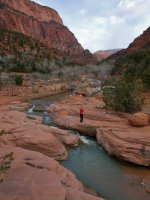
La Verkin Creek was nice.
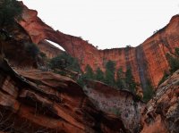
Almost 6.5 miles in you come to the turn off for Kolob Arch, which round trip is just over a mile out of the way. It's actually larger than it looks in the picture. The internet states it's span as 287'. The trail out to it was extremely pleasant. My brother and i walked out the tiny canyon below it to get better pictures. It's a very nice place off the trail below it. Signs discourage this travel, but do not forbid it. I recommend it. After coming back to out packs at the trail junction we only had may be half a mile to out camp. We'd started hiking just early after noon, but we made it to the camp early enough still that we walked a little farther up trail and climbed around before coming back and cooking dinner. Rehydrated spaghetti that i had dehydrated my self for the first time. And it was fantastic. It's now my favorite backpacking meal.
The next morning we packed up, back tracked a few minutes to the trail junction and headed up to Hop Valley. A little elevation gain here. Hop Valley was gorgeous, the highlight of the trip for me. Hidden Canyon, on the east side was a lot of fun, but i have been VERY few places as beautiful as Hop Valley.
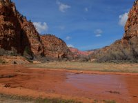
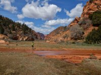
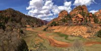
May be we got there at just the right time of the year. Broad and flat, steep red and sand walls, meandering water. I think a recent snow had just melted, but there was an appreciable amount of green when we went through. I wish we had camped there. The trail through is about six and half miles. It can also be accessed directly from a trail head.

View across the road after leaving Hop Valley and starting down the Connector Trail. Just right of center you can see Burnt Mountain again, behind us now, with Gregory Butte beyond it. Views near here were nice and open, particularly to the south like this one.

You start to see the canyon country that makes up so much of the park. The views last for a minute before the trail enters forest. And then cairns lead up this nice stretch.
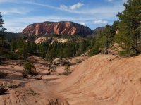
Looking back. There's a good view of Pine Valley Peak above here too, which is cool, but not quite amazing or any thing. And then more trees. And a little more than four miles from the Hop Valley Trail you come to the junction with the Northgate Peaks trail, which leads out to this beauty.

We dropped packs again and made the 2.2 mile (out and back) excursion. Again worth it.
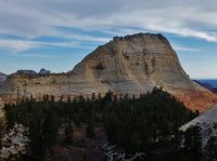

The gem in the center is North Guardian Angel, and the Northgate Peaks are on either side of it. The views are to the south. From the junction we continued on may be a mile and a half, and camped near the edge of Wildcat Canyon.
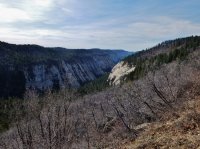
I liked it for looking unique from so many of the other canyons in Zion. Probably about 15 miles for the second day. The next day was going to be even longer. Packed up in the morning and got started after breakfast. Some of the trail near Wildcat Canyon appears to be an old road or wagon grade, which is interesting. We got water at this spring in Wildcat, which was helpful. I don't remember any other water between Hop Valley and Zion Canyon, but i could be forgetting some puddles.
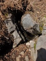
It had a steady trickle, and we pumped from a tiny pool in the rocks below it. Note the dry dead ferns around it. Continued up out of Wildcat the remaining three miles or so from where we'd camped to the junction with the West Rim Trail. Passed this bit of history before getting there.
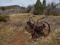
Note Lava Point in the background.
The West Rim Trail is long and rather uneventful. It is great at connecting the northern and southern portions of the park, but so is a car. There are some open views of lots of country to the east, but they aren't overly exciting.
Eventually though you come to a number of views to the west that are pretty fantastic.

From along the trail here you overlook the canyons of the Left and Right Forks of North Creek, home to the Subway. Finally the West Rim trail begins to work it's way down from 7400' on top of the canyon to 4300' at the Virgin River. Here you can see a little of the trail. Angels Landing from the back side, the darker rock right of center.
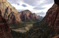
And then the obligatory photo of Zion Canyon coming down below Angels Landing.
When we got down to the bottom we had a problem. March is still technically the off season at Zion. So the shuttle buses weren't running. And the East Rim Trail is a mile or two up the road from where the West Rim trail comes down. And we'd already done probably eighteen miles that day, and there wasn't a lot of light left it, and we still had to make it a ways up the east side to get to open camping. This possibility hadn't even occurred to me until we showed up at the park and the ranger issuing our permit warned me about it. We reached this situation on a saturday. The buses would start running on tuesday, the first of april. Joke was on us. So we found a nice looking couple our age at the grotto parking area, asked if they had a car, and begged a ride off them. They were very helpful and friendly, and good conversation. They dropped us off where we needed to be and we shortly started up the trail. After rewatering at taps and using the bathroom. Going up was hard after such a long day. But we managed to make it what seemed like far enough and pitch a tent. It was windy and there wasn't enough sand to put stakes in, and we hadn't brought them any way, so we held the tent in place setting rocks in each corner. I think we cooked a dinner and a half that night. The first one wasn't enough. We probably did twenty miles or so. Which seems unnecessary looking back at it. A car is probably a better choice than the West Rim Trail. You won't miss much, and you'll get to see the good stuff twice.
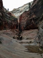
Heading up Echo Canyon toward the east rim.
Between our two nights on the east rim i wanted to do some day hiking before we left. No reason to move the tent since we were just going to have to come back to this point eventually. First thing we needed was more water though. I went back down the trail to some big pot holes that we had seen coming up. It wasn't far. Started raining while i was down there. I finished pumping and we sat the weather out in the tent for a while after that. Napped. It was pretty easy after the previous day, and considering the prospects of venturing out side. But eventually it let up, and early after noon we decided to go out. It didn't rain again, but it did snow and hail while we were out on the trail.
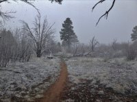
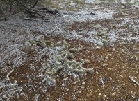
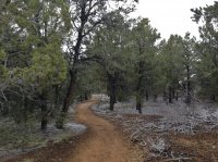
Which wasn't so bad, it was possible to stay dry that way. Mud was awful in some places though. It was bizarre to me, from farther north, to see the cactus dusted in white.
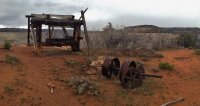
We went out to Cable Mountain to see what was left there. From 1901 to 1930 there was a cable and draw works used for lowering lumber from the mesa down to Zion Canyon for easier transport. These aren't the original structure though. They burned twice, so these should be from the early 1920s.
Worth the trip after that we went back to the tent and had dinner. That trip was probably ten miles round any way.
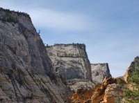
Next morning we packed up and went to hit Observation Point and Hidden Canyon on the way down. The weather was nice now. Only the one day of inclement. Here's looking back up at Cable Mountain from lower on the East Rim Trail. you can also see the Great White Throne beyond it.
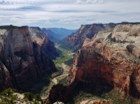
On the way down Observation Point is 4.4 miles round trip from the East Rim Trail. Good view of Zion Canyon from up there, it's higher than Angels Landing, and a great view, but a less interesting hike. It's nice being able to see closer to the start of the Narrows though.
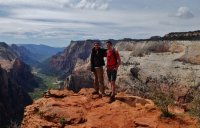
Me and my brother, Spencer.
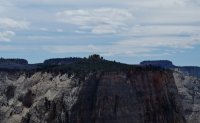
The Great White Throne, from the Point. I liked it.
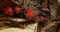
Flowers along the trail.
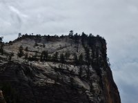
Closer view of Cable Mountain from below. You can see the timberworks right on the point of it.
After coming back down from Observation Point we continued along the trail till we got to the turn off for Hidden Canyon. I was a little excited about this one, but didn't know much about it. It paid off, interesting place.
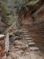
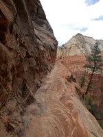
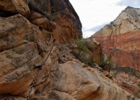
These are just the trail out to the mouth of Hidden Canyon, and that trail is a lot of fun it's self.
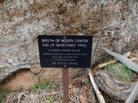
Beyond we did get some good scrambling up the canyon.
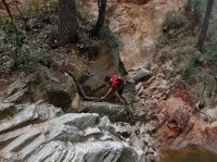
And then the beautiful and odd arch in it. Where did that thing come from.
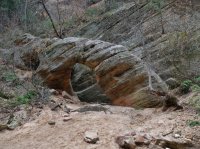
Keeping our feet dry as we went farther up canyon. Great place.
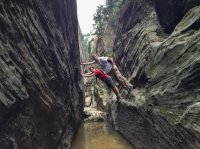
Lots of people in the start of Hidden Canyon, fewer the farther you go in. We hiked the rest of the way back down to the road, checked out Weeping Rock, which is fine, and after about two hundred cars passed us by with our thumbs out got a ride in the back of a pickup to the park entrance so we could meet our ride.
Great trip, but no hurry to do it again. Hop Valley and Hidden Canyon would be worth it though.
My brother and i hiked the La Verkin Creek Trail, through Hop Valley, across the Wildcat Connector to the West Rim Trail, all the way down it, and then over to the east rim, where we spent two nights, did some day hikes in between, and then hiked back down to Zion Canyon where we got a ride out to the entrance to await our ride. All in all about 60 miles of walking. Before getting to the east rim, we camped along the La Verkin Creek Trail near the Hop Valley junction the first night night, and then in the Wildcat Canyon use area the second night. There is a huge concentration of other really awesome things to do in Zion, but i wanted to get a better picture of the area as a whole, and i managed to accomplish that. While seeing some really awesome things in the process.
 From the parking lot near the trail head. The Kolob Canyons area is fairly epic, and often over looked i think. i'd been to Zion twice before with out ever seeing this side of it. It merits more time. The trail was nice, easy. The designated camp sites along it are scenic and well spaced. The trail goes straight, past the finger canyons in the photo above before turning up the point on the right and heading up La Verkin Creek.
View from a rise on the trail. Burnt Mountain in the center. May be Shuntavi Butte to the left of it. The trail turns in between them, and later we wrap around on the other side of Burnt Mountain, entering Hop Valley.

La Verkin Creek was nice.
Almost 6.5 miles in you come to the turn off for Kolob Arch, which round trip is just over a mile out of the way. It's actually larger than it looks in the picture. The internet states it's span as 287'. The trail out to it was extremely pleasant. My brother and i walked out the tiny canyon below it to get better pictures. It's a very nice place off the trail below it. Signs discourage this travel, but do not forbid it. I recommend it. After coming back to out packs at the trail junction we only had may be half a mile to out camp. We'd started hiking just early after noon, but we made it to the camp early enough still that we walked a little farther up trail and climbed around before coming back and cooking dinner. Rehydrated spaghetti that i had dehydrated my self for the first time. And it was fantastic. It's now my favorite backpacking meal.

The next morning we packed up, back tracked a few minutes to the trail junction and headed up to Hop Valley. A little elevation gain here. Hop Valley was gorgeous, the highlight of the trip for me. Hidden Canyon, on the east side was a lot of fun, but i have been VERY few places as beautiful as Hop Valley.


May be we got there at just the right time of the year. Broad and flat, steep red and sand walls, meandering water. I think a recent snow had just melted, but there was an appreciable amount of green when we went through. I wish we had camped there. The trail through is about six and half miles. It can also be accessed directly from a trail head.

View across the road after leaving Hop Valley and starting down the Connector Trail. Just right of center you can see Burnt Mountain again, behind us now, with Gregory Butte beyond it. Views near here were nice and open, particularly to the south like this one.

You start to see the canyon country that makes up so much of the park. The views last for a minute before the trail enters forest. And then cairns lead up this nice stretch.

Looking back. There's a good view of Pine Valley Peak above here too, which is cool, but not quite amazing or any thing. And then more trees. And a little more than four miles from the Hop Valley Trail you come to the junction with the Northgate Peaks trail, which leads out to this beauty.

We dropped packs again and made the 2.2 mile (out and back) excursion. Again worth it.


The gem in the center is North Guardian Angel, and the Northgate Peaks are on either side of it. The views are to the south. From the junction we continued on may be a mile and a half, and camped near the edge of Wildcat Canyon.

I liked it for looking unique from so many of the other canyons in Zion. Probably about 15 miles for the second day. The next day was going to be even longer. Packed up in the morning and got started after breakfast. Some of the trail near Wildcat Canyon appears to be an old road or wagon grade, which is interesting. We got water at this spring in Wildcat, which was helpful. I don't remember any other water between Hop Valley and Zion Canyon, but i could be forgetting some puddles.

It had a steady trickle, and we pumped from a tiny pool in the rocks below it. Note the dry dead ferns around it. Continued up out of Wildcat the remaining three miles or so from where we'd camped to the junction with the West Rim Trail. Passed this bit of history before getting there.

Note Lava Point in the background.
The West Rim Trail is long and rather uneventful. It is great at connecting the northern and southern portions of the park, but so is a car. There are some open views of lots of country to the east, but they aren't overly exciting.

Eventually though you come to a number of views to the west that are pretty fantastic.

From along the trail here you overlook the canyons of the Left and Right Forks of North Creek, home to the Subway. Finally the West Rim trail begins to work it's way down from 7400' on top of the canyon to 4300' at the Virgin River. Here you can see a little of the trail. Angels Landing from the back side, the darker rock right of center.

And then the obligatory photo of Zion Canyon coming down below Angels Landing.

When we got down to the bottom we had a problem. March is still technically the off season at Zion. So the shuttle buses weren't running. And the East Rim Trail is a mile or two up the road from where the West Rim trail comes down. And we'd already done probably eighteen miles that day, and there wasn't a lot of light left it, and we still had to make it a ways up the east side to get to open camping. This possibility hadn't even occurred to me until we showed up at the park and the ranger issuing our permit warned me about it. We reached this situation on a saturday. The buses would start running on tuesday, the first of april. Joke was on us. So we found a nice looking couple our age at the grotto parking area, asked if they had a car, and begged a ride off them. They were very helpful and friendly, and good conversation. They dropped us off where we needed to be and we shortly started up the trail. After rewatering at taps and using the bathroom. Going up was hard after such a long day. But we managed to make it what seemed like far enough and pitch a tent. It was windy and there wasn't enough sand to put stakes in, and we hadn't brought them any way, so we held the tent in place setting rocks in each corner. I think we cooked a dinner and a half that night. The first one wasn't enough. We probably did twenty miles or so. Which seems unnecessary looking back at it. A car is probably a better choice than the West Rim Trail. You won't miss much, and you'll get to see the good stuff twice.

Heading up Echo Canyon toward the east rim.
Between our two nights on the east rim i wanted to do some day hiking before we left. No reason to move the tent since we were just going to have to come back to this point eventually. First thing we needed was more water though. I went back down the trail to some big pot holes that we had seen coming up. It wasn't far. Started raining while i was down there. I finished pumping and we sat the weather out in the tent for a while after that. Napped. It was pretty easy after the previous day, and considering the prospects of venturing out side. But eventually it let up, and early after noon we decided to go out. It didn't rain again, but it did snow and hail while we were out on the trail.


Which wasn't so bad, it was possible to stay dry that way. Mud was awful in some places though. It was bizarre to me, from farther north, to see the cactus dusted in white.
We went out to Cable Mountain to see what was left there. From 1901 to 1930 there was a cable and draw works used for lowering lumber from the mesa down to Zion Canyon for easier transport. These aren't the original structure though. They burned twice, so these should be from the early 1920s.

Worth the trip after that we went back to the tent and had dinner. That trip was probably ten miles round any way.
Next morning we packed up and went to hit Observation Point and Hidden Canyon on the way down. The weather was nice now. Only the one day of inclement. Here's looking back up at Cable Mountain from lower on the East Rim Trail. you can also see the Great White Throne beyond it.

On the way down Observation Point is 4.4 miles round trip from the East Rim Trail. Good view of Zion Canyon from up there, it's higher than Angels Landing, and a great view, but a less interesting hike. It's nice being able to see closer to the start of the Narrows though.


Me and my brother, Spencer.

The Great White Throne, from the Point. I liked it.

Flowers along the trail.

Closer view of Cable Mountain from below. You can see the timberworks right on the point of it.
After coming back down from Observation Point we continued along the trail till we got to the turn off for Hidden Canyon. I was a little excited about this one, but didn't know much about it. It paid off, interesting place.


These are just the trail out to the mouth of Hidden Canyon, and that trail is a lot of fun it's self.

Beyond we did get some good scrambling up the canyon.

And then the beautiful and odd arch in it. Where did that thing come from.

Keeping our feet dry as we went farther up canyon. Great place.

Lots of people in the start of Hidden Canyon, fewer the farther you go in. We hiked the rest of the way back down to the road, checked out Weeping Rock, which is fine, and after about two hundred cars passed us by with our thumbs out got a ride in the back of a pickup to the park entrance so we could meet our ride.
Great trip, but no hurry to do it again. Hop Valley and Hidden Canyon would be worth it though.
Last edited:
