- Joined
- Aug 9, 2007
- Messages
- 12,949
December 2010
After failing to get permits at least a dozen times, I was finally able to visit Coyote Buttes North last weekend. We made it to the Wire Pass trailhead around 8:30am and spent pretty much the whole day out there, we didn't get back to the truck until after sometime after 4 (and still made it out to White Pocket before dark!). It's kind of funny, everyone gets so worked up about seeing The Wave but we probably only spent 30 minutes there, the rest of the area is really incredible, The Wave was just one small thing to see out of many.
Here is a map with some key points around The Wave including how to get to Sand Cove.
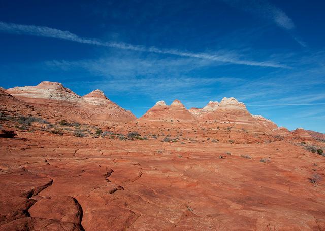
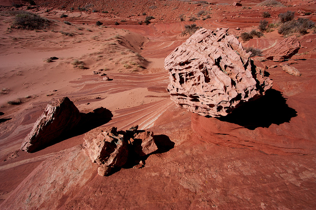
The first two and a half miles is a mix of sand slogging and really enjoyable slick rock wandering. This shot is taken during the latter.
As we arrived at the sand hill leading to The Wave we were catching up to a couple of people so we decided to head up the wash to Sand Cove instead. It was a really nice, warm day out but as soon as we got into the shade things were icy cold.
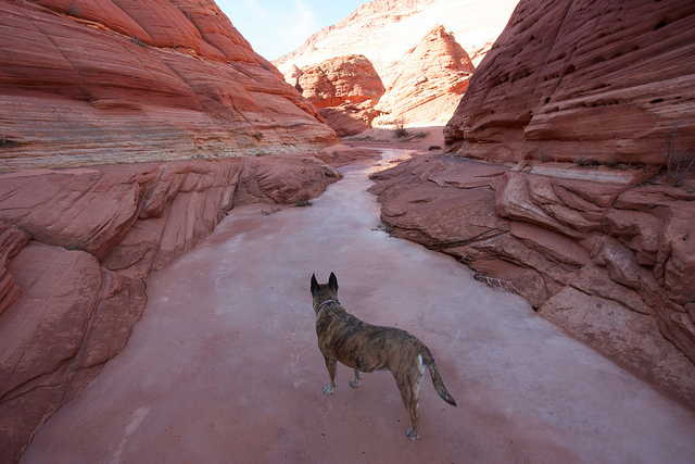
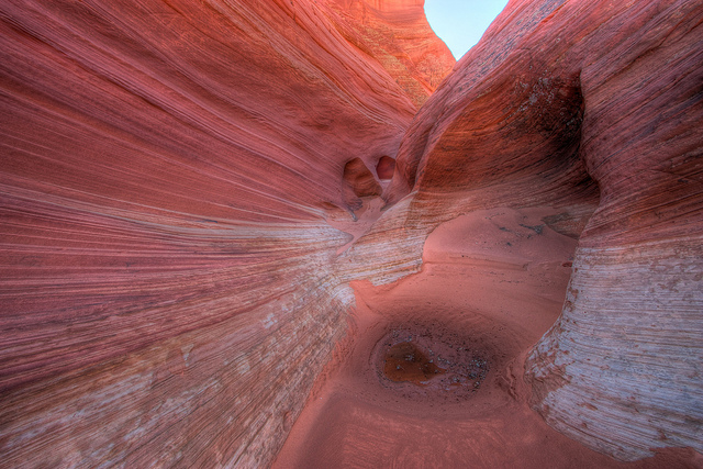
The canyon that leads to Sand Cove was really fun. It slotted up a few times and even had a dry fall that head to be negotiated.
After the little hike through the narrow sections, the canyon opens up to Sand Cove, a truly amazing place. We wandered up to near the top of the canyon where a spring fed a nice grove of trees. The next few pics are from Sand Cove.
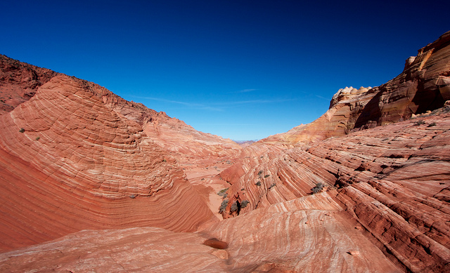
The view from the spring near the top of Sand Cove
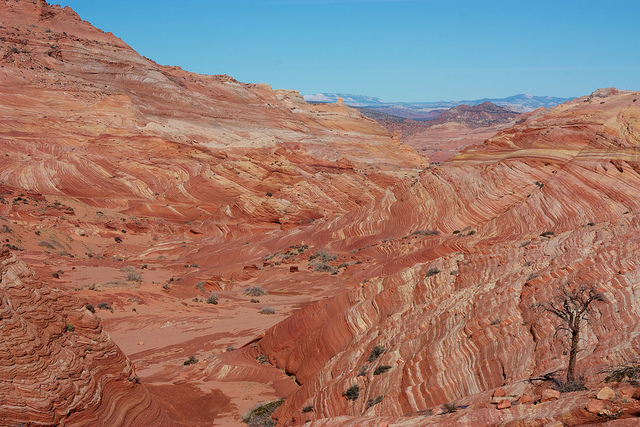
And zoomed in a bit
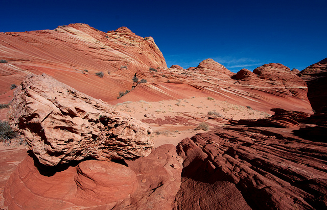
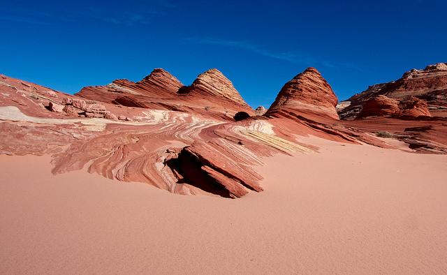
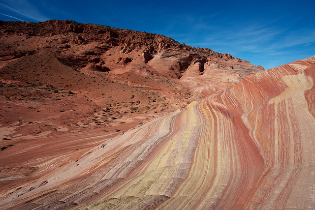
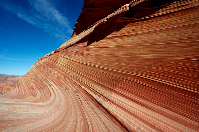
From Sand Cove we found a route up some beautiful multi-colored slickrock and onto the bench where the Wave is found. This is a view on the route up.
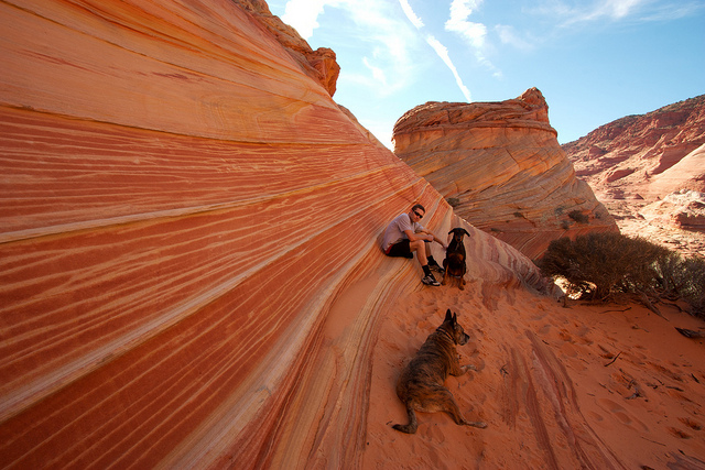
Once we were on the bench we made our way north to the area of The Wave, stopping to see the various formations and pools along the way.

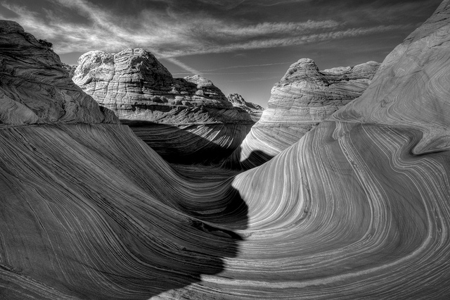
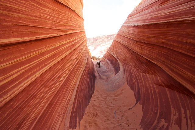
We finally got to The Wave around 1:30pm. Kind of late in the day for this time of the year. Most of it was in the shadows but I still had to try for the classic Wave shot. I liked it better in black and white.
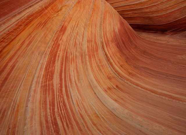
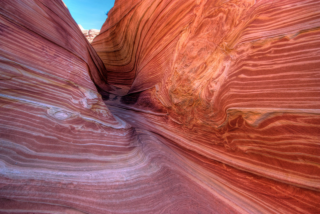
And here's a few other shots from The Wave
After failing to get permits at least a dozen times, I was finally able to visit Coyote Buttes North last weekend. We made it to the Wire Pass trailhead around 8:30am and spent pretty much the whole day out there, we didn't get back to the truck until after sometime after 4 (and still made it out to White Pocket before dark!). It's kind of funny, everyone gets so worked up about seeing The Wave but we probably only spent 30 minutes there, the rest of the area is really incredible, The Wave was just one small thing to see out of many.
Here is a map with some key points around The Wave including how to get to Sand Cove.
The first two and a half miles is a mix of sand slogging and really enjoyable slick rock wandering. This shot is taken during the latter.
As we arrived at the sand hill leading to The Wave we were catching up to a couple of people so we decided to head up the wash to Sand Cove instead. It was a really nice, warm day out but as soon as we got into the shade things were icy cold.
The canyon that leads to Sand Cove was really fun. It slotted up a few times and even had a dry fall that head to be negotiated.
After the little hike through the narrow sections, the canyon opens up to Sand Cove, a truly amazing place. We wandered up to near the top of the canyon where a spring fed a nice grove of trees. The next few pics are from Sand Cove.
The view from the spring near the top of Sand Cove
And zoomed in a bit
From Sand Cove we found a route up some beautiful multi-colored slickrock and onto the bench where the Wave is found. This is a view on the route up.
Once we were on the bench we made our way north to the area of The Wave, stopping to see the various formations and pools along the way.
We finally got to The Wave around 1:30pm. Kind of late in the day for this time of the year. Most of it was in the shadows but I still had to try for the classic Wave shot. I liked it better in black and white.
And here's a few other shots from The Wave
") .
.