- Joined
- Aug 9, 2007
- Messages
- 12,953
This is the first of 3 trip reports I'll be posting from my trip into The Maze over Memorial Weekend.
Check out the other trip reports from this trip:
Part 2: Shot Canyon to Pictograph Fork
Part 3: The Maze Overlook and Jasper Ridge
This trip was a long, long time in the making. I actually booked these permits in July of 2011. When I called in to see if they were any available, the ranger on the phone kind of laughed at me. I guess The Maze just isn't as high demand as some other places. So I booked our spot and waited...
The original plan was to do a car camp-backpack hybrid trip with the focus being on The Fins section of The Maze. It's the one area that we didn't really get down into on the 2011 Maze trip. We were going to drive into the Golden Stairs campsite and hike down to the Mother & Child and then out through Ernie's Country to access The Fins. Then exit out the top of Sweet Alice Canyon which is the only exit from The Fins to Land of Standing Rocks I know of, then road walk back to Mother & Child and hike back up to Golden Stairs to spend one last night with a cooler, good food and good moon-lit views of The Maze below. Sounded like a good plan, right?
But as the date got closer, I thought more about a couple we had ran into last year that had come in via jetboat out of Moab. I had called earlier to inquire about doing that but the guys at Tex's said that they would only do the hiker shuttle if they were going down to pick up canoes and I still hadn't booked the dates. But with a few months to spare, I called and booked 5 slots on the jetboat to Spanish Bottom and switched my Maze permit to all backpacking.
Now that the background info on the trip is out of the way, on to the trip itself. Below is a map of the entire route we hiked over the 4 days. It tracked out to be 38 miles with the small side trips and explorations that we did. Keep in mind that with the jetboat timing, you really only have 2 full days and 2 short days to work with so you have to be ready to do big mileage on the middle days. Our first day was about 8 miles and last was 5 or 6.
We spent night 1 in Water Canyon, night 2 at the bottom of the Maze Overlook and night 3 on the ridge between Jasper Canyon and The Maze. This first trip report will cover up to that first night in Water Canyon.
[parsehtml]
<iframe src="http://www.mappingsupport.com/p/gmap4.php?q=mymap,214533597045798101523.0004c14d0de1fd28c23be&t=t1" frameborder="0" marginwidth="0" marginheight="0" scrolling="no" width="800" height="800"></iframe><br>
<small>View <a href="http://www.mappingsupport.com/p/gmap4.php?q=mymap,214533597045798101523.0004c14d0de1fd28c23be&t=t1" target="_blank">The Maze Super Loop</a> full sized in a new window.</small><br><br>
[/parsehtml]We made it down to the Moab area a little after dark on Thursday night. We wanted to be close by and ready to go in the morning since we had to be at Tex's Riverways at 7:30am. We were going to camp at a known spot on the road into Arches but we hit some extremely slow road construction that was blocking the turn onto that road. To make it even worse, they splattered my Tacoma with tar as we drove through. I'm still trying to figure out how to remove it.
After getting shut down on our known spot, we went a bit further and turned down the road to Butler Wash. It was getting late and we weren't finding any spots so we just found a spur road with some flat spaces to sleep and camped there. No fire or anything but it worked out okay. It was pretty windy though.
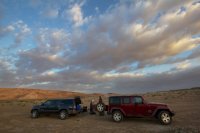
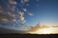
The next morning we were up bright and early getting our bags packed for the next 4 days. We had a nice sunrise at camp.
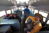
From there we were it was straight to Moab. We arrived at Tex's around 7:15. They took the keys to our vehicles and parked them in their back lot and loaded us up on an old school bus for the drive down to the Potash boat ramp.
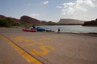
The Potash boat ramp. We waited here for like an hour for the boat to arrive. I guess they had problems filling it up or something. Pretty lame, seems like it would make sense to fill it up the night before if it's going to set things back an hour...
But finally, the boat arrived!
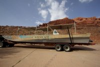
And we were on the river. It was really windy and hazy this day which made for a choppy ride but it was still pretty nice. Definitely better than the ride back. More on that in the last trip report.
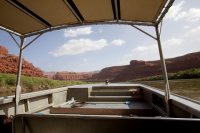
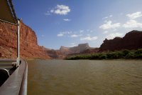
whitwilli had the right idea, hide from the wind...
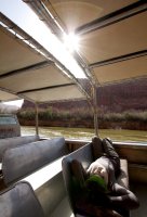
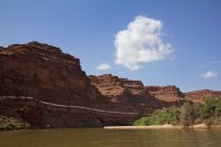
A section of river in The Loop.
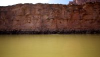
Looking up into The Green River at the confluence. You can see the difference in the waters between the Green and the Colorado.
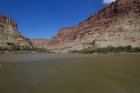
Spanish Bottom with The Dollhouse looming above.
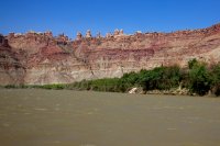
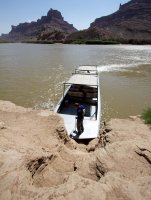
The boat pulled right up to some crude stairs cut into the dirt wall at lower Spanish Bottom, we hopped off, and they were gone. Quick and easy.
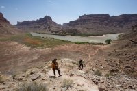
Now the not-so-easy part, the hike from Spanish Bottom to The Dollhouse. The trail starts mellow but soon it turns into about as steep a trail as I can imagine without becoming a literal climb.
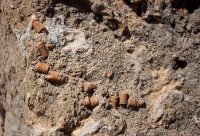
Crinoids
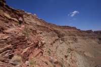
First view into The Dollhouse
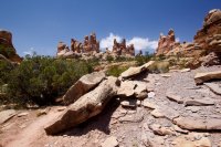
Since I was the only one who had been here before, I decided to lead the group on a longer route through the Dollhouse before continuing on towards Water Canyon. This is the view down into Surprise Valley along the trail.
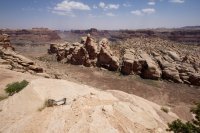
We dropped our packs and took the 1/4 mile spur trail out to check out these nice granaries.
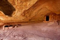
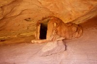
The next section of the trail took us through some cool joints.
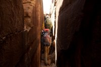
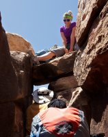
It got too skinny for packs in this spot so Whitney got into position above to pull packs out for us.
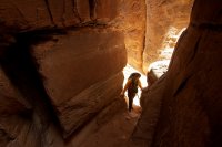
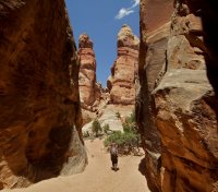
We eventually crossed back through the main Dollhouse road where we would have come out on the more direct trail. We ran into a guy there who was out solo checking things out. He had driven out there in an FJ Cruiser. We talked for a minute and continued out on the Confluence trail towards water canyon before stopping for a break in the shade at Beehive Arch.
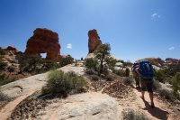
The next section of trail was rough going. The wind was pretty intense yet it was still SO hot out. We took a much needed break in a little refrigerator slot along the trail to cool down. That's lostlandscapes singing for us.
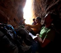
A nice little climb just up the trail from the refrigerator.
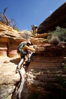
We decided not to hike out to the overlook since we had seen pretty much all of that already today. And of course the fact that you can't actually SEE the confluence. The fields of crypto are amazing out here.
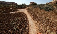
Descending into Water Canyon
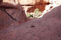
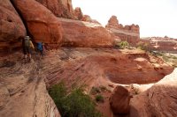
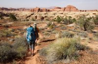
This is where the trail crosses Water Canyon and also where the spring is. Last year, the water was flowing from above, pouring off of the cliffs. This year, dry as a bone above the spring.
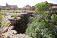
We climbed down and made our way to the source where we enjoyed the cool, clean water. We just sat our nalgene bottles all over and let the water pour directly in from the dripping moss above. It was also nice to stick our heads under the flow after the long, hot hike. Hopefully some of the other guys will post some pics as I was too wet to get out my camera.
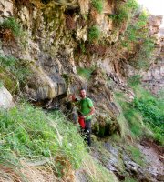
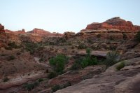
After dinner, a few of us climbed up to a cliff to check out any sunset that might occur. Not very eventful but still a pretty sight.
Coming up next: Water Canyon, Shot Canyon, The Land of Standing Rocks and the descent into The Maze via The Plug.
Continue reading part 2 here: The Maze: Shot Canyon to Pictograph Fork
Featured image for home page:
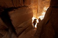
Check out the other trip reports from this trip:
Part 2: Shot Canyon to Pictograph Fork
Part 3: The Maze Overlook and Jasper Ridge
Check out the other trip reports from this trip:
Part 2: Shot Canyon to Pictograph Fork
Part 3: The Maze Overlook and Jasper Ridge
This trip was a long, long time in the making. I actually booked these permits in July of 2011. When I called in to see if they were any available, the ranger on the phone kind of laughed at me. I guess The Maze just isn't as high demand as some other places. So I booked our spot and waited...
The original plan was to do a car camp-backpack hybrid trip with the focus being on The Fins section of The Maze. It's the one area that we didn't really get down into on the 2011 Maze trip. We were going to drive into the Golden Stairs campsite and hike down to the Mother & Child and then out through Ernie's Country to access The Fins. Then exit out the top of Sweet Alice Canyon which is the only exit from The Fins to Land of Standing Rocks I know of, then road walk back to Mother & Child and hike back up to Golden Stairs to spend one last night with a cooler, good food and good moon-lit views of The Maze below. Sounded like a good plan, right?
But as the date got closer, I thought more about a couple we had ran into last year that had come in via jetboat out of Moab. I had called earlier to inquire about doing that but the guys at Tex's said that they would only do the hiker shuttle if they were going down to pick up canoes and I still hadn't booked the dates. But with a few months to spare, I called and booked 5 slots on the jetboat to Spanish Bottom and switched my Maze permit to all backpacking.
Now that the background info on the trip is out of the way, on to the trip itself. Below is a map of the entire route we hiked over the 4 days. It tracked out to be 38 miles with the small side trips and explorations that we did. Keep in mind that with the jetboat timing, you really only have 2 full days and 2 short days to work with so you have to be ready to do big mileage on the middle days. Our first day was about 8 miles and last was 5 or 6.
We spent night 1 in Water Canyon, night 2 at the bottom of the Maze Overlook and night 3 on the ridge between Jasper Canyon and The Maze. This first trip report will cover up to that first night in Water Canyon.
[parsehtml]
<iframe src="http://www.mappingsupport.com/p/gmap4.php?q=mymap,214533597045798101523.0004c14d0de1fd28c23be&t=t1" frameborder="0" marginwidth="0" marginheight="0" scrolling="no" width="800" height="800"></iframe><br>
<small>View <a href="http://www.mappingsupport.com/p/gmap4.php?q=mymap,214533597045798101523.0004c14d0de1fd28c23be&t=t1" target="_blank">The Maze Super Loop</a> full sized in a new window.</small><br><br>
[/parsehtml]We made it down to the Moab area a little after dark on Thursday night. We wanted to be close by and ready to go in the morning since we had to be at Tex's Riverways at 7:30am. We were going to camp at a known spot on the road into Arches but we hit some extremely slow road construction that was blocking the turn onto that road. To make it even worse, they splattered my Tacoma with tar as we drove through. I'm still trying to figure out how to remove it.
After getting shut down on our known spot, we went a bit further and turned down the road to Butler Wash. It was getting late and we weren't finding any spots so we just found a spur road with some flat spaces to sleep and camped there. No fire or anything but it worked out okay. It was pretty windy though.
The next morning we were up bright and early getting our bags packed for the next 4 days. We had a nice sunrise at camp.


From there we were it was straight to Moab. We arrived at Tex's around 7:15. They took the keys to our vehicles and parked them in their back lot and loaded us up on an old school bus for the drive down to the Potash boat ramp.

The Potash boat ramp. We waited here for like an hour for the boat to arrive. I guess they had problems filling it up or something. Pretty lame, seems like it would make sense to fill it up the night before if it's going to set things back an hour...

But finally, the boat arrived!

And we were on the river. It was really windy and hazy this day which made for a choppy ride but it was still pretty nice. Definitely better than the ride back. More on that in the last trip report.


whitwilli had the right idea, hide from the wind...


A section of river in The Loop.

Looking up into The Green River at the confluence. You can see the difference in the waters between the Green and the Colorado.

Spanish Bottom with The Dollhouse looming above.

The boat pulled right up to some crude stairs cut into the dirt wall at lower Spanish Bottom, we hopped off, and they were gone. Quick and easy.

Now the not-so-easy part, the hike from Spanish Bottom to The Dollhouse. The trail starts mellow but soon it turns into about as steep a trail as I can imagine without becoming a literal climb.

Crinoids


First view into The Dollhouse

Since I was the only one who had been here before, I decided to lead the group on a longer route through the Dollhouse before continuing on towards Water Canyon. This is the view down into Surprise Valley along the trail.

We dropped our packs and took the 1/4 mile spur trail out to check out these nice granaries.


The next section of the trail took us through some cool joints.

It got too skinny for packs in this spot so Whitney got into position above to pull packs out for us.


We eventually crossed back through the main Dollhouse road where we would have come out on the more direct trail. We ran into a guy there who was out solo checking things out. He had driven out there in an FJ Cruiser. We talked for a minute and continued out on the Confluence trail towards water canyon before stopping for a break in the shade at Beehive Arch.

The next section of trail was rough going. The wind was pretty intense yet it was still SO hot out. We took a much needed break in a little refrigerator slot along the trail to cool down. That's lostlandscapes singing for us.


A nice little climb just up the trail from the refrigerator.

We decided not to hike out to the overlook since we had seen pretty much all of that already today. And of course the fact that you can't actually SEE the confluence. The fields of crypto are amazing out here.

Descending into Water Canyon


This is where the trail crosses Water Canyon and also where the spring is. Last year, the water was flowing from above, pouring off of the cliffs. This year, dry as a bone above the spring.

We climbed down and made our way to the source where we enjoyed the cool, clean water. We just sat our nalgene bottles all over and let the water pour directly in from the dripping moss above. It was also nice to stick our heads under the flow after the long, hot hike. Hopefully some of the other guys will post some pics as I was too wet to get out my camera.

After dinner, a few of us climbed up to a cliff to check out any sunset that might occur. Not very eventful but still a pretty sight.

Coming up next: Water Canyon, Shot Canyon, The Land of Standing Rocks and the descent into The Maze via The Plug.
Continue reading part 2 here: The Maze: Shot Canyon to Pictograph Fork
Featured image for home page:

Check out the other trip reports from this trip:
Part 2: Shot Canyon to Pictograph Fork
Part 3: The Maze Overlook and Jasper Ridge
