- Joined
- Aug 9, 2007
- Messages
- 12,949
June 2011
Here it is almost the end of June and I'm backpacking Shingle Creek. Not good! Don't get me wrong, I like it, but by June 26th I should be able to get into some lakes, even if there is still a bit of snow around. But for years like this, or if you have an itch to get out before the high country has melted, Shingle Creek can be a good destination. I first did it on June 3rd, 2006. You can view that trip report here: Shingle Creek, Uintas, June 2006.
The Shingle Creek trailhead is located north of Highway 150 between the turnoff for Upper Setting Road and Norway Flats. Here's a map:
View larger map.
I hadn't really planned anything for this weekend, after the strenuous weekend I'd had in Zion a week earlier, I was kind of looking forward to sticking around home and relaxing. But my friend Tim had his sights on checking things out up there and invited me along. Tim is pretty new to Utah so this was to be his first glimpse at The Uintas. We left Salt Lake at 7am and headed east towards Kamas. We made a quick stop in Murdock Basin to grab something from Bill who was camping there before heading up to Bald Mountain Pass to see how far the road had been cleared.
We were able to drive all the way up the road to just below Bald Mountain Pass before we were stopped by snow. Typically this road is open by Memorial Day, sometimes a week or two later. I can't remember ever hearing about it closed this far into the summer.
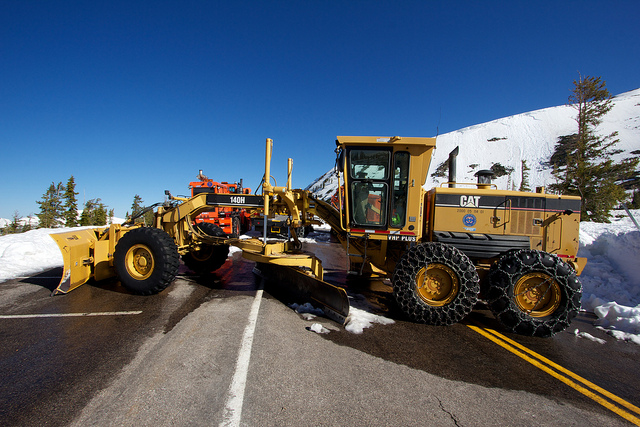
The road on the other side of the snow plows and blowers.
Still a lot of snow out there. Lost Lake and Lily Lake were still covered in ice with slushy spots starting to show but no open water. Up here at 10,700 feet there was easily 5-10 feet of snow still around.
We had brought along snowshoes in the hopes of hiking into the Duck/Marjorie/Weir Lakes area. I knew there would be snow but Duck is pretty low at 9800 feet and I thought we might be able to snowshoe over to it and find a bit of dry ground to setup camp. But the snow as just too thick well below 9800'. So much so that the turnoff to the Crystal Lake trailhead was still buried in snow, we couldn't even turn up there. So we went with the backup plan and headed back down the highway towards Shingle Creek.
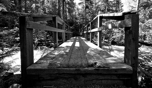
One of the reasons Shingle Creek works so well for an early season hike are the bridges. This would have been impossible to do without them. See my trip earlier this month along the North Fork Provo for a good illustration of that.
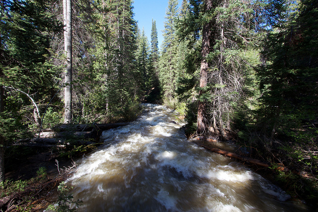
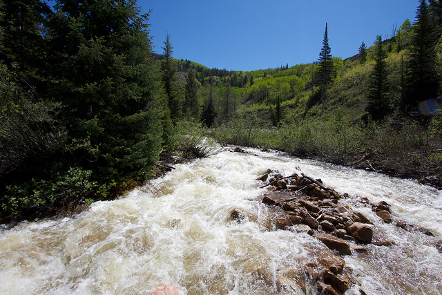
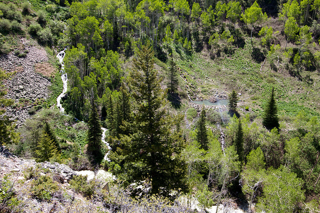
A little further up the trail, this is usually a meadow with a stream running through it but the raging river had overwhelmed it.
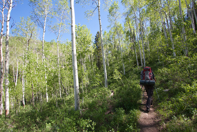
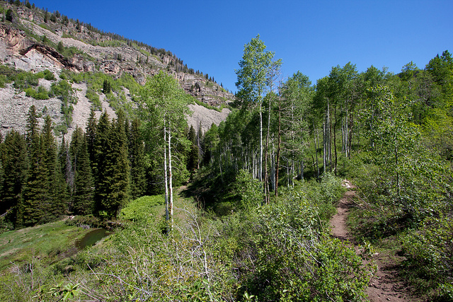
Tim heading up into the aspens.
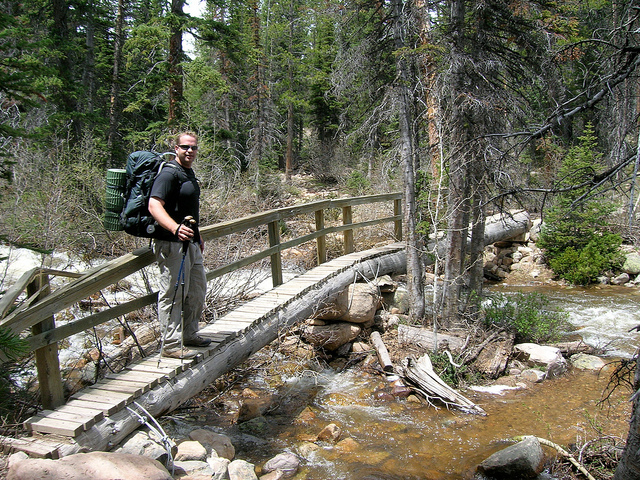
Tim crossing the second bridge along the trail.
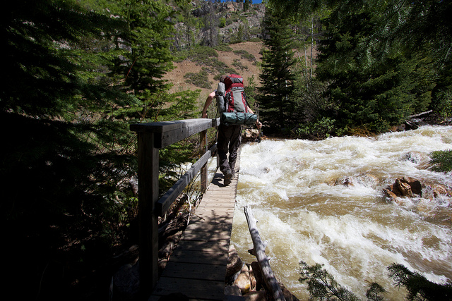
Looking up stream while crossing the second bridge. The volume of water was a little intimidating.
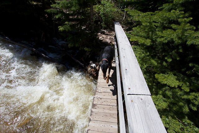
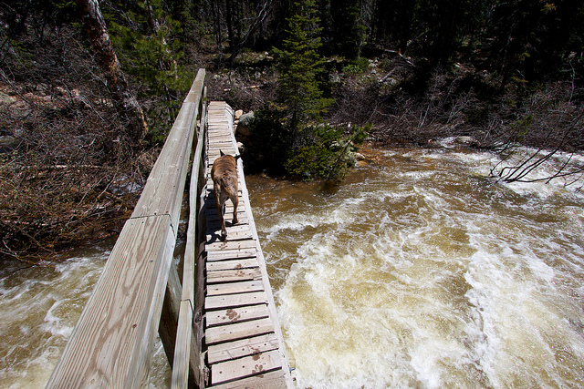
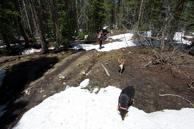
Teak was really scared and didn't want to cross. I'm actually really glad she is afraid of swift water, if only I could get here to fear the edges of cliffs.
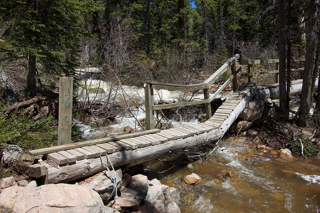
After the second bridge the trail gets steep for a bit but offers some excellent views. This shot is of a picturesque beaver pond and waterfall on the other side of the canyon.
Uh oh. We have bridge damage!
And the same bridge in 2006:
Once again, Teak was terrified of the bridge but apparently not the water. She ended up walking right through the calm water under this section of the bridge and climbing back up onto it beyond the broken section.
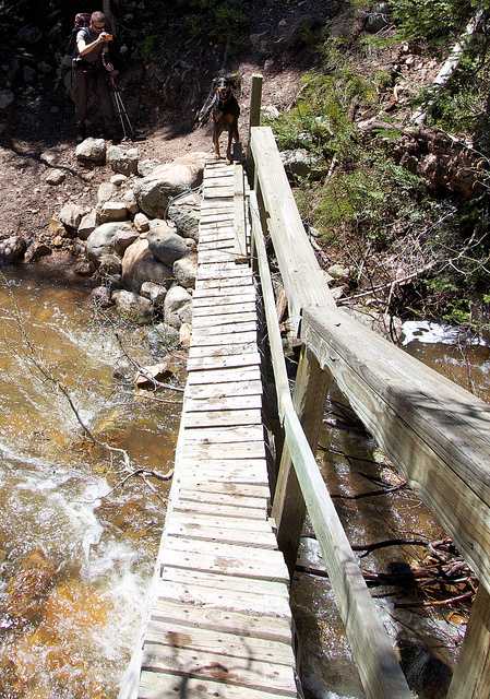
Nikita crossing the third bridge. I'm probably including a lot of photos I might not normally include but you'll understand why a little further into the report.
Not far past the third bridge is where we ran into snow on the 2006 trip. This time I was hoping to get a bit further up the trail. Possibly even hike in the snow up to East Shingle Creek Lake. But it was not to be...
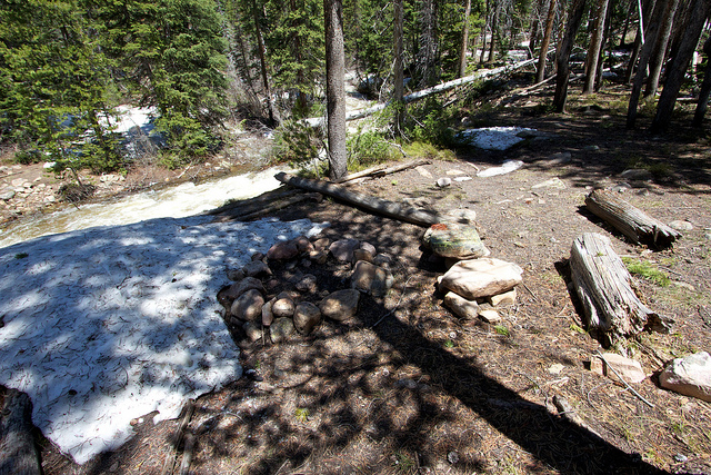
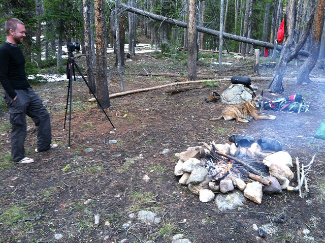
As soon as the trail entered into the forest, the snow started to get thick. A little thicker than it was on June 3rd of 2006 in fact. We decided to camp in the same spot I camped then but there was still a lot of snow right up to the fire pit. June 25, 2011:
Same campsite, June 3, 2006, not quite the same angle but you get the idea.
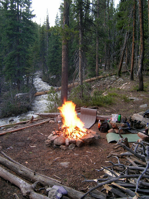
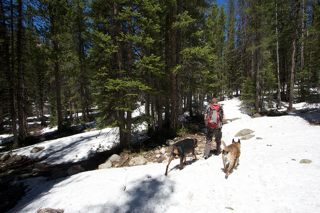
We ended up finding another campsite just 150 feet or so away that was clear of snow. We had some lunch, setup camp and decided to day hike further up the trail. At first it was just intermittent snow patches that had to be walked through. It was slippery and wet but not too bad.
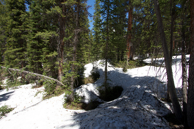
There were a few clear spots that were almost snow free but eventually it started to become pretty much pure snow. This is at about 8900 feet.
And then almost to 9000 feet we decided to turn around. It got a bit steeper and a lot deeper and it was difficult to hike in without some improved traction. Snowshoes would have been great. We had made it a little less than 2/3 of a mile by the time we turned around.
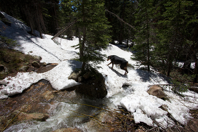
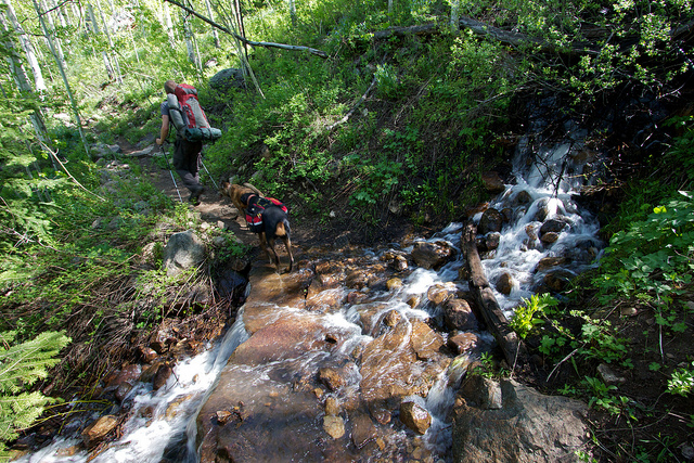
Shortly after turning back we arrived back on a small stream that we had crossed on the way up. Tim had originally tried crossing on a snow bridge but broke through and got his feet wet. I took the high road and crossed on rocks. It worked well going up the canyon but something went terribly wrong going down. See that rock on the bottom left corner of the photo? Well I stepped there and the next thing I know I'm on my hands and knees in the deepest part of the stream. And what went in to the drink with with me? My 6 month old Canon 60D SLR camera and 10-22mm ultra wide angle lens. About $2k in camera gear to be exact and it spent at least a few seconds fully submerged in the strongest part of the river before I could pull it out. It was still on when I pulled it out of the water so I turned it off and decided to let it dry for the rest of the day before doing anything. This was the last image I took before the incident.
We hiked back to camp talking about stories of camera destruction. I have to say that Tim made me feel much better with his story of dropping a 5D with several days worth of photos off of the cliffs of Big Sur and into the Pacific Ocean. Ouch! I had a pretty good attitude about it really. I figured it might cost me a few hundred bucks to repair but a valuable lesson was learned. And who knows, maybe once it dried out it will work fine.
So we went back to camp and spent the next few hours purifying water and relaxing. I set my camera out in the sun and let it roast, hoping that by some miracle it would still fire up later on. Sometime in the early evening I decided to give it a try and.... nothing. Totally dead. I popped the lens cap off of my ultra wide angle lens and there was condensation all over the inside of the front element. This is BAD.
Okay, no camera for the rest of the trip. I've been here before, it's a short trip. "No biggie" I tell myself. A few hundred bucks and it should be fixed and I will have learned an important lesson.
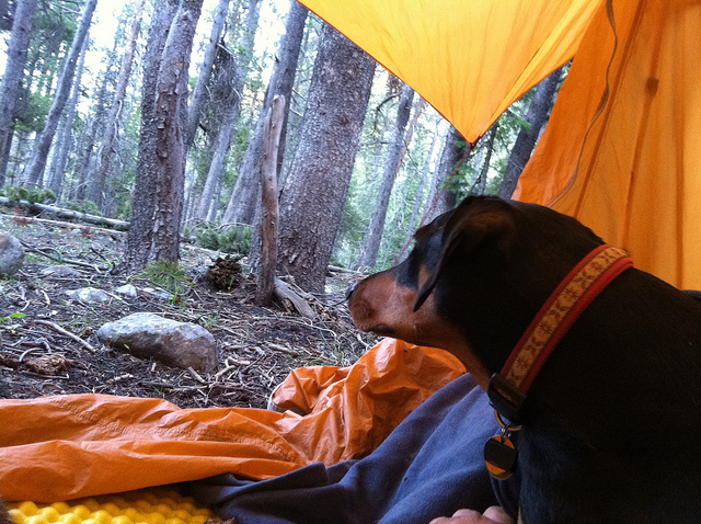
I used my iPhone for a few photos like this late that evening around camp.
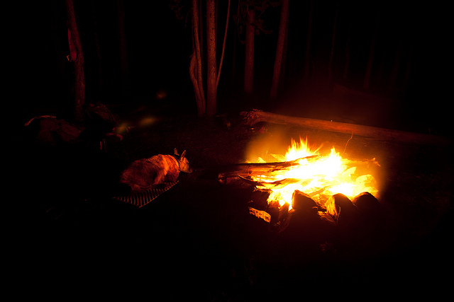
Later on that night Tim let me take a couple shots with his 5D. Here's one of Nikita and Teak around the fire.
A few more from the next day with my iPhone.
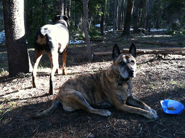
The dogs having breakfast.
And the hike out.
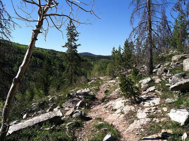
On the way out there was a spot where a small stream crossed the trail on some big flat rocks. I was a few hundred feet of Tim as I stepped into the stream. Immediately I slipped as if I had just hit black ice. As I scrambled to stay upright I ended up having to make a huge jump off the edge of the waterfall. It was only 4-5 feet but I did a big, high jump and landed squarely in the center of the stream below. If I had had a heavier pack or if there had been more rocks in the stream, I feel it could easily have been a broken leg kind of situation. I just stood there and shook for a few minutes afterwards. Whats with all the slipping on this hike!? Here's a pic of the spot as we were hiking in the first day.
We drove back to Salt Lake and I had the pleasure of telling Audra that I had apparently killed off my nearly new camera. We talked it over and after looking at the soles of my 4 year old boots, we decided they were largely to blame. They were my heavy duty Vasque backpacking boots. The boots still looked great and the tread still had a good amount left but the rubber had become super slick. First order of business, new boots!
Over the next couple of days I researched how to handle the camera situation. My hopes of paying a few hundred dollars crumbled apart as I read the accounts of other people who had water damaged their Canon SLR's. Pretty much every one I read stated that Canon would not fix the camera for any price. They were offered a light discount on refurbs but their cameras were effectively lost. This is NOT good. Just a month or two earlier I had looked into adding my camera equipment to a special insurance policy that would have covered them 100%. The price was low and I was going to do it, I just hadn't gotten around to submitting the serial numbers to my insurance agent. Could'a, would'a, should'a...
So I bit the bullet and shipped my 60D off to Canon Factory Service. After a few days I got an email saying that after initial inspection my warranty repair was approved and that I should have it back in 7 days. This was followed by another line that basically said 'unless we find water damage'. Over the next few days I waited, expecting at any time to get the email saying my camera was toast. But it never came. And then, exactly 7 days after they said it would be 7 days. My camera was back in my hands. And miraculously, they had repaired it under warranty. The repair sheet said that the circuit board was bad and had been replaced and that other cleaning had taken place. Talk about dodging a bullet! So now here I am, just a few weeks later and it's like nothing ever happened. My camera bag is now totally insured at a very reasonable rate (about $3 per month for $3k worth of gear). And I have an awesome new point and shoot camera that I picked up while my SLR was away. I am SO lucky.
Here it is almost the end of June and I'm backpacking Shingle Creek. Not good! Don't get me wrong, I like it, but by June 26th I should be able to get into some lakes, even if there is still a bit of snow around. But for years like this, or if you have an itch to get out before the high country has melted, Shingle Creek can be a good destination. I first did it on June 3rd, 2006. You can view that trip report here: Shingle Creek, Uintas, June 2006.
The Shingle Creek trailhead is located north of Highway 150 between the turnoff for Upper Setting Road and Norway Flats. Here's a map:
View larger map.
I hadn't really planned anything for this weekend, after the strenuous weekend I'd had in Zion a week earlier, I was kind of looking forward to sticking around home and relaxing. But my friend Tim had his sights on checking things out up there and invited me along. Tim is pretty new to Utah so this was to be his first glimpse at The Uintas. We left Salt Lake at 7am and headed east towards Kamas. We made a quick stop in Murdock Basin to grab something from Bill who was camping there before heading up to Bald Mountain Pass to see how far the road had been cleared.
We were able to drive all the way up the road to just below Bald Mountain Pass before we were stopped by snow. Typically this road is open by Memorial Day, sometimes a week or two later. I can't remember ever hearing about it closed this far into the summer.
The road on the other side of the snow plows and blowers.
Still a lot of snow out there. Lost Lake and Lily Lake were still covered in ice with slushy spots starting to show but no open water. Up here at 10,700 feet there was easily 5-10 feet of snow still around.
We had brought along snowshoes in the hopes of hiking into the Duck/Marjorie/Weir Lakes area. I knew there would be snow but Duck is pretty low at 9800 feet and I thought we might be able to snowshoe over to it and find a bit of dry ground to setup camp. But the snow as just too thick well below 9800'. So much so that the turnoff to the Crystal Lake trailhead was still buried in snow, we couldn't even turn up there. So we went with the backup plan and headed back down the highway towards Shingle Creek.
One of the reasons Shingle Creek works so well for an early season hike are the bridges. This would have been impossible to do without them. See my trip earlier this month along the North Fork Provo for a good illustration of that.
A little further up the trail, this is usually a meadow with a stream running through it but the raging river had overwhelmed it.
Tim heading up into the aspens.
Tim crossing the second bridge along the trail.
Looking up stream while crossing the second bridge. The volume of water was a little intimidating.
Teak was really scared and didn't want to cross. I'm actually really glad she is afraid of swift water, if only I could get here to fear the edges of cliffs.
After the second bridge the trail gets steep for a bit but offers some excellent views. This shot is of a picturesque beaver pond and waterfall on the other side of the canyon.
Uh oh. We have bridge damage!
And the same bridge in 2006:
Once again, Teak was terrified of the bridge but apparently not the water. She ended up walking right through the calm water under this section of the bridge and climbing back up onto it beyond the broken section.
Nikita crossing the third bridge. I'm probably including a lot of photos I might not normally include but you'll understand why a little further into the report.
Not far past the third bridge is where we ran into snow on the 2006 trip. This time I was hoping to get a bit further up the trail. Possibly even hike in the snow up to East Shingle Creek Lake. But it was not to be...
As soon as the trail entered into the forest, the snow started to get thick. A little thicker than it was on June 3rd of 2006 in fact. We decided to camp in the same spot I camped then but there was still a lot of snow right up to the fire pit. June 25, 2011:
Same campsite, June 3, 2006, not quite the same angle but you get the idea.
We ended up finding another campsite just 150 feet or so away that was clear of snow. We had some lunch, setup camp and decided to day hike further up the trail. At first it was just intermittent snow patches that had to be walked through. It was slippery and wet but not too bad.
There were a few clear spots that were almost snow free but eventually it started to become pretty much pure snow. This is at about 8900 feet.
And then almost to 9000 feet we decided to turn around. It got a bit steeper and a lot deeper and it was difficult to hike in without some improved traction. Snowshoes would have been great. We had made it a little less than 2/3 of a mile by the time we turned around.
Shortly after turning back we arrived back on a small stream that we had crossed on the way up. Tim had originally tried crossing on a snow bridge but broke through and got his feet wet. I took the high road and crossed on rocks. It worked well going up the canyon but something went terribly wrong going down. See that rock on the bottom left corner of the photo? Well I stepped there and the next thing I know I'm on my hands and knees in the deepest part of the stream. And what went in to the drink with with me? My 6 month old Canon 60D SLR camera and 10-22mm ultra wide angle lens. About $2k in camera gear to be exact and it spent at least a few seconds fully submerged in the strongest part of the river before I could pull it out. It was still on when I pulled it out of the water so I turned it off and decided to let it dry for the rest of the day before doing anything. This was the last image I took before the incident.
We hiked back to camp talking about stories of camera destruction. I have to say that Tim made me feel much better with his story of dropping a 5D with several days worth of photos off of the cliffs of Big Sur and into the Pacific Ocean. Ouch! I had a pretty good attitude about it really. I figured it might cost me a few hundred bucks to repair but a valuable lesson was learned. And who knows, maybe once it dried out it will work fine.
So we went back to camp and spent the next few hours purifying water and relaxing. I set my camera out in the sun and let it roast, hoping that by some miracle it would still fire up later on. Sometime in the early evening I decided to give it a try and.... nothing. Totally dead. I popped the lens cap off of my ultra wide angle lens and there was condensation all over the inside of the front element. This is BAD.
Okay, no camera for the rest of the trip. I've been here before, it's a short trip. "No biggie" I tell myself. A few hundred bucks and it should be fixed and I will have learned an important lesson.
I used my iPhone for a few photos like this late that evening around camp.
Later on that night Tim let me take a couple shots with his 5D. Here's one of Nikita and Teak around the fire.
A few more from the next day with my iPhone.
The dogs having breakfast.
And the hike out.
On the way out there was a spot where a small stream crossed the trail on some big flat rocks. I was a few hundred feet of Tim as I stepped into the stream. Immediately I slipped as if I had just hit black ice. As I scrambled to stay upright I ended up having to make a huge jump off the edge of the waterfall. It was only 4-5 feet but I did a big, high jump and landed squarely in the center of the stream below. If I had had a heavier pack or if there had been more rocks in the stream, I feel it could easily have been a broken leg kind of situation. I just stood there and shook for a few minutes afterwards. Whats with all the slipping on this hike!? Here's a pic of the spot as we were hiking in the first day.
We drove back to Salt Lake and I had the pleasure of telling Audra that I had apparently killed off my nearly new camera. We talked it over and after looking at the soles of my 4 year old boots, we decided they were largely to blame. They were my heavy duty Vasque backpacking boots. The boots still looked great and the tread still had a good amount left but the rubber had become super slick. First order of business, new boots!
Over the next couple of days I researched how to handle the camera situation. My hopes of paying a few hundred dollars crumbled apart as I read the accounts of other people who had water damaged their Canon SLR's. Pretty much every one I read stated that Canon would not fix the camera for any price. They were offered a light discount on refurbs but their cameras were effectively lost. This is NOT good. Just a month or two earlier I had looked into adding my camera equipment to a special insurance policy that would have covered them 100%. The price was low and I was going to do it, I just hadn't gotten around to submitting the serial numbers to my insurance agent. Could'a, would'a, should'a...
So I bit the bullet and shipped my 60D off to Canon Factory Service. After a few days I got an email saying that after initial inspection my warranty repair was approved and that I should have it back in 7 days. This was followed by another line that basically said 'unless we find water damage'. Over the next few days I waited, expecting at any time to get the email saying my camera was toast. But it never came. And then, exactly 7 days after they said it would be 7 days. My camera was back in my hands. And miraculously, they had repaired it under warranty. The repair sheet said that the circuit board was bad and had been replaced and that other cleaning had taken place. Talk about dodging a bullet! So now here I am, just a few weeks later and it's like nothing ever happened. My camera bag is now totally insured at a very reasonable rate (about $3 per month for $3k worth of gear). And I have an awesome new point and shoot camera that I picked up while my SLR was away. I am SO lucky.
") LOL!
LOL!