Vegan.Hiker
Member
- Joined
- Jul 5, 2014
- Messages
- 2,099
Franconia Ridge, White Mountains, NH - 8/19/14
Arethusa Falls and Mt. Willard, White Mountains, NH - 8/20/14
My wife Tyne and I went on a trip of New England last week. We spent time in Newport RI, Newburyport MA, Portsmouth NH, and on the last two days we hiked in the White Mountains of New Hampshire.
I'll be making a video of this trip but I'll post some pictures in the meantime.
Disclaimer - I'm not a photographer, these pics were taken with a $200 point and shoot with the exception of any pics with me in it which were then taken on my wife's DSLR.
On our first day of hiking we hiked Franconia Ridge. Franconia Ridge is part of the Appalachian Trail and the section of the ridge we hiked traverses Little Haystack, Mount Lincoln, and Mount Lafayette. We left our dog with a sitter for this hike because of the elevation gain and some technical scrambling getting up to and down from the ridge. While this loop is only 8.9 miles, it takes about 8-9 hours to complete. It's difficult to move more than 1 mph on the way up or down. There are very few switchbacks and you spend a good part of the climb and descent using your hands.
You arrive on the ridge at Little Haystack (a sub-peak of Mount Lincoln) and traverse Lincoln (5,089 ft) and Mount Lafayette (5,249 ft) before descending back down. While these elevations might not seem big to people on the west coast, the elevation gain from the trailhead to the ridge is 3,850 ft (over 4,000 counting dips) which is pretty substantial considering the rocky terrain of the trails and the lack of switchbacks. The ridge walk itself is pretty easy and lasts for 1.7 miles on this loop. We were fortunate to have done this on such a clear day. We spent about an hour and a half hiking the ridge with clear 360 degree views.
On our second day, we wanted to take it easy and bring our dog Joey so we decided to do two separate easy hikes with a lunch break in between. Before lunch we hiked Arethusa Falls, the highest falls in the White Mountains (about 3 miles and only 1000 ft elevation gain). After lunch we hiked Mount Willard (3.2 miles and another 1000 ft elevation gain).
On the third day we had planned to hike Mount Moosilauke but the weather changed and there were 60% chance of thunderstorms and lightning. We decided that an exposed ridge above treeline was not where we wanted to be stuck in a storm so we headed back home a day early. I'll be in Utah out by most of you guys to try and tackle Mt. Timp and Lake Blanche in 3 weeks, but as soon as I return from that I plan on taking a weekend to finally bag Mt. Moosilauke.
The Falling Waters Trail starts in a dense hardwood forest and follows a stream uphill. (My wife Tyne)
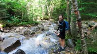
There are a number of falls and cascades on the way up.
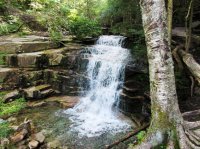
Tyne in front of Cloudland Falls

Almost above tree line, Cannon Mountain looms behind us.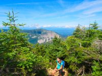
Finally, you creep out of the alpine forest and the ridge comes into view. You can take the ridge left towards Mount Lincoln or right towards Mt Liberty and Mt Flume. We took the ridge to the left towards Mt. Lincoln and Mt. Lafayette.
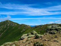
The view of Mt. Lincoln from Little Haystack.
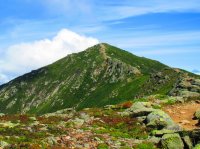
Heading north on the ridge, the Pemigewasset Wilderness is to our east.
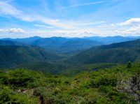
Tyne ahead of me, heading towards Lincoln.
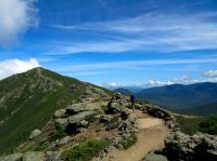
Tyne turning around to take my picture.
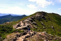
A look back at the trail along the ridge from atop Mount Lincoln (Liberty and Flume in the background).
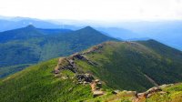
Once atop Lincoln, Mount Lafayette comes into view. This is a view of the trail. As you can see, the trail on the ridge is very well defined.
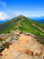
Some views looking east
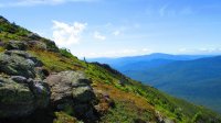
The Pemigewasset Wilderness to the east.
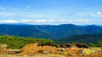
View to the west. I believe the mountains in the far distance are the Green Mountains of Vermont.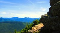
Another view west
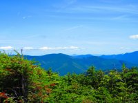
A false peak on the way up
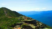
A picture looking back at Mount Lincoln and the false peak from atop Mount Lafayette.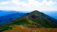
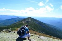
Eating a snack atop Lafayette.
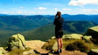
Tyne taking some pictures atop Mt Lafayette.
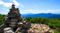
A cairn as we enter back below treeline into the alpine forest.
About halfway down Mt Lafayette... A look back up at the ridge.
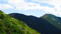
About a mile from the finish, a look up at the ridge. Lafayette is on the left, Lincoln on the right, and the false peak in between them.
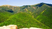
This TR is probably already too long so I'll just show two or three pictures from the next day.
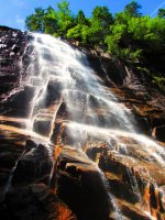
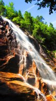
Arethusa Falls
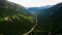
Atop Mount Willard looking into the saddle of Crawford Notch. Mount Willey is to the right, Webster Cliffs to the left, and Rt. 302 and the RR tracks down below.
It was a shame we couldn't tackle Mount Moosilauke because of the weather. We plan on coming back later this season after I return from Utah.
Here is a video I made of Franconia Ridge.
Arethusa Falls and Mt. Willard, White Mountains, NH - 8/20/14
My wife Tyne and I went on a trip of New England last week. We spent time in Newport RI, Newburyport MA, Portsmouth NH, and on the last two days we hiked in the White Mountains of New Hampshire.
I'll be making a video of this trip but I'll post some pictures in the meantime.
Disclaimer - I'm not a photographer, these pics were taken with a $200 point and shoot with the exception of any pics with me in it which were then taken on my wife's DSLR.
On our first day of hiking we hiked Franconia Ridge. Franconia Ridge is part of the Appalachian Trail and the section of the ridge we hiked traverses Little Haystack, Mount Lincoln, and Mount Lafayette. We left our dog with a sitter for this hike because of the elevation gain and some technical scrambling getting up to and down from the ridge. While this loop is only 8.9 miles, it takes about 8-9 hours to complete. It's difficult to move more than 1 mph on the way up or down. There are very few switchbacks and you spend a good part of the climb and descent using your hands.
You arrive on the ridge at Little Haystack (a sub-peak of Mount Lincoln) and traverse Lincoln (5,089 ft) and Mount Lafayette (5,249 ft) before descending back down. While these elevations might not seem big to people on the west coast, the elevation gain from the trailhead to the ridge is 3,850 ft (over 4,000 counting dips) which is pretty substantial considering the rocky terrain of the trails and the lack of switchbacks. The ridge walk itself is pretty easy and lasts for 1.7 miles on this loop. We were fortunate to have done this on such a clear day. We spent about an hour and a half hiking the ridge with clear 360 degree views.
On our second day, we wanted to take it easy and bring our dog Joey so we decided to do two separate easy hikes with a lunch break in between. Before lunch we hiked Arethusa Falls, the highest falls in the White Mountains (about 3 miles and only 1000 ft elevation gain). After lunch we hiked Mount Willard (3.2 miles and another 1000 ft elevation gain).
On the third day we had planned to hike Mount Moosilauke but the weather changed and there were 60% chance of thunderstorms and lightning. We decided that an exposed ridge above treeline was not where we wanted to be stuck in a storm so we headed back home a day early. I'll be in Utah out by most of you guys to try and tackle Mt. Timp and Lake Blanche in 3 weeks, but as soon as I return from that I plan on taking a weekend to finally bag Mt. Moosilauke.
The Falling Waters Trail starts in a dense hardwood forest and follows a stream uphill. (My wife Tyne)

There are a number of falls and cascades on the way up.

Tyne in front of Cloudland Falls

Almost above tree line, Cannon Mountain looms behind us.

Finally, you creep out of the alpine forest and the ridge comes into view. You can take the ridge left towards Mount Lincoln or right towards Mt Liberty and Mt Flume. We took the ridge to the left towards Mt. Lincoln and Mt. Lafayette.

The view of Mt. Lincoln from Little Haystack.

Heading north on the ridge, the Pemigewasset Wilderness is to our east.

Tyne ahead of me, heading towards Lincoln.

Tyne turning around to take my picture.

A look back at the trail along the ridge from atop Mount Lincoln (Liberty and Flume in the background).

Once atop Lincoln, Mount Lafayette comes into view. This is a view of the trail. As you can see, the trail on the ridge is very well defined.

Some views looking east

The Pemigewasset Wilderness to the east.

View to the west. I believe the mountains in the far distance are the Green Mountains of Vermont.

Another view west

A false peak on the way up

A picture looking back at Mount Lincoln and the false peak from atop Mount Lafayette.

Eating a snack atop Lafayette.

Tyne taking some pictures atop Mt Lafayette.

A cairn as we enter back below treeline into the alpine forest.

About halfway down Mt Lafayette... A look back up at the ridge.

About a mile from the finish, a look up at the ridge. Lafayette is on the left, Lincoln on the right, and the false peak in between them.

This TR is probably already too long so I'll just show two or three pictures from the next day.
Arethusa Falls


Atop Mount Willard looking into the saddle of Crawford Notch. Mount Willey is to the right, Webster Cliffs to the left, and Rt. 302 and the RR tracks down below.

It was a shame we couldn't tackle Mount Moosilauke because of the weather. We plan on coming back later this season after I return from Utah.
Here is a video I made of Franconia Ridge.
Last edited:
