Udink
Still right here.
- Joined
- Jan 17, 2012
- Messages
- 1,691
Hey look, another Maze trip report!  It seems like an awful lot of people on the forum have been there recently, and it was great to finally see it in person. This trip was June 1-5, 2012.
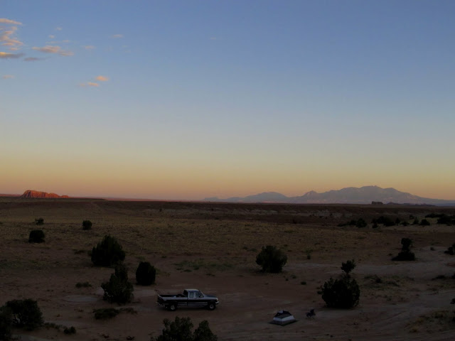
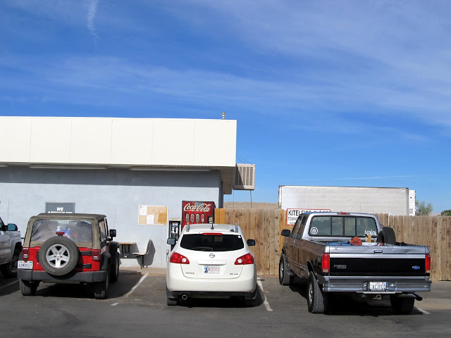
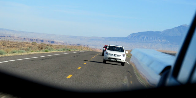
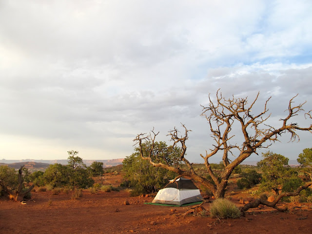
On a day in early January of this year, I was sitting at my desk in front of the computer and the phone rang, with a familiar name on the caller ID. It was Richard Barron of Ada, OK, with whom I was acquainted but had never met, asking if I'd be interested in a future trip to the Maze district of Canyonlands National Park. "Sure," I said, and so found myself driving south on Thursday afternoon last week to meet up with Richard and a third person, Kevin, who was nearing the end of a weeks-long trip to Utah from Vancouver, BC, Canada. I wasn't as well-acquainted with Kevin as with Richard, but I knew of him before the trip planning began. Of course, there was a lot of planning between January and now. I wanted to stick with my goal of camping at least one night per month in 2012, so I drove down one day in advance of our planned meeting and camped at a favorite spot near the Temple Mountain/Goblin Valley road junction. On Friday morning I arose early and packed up camp, then met Richard and Kevin in Hanksville for breakfast before we started our drive into the Maze. We got got to know each other better over breakfast, then in three separate vehicles drove north on UT-24 and then over 46 miles of rougher-than-usual dirt roads (Emery County has, according to the NPS ranger at Hans Flat, been late in their road maintenance). At the Hans Flat ranger station, we checked in and I obtained the permit I'd reserved months ago. Richard loaded his belongings and himself into my truck, then Kev followed in his rental Jeep Wrangler into the Maze while Richard's vehicle remained at Hans Flat.
My solo camping spot near the Temple Mountain/Goblin Valley road junction on Thursday evening before driving into the Maze
After meeting Richard and Kev on Friday in Hanksville for breakfast, we made a stop at Stan's Chevron for some last-minute supplies
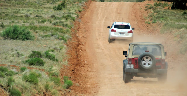
Side-mirror view of Richard in his Nissan Rogue and Kev in his rental Jeep, heading north on UT-24
The start of the dirt road into Hans Flat and the Maze
Hans Flat ranger station where Richard left his Nissan and piled in with me in the F-250
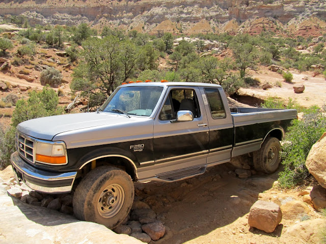
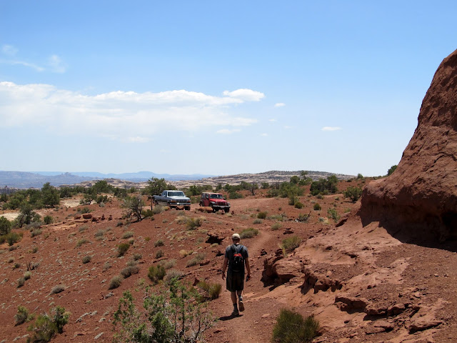
I knew it would be difficult getting my long-wheelbase truck down the Flint Trail switchbacks and through the rugged road around the head of Teapot Canyon. I was in the lead, and I took it slowly because of the stiff suspension on my heavy-duty truck. The technical 4WD obstacles in the road were actually a little more difficult than I was expecting, but the F-250 slowly and carefully made it through them without much effort. The overall roughness of the road was much worse than I could have imagined before actually experiencing it. Many times I stopped the truck and got out to inspect the road and obstacles ahead in order to choose the best line. After the roughest part around Teapot Canyon but before reaching camp, a noise began emanating from the front-end of my truck during the tighter turns. I unlocked the manual hubs and continued in 2WD--the noise went away but it had me worried. It took about six hours to get from the ranger station to our camp at Standing Rock, a distance of only 36 miles.
Flint Trail switchbacks
The road into the Maze
The road into the Maze; Kev stacking a few rocks
The road into the Maze
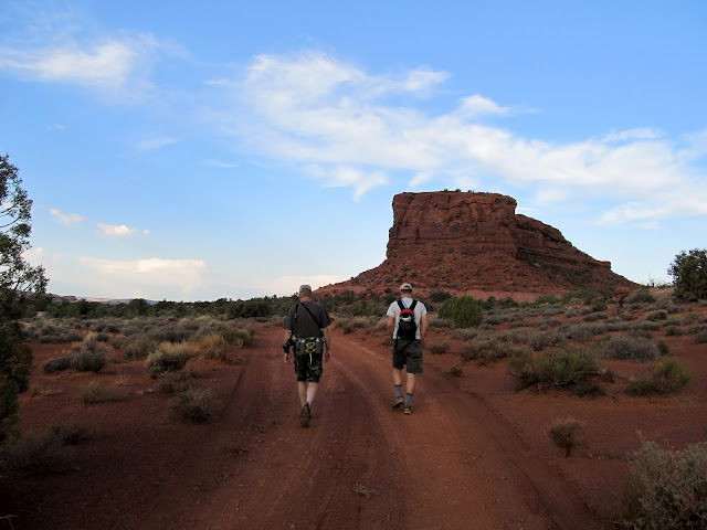
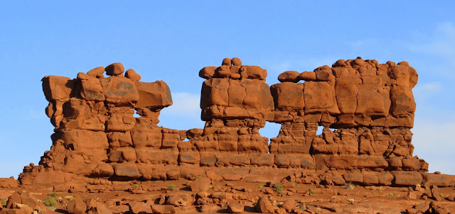
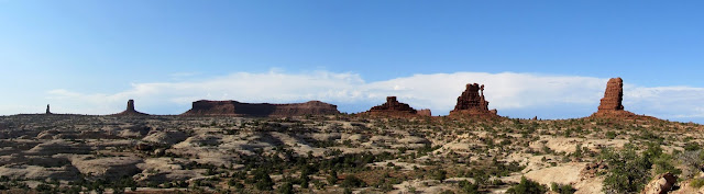
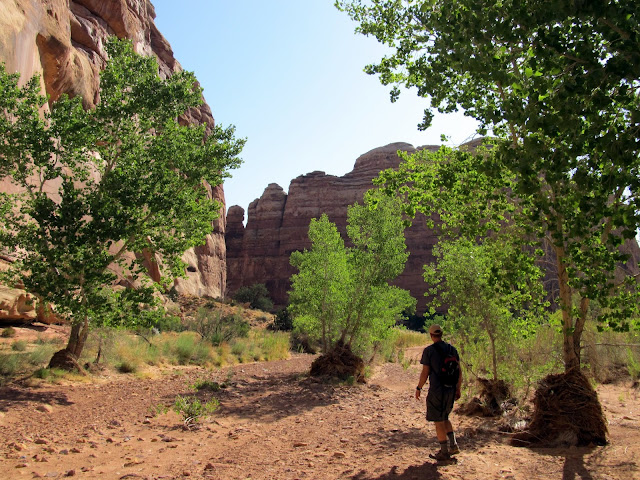
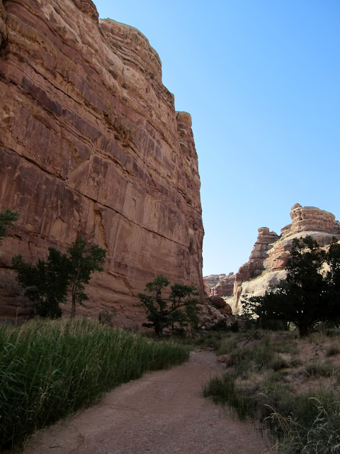
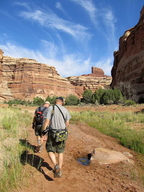
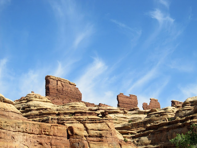
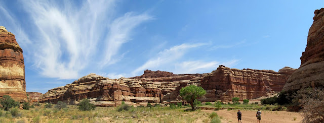
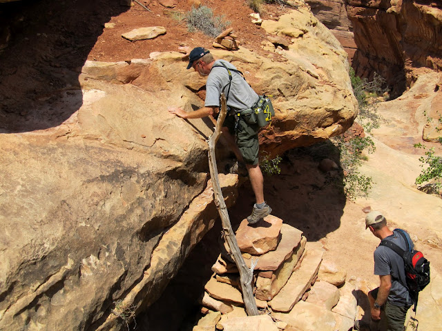
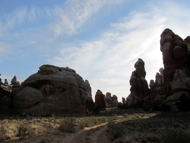
At camp we scouted around for spots to set up our tents, then hiked around a little to explore the immediate area. We sat in the shade of an alcove at the base of Standing Rock and talked through the evening, then turned in early. It was still hot outside after dark and I slept on top of my sleeping bag until early in the morning when I climbed inside to keep warm (this turned out to be the case each night). We were all awake by 5:30 and witnessed a beautiful sunrise. Before 7:00 on Saturday morning we were walking down the road toward the trailhead for the Chocolate Drops, a destination we'd chosen the previous evening. We had a 1.5-mile road walk before starting down the actual trail. As we hiked north on the trail our view of the Land of Standing Rocks receded, and the camp at Standing Rock looked quite far away. We were treated to and teased by amazing views down into the Maze canyons as we hiked the ridgeline to the Chocolate Drops. The hiking was fairly easy, with only one spot where we had to scramble with a little exposure as we crossed a saddle in the ridge just before reaching the Chocolate Drops (which, we decided, look much more like chocolate bars).
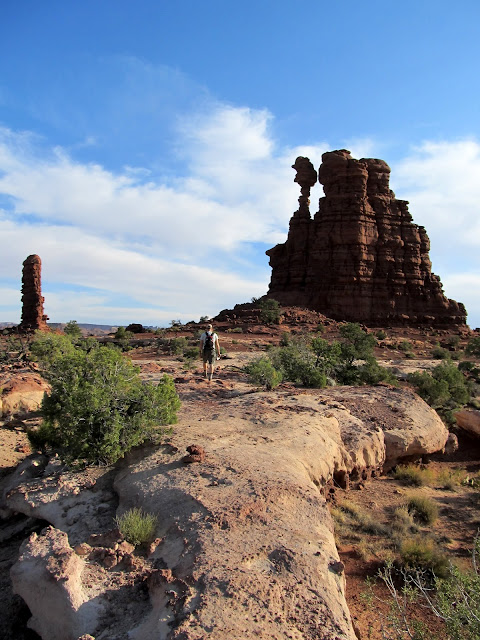
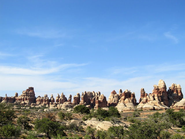
Chimney Rock (not Standing Rock
Standing Rock
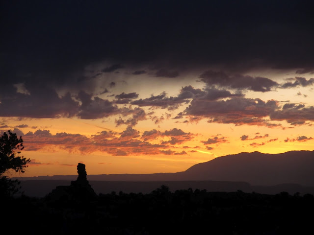
Sunset viewed alongside Standing Rock
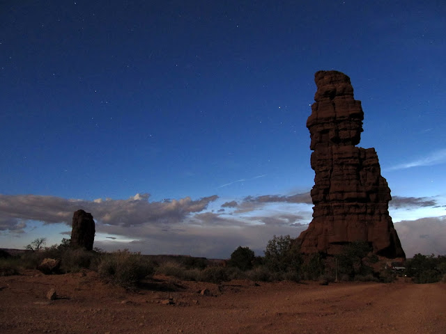
The Plug and Standing Rock at night
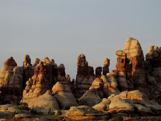
Chimney Rock at sunrise on Saturday
Walking along the road toward the Chocolate Drops trail
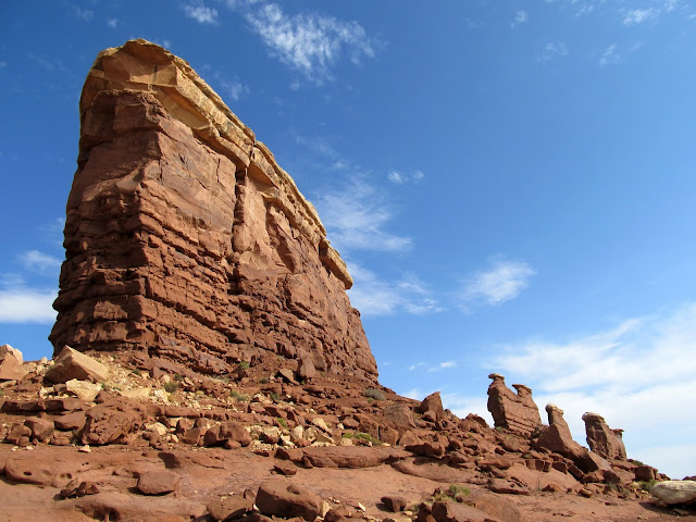
Tapestry Slab
Formations along the Chocolate Drops trail
View south from the Chocolate Drops trail toward the Land of Standing Rocks
Chocolate Drops
Chocolate Drops
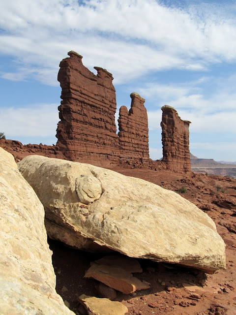
Chocolate Drops
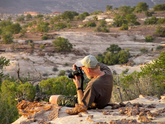
A storm had been moving in from the south as we hiked north. We rested in the shade of one of the Chocolate Drops before following the same route back to camp. The wind picked up and the sky darkened, and we worried about whether our tents were staked down well enough to withstand the onslaught. I think we rested less frequently on the hike back to camp, and I had to push myself to keep pace with Kev who was in the lead most of the time. I was grateful for the push, however, because I was afraid that I'd have to pick up the pieces of my tent a mile downwind from camp if we didn't hurry. We got back to camp at 12:30PM to find our camp intact. We'd hiked about 12 miles in just under six hours. The storm was short-lived, and the heat returned as the storm passed. We shaded up in the alcove beneath Standing Rock once again until it got relatively cooler in the evening. Richard and I took another evening stroll around sunset and took some photos. We fell into a routine of going to bed around 10:00 and rising around 5:30 each morning, a pattern which perfectly suited the best parts of the day to be hiking and sleeping.
The storm closing in
Returning to camp along the Chocolate Drops trail
Mammatus clouds
My tent at Standing Rock camp on Saturday evening
Richard taking a photograph
A canyon near Standing Rock with Elaterite Butte on the horizon
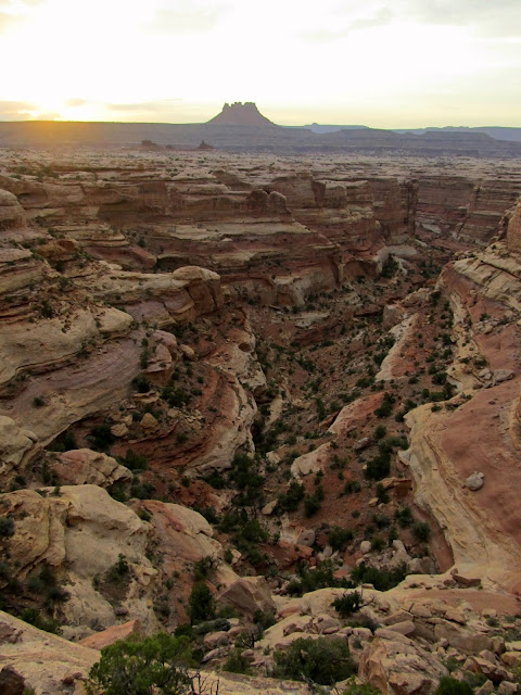
On Sunday morning it took us a while longer than usual to get started on the hike because we had to pack up camp first. Our two nights at Standing Rock camp were up and the next two nights would be spent at Doll House 3 camp. We took down our tents and drove to the Chimney Rock trailhead and started hiking at about 7:30. The plan, again decided in the shaded alcove the night before, was to descend the Chimney Rock route into the canyons of the Maze and visit the Harvest Scene pictograph panel, then ascend out of the canyons on the Pete's Mesa route back to Chimney Rock. By 8:00AM we'd descended into the shade of the canyon, and it was already a welcome relief from the sun. I should mention that daytime temps were reaching near 100° and nighttime lows were just below 70°. Early morning hiking, and shading up in the afternoon/evening, is the best course of action in the summer months. We followed what felt like a circuitous route into the bottom of the Maze, though on the map the route looks more direct than it felt. We easily scrambled down ledges and followed shelves of sandstone in one fork of the canyon until reaching the sandy bottom. From there, it was an easy but sandy and energy-sapping walk to the Harvest Scene. I was not prepared for the awesomeness of the pictographs there.
Not a bad view to wake up to

At Chimney Rock, the start of Sunday morning's hike
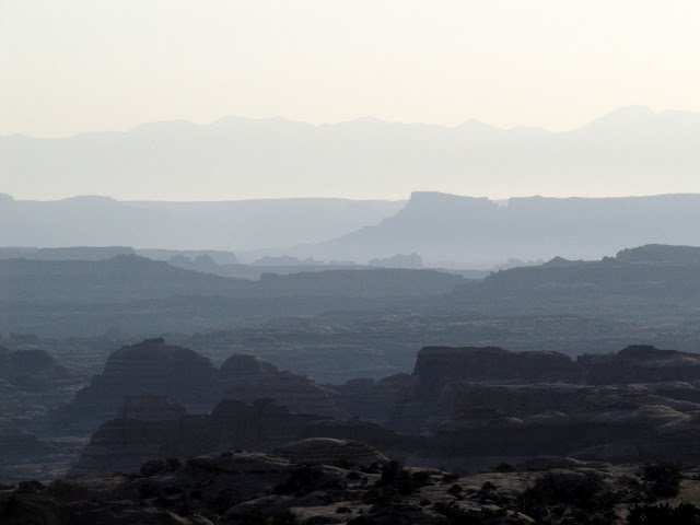
Hazy view to the east from Chimney Rock
Starting the descent on the Chimney Rock route into the Maze
In the canyon bottom
Panorama at the confluence
Cottonwood trees with flash flood debris
More shade in a relatively lush area
A seep where somebody had dug a hole in order to collect and pump/filter water
The destination of our previous day's hike, the Chocolate Drops, viewed from the canyon below
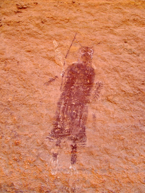
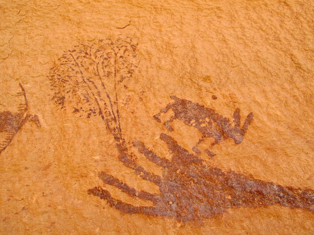
From my little research, I expected the pictographs to be life-sized and detailed, but they were more than just that. There were minute details that have faded over the centuries but are still hinted at. We could only speculate about their meanings, and for me that speculation led to much wonder about what it must have been like to call this place home. The rock art was shaded and so we spent plenty of time there resting and enjoying the art, then pressed on toward our exit route. We saw the Chocolate Drops from below, as our previous day's route was a mere third of a mile from the Harvest Scene, but separated by 600 vertical feet of ledges and cliffs. It was not yet 11:00AM and the heat of the day was bearing down. We ascended toward the ridge south of Pete's Mesa, resting in the shade occasionally. Once atop the ridge the ascent back to the vehicles was much gentler and we made good time. The total hiking distance for the day was about 10.4 miles and we ground it out in about 6.5 hours.
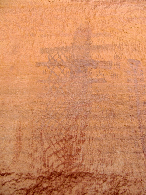
Harvest Scene pictographs; This dude was my favorite
Harvest Scene pictographs
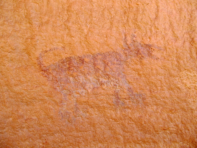
Harvest Scene pictographs; Man's best friend for thousands of years
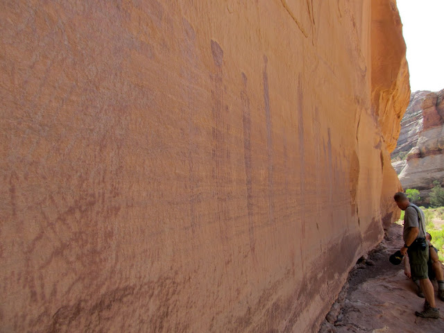
Harvest Scene pictographs, with Richard and Kevin for scale
Harvest Scene pictographs
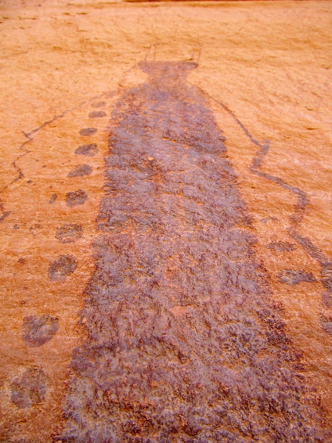
Harvest Scene pictographs
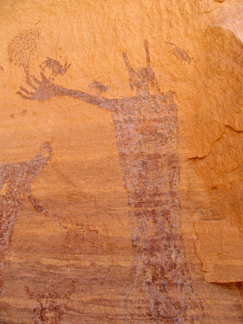
Harvest Scene pictographs
Major canyon confluence north of the Harvest Scene
Pete's Mesa route out of the Maze
The end of Sunday's hike
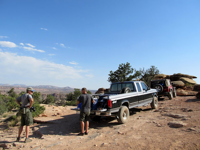
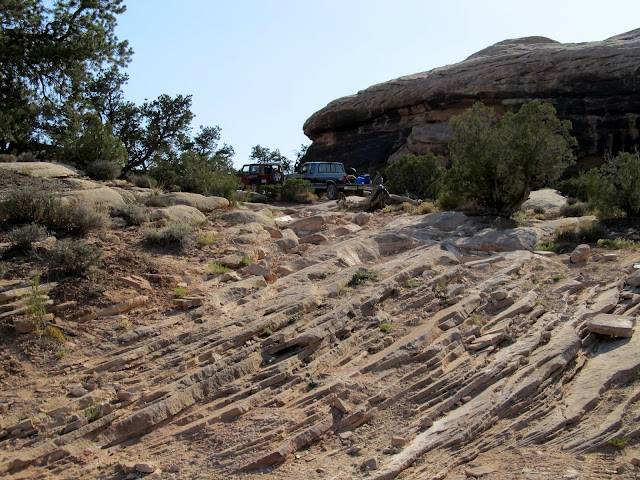
The drive between Chimney Rock and Doll House 3 required 4WD a few times, but I used it as sparingly as possible in the truck. Kevin took the lead this time because he was already below half a tank and it was very questionable whether he'd make it back to civilization before running out of fuel. My slow pace in the truck had caused him to get less-than-ideal fuel mileage on the drive in. Richard and I arrived at DH3 to find Kev waiting in his Jeep at the bottom of the rough-ass (yes, that's the perfect adjective) hill leading into the campsite and wondering if we should drive the remaining couple of hundred feet up. I was all for it, so we drove the rest of the way and once again took up shelter with our camp chairs in an alcove until it cooled off. Of the three camp sites in the Doll House area, ours was the only one outside of the Doll House, but it afforded a nice view of the Doll House. We started out on an early-evening hike to Surprise Valley, but I had become dehydrated during the earlier hike and I couldn't make it more than about a third of a mile before my thighs cramped up. I left Richard and Kev to continue while I returned to camp. I was severely bummed, but took the opportunity back at camp to take a spit bath using a wipe and the now-warm drinking water that I'd brought.
After arrival at the Doll House 3 camp site
The 'road' into Doll House 3
The Doll House
The Doll House
Tents at Doll House 3 camp
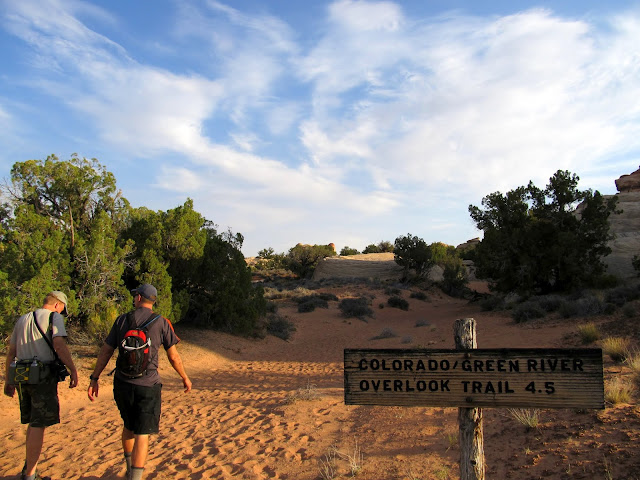
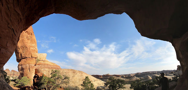
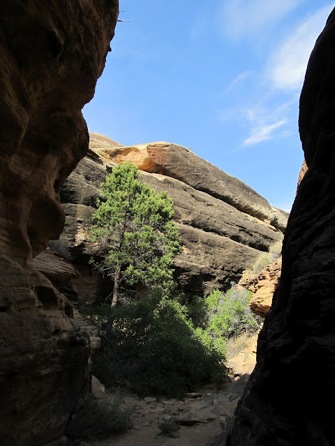
Monday was our last day of hiking, since most of the next day would be spent driving out of the Maze. I expected the higher-than-usual mileage of these trips to collectively take their toll on my body, but instead I actually became accustomed to the sleep schedule and my body got used to the long miles of hiking. We took my truck a short distance down the road and were hiking by 7:20AM on Monday morning. We were on the Colorado/Green River Overlook trail, which purported to have nice views of both rivers but it was questionable whether we'd be able to see the actual confluence where they came together. We hiked through the Doll House and past Beehive Arch. The route had many small ups-and-downs, but no sustained ascending or descending like Sunday's hike did. We seemed to stop to rest more on this day. Though my muscles couldn't take extended periods of hiking, my joints felt better than they had the previous couple of days.
Monday morning sunrise behind the La Sals from Doll House 3
In the Doll House for the start of the hike on the Colorado/Green River Overlook trail
Starting out on the trail Monday morning
Inside Beehive Arch
Colorado/Green River Overlook trail; We rested in the shade here just off-trail
Colorado/Green River Overlook trail
We first reached an overlook of the Colorado River. The view was great and reminded me a bit of a slightly less dramatic Toroweap. From there it was a short distance across a promontory to an overlook of the Green River, but we stopped in the shade of a juniper tree for a while before peering down toward the Green. We could actually just barely see the confluence with the Green and Colorado rivers from our viewpoint, but now I'm inclined to see the confluence from the east side in the Needles district of Canyonlands another day. The hike back to camp seemed to consist of more rest breaks than usual. Maybe my body was feeling the toll of the past couple of days, but my spirits were much improved. (Since returning home, I've tried to keep my activity level up by hiking and mountain biking, and I'll hopefully get into even better shape because of this trip.) The total distance for the hike was 10.2 miles and we did it in six hours and 20 minutes. Back at camp we rested in our shady alcove for a couple of hours. Kev labored over the decision whether to hike down to Spanish Bottom along the Colorado River, and eventually made up his mind to go for it. Richard and I nursed our sore muscles at camp but wished we were as fit as Kev. Were I at the banks of the Colorado, I could not have resisted taking a swim. I spread a tarp under my truck and looked at the drivetrain and found the u-joint on the outside of the right axle beginning to fail. That would account for the noise I heard on the drive in on the first day. I liberally oiled it with some engine oil and hoped that would be enough to get the truck to the top of the Flint Trail switchbacks. We had that and Kev's fuel situation to worry about the next day.
Colorado River
Colorado River
Green River, with the Green/Colorado confluence almost visible on the far right
The confluence can barely be seen from the trail
Tex's Riverways boat on the Colorado River
Cactus growing in moss
That evening we sat in our camp chairs, in our alcove, and drank some rum. We shared stories, and at least one of us saw two full moons rise as we reveled in our amazing time in the Maze. I slept well most of that night, but I was awake at the usual 5:30 on Tuesday morning. We skipped breakfast, packed up camp, and were on the road by 6:30. I used 4WD very sparingly on the drive out, undoubtedly leaving more rubber than necessary from my rear tires on the sandstone of the Maze. Kev took the lead driving back toward Hans Flat so that he could drive at his most economical speed and conserve fuel. He'd stop every once in a while and shut off the engine to wait for Richard and me. Getting past the head of Teapot Canyon was a relief, but the worry still wasn't over. I had the Flint Trail switchbacks to make it up before I was in the clear. The Flint Trail turned out to be more difficult to ascend than it had been to descend. One tight corner in particular caused me to make a lot of back-and-forth moves before the truck could clear it. Once at the top, I breathed a huge sigh of relief. The hubs were turned to the "Free" position for the last time of the trip and the worry was over.
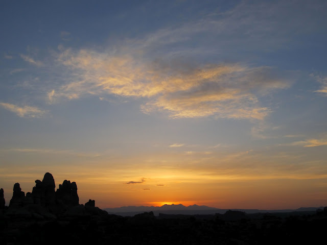
One final beautiful sunrise behind the La Sals
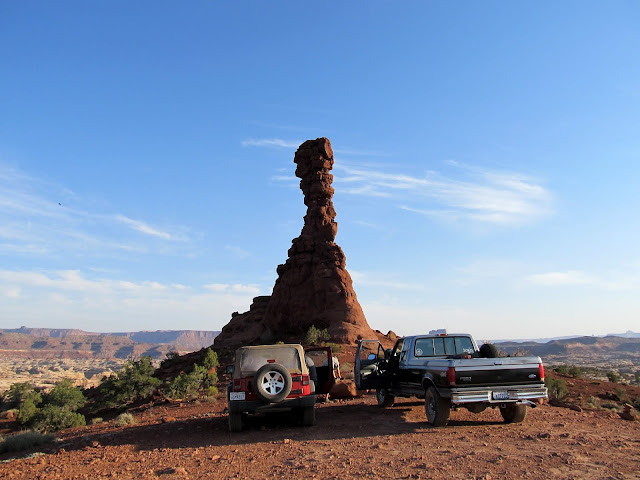
Quick stop on the drive out of the Maze on Tuesday
On the road out of the Maze
Road junction near Flint Cove
Having a little trouble with the long wheelbase on the Flint Trail switchbacks
We reached Hans Flat and Kev still had a little fuel to spare. Richard loaded his gear back into his car, then the trio of vehicles made way back toward pavement. Kev's plan was to travel as far as possible before running out of fuel, but the farther we traveled on the much better roads, the better his fuel mileage got. By the time we reached UT-24, the computer in the Jeep was estimating that Kev could make it to Hanksville before running out of fuel, so Richard followed him that direction while I departed to the north toward home.
Cruising from Hans Flat to UT-24
This trip was a little outside of my comfort zone. It was farther from home than I'm used to traveling, with people I'd never met, and on rougher roads than I've ever driven. It was wholly worthwhile. I made two new friends who made a hopefully long-lasting influence on me. I got a couple of different perspectives on life, both from my companions and the land in the Maze. I'm pretty certain that I'll never drive back into the Maze, but that doesn't mean I won't be back.
Check the full photo gallery here:
https://picasaweb.google.com/Dennis.Udink/TheMaze
Google Earth .KMZ File:
http://udink.org/geo/TheMaze.kmz
Google Maps:
https://maps.google.com/maps?q=http://udink.org/geo/TheMaze.kmz&hl=en&sll=37.0625,-95.677068&sspn=40.545434,86.572266&t=h&z=10
Featured image for home page:

It seems like an awful lot of people on the forum have been there recently, and it was great to finally see it in person. This trip was June 1-5, 2012.On a day in early January of this year, I was sitting at my desk in front of the computer and the phone rang, with a familiar name on the caller ID. It was Richard Barron of Ada, OK, with whom I was acquainted but had never met, asking if I'd be interested in a future trip to the Maze district of Canyonlands National Park. "Sure," I said, and so found myself driving south on Thursday afternoon last week to meet up with Richard and a third person, Kevin, who was nearing the end of a weeks-long trip to Utah from Vancouver, BC, Canada. I wasn't as well-acquainted with Kevin as with Richard, but I knew of him before the trip planning began. Of course, there was a lot of planning between January and now. I wanted to stick with my goal of camping at least one night per month in 2012, so I drove down one day in advance of our planned meeting and camped at a favorite spot near the Temple Mountain/Goblin Valley road junction. On Friday morning I arose early and packed up camp, then met Richard and Kevin in Hanksville for breakfast before we started our drive into the Maze. We got got to know each other better over breakfast, then in three separate vehicles drove north on UT-24 and then over 46 miles of rougher-than-usual dirt roads (Emery County has, according to the NPS ranger at Hans Flat, been late in their road maintenance). At the Hans Flat ranger station, we checked in and I obtained the permit I'd reserved months ago. Richard loaded his belongings and himself into my truck, then Kev followed in his rental Jeep Wrangler into the Maze while Richard's vehicle remained at Hans Flat.
My solo camping spot near the Temple Mountain/Goblin Valley road junction on Thursday evening before driving into the Maze
After meeting Richard and Kev on Friday in Hanksville for breakfast, we made a stop at Stan's Chevron for some last-minute supplies
Side-mirror view of Richard in his Nissan Rogue and Kev in his rental Jeep, heading north on UT-24
The start of the dirt road into Hans Flat and the Maze
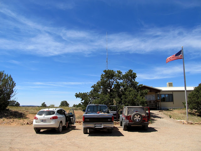
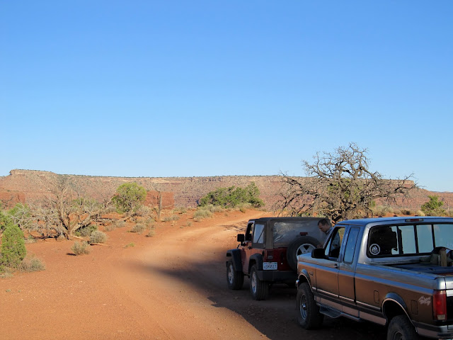
Hans Flat ranger station where Richard left his Nissan and piled in with me in the F-250
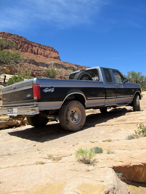
I knew it would be difficult getting my long-wheelbase truck down the Flint Trail switchbacks and through the rugged road around the head of Teapot Canyon. I was in the lead, and I took it slowly because of the stiff suspension on my heavy-duty truck. The technical 4WD obstacles in the road were actually a little more difficult than I was expecting, but the F-250 slowly and carefully made it through them without much effort. The overall roughness of the road was much worse than I could have imagined before actually experiencing it. Many times I stopped the truck and got out to inspect the road and obstacles ahead in order to choose the best line. After the roughest part around Teapot Canyon but before reaching camp, a noise began emanating from the front-end of my truck during the tighter turns. I unlocked the manual hubs and continued in 2WD--the noise went away but it had me worried. It took about six hours to get from the ranger station to our camp at Standing Rock, a distance of only 36 miles.
Flint Trail switchbacks
The road into the Maze
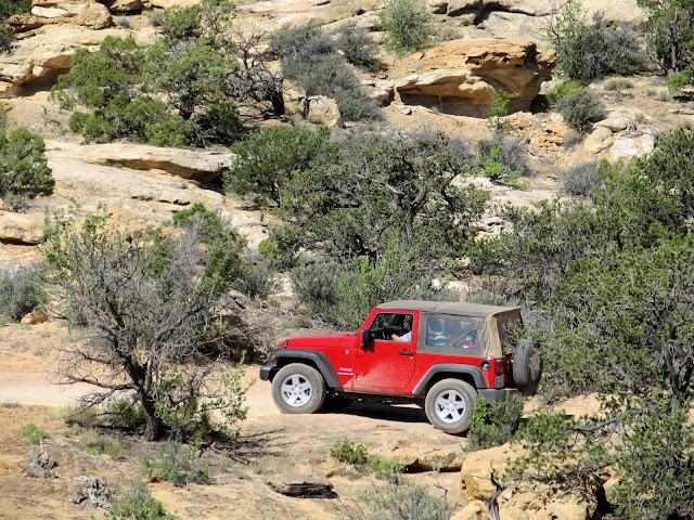
The road into the Maze; Kev stacking a few rocks
The road into the Maze
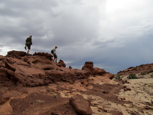
At camp we scouted around for spots to set up our tents, then hiked around a little to explore the immediate area. We sat in the shade of an alcove at the base of Standing Rock and talked through the evening, then turned in early. It was still hot outside after dark and I slept on top of my sleeping bag until early in the morning when I climbed inside to keep warm (this turned out to be the case each night). We were all awake by 5:30 and witnessed a beautiful sunrise. Before 7:00 on Saturday morning we were walking down the road toward the trailhead for the Chocolate Drops, a destination we'd chosen the previous evening. We had a 1.5-mile road walk before starting down the actual trail. As we hiked north on the trail our view of the Land of Standing Rocks receded, and the camp at Standing Rock looked quite far away. We were treated to and teased by amazing views down into the Maze canyons as we hiked the ridgeline to the Chocolate Drops. The hiking was fairly easy, with only one spot where we had to scramble with a little exposure as we crossed a saddle in the ridge just before reaching the Chocolate Drops (which, we decided, look much more like chocolate bars).
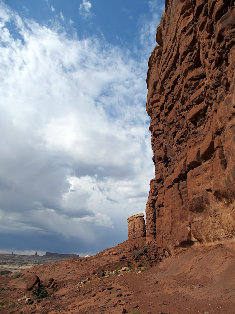
Chimney Rock (not Standing Rock
Standing Rock
Sunset viewed alongside Standing Rock
The Plug and Standing Rock at night
Chimney Rock at sunrise on Saturday
Walking along the road toward the Chocolate Drops trail
Tapestry Slab
Formations along the Chocolate Drops trail
View south from the Chocolate Drops trail toward the Land of Standing Rocks
Chocolate Drops
Chocolate Drops
Chocolate Drops
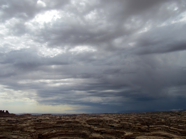
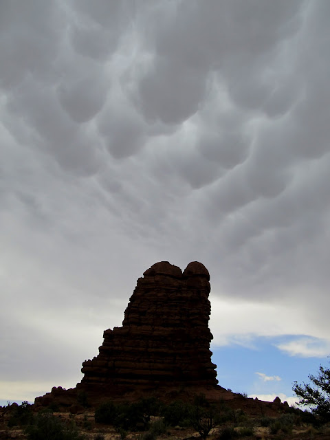
A storm had been moving in from the south as we hiked north. We rested in the shade of one of the Chocolate Drops before following the same route back to camp. The wind picked up and the sky darkened, and we worried about whether our tents were staked down well enough to withstand the onslaught. I think we rested less frequently on the hike back to camp, and I had to push myself to keep pace with Kev who was in the lead most of the time. I was grateful for the push, however, because I was afraid that I'd have to pick up the pieces of my tent a mile downwind from camp if we didn't hurry. We got back to camp at 12:30PM to find our camp intact. We'd hiked about 12 miles in just under six hours. The storm was short-lived, and the heat returned as the storm passed. We shaded up in the alcove beneath Standing Rock once again until it got relatively cooler in the evening. Richard and I took another evening stroll around sunset and took some photos. We fell into a routine of going to bed around 10:00 and rising around 5:30 each morning, a pattern which perfectly suited the best parts of the day to be hiking and sleeping.
The storm closing in
Returning to camp along the Chocolate Drops trail
Mammatus clouds
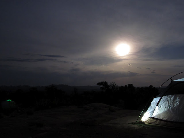
My tent at Standing Rock camp on Saturday evening
Richard taking a photograph
A canyon near Standing Rock with Elaterite Butte on the horizon
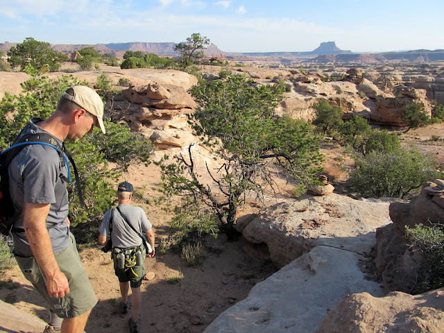
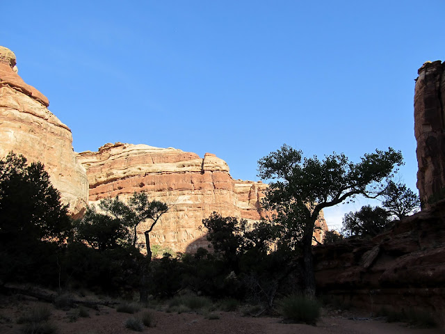
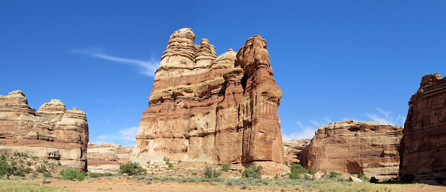
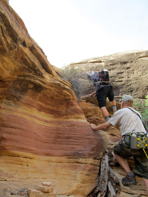
On Sunday morning it took us a while longer than usual to get started on the hike because we had to pack up camp first. Our two nights at Standing Rock camp were up and the next two nights would be spent at Doll House 3 camp. We took down our tents and drove to the Chimney Rock trailhead and started hiking at about 7:30. The plan, again decided in the shaded alcove the night before, was to descend the Chimney Rock route into the canyons of the Maze and visit the Harvest Scene pictograph panel, then ascend out of the canyons on the Pete's Mesa route back to Chimney Rock. By 8:00AM we'd descended into the shade of the canyon, and it was already a welcome relief from the sun. I should mention that daytime temps were reaching near 100° and nighttime lows were just below 70°. Early morning hiking, and shading up in the afternoon/evening, is the best course of action in the summer months. We followed what felt like a circuitous route into the bottom of the Maze, though on the map the route looks more direct than it felt. We easily scrambled down ledges and followed shelves of sandstone in one fork of the canyon until reaching the sandy bottom. From there, it was an easy but sandy and energy-sapping walk to the Harvest Scene. I was not prepared for the awesomeness of the pictographs there.
Not a bad view to wake up to
At Chimney Rock, the start of Sunday morning's hike
Hazy view to the east from Chimney Rock
Starting the descent on the Chimney Rock route into the Maze
In the canyon bottom
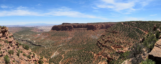
Panorama at the confluence
Cottonwood trees with flash flood debris
More shade in a relatively lush area
A seep where somebody had dug a hole in order to collect and pump/filter water
The destination of our previous day's hike, the Chocolate Drops, viewed from the canyon below
From my little research, I expected the pictographs to be life-sized and detailed, but they were more than just that. There were minute details that have faded over the centuries but are still hinted at. We could only speculate about their meanings, and for me that speculation led to much wonder about what it must have been like to call this place home. The rock art was shaded and so we spent plenty of time there resting and enjoying the art, then pressed on toward our exit route. We saw the Chocolate Drops from below, as our previous day's route was a mere third of a mile from the Harvest Scene, but separated by 600 vertical feet of ledges and cliffs. It was not yet 11:00AM and the heat of the day was bearing down. We ascended toward the ridge south of Pete's Mesa, resting in the shade occasionally. Once atop the ridge the ascent back to the vehicles was much gentler and we made good time. The total hiking distance for the day was about 10.4 miles and we ground it out in about 6.5 hours.
Harvest Scene pictographs; This dude was my favorite
Harvest Scene pictographs
Harvest Scene pictographs; Man's best friend for thousands of years
Harvest Scene pictographs, with Richard and Kevin for scale
Harvest Scene pictographs
Harvest Scene pictographs
Harvest Scene pictographs
Major canyon confluence north of the Harvest Scene
Pete's Mesa route out of the Maze
The end of Sunday's hike
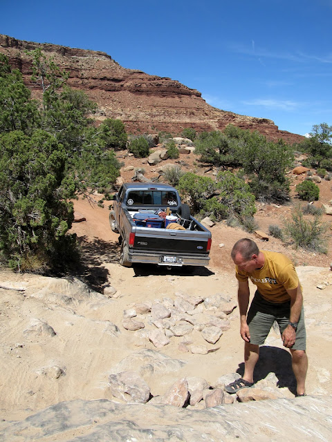
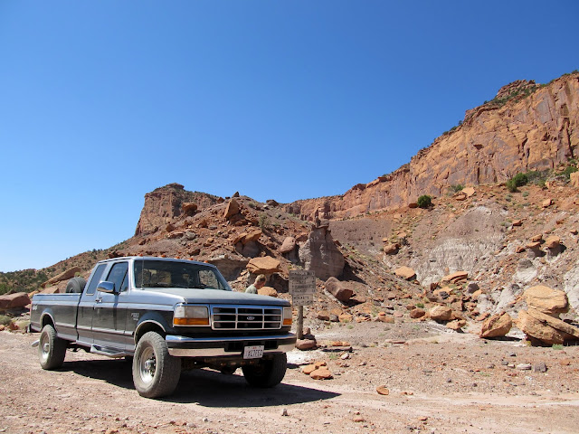
The drive between Chimney Rock and Doll House 3 required 4WD a few times, but I used it as sparingly as possible in the truck. Kevin took the lead this time because he was already below half a tank and it was very questionable whether he'd make it back to civilization before running out of fuel. My slow pace in the truck had caused him to get less-than-ideal fuel mileage on the drive in. Richard and I arrived at DH3 to find Kev waiting in his Jeep at the bottom of the rough-ass (yes, that's the perfect adjective) hill leading into the campsite and wondering if we should drive the remaining couple of hundred feet up. I was all for it, so we drove the rest of the way and once again took up shelter with our camp chairs in an alcove until it cooled off. Of the three camp sites in the Doll House area, ours was the only one outside of the Doll House, but it afforded a nice view of the Doll House. We started out on an early-evening hike to Surprise Valley, but I had become dehydrated during the earlier hike and I couldn't make it more than about a third of a mile before my thighs cramped up. I left Richard and Kev to continue while I returned to camp. I was severely bummed, but took the opportunity back at camp to take a spit bath using a wipe and the now-warm drinking water that I'd brought.
After arrival at the Doll House 3 camp site
The 'road' into Doll House 3
The Doll House
The Doll House
Tents at Doll House 3 camp
Monday was our last day of hiking, since most of the next day would be spent driving out of the Maze. I expected the higher-than-usual mileage of these trips to collectively take their toll on my body, but instead I actually became accustomed to the sleep schedule and my body got used to the long miles of hiking. We took my truck a short distance down the road and were hiking by 7:20AM on Monday morning. We were on the Colorado/Green River Overlook trail, which purported to have nice views of both rivers but it was questionable whether we'd be able to see the actual confluence where they came together. We hiked through the Doll House and past Beehive Arch. The route had many small ups-and-downs, but no sustained ascending or descending like Sunday's hike did. We seemed to stop to rest more on this day. Though my muscles couldn't take extended periods of hiking, my joints felt better than they had the previous couple of days.
Monday morning sunrise behind the La Sals from Doll House 3
In the Doll House for the start of the hike on the Colorado/Green River Overlook trail
Starting out on the trail Monday morning
Inside Beehive Arch
Colorado/Green River Overlook trail; We rested in the shade here just off-trail
Colorado/Green River Overlook trail
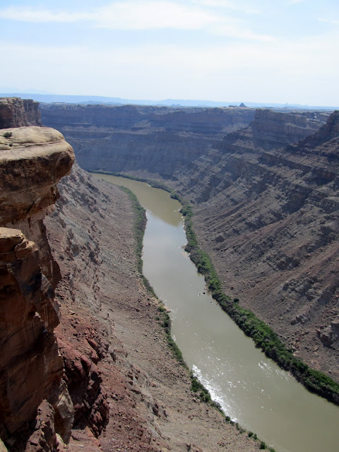
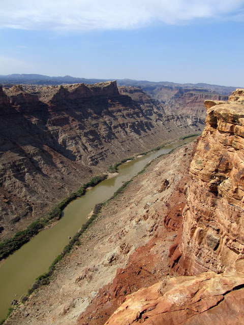
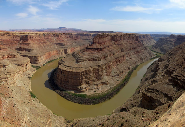
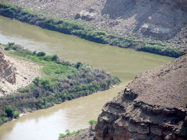
We first reached an overlook of the Colorado River. The view was great and reminded me a bit of a slightly less dramatic Toroweap. From there it was a short distance across a promontory to an overlook of the Green River, but we stopped in the shade of a juniper tree for a while before peering down toward the Green. We could actually just barely see the confluence with the Green and Colorado rivers from our viewpoint, but now I'm inclined to see the confluence from the east side in the Needles district of Canyonlands another day. The hike back to camp seemed to consist of more rest breaks than usual. Maybe my body was feeling the toll of the past couple of days, but my spirits were much improved. (Since returning home, I've tried to keep my activity level up by hiking and mountain biking, and I'll hopefully get into even better shape because of this trip.) The total distance for the hike was 10.2 miles and we did it in six hours and 20 minutes. Back at camp we rested in our shady alcove for a couple of hours. Kev labored over the decision whether to hike down to Spanish Bottom along the Colorado River, and eventually made up his mind to go for it. Richard and I nursed our sore muscles at camp but wished we were as fit as Kev. Were I at the banks of the Colorado, I could not have resisted taking a swim. I spread a tarp under my truck and looked at the drivetrain and found the u-joint on the outside of the right axle beginning to fail. That would account for the noise I heard on the drive in on the first day. I liberally oiled it with some engine oil and hoped that would be enough to get the truck to the top of the Flint Trail switchbacks. We had that and Kev's fuel situation to worry about the next day.
Colorado River
Colorado River
Green River, with the Green/Colorado confluence almost visible on the far right
The confluence can barely be seen from the trail
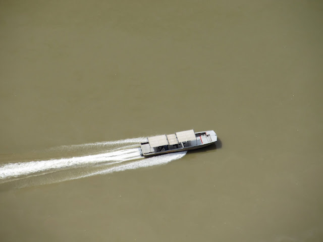
Tex's Riverways boat on the Colorado River
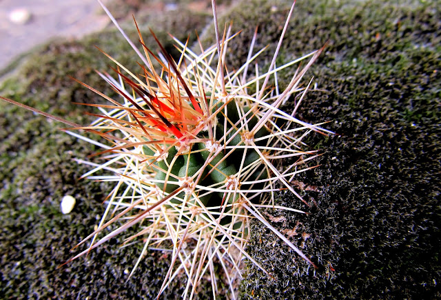
Cactus growing in moss
That evening we sat in our camp chairs, in our alcove, and drank some rum. We shared stories, and at least one of us saw two full moons rise
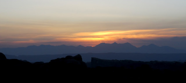
as we reveled in our amazing time in the Maze. I slept well most of that night, but I was awake at the usual 5:30 on Tuesday morning. We skipped breakfast, packed up camp, and were on the road by 6:30. I used 4WD very sparingly on the drive out, undoubtedly leaving more rubber than necessary from my rear tires on the sandstone of the Maze. Kev took the lead driving back toward Hans Flat so that he could drive at his most economical speed and conserve fuel. He'd stop every once in a while and shut off the engine to wait for Richard and me. Getting past the head of Teapot Canyon was a relief, but the worry still wasn't over. I had the Flint Trail switchbacks to make it up before I was in the clear. The Flint Trail turned out to be more difficult to ascend than it had been to descend. One tight corner in particular caused me to make a lot of back-and-forth moves before the truck could clear it. Once at the top, I breathed a huge sigh of relief. The hubs were turned to the "Free" position for the last time of the trip and the worry was over.One final beautiful sunrise behind the La Sals
Quick stop on the drive out of the Maze on Tuesday
On the road out of the Maze
Road junction near Flint Cove
Having a little trouble with the long wheelbase on the Flint Trail switchbacks
We reached Hans Flat and Kev still had a little fuel to spare. Richard loaded his gear back into his car, then the trio of vehicles made way back toward pavement. Kev's plan was to travel as far as possible before running out of fuel, but the farther we traveled on the much better roads, the better his fuel mileage got. By the time we reached UT-24, the computer in the Jeep was estimating that Kev could make it to Hanksville before running out of fuel, so Richard followed him that direction while I departed to the north toward home.
Cruising from Hans Flat to UT-24
This trip was a little outside of my comfort zone. It was farther from home than I'm used to traveling, with people I'd never met, and on rougher roads than I've ever driven. It was wholly worthwhile. I made two new friends who made a hopefully long-lasting influence on me. I got a couple of different perspectives on life, both from my companions and the land in the Maze. I'm pretty certain that I'll never drive back into the Maze, but that doesn't mean I won't be back.
Check the full photo gallery here:
https://picasaweb.google.com/Dennis.Udink/TheMaze
Google Earth .KMZ File:
http://udink.org/geo/TheMaze.kmz
Google Maps:
https://maps.google.com/maps?q=http://udink.org/geo/TheMaze.kmz&hl=en&sll=37.0625,-95.677068&sspn=40.545434,86.572266&t=h&z=10
Featured image for home page: