Ranger Joe
Feed the Rangers, not the wildlife!
- Joined
- Jan 27, 2012
- Messages
- 46
Quick links to all trip reports in this series:
Part 1 | Part 2 | Part 3 | Part 4 | Part 5 | Part 6 | Part 7 | Part 8 | Part 9
Greetings again and welcome to Episode III of the Great Colorado Expedition of 2012. Today we tackle the notorious Black Bear Pass...TWICE!
We were in Ouray for the 25th Annual Ouray Jeep Jamboree...but Black Bear Pass isn't included on the trail rides they offer. It isn't so much that the trail is so horrendously difficult (it really isn't), it's just that the road has a bad reputation because people have died on it. Well, heck, people have died on the Ohio Turnpike and you don't see anybody condemning it as a dangerous road. We asked the JJ Coordinator about adding Black Bear Pass, but he said it isn't likely to happen...mainly because the insurance company that underwrites the Jamboree won't allow them to include it.
That doesn't mean that the trail guides and Jamboree participants can't spontaneously congregate at the Best Western at 8:45 a.m. and decide to do the trail on their own without the official blessing of Jeep Jamboree USA.
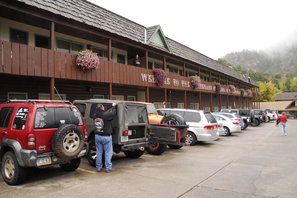
Here we see trail guides and Jamboree participants spontaneously congregating at the Best Western at 8:45 a.m.
Having spontaneously congregated and deciding, "Hey, let's do Black Bear Pass without the official blessing of Jeep Jamboree USA", our merry party of about 20 Jeeps headed south on US550 and stopped at the start of the Black Bear Pass road to air down and go over the rules.
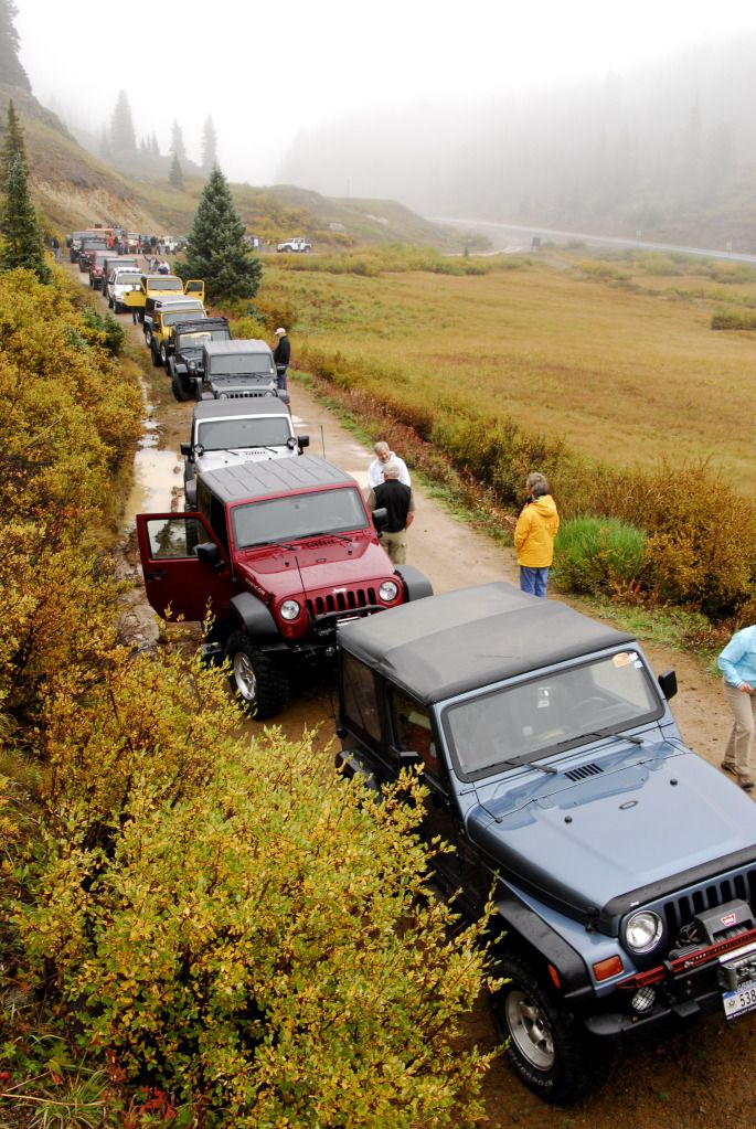
Most of the climbing is done on US550...it isn't really much of a climb to the pass itself. Much like last year's spontaneous and unsanctioned Black Bear Pass run, it was cloudy and raining as we headed towards the pass...unlike last year, there was no snow.
The white Liberty belongs to Sally, the most awesomest 85-year-old grandmother you'll ever meet...all five feet of her.
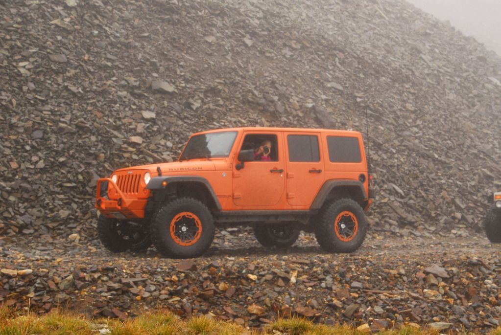
This overtly orange Wrangler belongs to one of the trail leaders, keeping an eye on us through a telephoto lens.
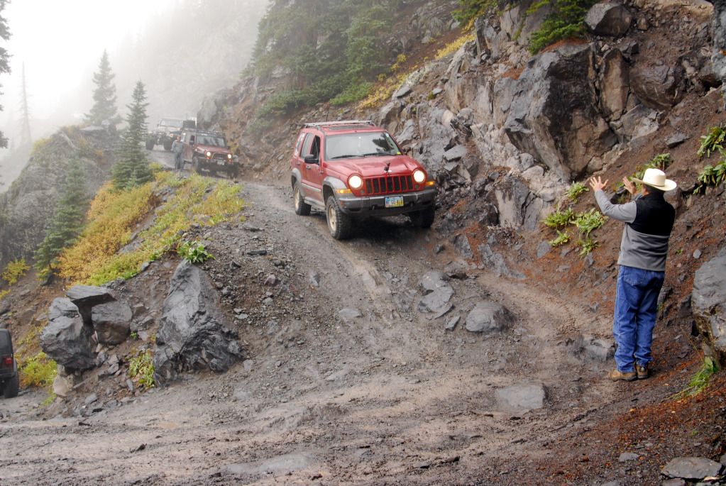
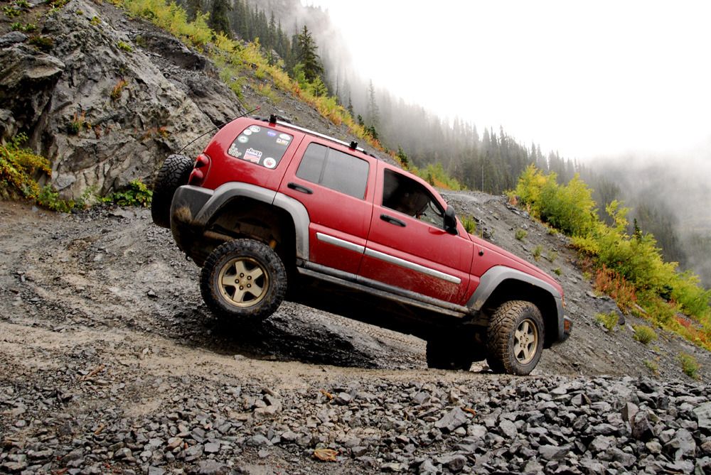
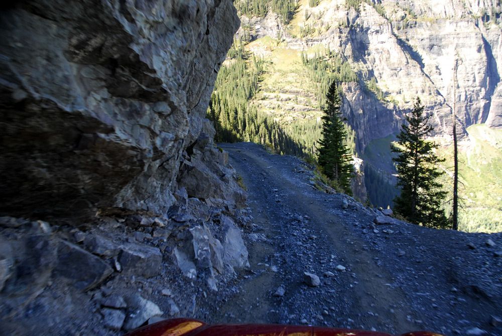
The fun begins after we pass through Ingram Basin and begin our descent into Telluride. There are two tricky sections of Black Bear Pass...this is the start of the first one, called The Steps. Loose shale, sometimes a bit off-camber, tilted downhill...and wet. If you go low and slow, it's not a problem.
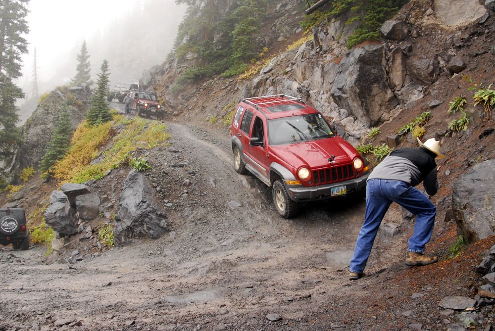
Sally begins her descent of the Steps, followed by Joe, one of the trail leaders.
Joe heads around the corner, a tight right angle turn at the edge of a waterfall.
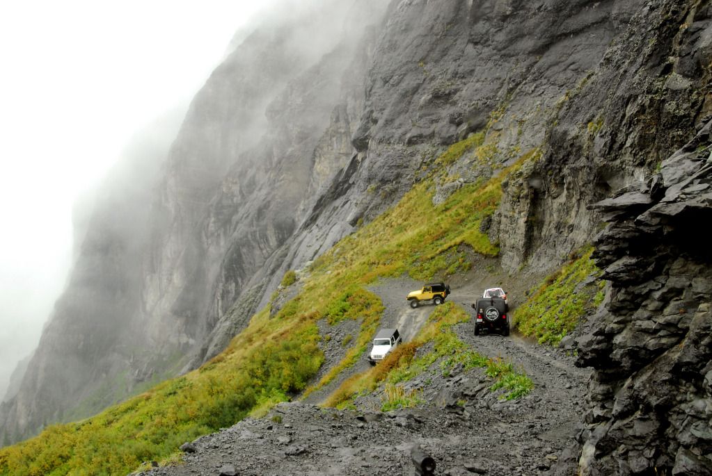
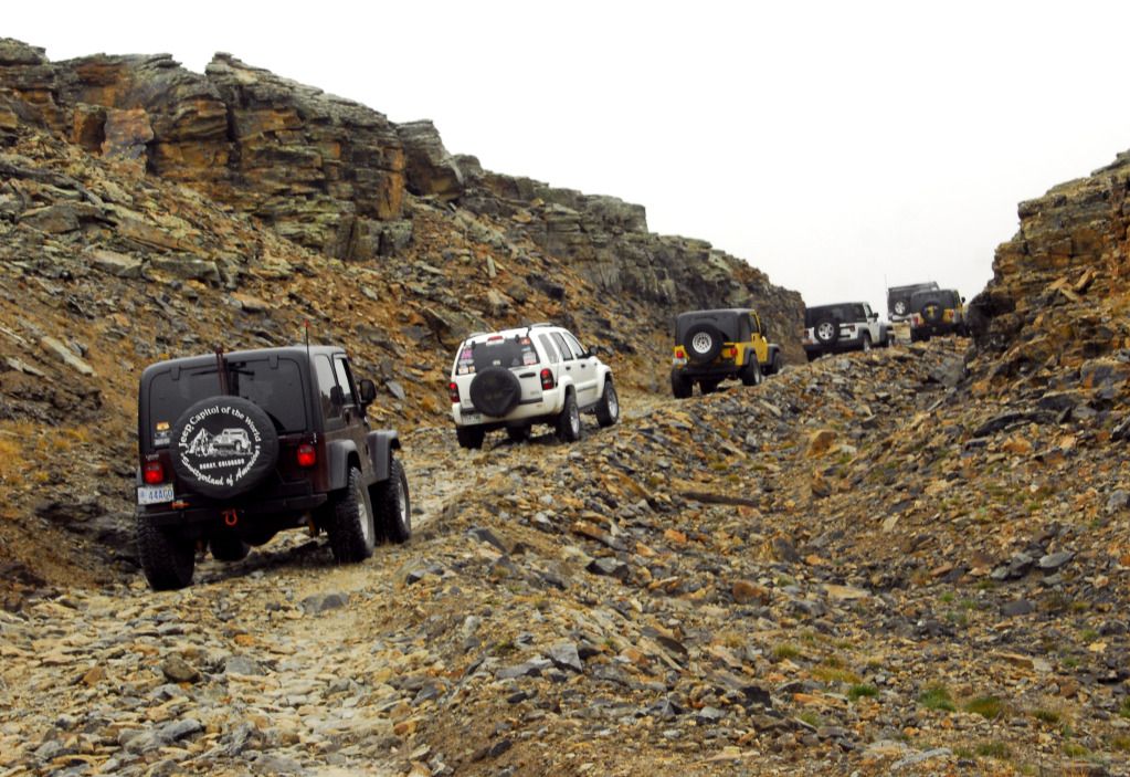
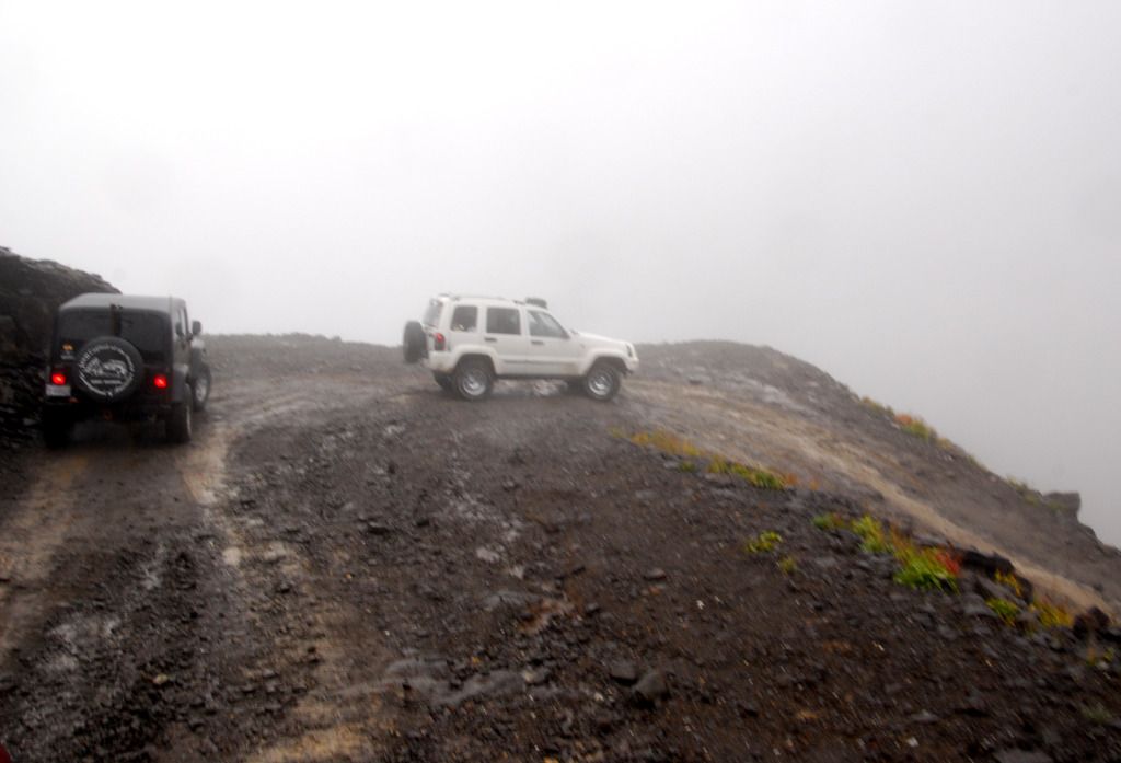
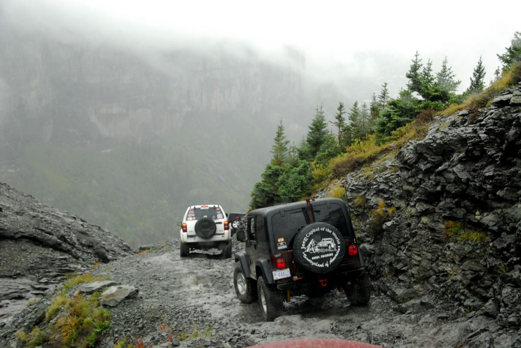
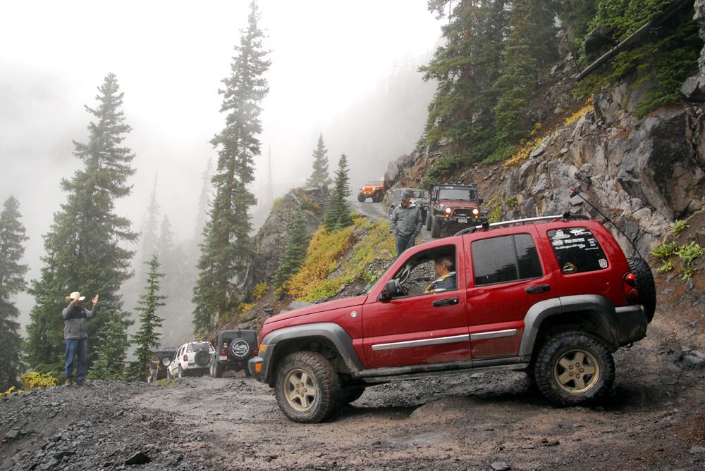
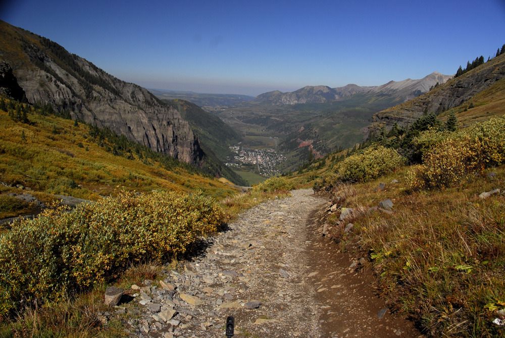
Once you're past the Steps, you now have to contend with the most visible part of Black Bear Pass -- the switchbacks that lead down to Telluride.
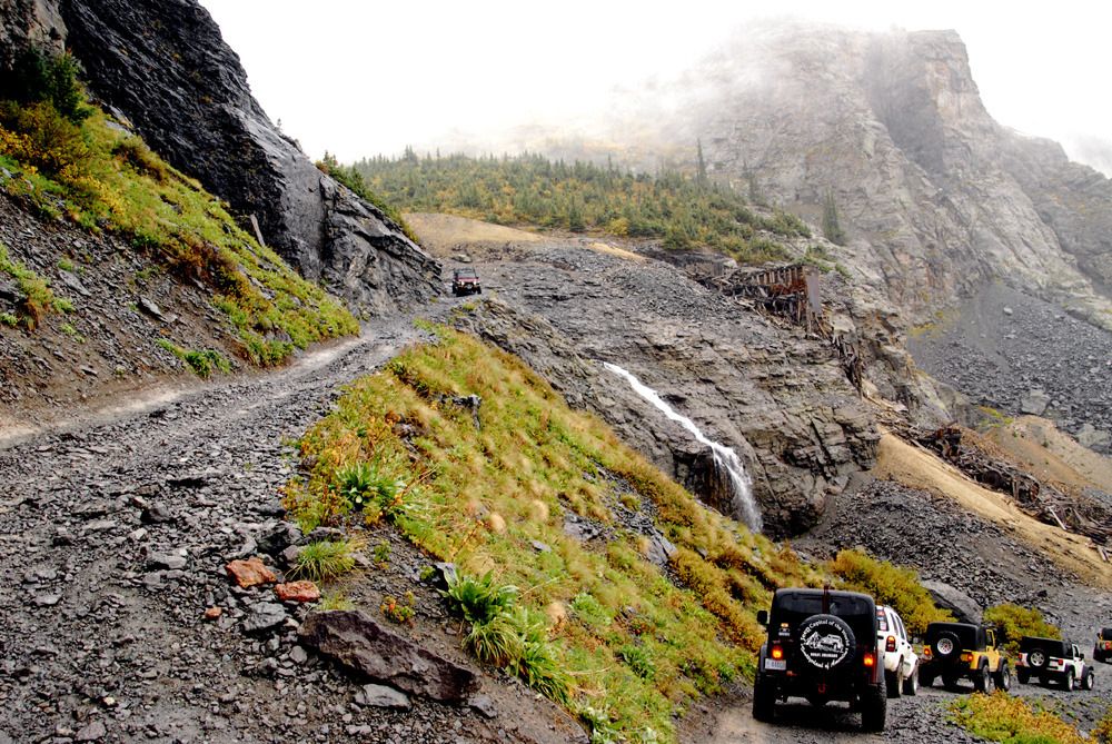
Looking back up at the Steps, with Ingram Falls and the ruins of an ore mill.
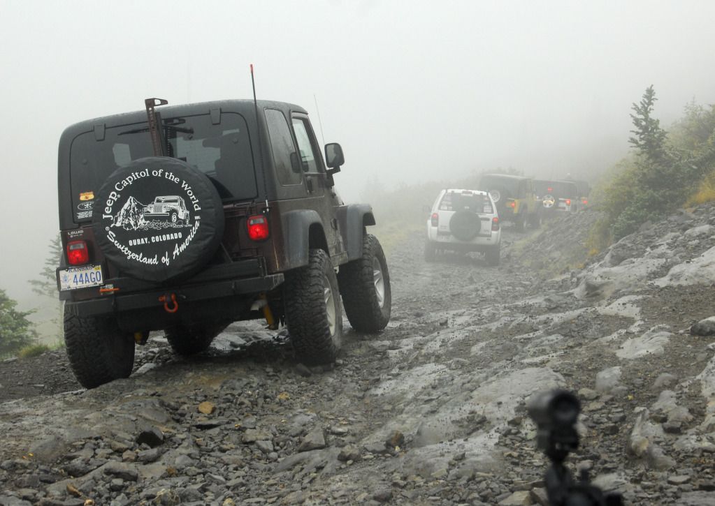
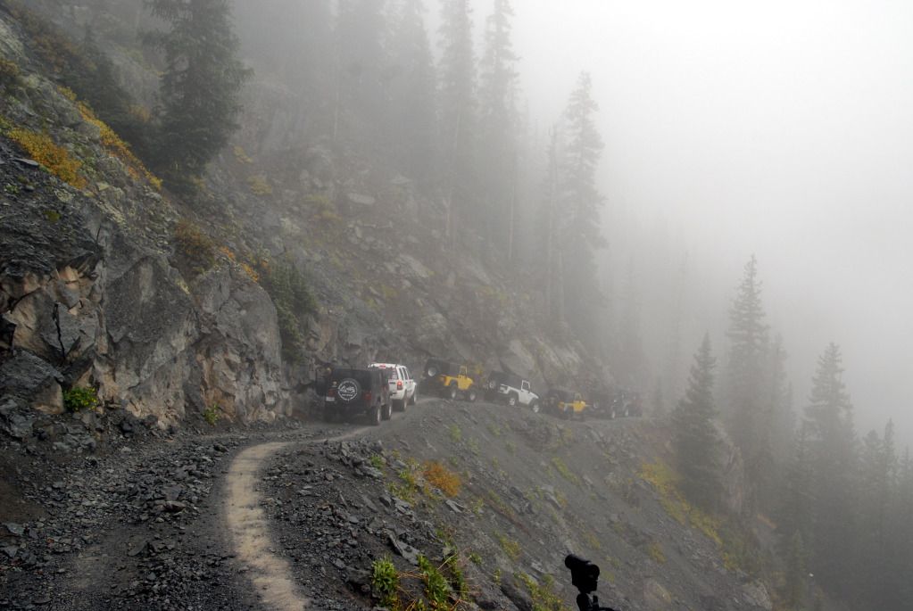
Our merry band continues down into the mist shrouding the mountains.
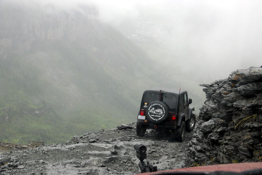
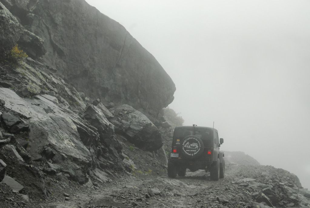
Approaching the second difficult spot on the trail, a tight, steep switchback.
Here we see Waldo Kadiddlehopper (NOT Ouray Jeep Jamboree Coordinator Chris Timmes, nope, that's not him...) guiding Linda around the tight switchback. It was here on an early Jamboree that a trail leader was helping a participant around the corner when he asked if the Jeep was in reverse...the driver said yes, stepped on the gas, and realized that the Jeep was in drive and the trail leader was hanging onto the Jeep's hood with his feet dangling over the edge. Black Bear Pass was no longer officially offered after that Jamboree.
Chris, er, I mean Waldo, shows Linda where he wants her tires to go.
Linda makes the turn and continues on down the trail.
Sally on the switchbacks.
Who says you have to have all four tires on the ground at the same time?
From this point, the descent into Telluride was without incident. We stopped at a local deli and had overpriced sandwiches in the parking lot. From there, we were all free to head back into Ouray by whatever route we wished (except for going back up over Black Bear Pass...it's one way from the top of the Steps down to about halfway down the switchbacks.)
We returned to Ouray via the easiest non-paved route, the Last Dollar Road. This road is mostly gravel and dirt and can easily be done with a Subaru.
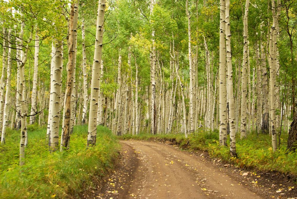
The road travels through part of the national forest, which is thick with aspens and has no humongus log mansions like other parts of the road.
As I mentioned earlier, this was the second time we had done Black Bear Pass, and it was also the second time we had done it in the rain and fog. When Thursday morning arrived, the sun was out and there wasn't a cloud in the sky, so Linda and I decided to do the road again, only this time we actually thought we'd see something. We were right.
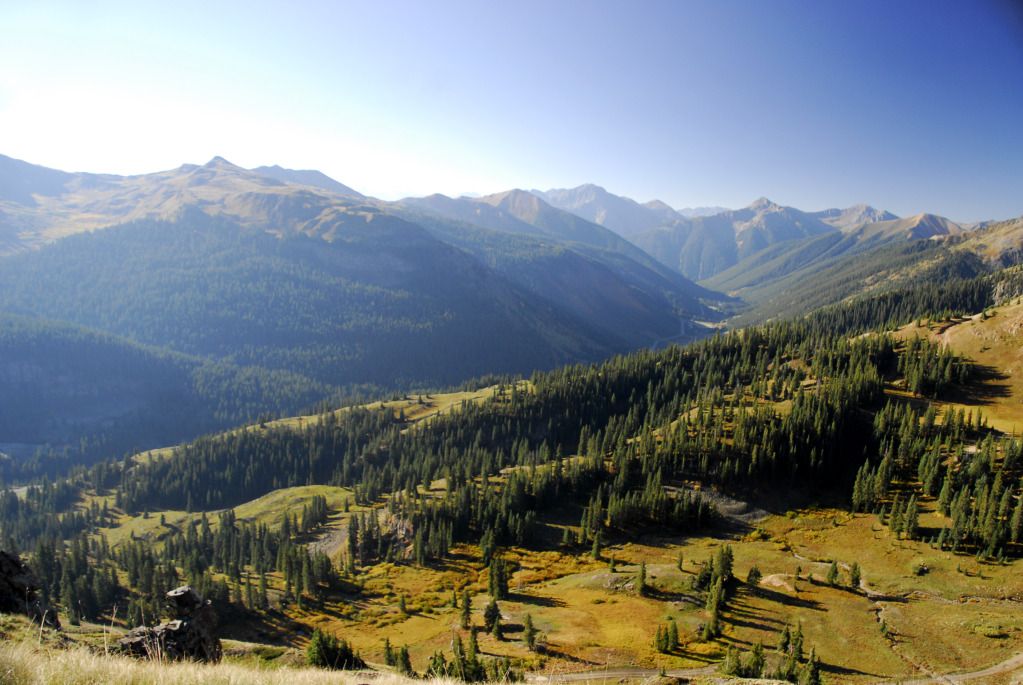
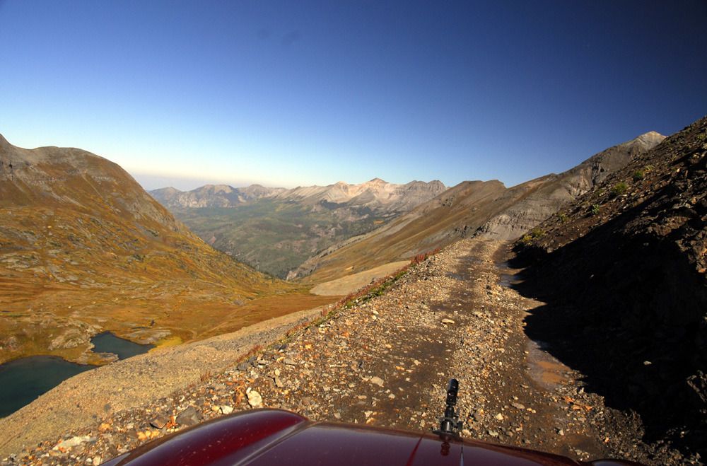
Heading up to the pass, looking back towards the valley below. US550 can be seen in the distance.
Another view behind us.
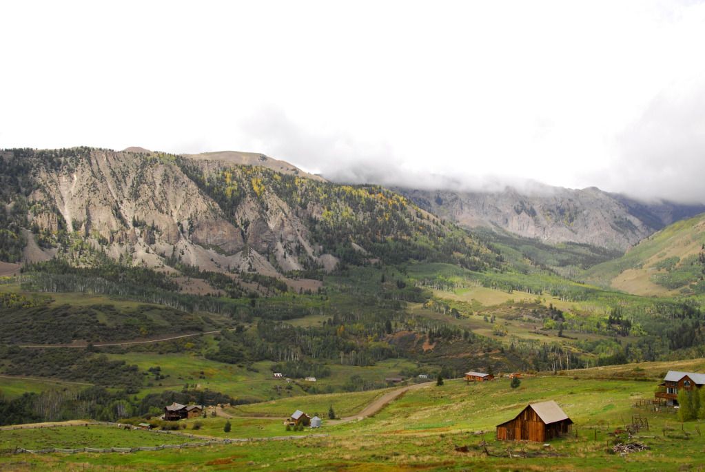
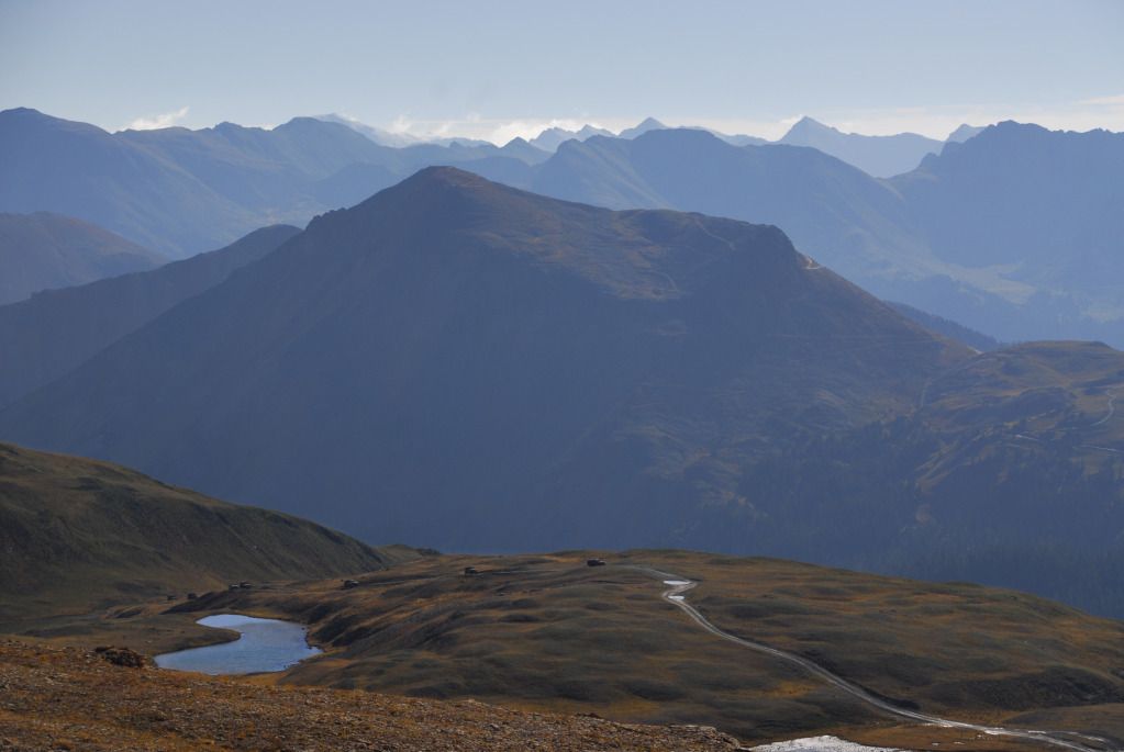
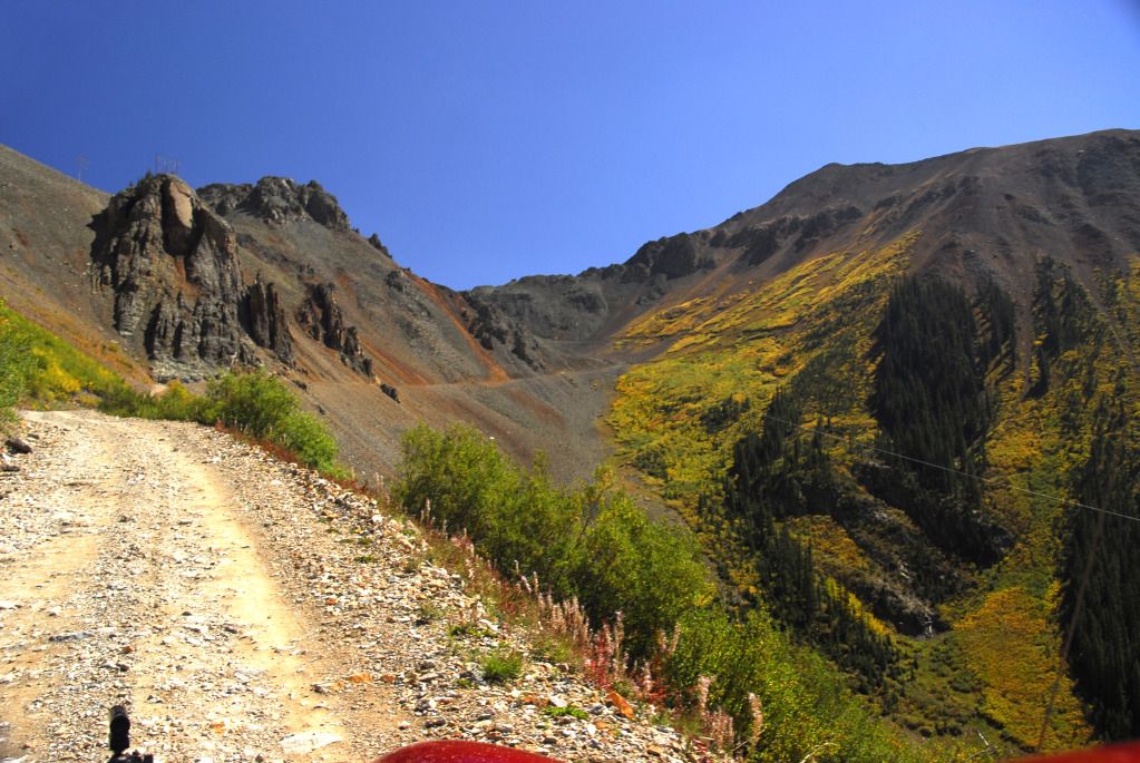
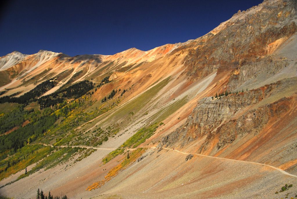
The view ahead of us...we saw none of this on previous trips.
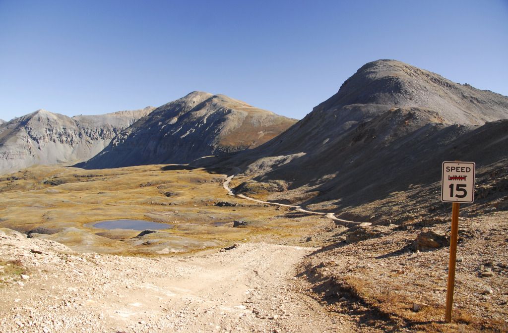
The Libby sits at the actual pass, and for the first time, we can actually see how spectacular this area is.
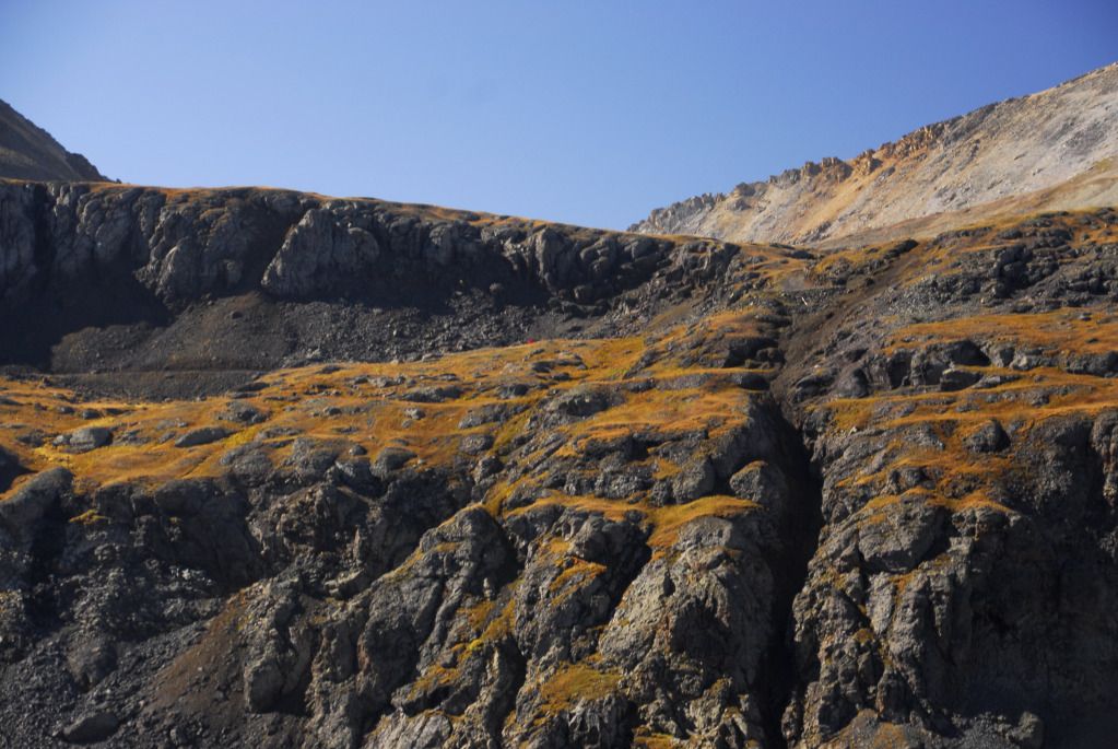
Looking back towards the early warning arrays and laser batteries of the Oppenheimer Space Defense System (ok, maybe not...I'm not sure what these are, actually...the trail leaders calls the lower one the "Ouray Drive-in Theater".)
Another group of Jeeps had the same idea as us...as it turned out, this was the same group of California firefighters we had met two days earlier near California Gulch.
Seriously?
There's a red Jeep in there somewhere.
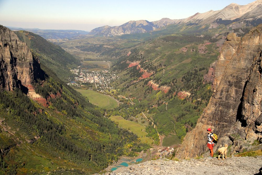
Crossing Ingram Basin, headed to Telluride. "Telluride" is an old Indian word meaning "Place where pretentious douchebags live."
Approaching the Steps.
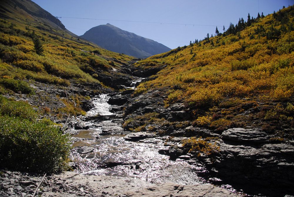
Ingram Creek, which soon empties into Ingram Falls.
Since I drove down the Steps yesterday, Linda got to drive today while I bailed out and took pictures (she has a problem with me driving and taking pictures at the same time...go figure.)
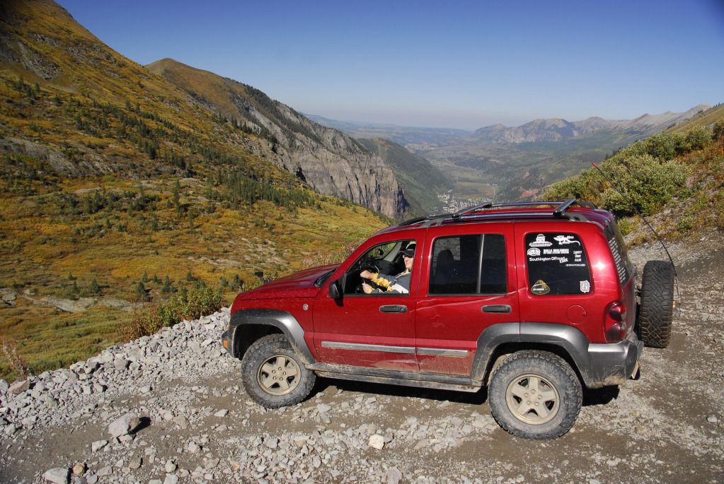
Our Libby with Telluride in the background.
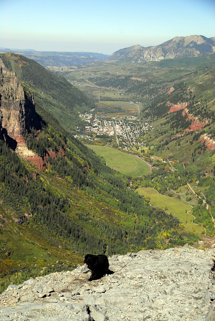
We actually saw a black bear on Black Bear Pass...well, sorta...ok, so it was a big, black Newfie.
The Newfie and his masters had hiked up from Telluride. We talked to them briefly...they thought we were nuts for driving down, and we thought they were nuts for hiking up.
Our Libby on the switchback near the ore mill.
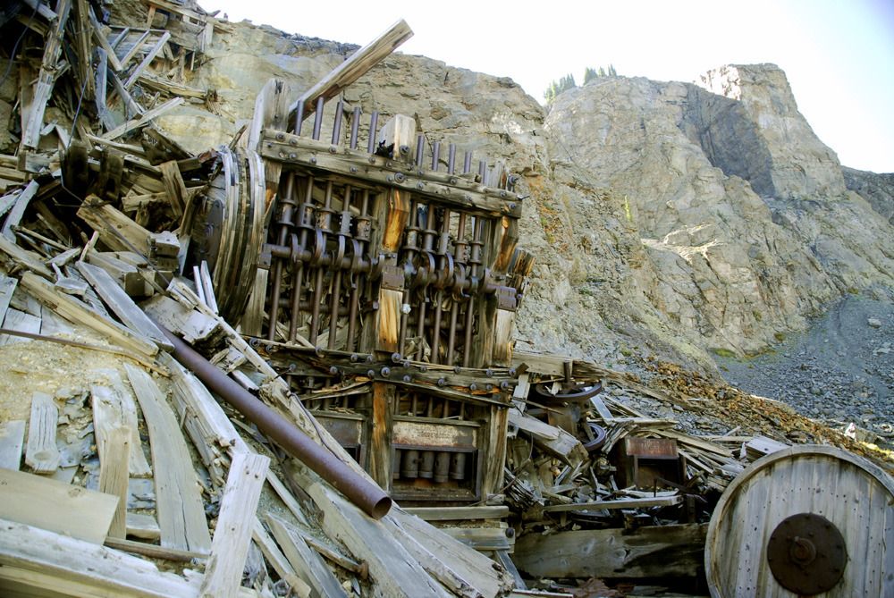
Remains of the ore mill. The large flywheel would turn the camshaft which in turn would drive the ore-crushing hammers. These things must have made a heck of a racket when in operation.
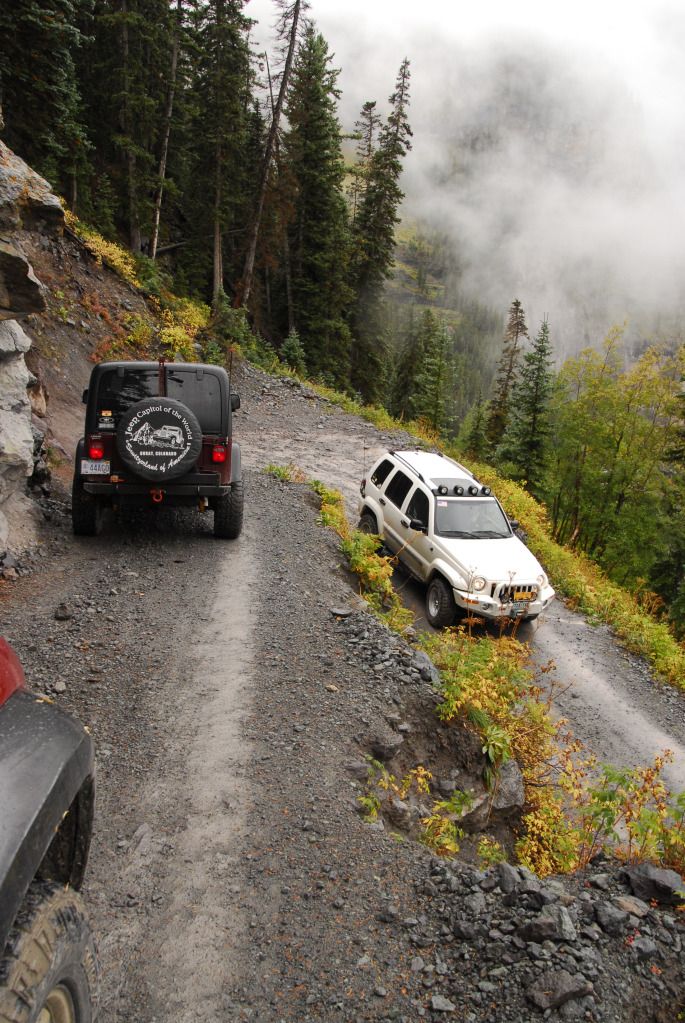
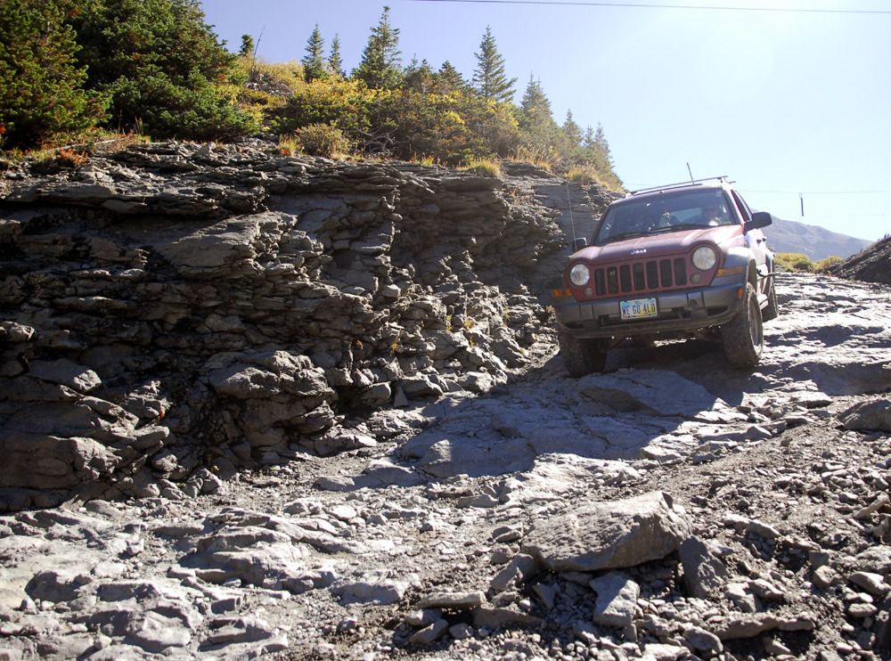
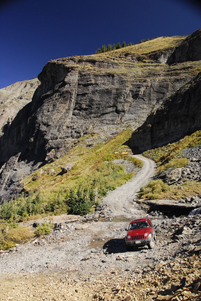
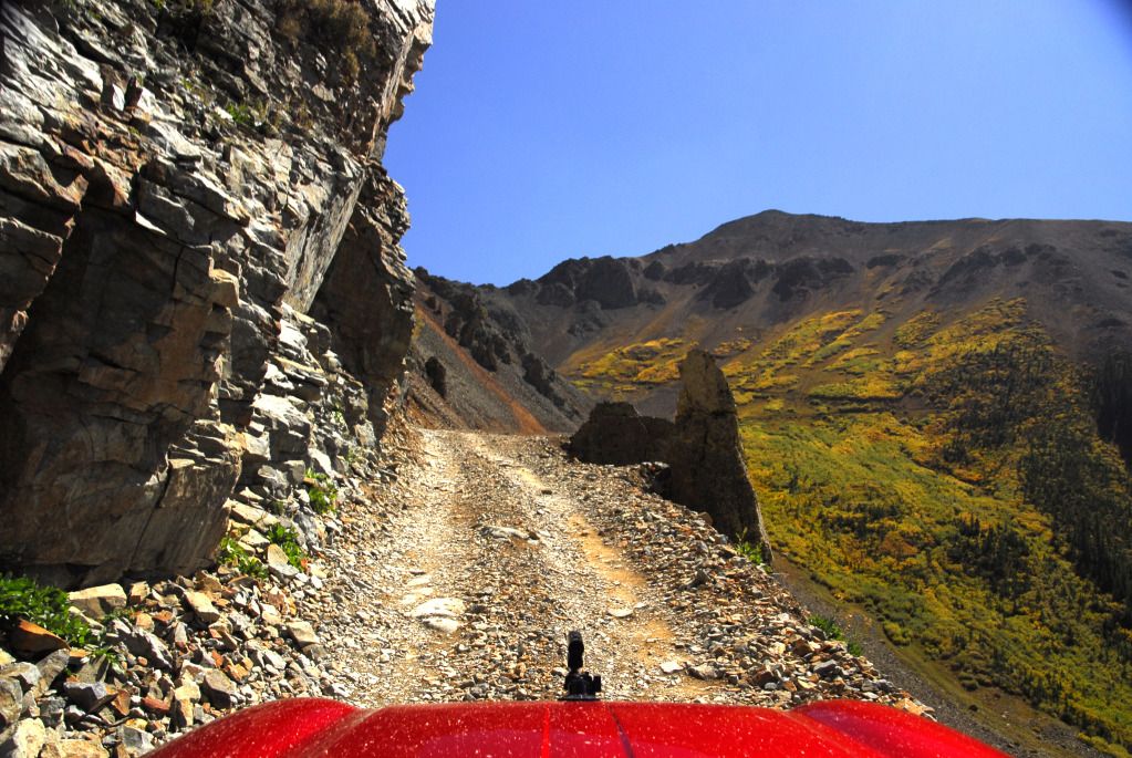
A narrow section of the switchback shelf road.
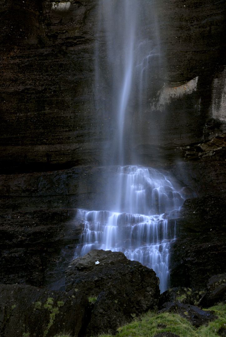
Close up of Bridal Veil Falls, near one of the lower switchbacks.
Again, we had to return to Ouray, and this time we did so via Ophir Pass, probably the second-easiest route over the mountain. The only part that might pose a problem is the long shelf road leading up to the pass...uphill has the right of way, and there's no room to get around another vehicle coming down.
Heading up to the pass.
Looking back down the shelf road from the pass...note the red Jeep for scale (a different one this time).
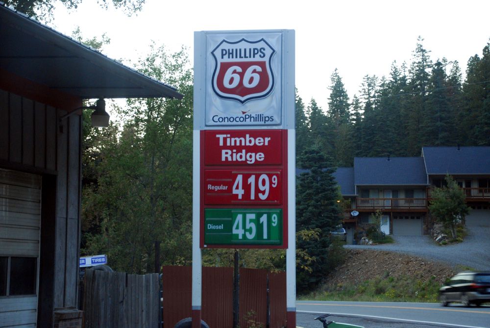
We returned to Ouray to find that the gas station figured out that there were a hundred Jeeps in town for the Jamboree (it was $3.98 when we arrived Monday night).
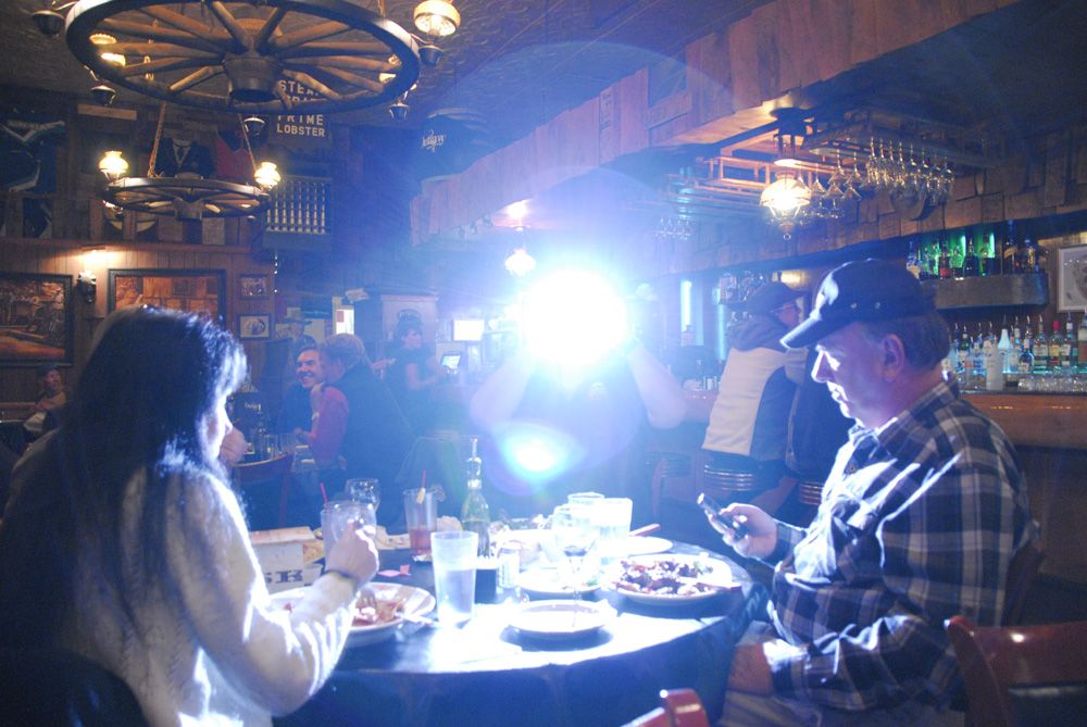
That evening, we had a great steak dinner at The Outlaw, the best steakhouse in Ouray, with a bunch of Jamboree participants who had connected via Facebook. Everything was going fine, until Dell opened a portal to another dimension...we lost two waitresses and the piano player.
Next up, Day One of the 25th Annual Ouray Jeep Jamboree, as the intrepid Liberteers tackle the toughest trail offered -- Poughkeepsie Gulch.
Quick links to all trip reports in this series:
Part 1 | Part 2 | Part 3 | Part 4 | Part 5 | Part 6 | Part 7 | Part 8 | Part 9
Part 1 | Part 2 | Part 3 | Part 4 | Part 5 | Part 6 | Part 7 | Part 8 | Part 9
Greetings again and welcome to Episode III of the Great Colorado Expedition of 2012. Today we tackle the notorious Black Bear Pass...TWICE!
We were in Ouray for the 25th Annual Ouray Jeep Jamboree...but Black Bear Pass isn't included on the trail rides they offer. It isn't so much that the trail is so horrendously difficult (it really isn't), it's just that the road has a bad reputation because people have died on it. Well, heck, people have died on the Ohio Turnpike and you don't see anybody condemning it as a dangerous road. We asked the JJ Coordinator about adding Black Bear Pass, but he said it isn't likely to happen...mainly because the insurance company that underwrites the Jamboree won't allow them to include it.
That doesn't mean that the trail guides and Jamboree participants can't spontaneously congregate at the Best Western at 8:45 a.m. and decide to do the trail on their own without the official blessing of Jeep Jamboree USA.
Here we see trail guides and Jamboree participants spontaneously congregating at the Best Western at 8:45 a.m.
Having spontaneously congregated and deciding, "Hey, let's do Black Bear Pass without the official blessing of Jeep Jamboree USA", our merry party of about 20 Jeeps headed south on US550 and stopped at the start of the Black Bear Pass road to air down and go over the rules.
Most of the climbing is done on US550...it isn't really much of a climb to the pass itself. Much like last year's spontaneous and unsanctioned Black Bear Pass run, it was cloudy and raining as we headed towards the pass...unlike last year, there was no snow.
The white Liberty belongs to Sally, the most awesomest 85-year-old grandmother you'll ever meet...all five feet of her.
This overtly orange Wrangler belongs to one of the trail leaders, keeping an eye on us through a telephoto lens.
The fun begins after we pass through Ingram Basin and begin our descent into Telluride. There are two tricky sections of Black Bear Pass...this is the start of the first one, called The Steps. Loose shale, sometimes a bit off-camber, tilted downhill...and wet. If you go low and slow, it's not a problem.
Sally begins her descent of the Steps, followed by Joe, one of the trail leaders.
Joe heads around the corner, a tight right angle turn at the edge of a waterfall.
Once you're past the Steps, you now have to contend with the most visible part of Black Bear Pass -- the switchbacks that lead down to Telluride.
Looking back up at the Steps, with Ingram Falls and the ruins of an ore mill.
Our merry band continues down into the mist shrouding the mountains.
Approaching the second difficult spot on the trail, a tight, steep switchback.
Here we see Waldo Kadiddlehopper (NOT Ouray Jeep Jamboree Coordinator Chris Timmes, nope, that's not him...) guiding Linda around the tight switchback. It was here on an early Jamboree that a trail leader was helping a participant around the corner when he asked if the Jeep was in reverse...the driver said yes, stepped on the gas, and realized that the Jeep was in drive and the trail leader was hanging onto the Jeep's hood with his feet dangling over the edge. Black Bear Pass was no longer officially offered after that Jamboree.
Chris, er, I mean Waldo, shows Linda where he wants her tires to go.
Linda makes the turn and continues on down the trail.
Sally on the switchbacks.
Who says you have to have all four tires on the ground at the same time?
From this point, the descent into Telluride was without incident. We stopped at a local deli and had overpriced sandwiches in the parking lot. From there, we were all free to head back into Ouray by whatever route we wished (except for going back up over Black Bear Pass...it's one way from the top of the Steps down to about halfway down the switchbacks.)
We returned to Ouray via the easiest non-paved route, the Last Dollar Road. This road is mostly gravel and dirt and can easily be done with a Subaru.
The road travels through part of the national forest, which is thick with aspens and has no humongus log mansions like other parts of the road.
As I mentioned earlier, this was the second time we had done Black Bear Pass, and it was also the second time we had done it in the rain and fog. When Thursday morning arrived, the sun was out and there wasn't a cloud in the sky, so Linda and I decided to do the road again, only this time we actually thought we'd see something. We were right.
Heading up to the pass, looking back towards the valley below. US550 can be seen in the distance.
Another view behind us.
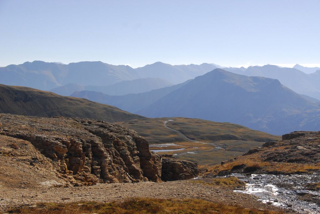
The view ahead of us...we saw none of this on previous trips.
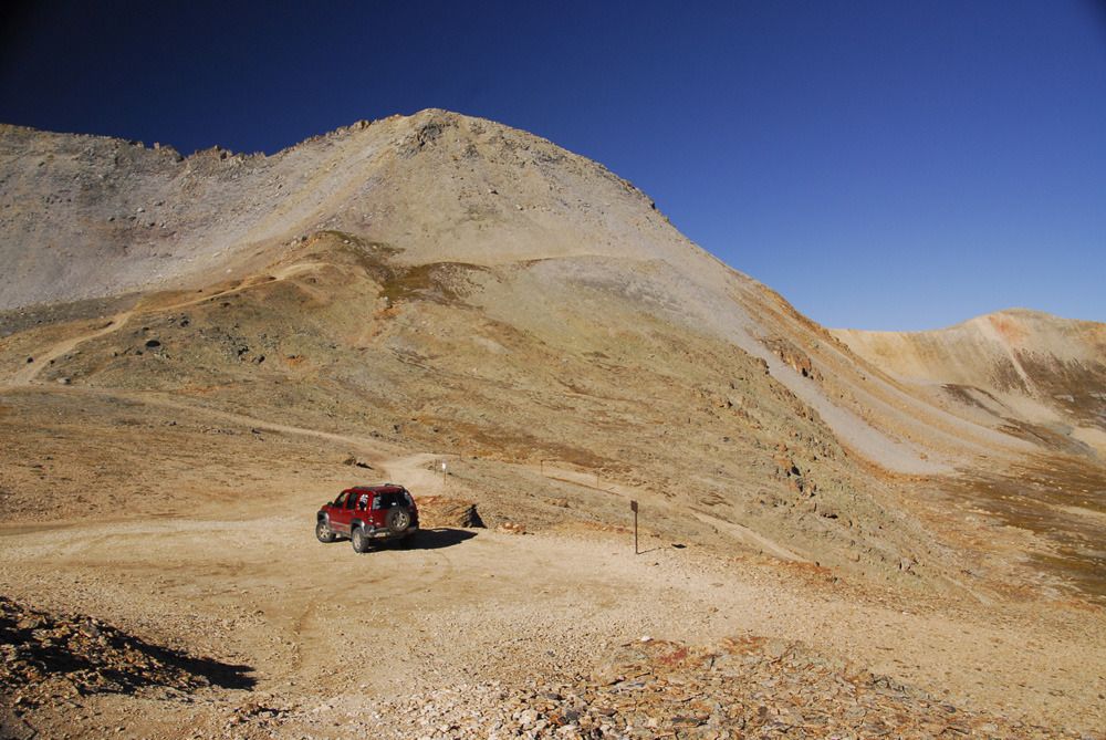
The Libby sits at the actual pass, and for the first time, we can actually see how spectacular this area is.
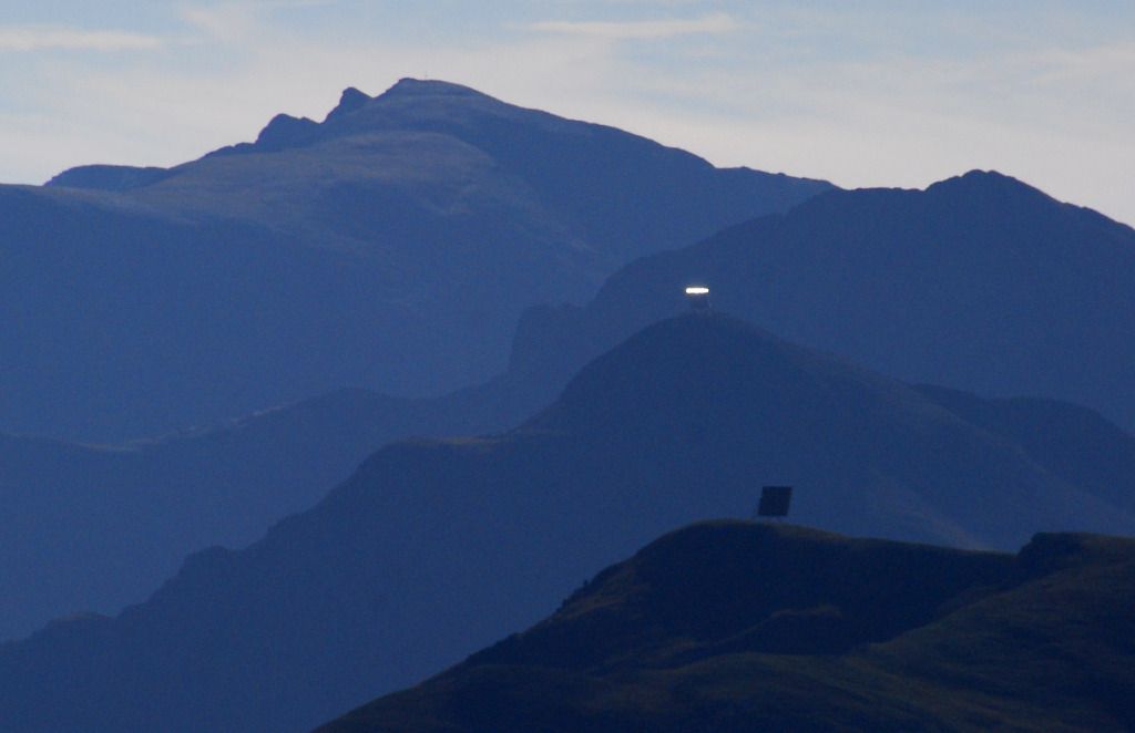
Looking back towards the early warning arrays and laser batteries of the Oppenheimer Space Defense System (ok, maybe not...I'm not sure what these are, actually...the trail leaders calls the lower one the "Ouray Drive-in Theater".)
Another group of Jeeps had the same idea as us...as it turned out, this was the same group of California firefighters we had met two days earlier near California Gulch.
Seriously?
There's a red Jeep in there somewhere.
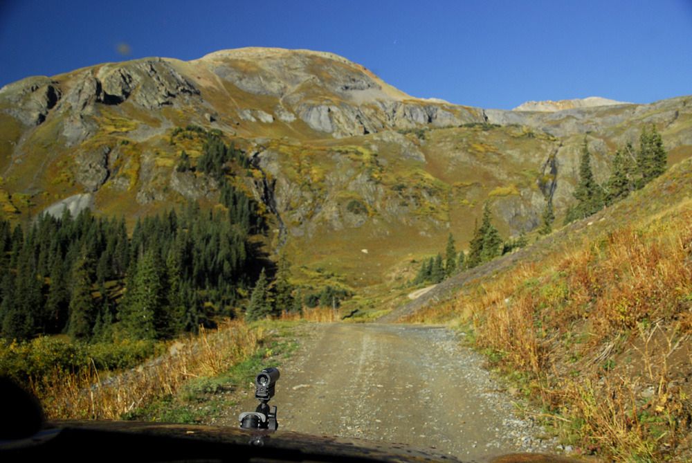
Crossing Ingram Basin, headed to Telluride. "Telluride" is an old Indian word meaning "Place where pretentious douchebags live."
Approaching the Steps.
Ingram Creek, which soon empties into Ingram Falls.
Since I drove down the Steps yesterday, Linda got to drive today while I bailed out and took pictures (she has a problem with me driving and taking pictures at the same time...go figure.)
Our Libby with Telluride in the background.
We actually saw a black bear on Black Bear Pass...well, sorta...ok, so it was a big, black Newfie.
The Newfie and his masters had hiked up from Telluride. We talked to them briefly...they thought we were nuts for driving down, and we thought they were nuts for hiking up.
Our Libby on the switchback near the ore mill.
Remains of the ore mill. The large flywheel would turn the camshaft which in turn would drive the ore-crushing hammers. These things must have made a heck of a racket when in operation.
A narrow section of the switchback shelf road.
Close up of Bridal Veil Falls, near one of the lower switchbacks.
Again, we had to return to Ouray, and this time we did so via Ophir Pass, probably the second-easiest route over the mountain. The only part that might pose a problem is the long shelf road leading up to the pass...uphill has the right of way, and there's no room to get around another vehicle coming down.
Heading up to the pass.
Looking back down the shelf road from the pass...note the red Jeep for scale (a different one this time).
We returned to Ouray to find that the gas station figured out that there were a hundred Jeeps in town for the Jamboree (it was $3.98 when we arrived Monday night).
That evening, we had a great steak dinner at The Outlaw, the best steakhouse in Ouray, with a bunch of Jamboree participants who had connected via Facebook. Everything was going fine, until Dell opened a portal to another dimension...we lost two waitresses and the piano player.
Next up, Day One of the 25th Annual Ouray Jeep Jamboree, as the intrepid Liberteers tackle the toughest trail offered -- Poughkeepsie Gulch.
Quick links to all trip reports in this series:
Part 1 | Part 2 | Part 3 | Part 4 | Part 5 | Part 6 | Part 7 | Part 8 | Part 9
") . I've always wondered what it looked like for a jeep coming down the pass. As I look up at it, I always think to myself "no way can a vehicle make it down that". It's amazing to actually see it through your pictures, twice! Thanks for sharing. I'm heading to Telluride this next week.
. I've always wondered what it looked like for a jeep coming down the pass. As I look up at it, I always think to myself "no way can a vehicle make it down that". It's amazing to actually see it through your pictures, twice! Thanks for sharing. I'm heading to Telluride this next week.